MBTA Buses & Infrastructure

The elephant in the room is that LMA sucks for both cars and transit. The very narrow streets even within LMA - most notably Longwood Ave and Francis St - means having a large number of workers commute by car is not an option, and it arguably already doesn't have capacity for additional car traffic. But if we want to encourage more LMA workers to take transit, an average walk of 10 minutes from the D and E branch stations doesn't do well at that either.
I will die on the hill that Longwood Ave between Louis Pasteur and Brookline should be transit/bike/delivery only. This would not change vehicular access to any of the parking garages or hospitals but it would greatly speed up transit making it a better alternative. Combined with bus lanes on Brookline and ALP and the new BNRD more direct routes to Longwood it’d be a very swift in and out on transit.
 
I didn’t make it clear but that wasn’t in reference to people that have been on since Cambridge transferring off the 1 to the Green Line but rather people on Marlborough, Beacon, or Comm Ave taking the 1 up to Hynes to then transfer off. Plus if you’re coming from Cambridge and want to go to a point E-W on the Green line it’s more direct to take a different bus or the Red Line. People are fickle and if their destination is east of Mass Ave and they live east of Hereford St they might just walk to Copley rather than backtrack to Mass Ave for the 1 up to Hynes unless there’s a bus very conveniently timed. I’d also imagine those living on Mass Ave itself would walk up to Hynes if they’re between Storrow and Clearway and the next bus is 10+min away. The entire Mass Ave north of Hynes in Boston is within a 1/4mi station walkshed. Then anyone south of Clearway would end up in the Symphony walkshed. The lack of reliability of the 1 and frequencies above 10min make using it as a Green Line feeder for most of Mass Ave pretty pointless.
That's a fair point, though I wasn't expecting many residents in Boston to use it as a Green Line feeder anyway. I do think there's a significant crowd using the 1 between Cambridge and Back Bay, especially if their origin is not very close to a Red Line stop and/or their destination is closer to Hynes than Copley; but yeah, they're more plausibility using it for a destination in the Back Bay area instead of transferring to the Green Line. If anything, whenever I wait for the northbound 1 at Beacon St, there's almost always more passengers boarding there and heading north across the river than passengers alighting there (often zero).

This doesn’t mean nobody does it. That’s exactly what I used it for. Since I commuted from Brighton to Roxbury down by Dudley common I would often take the Green to the 1 at Hynes then walk down Hampden.
Yeah, I think that's the more common use case for the southern half of 1: as a feeder to BMC and nearby workplaces. It appears that such crowds typically feed into GL/OL much more than Nubian, the latter of which is mildly surprising.

The M-2 route is one I have been the bus driver of myself during rush hour periods so while it’s not MBTA I’ve got the lowdown on exactly how that route trends. Of note though is that this is a HARVARD ONLY bus, that means no MIT students are allowed on board (ridiculous I know but they’re not a medical school and the M-2 is a LMA bus specifically for Harvard students and staff). MIT has its own cutaway bus that crosses the river that I’ve seen decently full but otherwise MIT students are mostly stuck with the 1.
MIT students can apply for a Harvard library card, which grants access to all buses that require Harvard IDs (M-2 and Harvard's own shuttles). MIT students who cross-register for courses at Harvard can also get a (permanent?) Harvard ID. Also, I believe that even though the M-2 is intended to be for LMA, Harvard students do use it for intermediate travels like to MIT and Central Square.

The MIT bus turns west around Beacon St and even the nighttime on-demand service stops just short of Newbury, so it's only useful for commuting students living in Back Bay and not for on-campus students going shopping or transferring to GL.
 
I will die on the hill that Longwood Ave between Louis Pasteur and Brookline should be transit/bike/delivery only. This would not change vehicular access to any of the parking garages or hospitals but it would greatly speed up transit making it a better alternative. Combined with bus lanes on Brookline and ALP and the new BNRD more direct routes to Longwood it’d be a very swift in and out on transit.
In such a world, would it be possible to extend the transit-only segment even further east to Huntington Ave? One notable thing about the BNRD is that it removes all buses on Ave Louis Pasteur: the LMA buses either use Francis St (T12, T22, T28, T66), or use Longwood Ave and Huntington Ave and then to Ruggles (T47, 65, 85).

(The initial BNRD proposal in May 2022 had a notice that the Longwood routings were not final and subject to a detailed study later, but the final version in October 2022 removes that notice. I'm not sure if the study has already been conducted or if they simply forgot to include it.)
What about splitting bus traffic between Francis St and Longwood Ave? While it would add some time to buses coming from Nubian needing to turn onto and then off of Huntington, it would allow both streets to maintain one mixed traffic lane as well as allowing for street parking on Francis St for the residential buildings located on the western side. Here are some quick Streetmix visuals for each one:

Francis St
francis-st.png


Longwood Ave
longwood-ave.png


These streets are about the same width, so if street parking could be removed along Francis St then there's no reason you couldn't use the nicer Longwood Ave design for both, or if you can go a step further and remove all private vehicle traffic, then that would allow for bi-directional bus lanes. I think these options are less likely, however.

For funsies, here's another for what Brookline Ave could look like:
brookline-ave.png
 
These streets are about the same width, so if street parking could be removed along Francis St then there's no reason you couldn't use the nicer Longwood Ave design for both, or if you can go a step further and remove all private vehicle traffic, then that would allow for bi-directional bus lanes. I think these options are less likely, however.
The level of bus traffic is incredibly high on Longwood and Francis when you factor in the Yankee shuttles, individual hospital shuttles, and MASCO bus routes into the MBTA equation so I think transit priority on both should be the way to go. My concern with Francis St though is that one side of it beyond Vining is all residential, and I’m pretty sure a bunch of them are assisted living. They have plaques on the doors or porches but I can’t remember exactly what they say. Either way I’ve seen many people with various assisted mobility devices going in and out of those houses to vehicles parked out front so resident parking and front door vehicular access should probably remain in a reconfiguration.
 
The level of bus traffic is incredibly high on Longwood and Francis when you factor in the Yankee shuttles, individual hospital shuttles, and MASCO bus routes into the MBTA equation so I think transit priority on both should be the way to go. My concern with Francis St though is that one side of it beyond Vining is all residential, and I’m pretty sure a bunch of them are assisted living. They have plaques on the doors or porches but I can’t remember exactly what they say. Either way I’ve seen many people with various assisted mobility devices going in and out of those houses to vehicles parked out front so resident parking and front door vehicular access should probably remain in a reconfiguration.
With those considerations in mind a full transit (And other essential traffic) conversion of Longwood Ave between Brookline and Huntington probably makes the most sense. I'd suspect adding a bus lane on Francis St still makes sense though, even with Longwood Ave being fully set aside for buses/shuttles/delivery vehicles.
 
Thank you so much for this incredibly detailed analysis. I have more to say on this (and @TheRatmeister's follow-up on the 1) that I may get back to weeks later, but of the remaining routes you listed, aside from what others have already mentioned, some of my own curiosities are:
  • 86: The T seems to think not many people take the bus beyond Harvard, as seen by how the 86 is truncated to Harvard in the BNRD and the T109 takes over Harvard-Sullivan. However, community reaction of this change seems to suggest otherwise. Also, I'm curious whether people take it all the way from Harvard to Sullivan as a RL-OL connection, or if they use it to get to Union Sq Somerville from either rapid transit lines.
  • 10: I wonder why it seems to be the South Boston bus route with the lowest ridership despite offering reasonable crosstown connections (and also doesn't bode well for any potential improvements to South Boston that connect at Andrew). Do people prefer the 9 which connects to RL closer to downtown? The BNRD does do a 8-10 swap and sends the 10 to Ruggles, which will hopefully improve its utility.
  • CT3: This is the lowest on my priority list for sure.
It’ll take a bit to type up more detailed analysis on my computer of these routes. But from my phone (on the 65 headed to Brighton, 2 back to 2 both standing room only leaving Longwood Ave) I can say about this I’ve only taken the 86 on a weekday beyond Harvard a couple times so I’m not the most qualified there but there’s a handful that remained that boarded along Chestnut Hill Ave and Market St in Brighton. I take the 86 the full length all the time on weekends both ways though and there was a lot more activity in that segment on those days. The primary trip generators appeared to be Harvard-Union Sq and Union Sq-Sullivan pairings. At Sullivan I see more people transferring to or from other bus routes rather than heading into the orange line or coming out of it. I’d assume its the best way to get from Malden and points north of the Mystic to Harvard or Union Squares. I take it from Brighton because it’s much faster than going Green downtown and transferring up (by 15+ min) even with Cambridge congestion. I’d imagine others who work up there do the same.
This is a small spreadsheet I made from the Better Bus Profile data:

1702051528064.png


The profile only broke out westbound data, so that's what I'm using here. Verbal stop-by-stop breakdown below -- note that the spreadsheet consolidates some stops.

Between Sullivan and the last stop before Harvard, a total of 1670 people boarded (over the course of the day). Along that same stretch, plus Harvard, only 1110 people alighted. That suggests that 560 riders ride through Harvard from one side of the Red Line to the other. Of the 3120 people that board the bus at any point, those 560 riders comprise about 18%.

Also worth noting that the bus fills to 75% of its highest load immediately at Sullivan, and stays at about that level or higher all the way through to Brighton, only starting to drop after crossing Washington St (transfer to the 57 bus). This reflects the broadly consistent turnover at each stop that we see in the Ons and Offs.

Also note that the cumulative stops in Brighton -- along Market St and Chestnut Hill Ave but excluding the Green Line transfer points -- see a total of 970 alightings, over the course of about a mile; eyeballing the data for a similar length straddling Union Sq in Somerville/Cambridge, I'd guess that stretch's ridership equivalent is closer to 570 (though it's a little hard to parse out in that both directions could be considered "inbound", and we have reason to suspect that there is local traffic as well.)

1702052078324.png


In sum, while it's true that the 86's ridership does skew to the eastern half of the line (I wonder how many passengers are straight up just doing Sullivan <> Harvard), there is non-trivial through-running ridership, with significant numbers of passengers going to Brighton, and additionally going to the Green Line transfer points.
 
Union Sq Allston is an important neighborhood center to directly serve and since it is unfortunately the only North-South route for about a mile each way east or west it makes sense for it to make this diversion. The other consideration is that the extra time it takes to go up to Brighton Ave is made up during rush hour by the fact that the bus doesn't have to make that left onto Harvard from Cambridge St. as that left gets backed up all the way to Lincoln. That said going northbound Union Sq is definitely a time-consuming detour since you can right on red onto Cambridge. Because of the prior point, I'd say the detour is not a huge time loss overall but I get the frustration for those on for the long haul. I think there should be a bus that runs from Central Sq to Jackson via Magazine, St. Paul, Cypress, and Perkins St to relieve some North-South transit demand.

Last document I saw with a potential configuration of West Station has Malvern St extended across to Seattle St and provisions for Agganis Way to extend across in some way when they figure out how to reconfigure the throat. Doing this, however, is sure to induce more vehicular demand as you've then made driving across more easy. This is fine to better connect people across this vast gap (would be better as a transit/bike/commercial vehicle/pedestrian connection only more on that later) but it'll only add to the traffic problem down to Longwood. Making a more direct route by, what you seem to be proposing but I could be wrong, removing traffic lights and reducing sidewalk width to widen roads would further exacerbate the traffic problem. The space inefficiency of private cars is an inherent bottleneck because these destinations, Allston/Cambridge/Brookline/LMA, are of a finite size. If you encourage more people to drive via some high-speed "shortcut" to the destination all it will do is clog up the endpoint with more vehicles quicker. The only real 'solution' to the traffic along this key route is if we had a high-capacity, frequent, space-efficient, and reliable transportation alternative to driving along it. The 66 in its current state does not check off the frequent or reliable boxes because it's stuck in the same vehicular traffic. Why would you take the bus that sits in the same traffic you'd otherwise drive in? Therefore it'd need dedicated infrastructure to bypass traffic to make it the better option attracting more people to use it who can, and in turn reduce the number of drivers alleviating traffic. A bus isn't the best solution for this corridor though and there really should be a heavy rail subway line here.

Yeah old street layout from before cars and the geographic feature that is Mission Hill left only three roads including Heath to cross into the LMA from the south. At the time two direct roads only a couple thousand feet apart were probably more than enough for all the people in streetcars, walking, biking, and goods movement but now the LMA is there and it is a massive traffic draw. It'd be ridiculous to do what most of America did and bulldoze all the commercial, residential, and educational establishments surrounding this to make more room for cars that would only further the congestion problem when an actual solution would be more viable transportation alternatives like the aforementioned heavy rail line or the Ruggles Busway planned in the urban ring. What'd really rile people up is if you made Ruggles and Tremont 1-way clockwise in relation to Huntington and Columbus but with counterflow bus/truck lanes so they can travel both ways.
View attachment 45331View attachment 45332
This would make the tens of thousands that rely on 7+ bus routes on Ruggles and the 66 on Tremont have reliable service and attract more people to switch to transit due to its viability. Would also make the Parker intersection safer and smoother by eliminating half the left-turn movements.

While redundancy would indeed spread out traffic across more streets, people still need to converge on the same location. The reality the rest of the world is realizing or has realized in their cities is that private automobiles are simply incompatible with density. You will never create enough space for cars to be the primary mode of transportation without heavy congestion and dedicating vast amounts of space to store them there. Creating the same redundancy dedicated to alternative higher density and capacity modes of transportation can serve a given area with a much higher bottleneck threshold.
Everything takes up space even people, that's why we built upwards, and a method that transports more people in less space that doesn't need to then be stored is the way to mitigate traffic on our roads. Better transportation infrastructure would prioritize the most efficient and suitable methods of moving people to their destinations reliably and safely.

The culmination of all I've had to say so far is Brookline and Allston's traffic woes are the result of supposed "solutions" to traffic, (fast, multilane, direct roads in the forms of I-90, Rt 9, Jamaicaway, and Rt 28) that serve to dump a large quantity of space-inefficient transportation into a small area they greatly outsize, rather than the alternatives that would've been able to handle the transportation demand. It sure was bad planning that got us here, and doing more of the same won't get us out.
A lot to respond to here, but let's simplify:

There will always be key nodes into which traffic converges. The particular area bounded by Harvard Sq-Allston-Coolidge-LMA is a very interconnected area. And there are very few ways of getting across because of massive barriers: 1) the river, 2) the rail yard and 3) the very dense and narrow streets of the neighborhood to the west of the rail yard.

Consequently, all traffic funnels into very limited streets. If you had more ways to cut across, this would not be the case. If you simply added two roads that crossed the rail yards, you would decompress some traffic that otherwise would take Harvard or Linden. Huge. If you added a GLX or BRT from West -> Harvard, even better. Still, even without the latter, decompressing Harvard Ave/Linden/Cambridge St makes those roads function better as throughput. That makes the 66 work better. That attracts more people to take it. And so on.

There is a huge diff between having Harvard Sq being a big traffic backup because of destination, vs every single road for the entirety of the way to Harvard Sq for miles to the south all being almost totally impassable to traffic.

And not every single road project = massive and unnecessary induced demand. Lightening traffic in a specific surgical spot does not mean that a Malvern access would be drowning in cars in ten years. And thats also why you plan in robust transit changes at the same time.

********


As to your other points, Im broadly in favor of massive transit investment and the errors of auto centricity. But you go too far. The issues are not just because of J Way, Mass Pike, etc. These things get overly scapegoated. Problematic, yes, They aren't the whole problem. We have cars built into the way we live and for old, dense neighborhoods that separate major nodes that pepper a region, like we have in Boston, this is just a problem that does not have a very easy solution. Major, major transit investment will help. But it is incredibly stupid to not introduce new roads right now when there is an opportunity to ford a major barrier that causes traffic backups everywhere. Not every road project = interstate highway disaster (and not every highway project is bad, either).

In fact, people actually ignore the way roads work in Europe. Europe has much better urban highways than the US does. In London, for example, there are all sorts of arterial roads that are worked into the city. They aren't nice, they dont have sidewalks, and you'll get nailed if you try to pedestrian your way across them. but they have a smaller footprint overall and they exist in parallel with a strong transit network. Problem on this board and with a lot of transit advocacy is the anti-car rhetoric is carried away and unrealistic. Even in socialist Europe, there is strong highway infrastructure; it's just not 12 lanes plus ramps plus urban decay but rather 4-6 lanes, with narrower lanes, mushed into the city. In many ways, Boston is far, far nicer to pedestrians than a much better transit city like London or Paris. There, you dont get to just fling yourself into the road and expect cars to stop. You wait and you only cross at crosswalks and many busy roads force you to use a "subway" tunnel underneath. Try doing that here and the walk advocates go nuts, since they expect speed humps and crosswalks mandating STOP every twenty feet on every road. We need balance. Ours is askew in every possible way, re cars, bus, train, everything.
 
Consequently, all traffic funnels into very limited streets. If you had more ways to cut across, this would not be the case. If you simply added two roads that crossed the rail yards, you would decompress some traffic that otherwise would take Harvard or Linden. Huge. If you added a GLX or BRT from West -> Harvard, even better. Still, even without the latter, decompressing Harvard Ave/Linden/Cambridge St makes those roads function better as throughput.
Genuine question: How is this different from "if you simply add two lanes on a highway, you would decompress some traffic that otherwise would use the other 6 lanes. Huge."?
 
I'm back with more stop-by-stop analyses of the 2022 bus ridership data. I'm just doing key bus routes + ones I'm interested/curious about. This batch will have the 15, 22, 23, 28, 47, 57, and 66. I will come back with the 32, 71, 73, 77, 86, 111, and 116/117 later.

General disclaimer: I am only looking at stops that are regularly served. There are some weird early morning/school day route variations that are not very common and I'm therefore choosing to ignore them.

Screenshot 2023-12-08 at 15.05.06.png
15:

Takeaways:
  • Buses only run to Kane Sq during peak hours, so that's the only area with peak load data. Buses terminate at St Peters Sq or Fields Corner the rest of the day.
  • There is very little passenger turnover. Over 70% of riders travel all the way to Nubian, Ruggles, or Roxbury Crossing, likely making transfers to downtown, and around 40% of riders travel to/from a stop within walking distance of Uphams Corner on the Fairmount Line.
  • Warren St is the largest source of ridership lacking an alternative rapid transit option.
My thoughts:
  • This route would likely have its ridership absolutely gutted by increased Fairmount Line service. Around 25% of its ridership already comes from journeys between the area around Upham's Corner and downtown.
Screenshot 2023-12-08 at 15.37.31.png

22:
Takeaways:
  • This route turns over more than the 15, but there are still a large chunk of riders that travel all the way from their local stop to a rapid transit stop. (Either Ashmont, Jackson Sq, Roxbury Crossing, or Ruggles)
  • Stops north of BHA have a noticeable commuter bump, while the stops closer to Ashmont have a more consistent ridership.
  • Around 60% of southbound journeys start at the OL stations, while around 30% of journeys end at a stop within walking distance of the Fairmount Line.
My thoughts:
  • Once again the Fairmount line would steal a lot of riders away. I'd estimate a minimum of ~10-15% of riders would switch immediately if they had the option.
  • Please, pretty please, could we get the Columbus Ave bus lanes extended along Seaver St to BHA?

Screenshot 2023-12-08 at 16.05.54.png
23:
Takeaways:
  • The bus turns over about once between Ashmont and Nubian.
  • The load is very consistent off-peak between Washington St and Nubian.
  • The peak load is primarily between the area around Four Corners/Geneva and Nubian
  • Around 50% of SB journeys start at Ruggles, Roxbury Crossing, or Nubian, and around 35% of SB journeys end at a stop within walking distance of a Fairmount Line stop
My thoughts:
  • Another big potential win for the Fairmount line that's squandered by poor service. ~15% of 23 riders would likely switch if it was an option.
Screenshot 2023-12-08 at 23.34.47.png

28:
Takeaways:
  • The 28 also has around 50% of its boardings/alightings at Ruggles, Roxbury Crossing, and Nubian, but unlike with the 22 and 23 the southern terminus is more of a local node, rather than a major connecting point.
  • Warren St is still a major rapid-transitless source of ridership
  • Around 60% of alightings come from stops within the Fairmount Line walkshed.
  • The 28 does double duty as a BHA local service most of the day, while also serving as the main connection to rapid transit hubs for commuters, with frankly staggering load numbers.
  • As far as I can tell, this is the busiest MBTA bus route.
My thoughts:
  • Probably the worst showing for the Fairmount Line there is, which is not surprising given the degree that the 28 parallels the route. Again as a rough estimate, ~30% of riders would likely switch immediately if the Fairmount Line was a more compelling option.
  • This route should probably receive the highest priority for new bus infrastructure, given the high ridership, neighborhood demographics, and absolute lack of any dedicated bus lanes for the entire route.
  • Given the present situation, articulated buses should absolutely be considered for this route.
Screenshot 2023-12-09 at 00.26.44.png

47:

Takeaways:
  • The 47 is noticeably split into two chunks: The northern half, stretching from Cambridge to Nubian/Ruggles, and the Southern half, from Broadway to Nubian/Ruggles.
  • Ridership is highest between LMA and Central
  • Central is by far the largest source of riders, around 1/3 of riders board or alight there, increasing to approximately 50% in the peak direction during rush hour.
  • Ridership at the GL stations is relatively low compared to Central, Ruggles, Nubian, and Broadway.
  • Cambridgeport appears to be the largest source of local ridership.
  • The 47 is very peak-focused, ridership is somewhat lacking during off peak hours but the buses are bursting at the seams during rush hour.
My thoughts:
  • Given that relatively few riders seem to cross between the northern/southerns sections, this definitely validates the decision to cut the 47 back to Ruggles.
  • Two major groups seem to use the northern section: Riders looking for an alternative to the 1, and those who just want a Cambridge-LMA express. This explains the relatively consistent all-day demand with high turnover, as well as the peak demand with extremely low turnover. The high number of the latter makes the decision to eliminate the CT2 rather than have it provide extra express service on the 47 somewhat puzzling.
  • An urban ring would likely take over most of the 47's ridership if it existed.
Screenshot 2023-12-09 at 00.49.16.png

57:

Takeaways:
  • There is a significant bump in AM peak load numbers between Quaint Ave and Dustin St. I have no idea why this is.
  • Around 10% of 57 riders use it as a substitute for the B branch, traveling between Kenmore and one of the stops located along Comm Ave.
  • Around 35% of riders board/alight at Kenmore
  • Ridership drops off significantly after Oak Sq, although Newton Corner and Watertown Yard are both significant stops in terms of ridership.
My thoughts:
  • Those 10% of trips between B branch stops and Kenmore should just, not be a thing. Signal priority, crossing reduction, and stop consolidation on the B branch needs to happen to make it more reliable.
  • Justifying the restoration of the A branch past Oak Sq seems challenging compared to adding a CR stop at Newton Corner and improving the Mt Auburn St corridor, although if service could be split between Washington St and Tremont St it could make sense.
Screenshot 2023-12-09 at 01.16.20.png


66:
It's time for the bunching king.

Takeaways:
  • Since this is a crosstown route, it shouldn't be surprising to see that the load numbers are relatively consistent, although the Cambridge and Brookline portions of the line do feature a noticeable commuter bump.
  • Turnover on this route is extremely high, but generally quite concentrated at a few areas.
My thoughts:
  • The "high turnover with a few key points" ridership pattern suggests that many passengers are making longer distance trips that would be more suited to a rail line, and that any urban ring should focus on trying to take passengers from the 66 when possible.
  • Given the significant amount of local demand, as pointed out by @Koopzilla24 and visible in the data, Coolidge Corner should not be excluded from urban ring considerations.
 
Genuine question: How is this different from "if you simply add two lanes on a highway, you would decompress some traffic that otherwise would use the other 6 lanes. Huge."?
Opening connections in areas that LACK them is different than just building a highway that opens up new territory to car only development. We’re talking about local adjustments.

Boston’s gridlock is not just the old streets but the random barriers that wall off certain neighborhoods. When there is a rare opportunity to increase flow, that should be done.
 
Responding to this comment in the General MBTA thread, but redirecting it to a thread called MBTA Buses & Infrastructure:

I'd say that many high-ridership routes (according to the 2014 blue book), such as 1, 23, 66, 111, 57, 116/117 etc, can benefit from articulated buses. I'd even say the 39 and 28 should probably use

One factor that currently limits the number of articulated buses is that only Southampton Yard can host them. I'm not sure if that will change anytime soon with the garage renovations.

However, reliability may play a bigger role in routes like 1 and 66 than capacity per vehicle alone. Three artics coming every 30 minutes is better than three standard 40' buses, but much less ideal than even one 40' bus every 10 minutes. I personally think the primary focus should be to have buses run more reliably (signal and ROW priority, dispatching, pre-boarding fare collection, etc), and that they may do better than simply increasing capacity with articulated buses (and even LRT conversion, which is a very popular proposal for the 1 bus).
More effectively increasing capacity (with 40 foot buses) by incewasing is what you're trying to say.
Sounds like the 32 would be getting articulated buses when Arborway Garage is redone. Today you can luck out and get an articulated 16 on some trips, which could also benefit - one of the few bus routes that is steadily growing: https://mass.streetsblog.org/2023/1...om-for-hundreds-of-new-transit-oriented-homes
32 had used articulated buses in 2007 but they stopped that according to an operator because of issues with getting the buses through the streets.
 
Skip to bottom for bus transit forum-related talking point

A lot to respond to here, but let's simplify:

There will always be key nodes into which traffic converges. The particular area bounded by Harvard Sq-Allston-Coolidge-LMA is a very interconnected area. And there are very few ways of getting across because of massive barriers: 1) the river, 2) the rail yard and 3) the very dense and narrow streets of the neighborhood to the west of the rail yard.

Consequently, all traffic funnels into very limited streets. If you had more ways to cut across, this would not be the case. If you simply added two roads that crossed the rail yards, you would decompress some traffic that otherwise would take Harvard or Linden. Huge. If you added a GLX or BRT from West -> Harvard, even better. Still, even without the latter, decompressing Harvard Ave/Linden/Cambridge St makes those roads function better as throughput. That makes the 66 work better. That attracts more people to take it. And so on.

There is a huge diff between having Harvard Sq being a big traffic backup because of destination, vs every single road for the entirety of the way to Harvard Sq for miles to the south all being almost totally impassable to traffic.

And not every single road project = massive and unnecessary induced demand. Lightening traffic in a specific surgical spot does not mean that a Malvern access would be drowning in cars in ten years. And thats also why you plan in robust transit changes at the same time.
There's a keyword repeated and that's traffic. Cars are geometrically incompatible with dense land use. Not to say that there's no place for private automobiles as they're a very useful transportation tool. That said, of this 66-served region that we're discussing, the only part that potentially has a genuine automobile access and capacity problem is Harvard-Allston crossing the Charles. Without that Eliot Bridge interchange taking up that entire area, it would be a good idea to have a bridge extending from Hawthorn so that not all traffic coming or going northeast from Allston is funneled across the existing Anderson Memorial. It still boils down in the end to too many cars all trying to go to finite-sized destinations and not enough alternative transportation modes to suit the travel corridor demand. The population and job market aren't stagnated, the travel demand will only continue to increase. A Malvern extension would only offer about a half mile of "relief" which just puts the same cars right back to Comm, Brighton, Cambridge Ave, etc. The working design alternatives also have I-90 exiting onto Malvern.
1702149447755.png

As to your other points, Im broadly in favor of massive transit investment and the errors of auto centricity. But you go too far. The issues are not just because of J Way, Mass Pike, etc. These things get overly scapegoated. Problematic, yes, They aren't the whole problem. We have cars built into the way we live and for old, dense neighborhoods that separate major nodes that pepper a region, like we have in Boston, this is just a problem that does not have a very easy solution. Major, major transit investment will help. But it is incredibly stupid to not introduce new roads right now when there is an opportunity to ford a major barrier that causes traffic backups everywhere. Not every road project = interstate highway disaster (and not every highway project is bad, either).
That's frankly not how scapegoating works. The vehicular congestion in the LMA is not coming from people driving from Allston/Brighton/Cambridge, there are not enough car users from these places with LMA jobs to cause that congestion, and they have decent transportation alternatives. Boston is an actual city where real people live, so it's as you say major center nodes pepper a region of dense old residential neighborhoods. This is the best way to build environments where as many people as possible can live close to work and amenities. Originally it was to be able to walk easily but then we invented an amazing thing called mass transportation that allowed more people to live in these same kinds of places but with greater regional access to more opportunities. Unfortunately, we built cars into the way we live, as infrastructure prioritized for cars is dangerous to people and makes getting around our dense human environment more difficult. Roads are good when they prioritize moving people not cars. Highways have their place to move people and goods between urban centers but not within them.

I'll reiterate that the best way to alleviate traffic along this travel corridor (which extends further north and west than Harvard Sq and Allston) is more and better fast, frequent, reliable mass transportation. Anything from a bus with dedicated lanes to a $22bil full-bore TBM tunneled subway would do more for traffic than any additional roads, road intersection removals, or road widening (unless that road is widened to fit dedicated transit).
In fact, people actually ignore the way roads work in Europe. Europe has much better urban highways than the US does. In London, for example, there are all sorts of arterial roads that are worked into the city. They aren't nice, they dont have sidewalks, and you'll get nailed if you try to pedestrian your way across them. but they have a smaller footprint overall and they exist in parallel with a strong transit network. Problem on this board and with a lot of transit advocacy is the anti-car rhetoric is carried away and unrealistic. Even in socialist Europe, there is strong highway infrastructure; it's just not 12 lanes plus ramps plus urban decay but rather 4-6 lanes, with narrower lanes, mushed into the city. In many ways, Boston is far, far nicer to pedestrians than a much better transit city like London or Paris. There, you dont get to just fling yourself into the road and expect cars to stop. You wait and you only cross at crosswalks and many busy roads force you to use a "subway" tunnel underneath. Try doing that here and the walk advocates go nuts, since they expect speed humps and crosswalks mandating STOP every twenty feet on every road. We need balance. Ours is askew in every possible way, re cars, bus, train, everything.
Europe barely has any urban highways, and the places that do *cough* UK cities *cough* absolutely suck. Other places that realized they suck tore them down. What European cities do well is indeed their division of arterials, collectors, and local streets in terms of vehicular traffic management and in part safety. Europe also got flattened during a couple of wars right in time for the rise of the automobile making it easier to restart street layouts for the car. I'm not sure where you're getting no sidewalks and terrible for pedestrians from though. Yeah, Europe has roads that are bad offenders of car priority to the detriment of pedestrians but they are very limited, and like you say they'll have a robust transit system to facilitate the safe movement of people in this dangerous car-dominated world. Also, the UK, France, Italy, and Germany are known for being incredibly car-dependent outside of a select number of cities. Every city has room to grow and be better for people, some are farther along in that than others and that's where examples of success can be pulled from.

Being a better city for pedestrians aka people is a bad thing? Not that Boston is better than London or Paris, it's not. London slaps pedestrian crossings on main arterials too.
1702154772789.png
As does Paris.
1702154976042.png


People cross roads wherever possible whenever they want everywhere in the world. If there's a clear desire for people to cross roads in between intersections that might mean there should be a safe crossing there. Other parts of Europe like the Netherlands also don't have antiquated signals that only work in a cycle. They have advanced sensors that can tell when pedestrians or bikes approach and switch car traffic to red to prioritize crossing. These lights also change the signal on a direction with less cars to prioritize one with more to keep traffic flowing better. What most of Europe gets right is that their city centers put moving people above moving cars which means prioritizing higher capacity and safer transportation infrastructure for walking, biking, and public transit.


Bus Talk:
More of our main bus arterials should look like Columbus Ave. To make service more fast and reliable I think the MBTA should do a sort of Corridor ID like Amtrak where they indentify which roads have a lot of route overlap and passenger turnover on them and select which ones could be redesigned with center bus lanes within their current street width and rank priority on their funding and implementation based on those metrics. Harvard Ave is a more narrow road and the 66 is the only route serving it despite its high ridership so I'd think it'd end up down the priority list. But there's potential for a couple new routes to be created that could use the same infrastructure and add passenger capacity to the route. A Watertown Sq to Brookline Village or a potential Longwood bus hub via North Beacon and Harvard Ave is a potential addition as well as a theoretical West Station to Ruggles via Babcock-Harvard-LMA.

In terms of getting across the river, we have limited bridges so the T and the city should prioritize the few routes that run across them for the benefit of North-South people movement.
 

Attachments

  • 1702156114031.png
    1702156114031.png
    1.2 MB · Views: 54
  • 1702156200722.png
    1702156200722.png
    1 MB · Views: 62
Skip to bottom for bus transit forum-related talking point


There's a keyword repeated and that's traffic. Cars are geometrically incompatible with dense land use. Not to say that there's no place for private automobiles as they're a very useful transportation tool. That said, of this 66-served region that we're discussing, the only part that potentially has a genuine automobile access and capacity problem is Harvard-Allston crossing the Charles. Without that Eliot Bridge interchange taking up that entire area, it would be a good idea to have a bridge extending from Hawthorn so that not all traffic coming or going northeast from Allston is funneled across the existing Anderson Memorial. It still boils down in the end to too many cars all trying to go to finite-sized destinations and not enough alternative transportation modes to suit the travel corridor demand. The population and job market aren't stagnated, the travel demand will only continue to increase. A Malvern extension would only offer about a half mile of "relief" which just puts the same cars right back to Comm, Brighton, Cambridge Ave, etc. The working design alternatives also have I-90 exiting onto Malvern.View attachment 45495

That's frankly not how scapegoating works. The vehicular congestion in the LMA is not coming from people driving from Allston/Brighton/Cambridge, there are not enough car users from these places with LMA jobs to cause that congestion, and they have decent transportation alternatives. Boston is an actual city where real people live, so it's as you say major center nodes pepper a region of dense old residential neighborhoods. This is the best way to build environments where as many people as possible can live close to work and amenities. Originally it was to be able to walk easily but then we invented an amazing thing called mass transportation that allowed more people to live in these same kinds of places but with greater regional access to more opportunities. Unfortunately, we built cars into the way we live, as infrastructure prioritized for cars is dangerous to people and makes getting around our dense human environment more difficult. Roads are good when they prioritize moving people not cars. Highways have their place to move people and goods between urban centers but not within them.

I'll reiterate that the best way to alleviate traffic along this travel corridor (which extends further north and west than Harvard Sq and Allston) is more and better fast, frequent, reliable mass transportation. Anything from a bus with dedicated lanes to a $22bil full-bore TBM tunneled subway would do more for traffic than any additional roads, road intersection removals, or road widening (unless that road is widened to fit dedicated transit).

Europe barely has any urban highways, and the places that do *cough* UK cities *cough* absolutely suck. Other places that realized they suck tore them down. What European cities do well is indeed their division of arterials, collectors, and local streets in terms of vehicular traffic management and in part safety. Europe also got flattened during a couple of wars right in time for the rise of the automobile making it easier to restart street layouts for the car. I'm not sure where you're getting no sidewalks and terrible for pedestrians from though. Yeah, Europe has roads that are bad offenders of car priority to the detriment of pedestrians but they are very limited, and like you say they'll have a robust transit system to facilitate the safe movement of people in this dangerous car-dominated world. Also, the UK, France, Italy, and Germany are known for being incredibly car-dependent outside of a select number of cities. Every city has room to grow and be better for people, some are farther along in that than others and that's where examples of success can be pulled from.

Being a better city for pedestrians aka people is a bad thing? Not that Boston is better than London or Paris, it's not. London slaps pedestrian crossings on main arterials too.
View attachment 45500As does Paris.View attachment 45501

People cross roads wherever possible whenever they want everywhere in the world. If there's a clear desire for people to cross roads in between intersections that might mean there should be a safe crossing there. Other parts of Europe like the Netherlands also don't have antiquated signals that only work in a cycle. They have advanced sensors that can tell when pedestrians or bikes approach and switch car traffic to red to prioritize crossing. These lights also change the signal on a direction with less cars to prioritize one with more to keep traffic flowing better. What most of Europe gets right is that their city centers put moving people above moving cars which means prioritizing higher capacity and safer transportation infrastructure for walking, biking, and public transit.


Bus Talk:
More of our main bus arterials should look like Columbus Ave. To make service more fast and reliable I think the MBTA should do a sort of Corridor ID like Amtrak where they indentify which roads have a lot of route overlap and passenger turnover on them and select which ones could be redesigned with center bus lanes within their current street width and rank priority on their funding and implementation based on those metrics. Harvard Ave is a more narrow road and the 66 is the only route serving it despite its high ridership so I'd think it'd end up down the priority list. But there's potential for a couple new routes to be created that could use the same infrastructure and add passenger capacity to the route. A Watertown Sq to Brookline Village or a potential Longwood bus hub via North Beacon and Harvard Ave is a potential addition as well as a theoretical West Station to Ruggles via Babcock-Harvard-LMA.

In terms of getting across the river, we have limited bridges so the T and the city should prioritize the few routes that run across them for the benefit of North-South people movement.
You're just flat wrong about Europe. Im not talking about Berlin or Rotterdam (which got flattened), and London definitely doesn't suck. Doesnt mean there's zero traffic. What it means is there is not a totally brainless denial of the fact that people (oh gee whiz) use cars, and there is a much more logical land use and urban planning in any cities, destroyed in there wars or not.

The anti car nuts in Boston want to prevent any and all changes that make traffic flow better. There's a huge difference between demolishing half the Bronx for a highway for commuters, and sensible planning policy that addressed major and obvious congestion points in rational fashion.

People cross roads wherever possible whenever they want everywhere in the world. If there's a clear desire for people to cross roads in between intersections that might mean there should be a safe crossing there. Other parts of Europe like the Netherlands also don't have antiquated signals that only work in a cycle. They have advanced sensors that can tell when pedestrians or bikes approach and switch car traffic to red to prioritize crossing. These lights also change the signal on a direction with less cars to prioritize one with more to keep traffic flowing better.
Sorry dude this is just absolute and complete bullshit. In Boston, pedestrians disregard any and all rules. So do bikes and so do cars. People walk, drive, and bike how and wherever they want. They walk in the bike lanes and they walk across roads, they speed up in cars when someone is trying to get across a crosswalk, they'll zoom a car or pedestrian on bike, and it has nothin whatsoever to do with safety. This is a cultural/local problem. Perhaps you're not from here? Even in NY people dont do this anywhere close to the way they do here. And in any European city, people behave and follow the rules. Cars stop at yellow lights, people walk during the walk signal, and scowl at Americans who break these rules. Ditto for Americans strolling along like assholes in bicycle lanes. Because in Europe people are orderly and are used to accommodating density and that we dont live in a free for all. That is an American problem. And back to my original point, the diff between USA and Europe gets right to that point, which is that in the US, everyone greedily wants their little fiefdom and ideology. The pro-transit people want to obliterate roads, and the car people want forests paved over. There is BALANCE in Europe. Not to ignore their many problems but the functionality of the transportation networks in Western European cities is not only about good design. People also follow the rules in ways Americans simply won't and in ways we will never, ever see in this city especially.

PS I lived in London for a year. Overall, it's a much better city than Boston for pedestrians, but that's because it's walkable, the tube and bus networks are incredible, and the scale is made of humans. However, people obey the walk signals, and for many busier roads (what you would call "urban arterials") as I already said, there aren't even grade crossings, there are pedestrian subways wand the street level crossing is fenced off. Contrary to what fanatics on here would become hysterical over, it's not a bad and overall the city is far better for someone wandering around on foot than Boston is.
 
Last edited:
And in any European city, people behave and follow the rules. Cars stop at yellow lights, people walk during the walk signal, and scowl as Americans who break these rules
This is most definitely not true. At least in the Netherlands, People cycle through red lights, cycle while on their phone, (Middle-school aged kids especially) walk in the bike lanes, mopeds will absolutely scream down the bike paths, people will cross the street wherever they want (Although there's nothing illegal about it) and there are still people that are probably too old to be driving causing accidents. That's not to say nothing is different, you'll very rarely see cars double parked or parked in the bike lanes, even when there's no physical barrier, and I would generally say cars are better behaved in general, likely due in part to the process of getting a driver's license being much more expensive and time consuming.
the diff between USA and Europe
This is a false dichotomy, and going to more than one place in Europe will immediately show you this. I would say in the Netherlands nobody really cares one way or the other. I think a majority of people wait at crosswalks, but nobody well tell you off if you don't, nor is it illegal. German culture on the other hand is generally much more "follow the rules" and so blowing through crosswalks is more frowned upon (And technically illegal, although enforced about as much as everywhere else) and you will sometimes find grumpy old people that will tell you off for it. (Although it's still pretty common in urban areas.) Any Bostonian or New Yorker would feel right at home in Milan though.
the diff between USA and Europe gets right to that point, which is that in the US, everyone greedily wants their little fiefdom and ideology
Europeans are more than capable of being greedy. It's not a communist utopia.

Anyways, back to buses?
 
Last edited:
This is most definitely not true. At least in the Netherlands, People cycle through red lights, cycle while on their phone, (Middle-school aged kids especially) walk in the bike lanes, mopeds will absolutely scream down the bike paths, people will cross the street wherever they want (Although there's nothing illegal about it) and there are still people that are probably too old to be driving causing accidents. That's not to say nothing is different, you'll very rarely see cars double parked or parked in the bike lanes, even when there's no physical barrier, and I would generally say cars are better behaved in general, likely due in part to the process of getting a driver's license being much more expensive and time consuming.

This is a false dichotomy, and going to more than one place in Europe will immediately show you this. I would say in the Netherlands nobody really cares one way or the other. I think a majority of people wait at crosswalks, but nobody well tell you off if you don't, nor is it illegal. German culture on the other hand is generally much more "follow the rules" and so blowing through crosswalks is more frowned upon (And technically illegal, although enforced about as much as everywhere else) and you will sometimes find grumpy old people that will tell you off for it. (Although it's still pretty common in urban areas.) Any Bostonian or New Yorker would feel right at home in Milan though.

Europeans are more than capable of being greedy. It's not a communist utopia.

Anyways, back to buses?
I’ve spent time in Leiden, Utrecht, Amsterdam and Rotterdam and the behavior of pedestrians and bikers is night and day to anything you see here. So no, I’m not talking one trip or “one city” but thanks.

There isn’t any ambiguity here. Europe, or Western Europe, regardless of where you are, has infinitely better transit and transportation planning AND commuter behavior in any Boston-equivalent city, compared to Boston or compared to any other American city. You want to die on some hill around this? Go ahead, but it’s not even opinion. Doesn’t mean it’s perfect there but it’s way better than here.

And there isn’t a single city in Europe that, if a project like Beacon Yards came onto the table, wouldn’t refuse to knit the road network together as part of a planning process. And doing so would help the 66. Buses, great.
And I live in the Netherlands currently. I think we're both allowed to speak on this topic. Your experiences are not wrong or invalid, but they're not universal. That's all I'm saying.
 
And I live in the Netherlands currently. I think we're both allowed to speak on this topic. Your experiences are not wrong or invalid, but they're not universal. That's all I'm saying.
The chaos of the USA is the great appeal and the great drawback of this country. When I say there's no ambiguity on that, it's because there just isn't. Europe is tired, old, limited, claustrophobic, but also orderly and the settled and takes care of its [well, at least, natural born] people. The US is wild and free, but wasteful and chaotic. Are these stereotypes? Only to a point. It is ridiculous to argue that the behavior of Boston or American drivers, bikers, or walkers is not worse, overall, than the behavior of their counterparts in Amsterdam, London or Paris. We are a frontier society that got catapulted through the industrial revolution, and it shows in all the good and bad ways. It's ok, Europe exported its barbarism to the colonies and "othered" its problems in different ways. They aren't innocent or perfect by any means.

Humans are human the world over, yes. But culture matters, and a social welfare state + dense population + ideology influences behavior immensely. De Toqueville predicted that the intersection of egalitarianism and democracy would ultimately lead to exactly this, and he was right. Pluses and minuses.

I have never once been in any European city where a pedestrian casually strolls across a busy street, not even looking to see if the car will hit them or not. Nor have I routinely seen crowds of pedestrians walking flagrantly in a major, well marked bike-only lane. Nor is it my experience driving anywhere in Europe whether it's the UK, Spain, Italy or France, on a highway, where cars drive slow in the left lane. People behave and there is an order to the road that is alien in this country. Not saying it never, ever happens, but it happens here all the time, to the point it feels as if there are no rules at all. It is a typical American phenomenon, just like it's typically American to get your all your healthcare at 5 times the cost in an ER because there's no state sponsored healthcare system. We could have the same conversation as transit behavior about healthcare and you could make the claim that it's harder to get a MRI of your knee in most socialistic countries, which might be true, but on the whole, the healthcare is superior and the metrics prove it.

Nothing is perfect, and no stereotype is 100% true, but there are generalities that sift one way or another, and this is one of them.
 
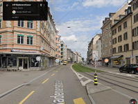
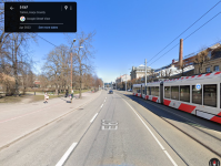
In London, for example, there are all sorts of arterial roads that are worked into the city. They aren't nice, they dont have sidewalks, and you'll get nailed if you try to pedestrian your way across them. but they have a smaller footprint overall and they exist in parallel with a strong transit network.
This sounds super intriguing. Can you link to a Google Maps/Google Streetview of what you are describing?
 
Sorry dude this is just absolute and complete bullshit. In Boston, pedestrians disregard any and all rules. So do bikes and so do cars. People walk, drive, and bike how and wherever they want. They walk in the bike lanes and they walk across roads, they speed up in cars when someone is trying to get across a crosswalk, they'll zoom a car or pedestrian on bike, and it has nothin whatsoever to do with safety. This is a cultural/local problem.
Welcome to reality. Humans aren't robots that perfectly follow rules and react to external stimuli in the same predictable way every time. The thing is, not following rules or acting unpredictably has far more serious consequences in only one of these; being behind the wheel of an automobile. A car is heavy machinery and there is a local/cultural problem that we let just about anyone and everyone drive with next to zero training here. That's a big difference with the rest of the world.
The chaos of the USA is the great appeal and the great drawback of this country. When I say there's no ambiguity on that, it's because there just isn't. Europe is tired, old, limited, claustrophobic, but also orderly and the settled and takes care of its [well, at least, natural born] people. The US is wild and free, but wasteful and chaotic. Are these stereotypes? Only to a point. It is ridiculous to argue that the behavior of Boston or American drivers, bikers, or walkers is not worse, overall, than the behavior of their counterparts in Amsterdam, London or Paris.
It is very true that individualism and the idea of freedom promote a culture here where everyone feels they should be free to inconvenience others, and that is a problem, but there's a huge difference between inconveniencing people and endangering the lives of others.

If someone is operating something that can so easily cause death or destruction then that needs to be handled with the utmost responsibility. If there were no cars or bikes, a pedestrian not paying attention or making a bad judgment and colliding with another person or structure would result in some scrapes and bruises and only in the most freak of circumstances, death. Add bikes and things become slightly more dangerous. Bikes colliding with each other or pedestrians can result in occasional instances of broken bones but again in only freak instances, death. So bikes should always yield to pedestrians and be more mindful than they currently are, but it's still fine to have bikes and pedestrians mix somewhat. It's still preferred to have separated cycle tracks and pathways to reduce conflict points. Bikes also don't have the mass to cause more property damage than a person can. Now introduce automobiles into the equation. The consequences of collisions between automobiles and anything are drastic. Even at the same speeds that a person or bike can travel, the mass of a vehicle means property can be destroyed and people can be seriously injured. Yet on our city streets where there are people and things not also protected by a metal box, we allow them to travel at speeds that can result in certain death and destruction. Not getting seriously injured at minimum when in a collision with a vehicle is "being lucky." That's not something normally said about collisions with other modes. None of this even includes how when in a vehicle your senses are reduced or how vehicles can experience sudden mechanical failures. Reintroduce natural human unpredictability into the equation and the obvious and most reasonable course of action should be to do everything possible to protect from potential unpredictability and reduce serious consequences right? Be we don't do that. That would mean making things a little less convenient for drivers. Instead, we put the weight of safety and inconvenience when trying to freely move about the world on the most vulnerable who should have the most right to be unpredictable humans. Trying to go to the shop directly across the street 60' away? Sorry, you have to go 200' to the nearest crosswalk, wait to cross the 60' there, and backtrack another 200' because if you try to cross the 4-lane, 30mph road here, drivers have no obligation to yield and if they hit you it'll likely result in at least serious injury and it'll be entirely your fault. It's ridiculous to put every precaution on one party especially when it's not the one that would be the sole cause of any damage. I'm not saying everyone should be always crossing the middle of the street wherever and whenever. I'm describing a normal, common, regular human behavior scenario that happens and was the norm for all human civilization until about 60 years ago. Obviously, times change and this is the modern age where automobiles exist and are in the hands of most adults. Safety is good, but safety doesn't only go one way where the pedestrian has to check off a list of boxes and go well out of their way while a driver only needs to follow colored lights and somewhat obey a number on a sign to be absolved of any responsibility in a collision. Creating a properly safe and equitable modern urban environment means taking precautions for human behaviors and other externalities that will require inconveniences for all parties involved at differing levels depending on the severity of responsibility they hold in safety. This means that yes, pedestrians should cross at crosswalks on their walk phase where present, but since not all will, roads, where people are around, should be designed to force lower speeds and more attentiveness to surroundings so that in the event of someone crossing where there isn't a crosswalk they will be much more easily seen and the driver will be able to make a sudden stop if need be. Yeah, it's annoying that people can just cross the street making you stop your car but it's only that; annoying. They have not endangered the driver or caused any damage to anything. A driver disobeying rules or lapsing in judgment or focus has potentially serious consequences for everything around them. Therefore disobeying said rules and not being attentive should be treated as such. In a private, protected, climate-controlled machine is the short delay more important than a person's life? And should a person be at great risk of being seriously injured or killed for a decision that doesn't have consequences for anyone else?
You're just flat wrong about Europe. Im not talking about Berlin or Rotterdam (which got flattened), and London definitely doesn't suck. Doesnt mean there's zero traffic. What it means is there is not a totally brainless denial of the fact that people (oh gee whiz) use cars, and there is a much more logical land use and urban planning in any cities, destroyed in there wars or not.
London is unique in the UK for its public transit and low car ownership. The rest of the UK's cities seriously lag behind. Rotterdam is known for being the car-centric city of the Netherlands but it still doesn't have a limited access highway to the city center and neither does Berlin.

Boston's downtown and neighborhood centers aren't much different from European counterparts except we still have limited access highways through the city. In that regard, we have far more car-focused downtown access than any European counterpart especially when factoring in the geographic barriers of downtown being a peninsula with random hills and only a mile-wide isthmus connecting back to the rest of the city. Route 1, 1A, 28 (North), I-93, I-90, Storrow, all serve this purpose. There's nothing to compare in most European cities.

In modern Europe and around the world, cities are removing car lanes to reduce car capacity and speed to encourage alternative transportation and create safer streets because that's what's better for the human environment.

Here are some varying arterial transformations:
1702241475949.png
1702241519253.png

1702241585373.png
1702241614408.png

1702241704382.png
1702241728570.png

1702242021042.png
1702242098850.png


I've said my peace and I'm no longer going to continue with this. I came here for buses and that's what I'm gonna get back to.
 

Back
Top