Riverwalk Bridge @ Science Park | Boston - Cambridge

cubbe8

Active Member
Joined
Mar 18, 2022
Messages
408
Reaction score
720

This project will construct a new shared use path connection on the west side of the Museum of Science, connecting the Boston and Cambridge sides of the Charles River, across a series of bridges and boardwalks.
Not sure the exact details of this but seems like a pretty large project.
 
Last edited:
Pretty hype ngl. Used to use this route all the time, although crossing on the western side of the museum was always more awkward than dangerous feeling. Taking a right merging onto a super thin painted path next to six lanes of traffic did feel a little sketchy sometimes though. Sounds like that segment is out of the scope of this project?

Looks like they have 150m slated for this project, what do people think would/would not be included in a project of that size?
 
That would be a nice connection. It's currently doable about halfway across, you have to cut through the parking garage eventually.
 
A bit more information, and a few renders in this new @StreetsblogMASS article.


There is also a link in the article to a lengthy PDF with more art. It looks pretty amazing, although I don't much like the way it connects with the River paths.

1755280653109.png
 
It seems like the stated goals of this project are not aligned with the illustrated concept. If this is meant to be transportation, why is the path so winding? Shouldn't it connect straight through to existing roads, paths, and crosswalks? As drawn, Charles River Dam Rd will still be a much more convenient way for peds and cyclists to cross the river.
 
If this is meant to be transportation, why is the path so winding?
I am obviously not the designer of this project, but if I were designing a shared path like this, it would be winding to force bikes to slow down. Yes I'm sure it will be split 50/50 like these paths generally are but you still don't want bikes or worse ebikes or mopeds speeding past pedestrians.

But as you say, this design is not great at being a transportation node. Connections to the Thoreau and Somerville Community Paths are clearly missing. Part of that is likely due to a scope limitation but that's a scope limitation that doesn't reflect trips people will actually be making. And it's not like those are difficult connections to make, all that's needed are a bridge like the one at the Esplanade to connect to the Thoreau path and a 450' bit of path across Charles River Dam Rd and up Museum Way to connect to the Somerville Community Path at North Point Park.
 
As drawn, Charles River Dam Rd will still be a much more convenient way for peds and cyclists to cross the river.
They're putting a drawbridge 150 ft. from another drawbridge. Like...why bother if you're not going to go all 400 ft. to the mouth of the canal?
 
They're putting a drawbridge 150 ft. from another drawbridge. Like...why bother if you're not going to go all 400 ft. to the mouth of the canal?
Visual proximity to the existing control tower so the operator can be looking at both simultaneously? Coupled with the fact that there's an existing structure directly abutting the edge of the canal at the end of it? As far as why bother...because the sidewalk on the existing draw is ridiculously narrow at that point...
 
Seeing this newly proposed project reminded me of a proposed pedestrian bridge that was supposed to be built in conjunction with North Point Park, as shown in this plan for the area in 1995. The layout below is copied from the document, and the red arrow (mine) points to the proposed bridge. Does anyone know why it was never built?

1755301373174.png
 
It may be trying to fit in an accessible ramp to the bridge without obscuring the pavilion. I think your proposal would end up creating a mini Central Artery between the pavilion and the planetarium.

Edit: I looked closer at the render. You can see the path loop at grade behind the pavilion and only start elevating after looping back towards the road bridge. It’s hack to make it fit like the existing road bridge.
 
Last edited:
It may be trying to fit in an accessible ramp to the bridge without obscuring the pavilion. I think your proposal would end up creating a mini Central Artery between the pavilion and the planetarium.
maybe? but like, why? It has to be a drawbridge regardless. Just make it level with the park.
 
Presumably it's to get it to the height of the road bridge, which doesn't always have to open for smaller craft. But I agree that the odd angle isn't ideal either.
 
Is the need for the bridge operator to have visibility of the span a factor?
 
We definitely badly need this riverwalk bridge, but it also seems to be tailored for tourists, runners, and recreational cyclists rather than actual people trying to get from home to work efficiently. Of course if Charles River Dam rd is a death trap (like it currently is) cyclists who are less comfortable will use the riverwalk path even if it is slightly less direct.

The obvious solution that will cost about 99% less (and be completed 99% sooner) is to take one car lane on the eastbound side), and make it a curb-separated bike lane. Then on the westbound side, make the car lanes slightly narrower to make way for a concrete barrier. That would actually accomplish our climate goals of reducing congestion and increasing mode-shift.
 
It seems like the stated goals of this project are not aligned with the illustrated concept. If this is meant to be transportation, why is the path so winding? Shouldn't it connect straight through to existing roads, paths, and crosswalks? As drawn, Charles River Dam Rd will still be a much more convenient way for peds and cyclists to cross the river.
Yeah, I think for pure transportation purposes, the dam road is preferable for those of us who are comfortable using it. But there are a lot of bike riders who are not. This might help them, particularly younger riders with a family that might be enjoying the Esplanade or even biking to the museum. It's purpose is likely for them and that kind of transportation, not for commuter warriors.
 
So, I might be able to provide some insight here because this is my commute, I go down CRD Rd to get from Cambridge to Bulfinch on my bicycle to get to work. In my opinion CRD road is not actually that unsafe anymore since they put in the bike lanes, yes there's no physical separation but these are actually quite wide bike lanes that i never see people park in except for a short stretch over the drawbridge.

The huge eater of space here, in my opinion, is actually the museum of science's driveway. They have this loading zone here that is raised eight feet or so up from the road, for some reason, and it is prodigiously wide. It's a very suburban hotel pull-off style thing, it does not need to be that wide, it should probably be exploded and then a proper bike path added. That said, yea you could probably take a traffic lane here if you didn't want to do that. My problem with this project is I cannot imagine any scenario where I would wait at that stupid light, turn right onto the sidewalk and fight traffic that way, and then go down through this path, and then find my way back across Storrow to get where I'm going...

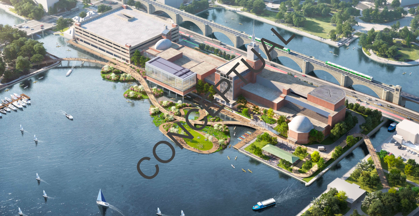
The solution nobody wants to say is that the entire Museum should be redeveloped. Start with the garage, go all the way down with "air rights" projects over the museum until you get to the Alcott in the west end. Prioritize making the buildings porous with a path going beside them with plantings.

Lastly, at 300 million, you could just spend that money to extend the E branch. It's not worth 300 million to add a path for pleasure purposes with marginal transit benefits.

1755522474245.png
1755524586959.png
1755524605326.png
 

Back
Top