Boston & Cambridge - 1950's

Charlie_mta

Senior Member
Joined
Jul 15, 2006
Messages
4,054
Reaction score
5,254
...and a little bit of Somerville.

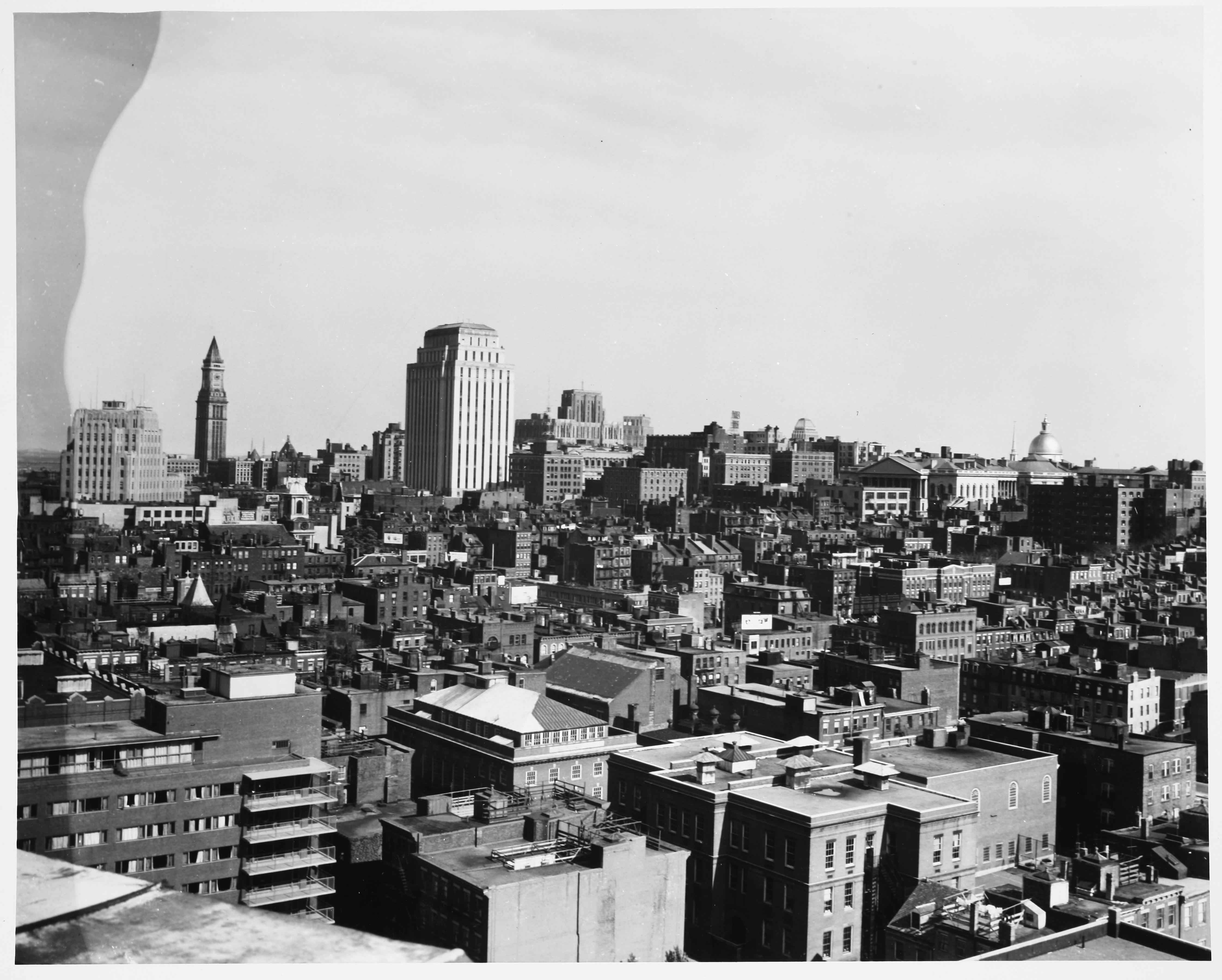
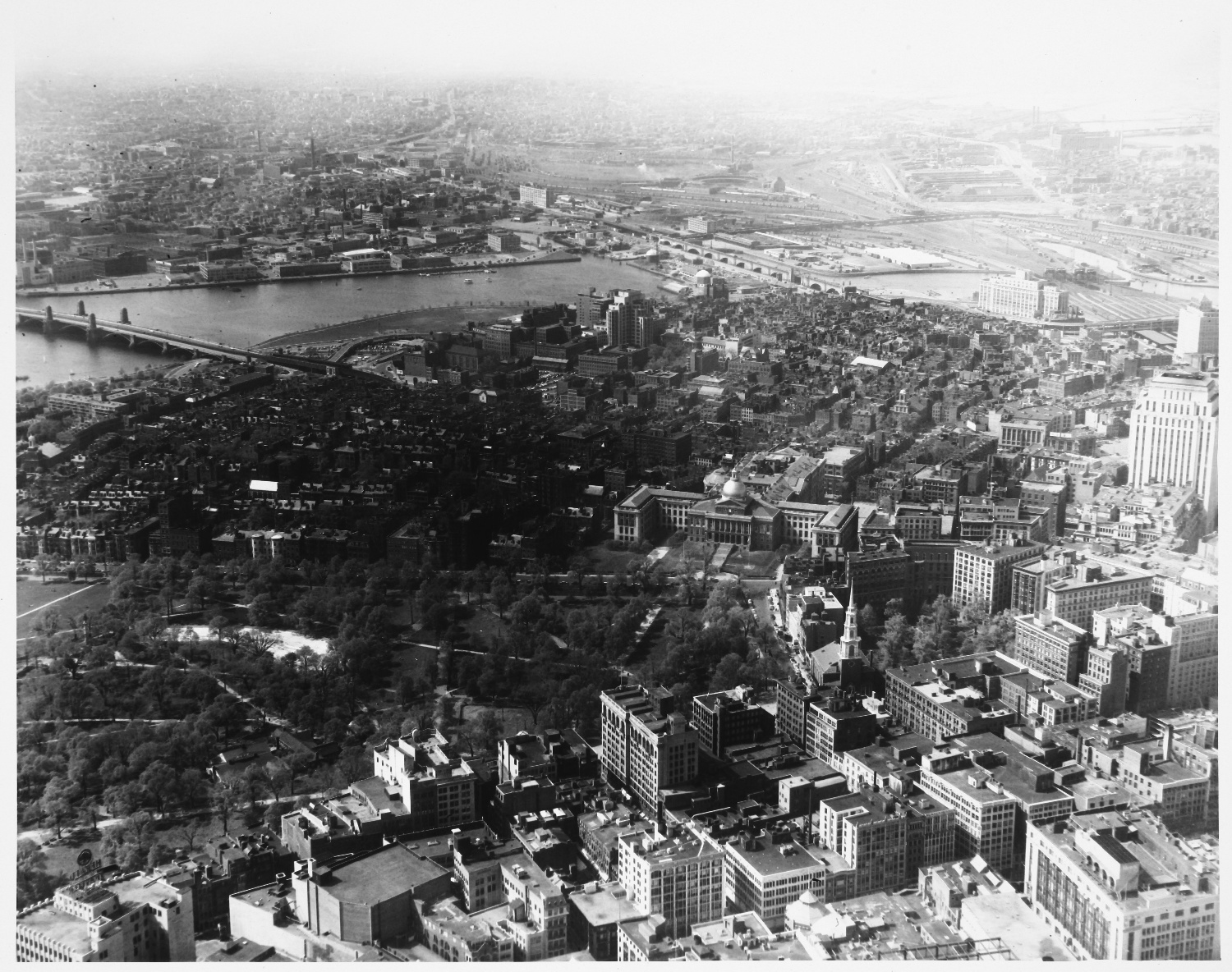
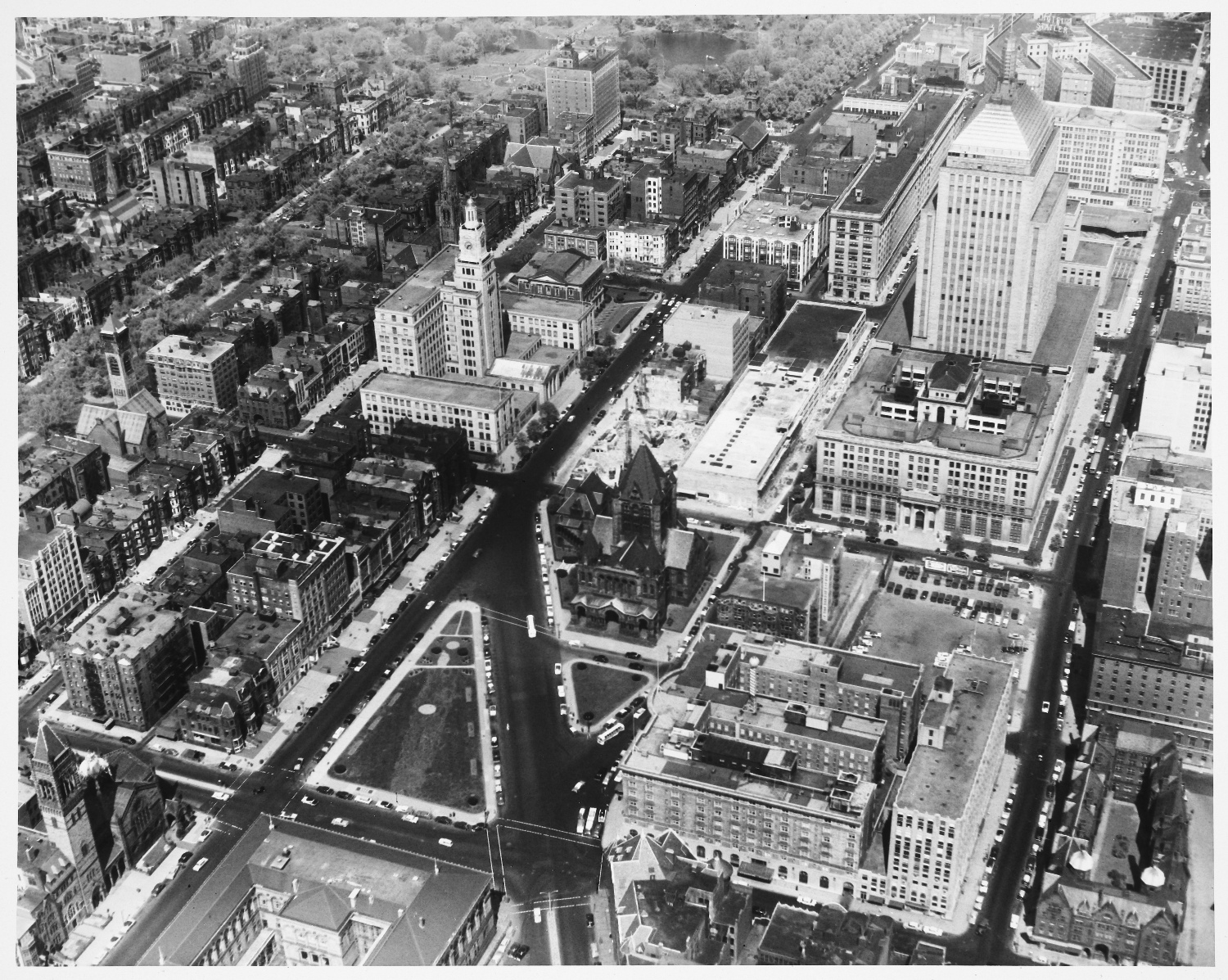
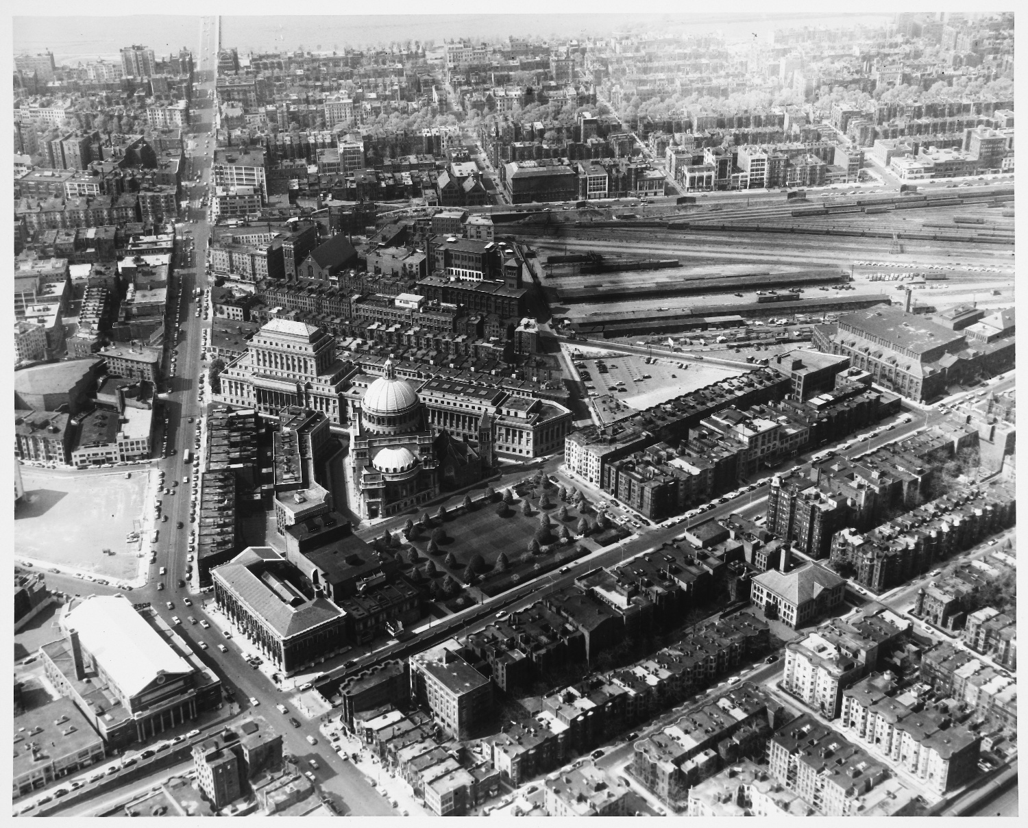
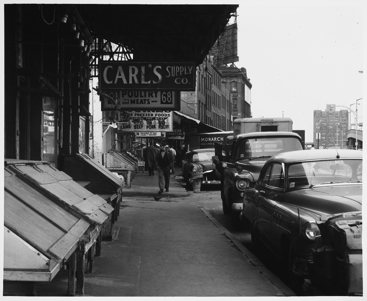
Here's an extensive collection of streetscape photos taken in the 1950's by some MIT folks. Great stuff. Just type in a key word like "Subway", or "Scollay Square", or "Central Square", or play around with different searches.

http://dome.mit.edu/handle/1721.3/33655
 
These are fantastic! Thanks for posting this!
 
I dont want to hear anyone complaining about Kenmore Square ever again.

Search and you find a serious selection of parking lots. All shapes and sizes. Almost no buildings. I didnt realize the citizens bank (first national in the pics) was old.

The one sad change is the large number of enormous trees visible in the pictures that are no longer there. Comm ave looked much more like beacon street.

http://dome.mit.edu/bitstream/handle/1721.3/34926/KL_001291_sv.jpg?sequence=3

Did they die or were they killed?
 
Last edited:
It's too bad the city effectively banned this sort of signage out of existence. What the hell were we thinking?
 
Last edited:
Just absolutely pure urbanity, sadly lost. I didn't imagine that it was this dense and big:

(West End)
KL_000782_sv.jpg


KL_000769_cp.jpg
 
However, I'd guess you'd call today's Copley better than it was before:

KL_000749_cp.jpg


Not necessarily. This was the street configuration Trinity was designed to respond to. When the Square was expanded and streets realigned, the original relationship the church had with its site was lost.

And I know this is probably considered heresy, but I think, as a public space, Copley Sq. is insanely overrated.
 
KL_000765_cp.jpg

I always wondered what there there before the current CSP.

KL_001080_cp.jpg

This is like out of a movie.


Also these wayfinding and orienteering reports Kevin Lynch had his students do are fascinating. From one in the South End:
Old man stops me, without introduction says, ?I worked over there?, pointing across the street, ?in 1911?. Asked him if notices any change in area, Looks at me. ?Change ??,?yes?. He:?yes, much change.? Walks on.

the nadir, a nether region, all enclosed overhead the sun is shut out, a variety of stores, neon signs in daytime, smells varied, sidewalks all marked with spittle, vomit, cigarette buts, tension evident, about fifty feet from corner must cross-over as buildings to the right are being torn down

movie house area, neon signs, bars, smell of {L circled} stale beer and food quite pronounced, a seemingly accelerated paced becomes apparent as one crosses Stuart street

one can?t walk up Salem without sensing a pulsating dynamic neighborhood, life in a sardine can, two of the famed North End blonde Italians, female, raucous voices, blooming figures, yet with lots of pace and romance in their gestures as they argue, Anna Magnani vitality, Cadillacs in front of the stores, the stores in front of the curbs, the people everywhere,
all ages and sexs, the Old Irish cop berating two young girls for cursing, the plump Italian storekeeper upholding the policeman fordoing so?. noise, color, texture
 
First photo: Some of the buildings taken down for the Christian Science Center and Church Park apartments:
Uptown Theatre was just to the right of Horticultural Hall on the north side of Huntington Ave
Strand Theatre (called 'Capri' in its final years) was a block to the east of the Uptown
Loew's State (called 'Donnelly Memorial' and then 'Back Bay' in its final years) and Fine Arts Theatre were on the west side of Mass. Ave.

Second photo: is that Blackstone Street, next to the old elevated Central Artery?
 
I dont want to hear anyone complaining about Kenmore Square ever again.

Search and you find a serious selection of parking lots. All shapes and sizes. Almost no buildings. I didnt realize the citizens bank (first national in the pics) was old.

The one sad change is the large number of enormous trees visible in the pictures that are no longer there. Comm ave looked much more like beacon street.

http://dome.mit.edu/bitstream/handle/1721.3/34926/KL_001291_sv.jpg?sequence=3

Did they die or were they killed?

Probably Dutch Elm disease wiped them out in the 70s.
 
Where is the Ballantine Ale sign next to the streetcar curving sharply out of a tunnel? I don't recognize this place at all.

I'm curious why the MTA/MBTA stopped selling ads on the wall such as what you show at Summer station.
 

Back
Top