
I think you can see it in this 1971 skyline photo too.Lol you got into the Globe's archives about 5 minutes faster than I did. Here's the other ones I found:
You are using an out of date browser. It may not display this or other websites correctly.
You should upgrade or use an alternative browser.
You should upgrade or use an alternative browser.
"Dirty Old Boston"
- Thread starter theSil
- Start date
Charlie_mta
Senior Member
- Joined
- Jul 15, 2006
- Messages
- 4,064
- Reaction score
- 5,275
Wow, taken from the same location and same direction as the first photo you posted:Another picture looking down State Street, this time from 1875.
State Street at Chatham 1875 LOC - Detroit Publishing by clamshack, on Flickr

 Pemberton Square - Suffolk County Courthouse by clamshack, on Flickr
 Boston skyline (Back Bay) Boylston St. at Common c1948 by clamshack, on Flickr
Another picture looking down State Street, this time from 1875.
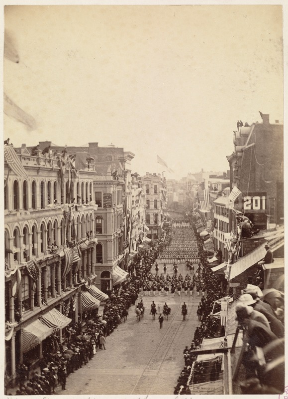
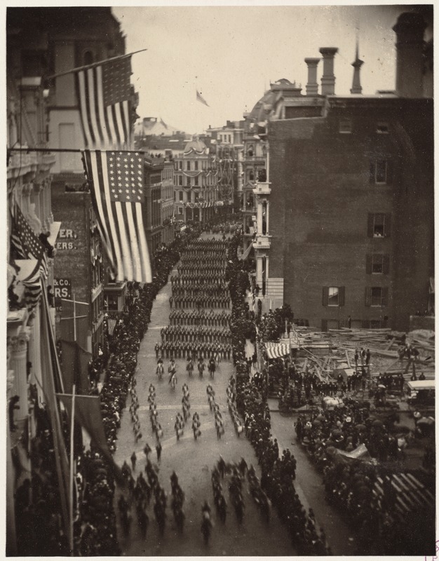
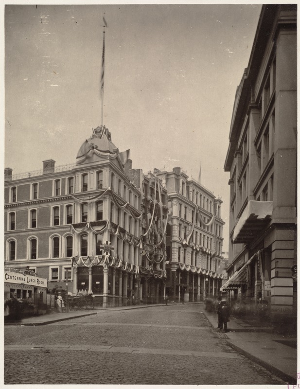
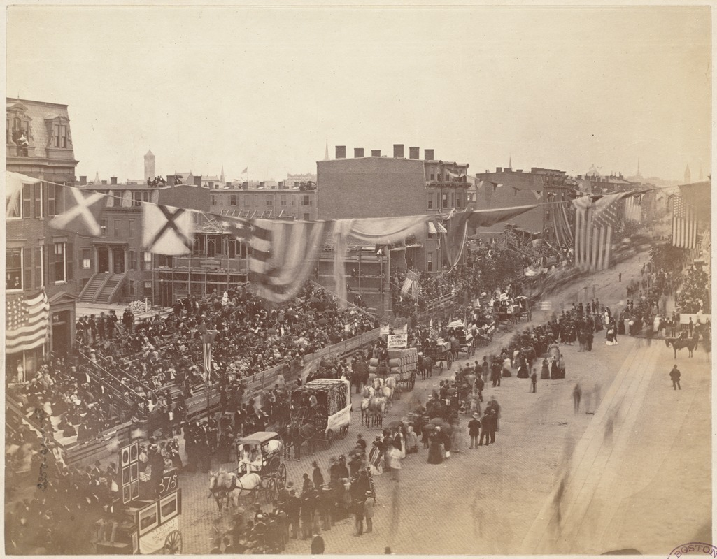
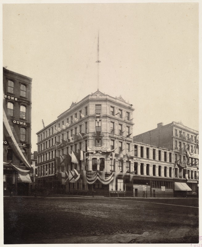
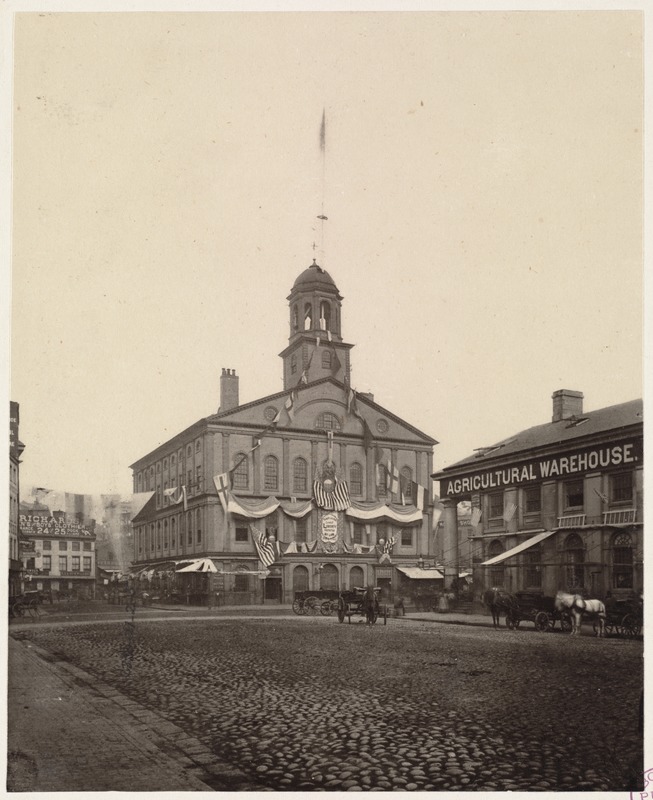
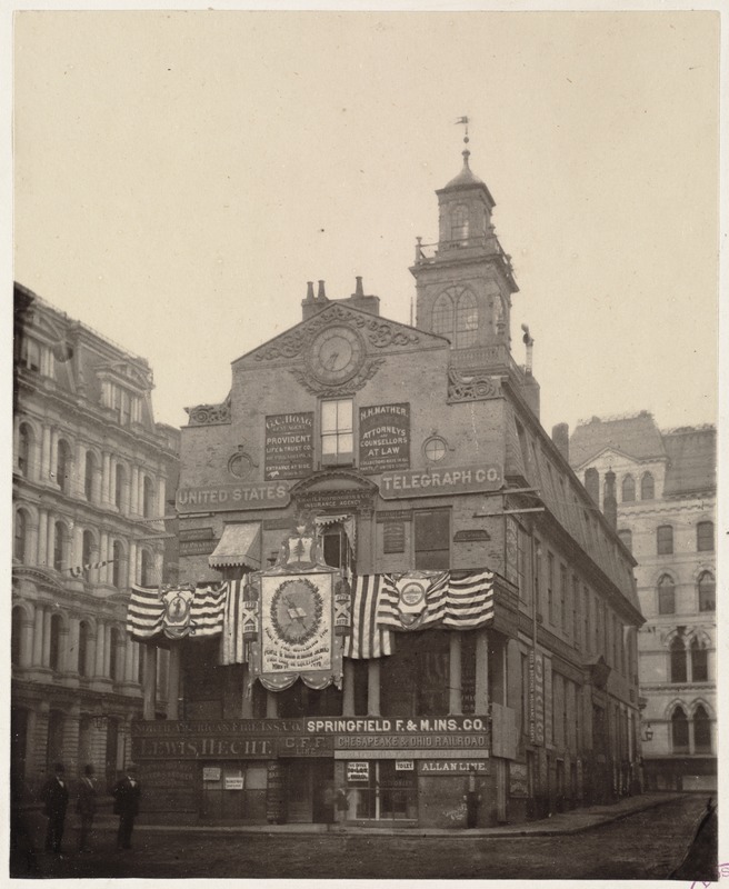
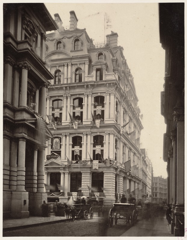
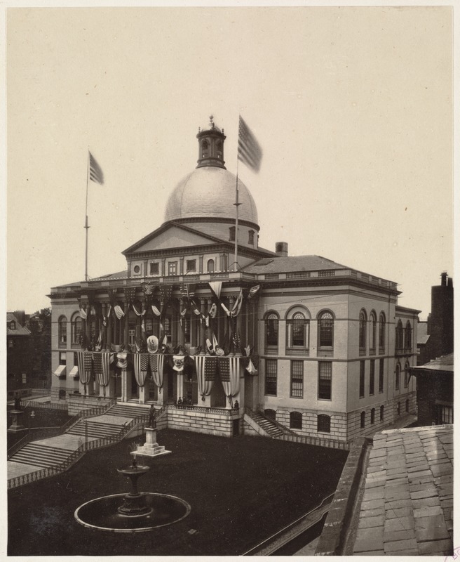
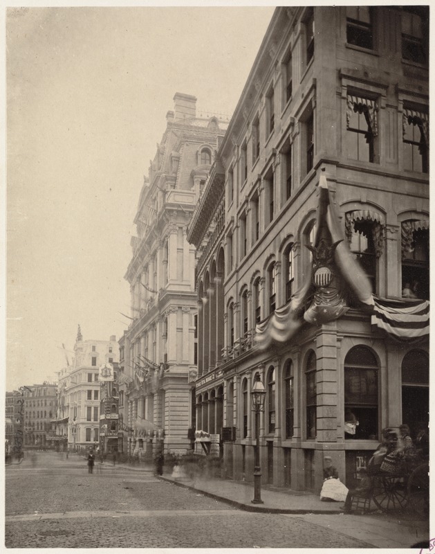
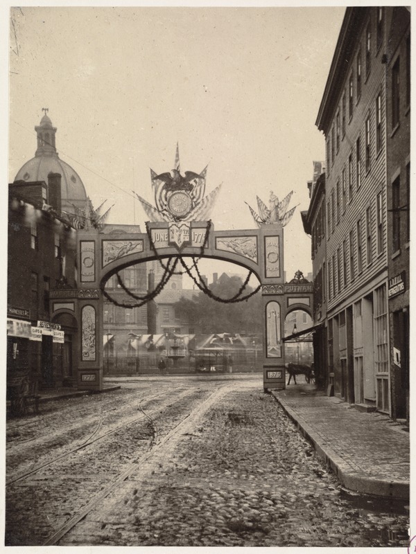
This was from the Centennial celebration of the Battle of Bunker Hill...always really liked this photo series.
Some other scenes from that event:
Washington Street, looking south from Milk Street
Quincy Market, looking east
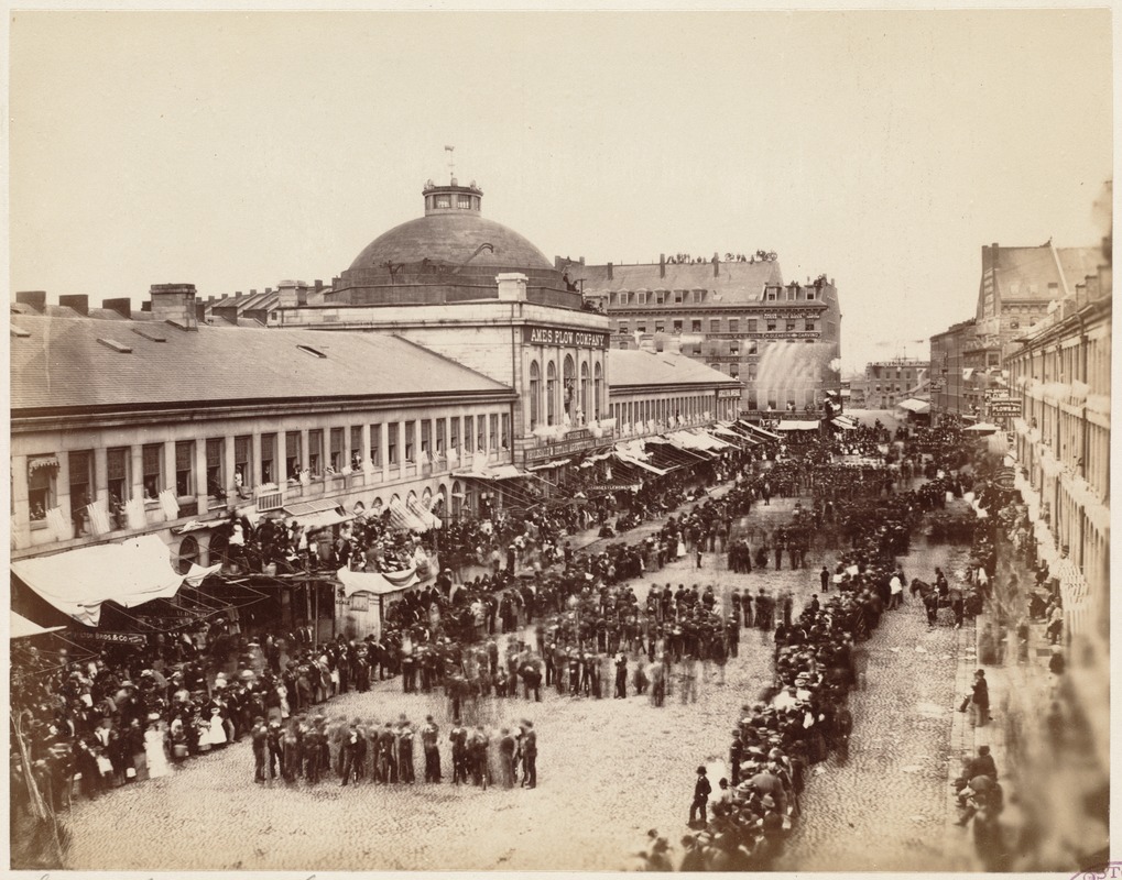
Milk Street, looking west
Columbus Avenue, looking northeast (467 Columbus on left; Braddock Park mid-left)

West side of Washington Street at Brattle Street (now occupied by City Hall)
Faneuil Hall
Old State House
East side of Devonshire Street, looking south from Milk Street
State House
Milk Street, looking east from Arch Street
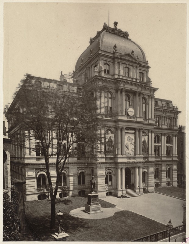
City Hall, School Street
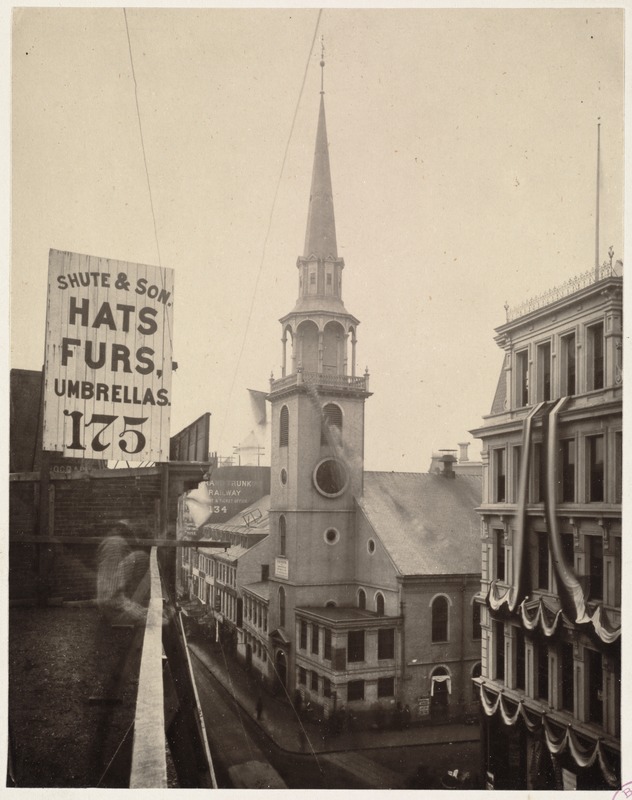
Old South Meeting House
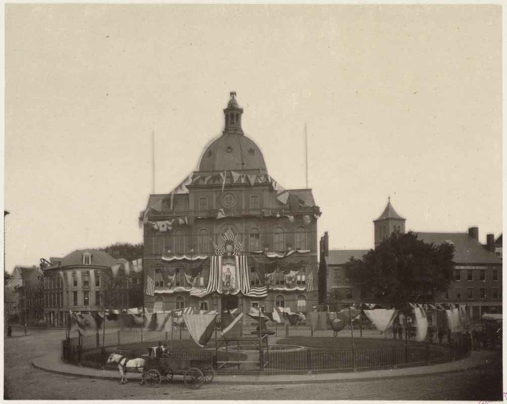
City Square, Charlestown
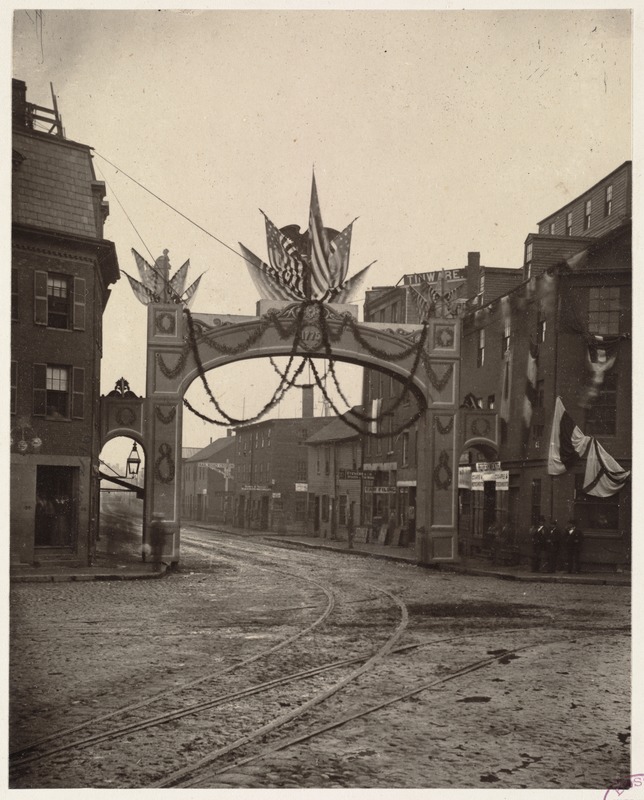
Boston Post Article

Last edited:
My lord, the volume of stunningly gorgeous architecture we lost. DAGThis was from the Centennial celebration of the Battle of Bunker Hill...always really liked this photo series.
Some other scenes from that event:
Washington Street, looking south from Milk Street
Quincy Market, looking east
Milk Street, looking west
Columbus Avenue, looking northeast (467 Columbus on left; Braddock Park mid-left)
West side of Washington Street at Brattle Street (now occupied by City Hall)
Faneuil Hall
Old State House
East side of Devonshire Street, looking south from Milk Street
State House
Milk Street, looking east from Arch Street
City Hall, School Street
Old South Meeting House
City Square, Charlestown
Boston Post Article
What is that domed building in City Square? Anyone know what it was, or when it was torn down?This was from the Centennial celebration of the Battle of Bunker Hill...always really liked this photo series.
Some other scenes from that event:
Washington Street, looking south from Milk Street
Quincy Market, looking east
Milk Street, looking west
Columbus Avenue, looking northeast (467 Columbus on left; Braddock Park mid-left)
West side of Washington Street at Brattle Street (now occupied by City Hall)
Faneuil Hall
Old State House
East side of Devonshire Street, looking south from Milk Street
State House
Milk Street, looking east from Arch Street
City Hall, School Street
Old South Meeting House
City Square, Charlestown
Boston Post Article
bigpicture7
Senior Member
- Joined
- May 5, 2016
- Messages
- 3,491
- Reaction score
- 7,304
Kendall Sq, circa 1962. Land had just been cleared to build the NASA Electronics Research Center (which became the Volpe Transportation Systems Center):
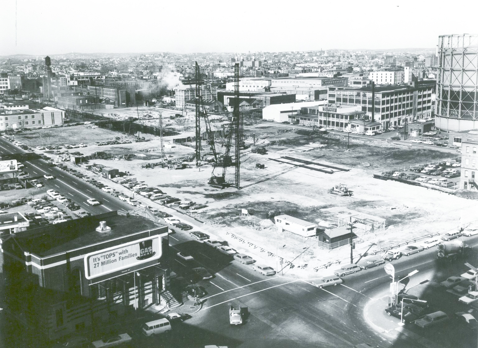
Photo: NASA (https ://www.nasa.gov/electronics-research-center/)
^Notable in above, the Broad Canal, which had once run all the way from the Charles River near to where Hampshire St. branches off from Broadway, and is now predominately filled in...here is only partially filled in. If you look at the upper-middle-left of the picture, you can see part of the canal still visibly filled with water.
Charlie_mta
Senior Member
- Joined
- Jul 15, 2006
- Messages
- 4,064
- Reaction score
- 5,275
If JFK hadn't been assassinated, this location would've become NASA headquarters. No big loss, IMO. But that aside, I used to love the old Kendall Square in the late 1950s. My mom worked on the assembly line at the Carr Fastener factory on the south side of Kendall Sq, and when we picked her up from work the smell of candy from the Necco factory absolutely permeated the whole neighborhood. Man, I loved those old factories. I never wanted to work in one, but I liked the historic industrial look. MIT has done a great job of preserving and repurposing many of those great buildings.Kendall Sq, circa 1962. Land had just been cleared to build the NASA Electronics Research Center (which became the Volpe Transportation Systems Center):
Photo: NASA (https ://www.nasa.gov/electronics-research-center/)
^Notable in above, the Broad Canal, which had once run all the way from the Charles River near to where Hampshire St. branches off from Broadway, and is now predominately filled in...here is only partially filled in. If you look at the upper-middle-left of the picture, you can see part of the canal still visibly filled with water.
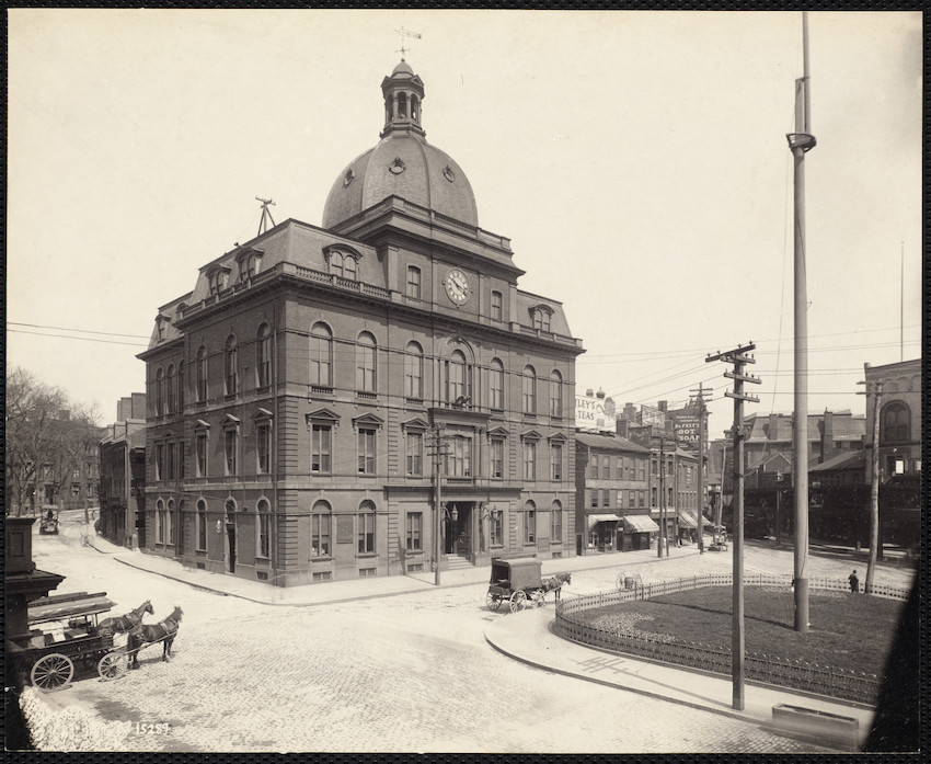
That's the (former) Charlestown City Hall, erected 1867 and demolished 1913. Following annexation, it was turned into a public library and police station. It's now the site of the Municipal Building.What is that domed building in City Square? Anyone know what it was, or when it was torn down?
Java King
Active Member
- Joined
- Apr 6, 2007
- Messages
- 849
- Reaction score
- 1,668
That's the (former) Charlestown City Hall, erected 1867 and demolished 1913. Following annexation, it was turned into a public library and police station. It's now the site of the Municipal Building.
Is this the current building on the site? Or do I have the location incorrect?
Yep, that's the spot. In the previous picture, you can see the edge of Roughan Hall on the right.Is this the current building on the site? Or do I have the location incorrect?
View attachment 48104
Charlie_mta
Senior Member
- Joined
- Jul 15, 2006
- Messages
- 4,064
- Reaction score
- 5,275
That's a great shot. It really shows the unique way Boston's skyscrapers in the Financial District are juxtaposed at myriad orientations, looking like a collage of photos mixed together, compared to the straight linearity of other cities' grid-based skyline.
BeyondRevenue
Active Member
- Joined
- Mar 13, 2020
- Messages
- 543
- Reaction score
- 1,132
Reminds me of when my daughter was little and I used to read her this...View attachment 48214
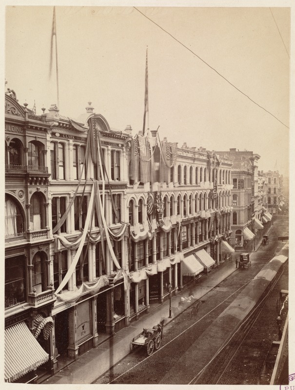
Looking through this thread, it's amazing how this building on Milk St has survived so many changes to the area. (Taken earlier this year)
The Town That Got Out of Town: Robert Priest: 9780879237868: Amazon.com: Books
The Town That Got Out of Town [Robert Priest] on Amazon.com. *FREE* shipping on qualifying offers. The Town That Got Out of Town
www.amazon.com
My parents would read that to my late son when they watched him. Excellent book.Reminds me of when my daughter was little and I used to read her this...
The Town That Got Out of Town: Robert Priest: 9780879237868: Amazon.com: Books
The Town That Got Out of Town [Robert Priest] on Amazon.com. *FREE* shipping on qualifying offers. The Town That Got Out of Townwww.amazon.com
 1906_TremontSt_Boston_USA_byDetroitPublishingCo_LC by Erika Hartman, on Flickr
 Masonic Temple, Tremont & Boylston Sts from BPL by clamshack, on Flickr
 Boston South Station In June Of 1977 by Mixer Man 1978, on Flickr
stick n move
Superstar
- Joined
- Oct 14, 2009
- Messages
- 10,391
- Reaction score
- 11,777
Boylston st. 1000 boylston would have been built directly to the right of the bridge. Would be pretty cool if the bridge had remained while the pike holes were here.

https://www.facebook.com/share/1PRc4BbmDtXRae6y/?mibextid=WC7FNe
https://www.facebook.com/share/1PRc4BbmDtXRae6y/?mibextid=WC7FNe