MBTA Buses & Infrastructure

The bus depot adds a lot of time for through routed buses. Maybe they are moving in the direction of only having terminating routes use the depot, shaving a few minutes off the schedule for the others. Or perhaps it's just through routed buses that do not have a significant ridership share board/deboard at Ruggles that will skip the depot.
 
The bus depot adds a lot of time for through routed buses. Maybe they are moving in the direction of only having terminating routes use the depot, shaving a few minutes off the schedule for the others. Or perhaps it's just through routed buses that do not have a significant ridership share board/deboard at Ruggles that will skip the depot.

See I would be fine with through routed buses without significant ridership at Ruggles bypassing the busway but their own route profile of Route 8 shows that Ruggles is the single highest ridership stop on the entirety of Route 8.

I would rather see them adjust the timing on the traffic light at the end of the Ruggles bus loop, switching the buses to go before the pedestrians, and maybe making the pedestrian cycle request only after maybe 9/10pm, I think its ridiculous that buses trigger the pedestrian cycle even at 11PM/1AM etc and have to sit there for the invisible peds to cross in the 25 second cycle. I think that would have a larger impact...
 
That all makes sense, might be worth submitting a comment. I'm about 50/50 on my use of Ruggles bus lines, as to whether I originate/end the trip there verses passing through. For me, I can't stand the added time for passing through. But I'm also a pretty infrequent user of any of those bus routes.
 
One issue I have noticed is that they are 100% focused on what stop people get on or off at...instead of the actual destination people are going or coming from.

Lets imagine a grid where you have 100 riders get off at 3rd Ave (north south) and A st (east west). You then propose shifting the line to 2nd ave, and justify it as people only having to walk one extra block. But if everyone is actually going to 4th avenue, youre now forcing a 2 block walk.

Without knowing where people are actually trying to go, it doesnt make sense to make these changes and claims.
 
Without knowing where people are actually trying to go, it doesnt make sense to make these changes and claims.

I think they chose 3 kinds of "wasted miles" where, while not "for sure" the odds that changes were doing good vastly outnumber the odds that changes were doing harm.

Changing from dangling ends to square-to-square (95 in Medford)
Eliminating extra loops and polygons mid-route (70s on Concord Ave, some Ave Pasteur-to-Longwood Ave swaps)
Nipping off a second subway connection (136/137)

Even without knowing exactly where people were going door-to-door, you could show that you had a lot of linear bus miles that were:
- not creating extra square feet of coverage.
- double-serving the same square feet
 
Last edited:
I can’t believe it, but I don’t think there’s a forest hills station thread... and not gonna start one now that it’s almost finished.

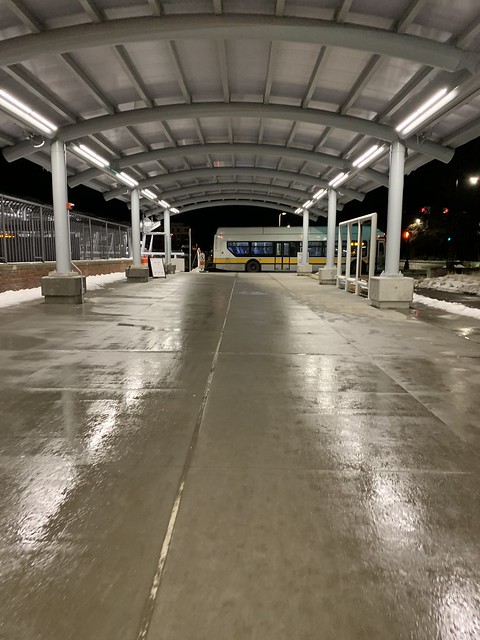
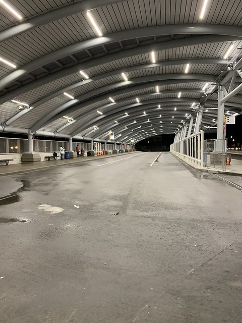
But anyway, the upper level busway is now open. Finishing touches have yet to be completed, but it’s pretty nice already. One complaint is that the signage for the bus routes is too small and poorly lit to see from afar.

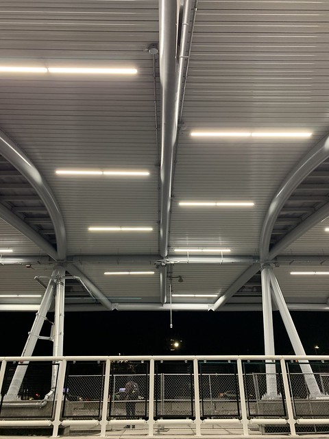
The lights are finished and look pretty good minus the one that has been broken and constantly flickering....
The fencing they're putting in seems odd to me and a little unnecessary. Otherwise it feels great and like they're actually investing in bus users.

33297407788_577730e8c7_z.jpg


46258558735_36b9e13576_z.jpg


33297407858_57d422e342_z.jpg
 
I think the fencing is to make it less likely that people will cross through the busway between platforms. If there is only one bus that works for you, ie you need to be on a 34E, then you'd have no reason to cross. But somebody going to Rozzie Square can take most buses from either platform, so they might cross to grab whichever one is about to leave next. That's a safety issue, so the fence is there to force people to only cross at the designated crosswalk. It looks much nicer than the "temporary" chain link fences they used in the old depot.

One other thing to add, now that I've used the depot several times to get a sense of things: I really like the view from the Hyde Park Ave. side of the depot, where you wait for the Washington St. buses (34/40/50). It feels a bit like an el station, the way it's almost over hanging the street and you can look down at the bars and restaurants. With the new buildings going up in the old parking lot, the spot has a distinctly urban flavor and is quite pleasing to my eye.

Yeah I guess, but its definitely not restricted like this at dudley and doesn't seem to be a safety issue. I'm not saying keep the chain fence, but at least have some sort of ease of cross over besides walking all the way around. Not a huge deal obviously but...
 
“Boston, MA– The MBTA has been making adjustments to their system over the past few years, and some recent changes focus on reducing pollution in and around the city of Boston.”

“To that end, they’ve decided to test out battery-powered buses next month. The MBTA aims to reduce the pollution from diesel buses by trading them out for the battery-powered models. Steve Poftak, general manager of the MBTA, stated: “We decided we’re not going to purchase any more diesel buses,” as reported by WGBH.”

https://www.uptoboston.com/battery-operated-buses-to-be-tested-by-the-mbta-next-month/

That quote gets taken waaaaaaaaaay out-of-context. They will still need to procure diesel-hybrid buses into the future for longer-haul routes that don't fit comfortably in the charging range of current battery tech. Straight diesels with no hybrid drive are already well on phase-out, with last one of those being purchased 11 years ago.

On the actual FCMB slides about the battery buses they duly note that while the majority of the equipment pool can migrate over to batteries there are still route outliers on the system that outstrip current and foreseeable-future capabilities of a charge. Besides long routes there are some that begin/end far from a garage, and others that for misc. reasons won't easily be able to accommodate a pause for charging between runs. Other initiatives like RER basically depend on large-scale service expansion in the outer reaches of the bus district, so in order to do RER right the expanding suburban routes that range closest to 128 and furthest from the main garages will still need some sort of fossil fuel drive (albeit with ever more efficient generations of hybrid drive).

Battery buses merely become the biggest load-bearing share of the fleet going forward, by virtue of the highest-ridership and most urban routes being short-hauls in close range to one of the downtown garages. That's pretty straightforward, as the tech is now mature enough to handle the average route length of any Key Bus Route and majority of urban routes. But nowhere is Poftak suggesting that they're going to be self-limiting by equipment about what services they can run. Diesel-hybrids are going to remain an essential part of the toolbox even if their route share flips on its head.
 
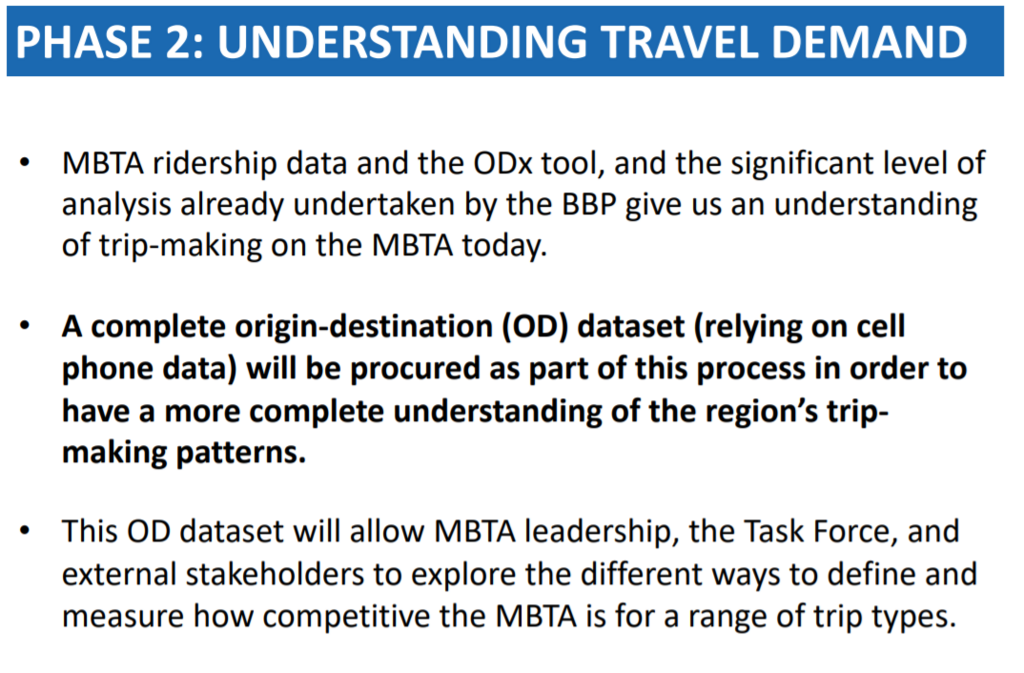
Was wondering if anyone could explain the meaning of the second bullet point in this slide presented yesterday? Cell phone data? What kind and how so? WE talking data from providers about customers, or MBTA staff or transit/Google Maps or what? Missed the presentation itself they might have explained it.
bus.png

Don't have time to look it up, but the FMCB presentations are recorded and available to replay.

Here is the link to the recording and the slide decks. Somewhere in there is probably your answer.

https://www.mbta.com/events/2019-03-25/fiscal-and-management-control-board-meeting
 
Was wondering if anyone could explain the meaning of the second bullet point in this slide presented yesterday? Cell phone data? What kind and how so? WE talking data from providers about customers, or MBTA staff or transit/Google Maps or what? Missed the presentation itself they might have explained it.

It's data from everyone. Location-based services provides use data from every cell phone that is moving to measure travel speed and travel time on any segment of a network, and they can guess at what mode a phone (or other GPS device) was on from how fast it was moving, among other attributes.

Since it's known when a phone started and stopped moving, LBS services can also identify Origin/Destination pairs, count the number of people moving between geographic areas (like neighborhoods or station catchments), and identify/quantify the routes people took to get between them. That's the main way that the network redesign will use it - identifying underserved or unserved markets and routes.

This stuff is completely anonymized and purchased from cell phone companies. It's not like the MBTA is going to ask people to download an app to participate. If you don't want to be tracked in LBS, turn off the GPS on your phone.

Never said I had an issue with it, just was curious especially with the blatantly inaccurate GPS location I get in tunnels. I suspect its cell tower data not GPS data, especially since the MBTA has had companies install cell networks in the subway tunnels yearsss ago. Also just wondering if that correctly maps the needs of lower-income communities, elders, and youth? Smartphones are near ubiquitous today but not entirely. Most cell network providers aren't given precise GPS location data, especially on iPhones. They get an estimated location based on cell tower data.
 
Never said I had an issue with it, just was curious especially with the blatantly inaccurate GPS location I get in tunnels. I suspect its cell tower data not GPS data, especially since the MBTA has had companies install cell networks in the subway tunnels yearsss ago. Also just wondering if that correctly maps the needs of lower-income communities, elders, and youth? Smartphones are near ubiquitous today but not entirely. Most cell network providers aren't given precise GPS location data, especially on iPhones. They get an estimated location based on cell tower data.

I believe the service is fairly universal among income groups, but it may not be perfect. I don't believe that it serves tunnels well, but I'm not sure. The purpose here isn't to pick up movement in the tunnels in any case...
 
A lot of info here. But relevant to this thread, Boston's FY20 budget includes:

T$200,000 in additional support for Boston's ongoing bus lane program, including repainting the Washington Street and Essex Street bus lane corridors that serve the Silver Line 4 & Silver Line 5, and investing in a plan for improvements to Blue Hill Avenue.
(Bolding mine.)

Additionally,
The City will also continue to increase the investment in a citywide, multi-year campaign to bring all painted crosswalks, lane markings, bike and bus lanes into a state of good repair.

link with more
 
Even when those lanes had fresh new paint, it didn't seem to make a difference.
 
Essex St in particular will never change without police enforcement, which means it never will because they abuse it too. Maybe those little flappy bollards might do the trick. But it's just too convenient of a corridor to slip onto 93 from the greater downtown area. People hate sitting in traffic when there's an empty lane adjacent, I've seen it during the evening rush and the 2am club emptying rush on weekends, unless someone is posted up writing tickets or they fully protect the lane it's never going to be buses/bikes only.
 
Essex St in particular will never change without police enforcement, which means it never will because they abuse it too. Maybe those little flappy bollards might do the trick. But it's just too convenient of a corridor to slip onto 93 from the greater downtown area. People hate sitting in traffic when there's an empty lane adjacent, I've seen it during the evening rush and the 2am club emptying rush on weekends, unless someone is posted up writing tickets or they fully protect the lane it's never going to be buses/bikes only.

I think bollards are a good idea. Its not perfect, but it forces cars to commit to entering the lane at an intersection instead of merging over mid-block to pass something and then just staying in the lane.

As an aside and a counterpoint, they put up a bunch of floppy bollards all over my neighborhood (Ball Square Somerville) due to the year-long Broadway closure. They were placed near street corners and in the middle of lanes to prevent detoured traffic from speeding around corners and through intersections. Almost every one of the bollards has been flattened. It is quite disheartening how little people care about what they run over with their cars.
 

Back
Top