Boston Harbor Flood Protection Projects

My presumption was that port activity, new yacht/marina slips, presumed toll collection for the bypass, and real estate development opportunity for the above schematic would help offset some of the heavy cost associated with an engineering undertaking of that magnitude. If I had to guess, that barrier would be somewhere in the $20 billion range to construct.

If Massport could relocate their port activity, their South Boston real estate alone could be sold for several billion dollars if recent land sales are any indication. The miles of new waterfront property with unobstructed harbor and city views could spell billions of dollars more in real estate investment along the new ring barrier.

Although I'm titilated by the proposal, my main confusion with it is how a new 4-lane highway (I-493?) and railroad would affect Quincy and Winthrop/East Boston. What would those connections look like? Also--the Boston Harbor Islands are a National Park, correct? Is there a precedent for this kind of fill development through and around the islands? Could the Commonwealth even get a variance from the federal government to build here?
 
This is the first image on google, looks like the simplest idea. We all know the drill though, it will take a devastating storm to wreak havoc on Boston to get this done. If something has not happened yet its hard to get people behind something like this. If god forbid a storm slams Boston and causes billions of dollars in damage and loss of life people will be beating the doors down to get this done. Until then it is just a fantasy.

http://environment.harvard.edu/node/3272


FrontImage.jpg
 
Thanks for posting that, stick n move, I hadn't seen it.

But I read the source site, and see that the swing barrier would stop a rise of mean sea level up to 18 feet. Logan is nowhere near that high above sea level. So at the risk of sounding like I'm beating a dead horse: how does this swing barrier protect Boston? The surge just over washes Logan, unless you dike that to a similar height, and perimeter dikes like that would cause some issues with the runways, I would think (like plane crashes if a pilot comes in a tad low, and so on...minor stuff). Or do they propose raising all of Logan? Oops, there went many additional $billions.

Cool schematic though, and it'd be cool to see it get built, in and of itself, even cooler to watch it get deployed one day. I just feel like there's a 900 pound gorilla in the room.
 
It would still protect Boston from any storm surge not high enough to wash over Logan. That's not nothing!
 
It would still protect Boston from any storm surge not high enough to wash over Logan. That's not nothing!

But what kind of damage to Boston does a surge do that is not big enough to wash over Logan? I ask from ignorance, not from snark. Logan is awfully low. Anything that falls just short of cresting over Logan's banks would only be flooding a fairly small amount of Boston, wouldn't it? Or am I wrong?
 
I'd worry about the water-holding capacity on the Boston side of and Airport-Castle Island barrier.

The premise behind these barriers is that 12 to 18 hours worth of storm-fed flow of the Charles and Mystic has to stored on the "Boston" side of the barrier while a high-tide / storm-surge is repelled on the Ocean Side.

If the city-side basin is too small, you run the risk that the rivers flood the city, even as the sea is kept at bay. So a big area protected on the city side is a double win:
1) minimal harbor rise while storing a lot of water
2) more assets protected.

Basically, it is the rivers that carry the surge to unprepared places. You need to let their freshwater flow out and not let the sea back them up. That starts with:

Charles
Mystic
Neponset

(as the Squantum-Egg barrier covers).

But really, are you going to leave all of Quincy and Hingham to flood? If this gets built, it makes more sense to go Hull-Egg and raise the dunes as far north as Rumney Marsh (Revere) and as far south as Cohasset.

You also have massive pumps to pump like the daylights to get the river surge water out.
 
You also have massive pumps to pump like the daylights to get the river surge water out.

New Orleans tried that and it didn't work to well during Katrina. In a really big storm, you need simple solutions and not mechanical failure points.
 
New Orleans tried that and it didn't work to well during Katrina. In a really big storm, you need simple solutions and not mechanical failure points.

You just need someone more competent than the Army Corps of Engineers designing the system. All the Dutch flood barricades have pumping systems also. They know what they are doing.
 
But what kind of damage to Boston does a surge do that is not big enough to wash over Logan? I ask from ignorance, not from snark. Logan is awfully low. Anything that falls just short of cresting over Logan's banks would only be flooding a fairly small amount of Boston, wouldn't it? Or am I wrong?

This is a great question. Anybody know the answer?
 
This is a great question. Anybody know the answer?

It's the drainage, not the elevation:

sixfeet.jpg


What you see ^here^ in the dry land on the flood map are, roughly. . .

Shawmut.jpg


. . .the ^original Shawmut Peninsula and original Harbor Islands^.

The inundated areas are overwhelmingly in the human-engineered landfill. Landfill saturates way fast, and drains real slow because the drainage patterns have to channel out the mouths of the old inland tidal flats before being able to dump out into open harbor. The original bedrock terra firma the Puritans settled in the 17th century might take a quick and largely superficial bath at high tide, but the water washes right off its backs quickly and doesn't supersaturate the ground. Unfortunately, that fucks the landfill areas even harder because that's where half the water washes off backs...straight into the same constipated ancestral drainage channels that make the landfill's inundation so long-lasting in the first place.

In short: the damage (with some exceptions) concentrates not around proximity to the water today...but proximity to the inland water 300 years ago that doesn't have a wide-open, straight-shot storm drain back into open ocean.


In shorter: invest in real estate in Southie, really good flood insurance in South End.
 
You just need someone more competent than the Army Corps of Engineers designing the system. All the Dutch flood barricades have pumping systems also. They know what they are doing.
I think that is because the Dutch are always below sea level and they don't have a "no pump" option. I think St. Petersburg (check me on this) is a no pump, big lagoon setup whose only movig part is the surge barrier in the perimeter seawall
 
I think that is because the Dutch are always below sea level and they don't have a "no pump" option. I think St. Petersburg (check me on this) is a no pump, big lagoon setup whose only movig part is the surge barrier in the perimeter seawall

Boston wouldn't need pumps out in the open water on the perimeter gates. That outflow takes care of itself with the next tide cycle.


The landfill areas? They're gonna need big-ass pumps. An entire subterranean network of big-ass pumps strung together like a new utility grid, with sewer pipes built to suit and massive outflow channels going past the flood wall. It'll be as big a Dig Safe utility project as the late 19th century when all the thickets of overhead telegraph lines were relocated to under-street across the entire city. And, yes, they will have to pick winners and losers on which streets worth of buildings are designated sacrifices because the road happens to align like a natural drainage channel. Dartmouth, Clarendon, etc. I don't think we need to think high-concept like changing those streets into permanent Venice canals. But there will be a handful of them designated as flood drainage routes, and if you want that posh brownstone you better be willing to play the odds that you'll get through your years in that bungalow with no flood events and no flood insurance offered.
 
I think that is because the Dutch are always below sea level and they don't have a "no pump" option. I think St. Petersburg (check me on this) is a no pump, big lagoon setup whose only movig part is the surge barrier in the perimeter seawall

Arlington, good observation about the Dutch installations. I think you are correct about the Saint Petersburg Flood Prevention Facility Complex. There are however, 30 water treatment facilities as part of that complex that do pump some water out of containment area, but they are not there for storm water removal (they are there to clean up the sewage).
 
F-Line, thanks for that map and the point about the issue of water from the rivers. I was in North Carolina for a while in the 90s, and there was a hurricane (can't remember which one, there were lots in that stretch) where one of the barrier islands got breached from the inland direction in a way similar to what you describe. There was no man-made barrier influencing events, it was all natural. But the dynamic was freaky strange and surprising, except to the people who study such things, whose response was "probably happens plenty often on this coast on a geological time scale."

The surge that came into Pamlico and Albemarle Sound couldn't get itself drained back out before the river flooding arrived, and at one location a barrier island was breached badly by water pouring over it OUTbound. The winds had eased enough for news helicopters o be able to hover over the breach, and it was clear the water in the Sound was several feet higher than the water in the Atlantic. There were half a dozen near breaches of a similar nature all up and down the barrier islands.

Back to Boston, I'm surprised to see on your map that the container port looks more vulnerable than much of Logan, at least the pat of Logan where the proposed inner swing barrier would anchor.

Another trouble point for an inner barrier is father south. Your map captures it a bit, this one goes a little farther south:

http://www.tbha.org/sites/tbha.org/..._slr_forum_creativecommons_by_sa_20110728.jpg

If an inner barrier were built, it'd be up there stopping a surge into the main inner harbor, but it would leave exposed several wide breach points: across Moakley Park, then again at Savin Hill Cove and the next little cove south from there. They all feed directly into the Morrisey Blvd / I93 / Red Line / commuter line corridor, which would feed the surge into the Widett area and parts of the South End and into the Fort Point area. And then, referring back to your historical map, we'd have to hope the remnants of the original isthmus could hold or it could make it across into Back bay. And all the while the issue with the river flooding, which you described, is playing out from the upstream direction.

When the BSA and Harbor Islands folks were doing that competition on resilient planning, they did some reviews of these risks. I can't remember who all spoke, but they made a point of this: they referred to the I-93 / Red Line corridor as the soft underbelly of Boston. And one person specifically said computer flood modeling had suggested that the Back Bay might have more flood risk from across the South End direction than from the Charles, in the case of major storm surges.
 
Boston wouldn't need pumps out in the open water on the perimeter gates. That outflow takes care of itself with the next tide cycle.


The landfill areas? They're gonna need big-ass pumps. An entire subterranean network of big-ass pumps strung together like a new utility grid, with sewer pipes built to suit and massive outflow channels going past the flood wall. It'll be as big a Dig Safe utility project as the late 19th century when all the thickets of overhead telegraph lines were relocated to under-street across the entire city. And, yes, they will have to pick winners and losers on which streets worth of buildings are designated sacrifices because the road happens to align like a natural drainage channel. Dartmouth, Clarendon, etc. I don't think we need to think high-concept like changing those streets into permanent Venice canals. But there will be a handful of them designated as flood drainage routes, and if you want that posh brownstone you better be willing to play the odds that you'll get through your years in that bungalow with no flood events and no flood insurance offered.

This was my point exactly -- it is not the open harbor that needs pumps, it is getting the water out of the landfill areas quickly that needs to be facilitated. Basically massive storm drains that are pumped for fast evacuation of water. Probably also more storm water storage capacity as well.

This is the stuff the Dutch have to do (because so much of the land is below sea level), but it is very similar to the state of our landfill areas.

It also makes sense that the old South Bay area presents a huge threat from storm surge that could inundate the South End and even Back Bay. At least we have the Mass Pike "canal" that might protect Back Bay for a bit. Goodbye transportation infrastructure, though.
 
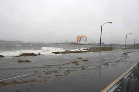
Morrissey is always the leading indicator of trouble, since it gets closed all the fucking time during Nor'easters for storm surge flooding. At least there's not very much damage to be done down by Day Basin except for more potholes to patch and a few shorted-out streetlights, but take this nearly yearly occurrence. . .

WEBMorrissey%20floosing%2011-13.img_assist_custom-475x316.jpg

wickedpic-thumb-520x390-57018.jpg


. . .and project upward from there.


Re: transit corridors. . .

The Red Line itself, despite running on a vulnerable corridor, should handle a 50-year flood better than all 3 of its rapid transit counterparts. The Kendall and Beacon Hill portals are dozens of feet above ground level preventing the drainage sink effect, Dot Ave. where the SS-Andrew tunnel goes is the last strand of thoroughfare that stays dry, and because Kendall + Central stations frame the dry ends of Main St.'s minor issues there shouldn't be any tunnel breaches in East Cambridge. In the worst rain events of recent memory, Red on those stretches has stayed dry while the others have had more serious problems. It's mainly going to be the Braintree Branch at North Quincy and Wollaston (Wollaston's fare lobby floods all the damn time).

BTW...I say this all the time on the Crazy Transit Pitches thread...do not even think about tunneling the Grand Junction under Red @ Kendall for some rapid transit build. The GJ used to be the ancestral tidal flat shoreline before the last of the East Cambridge landfilling, and ran on a causeway through Cambridgeport to the Main St. grade crossing. Burrow under Red and you WILL create exactly the fatal storm drain effect that Red is more or less inoculated from in Cambridge, and it WILL breach the Red level and destroy everything out to Harvard.

Downtown you just get wall leakage on the stations where Red's at the lower level. But that's a state-of-repair vs. water table problem like the neverending Porter Sq. & Alewife leaks rather than a drainage problem. Those stations need some long-overdue sealing, but that's not a leading indicator of trouble (especially Porter-Alewife, where Alewife Brook's high water table is totally disconnected from tidal influence). You would need to have good flood doors installed at Columbia portal to keep that one vulnerability tight, and have an evacuation plan in advance of the surge for all the trainsets stored at Cabot Yard so there's no goofs akin to NJ Transit letting its commuter rail coaches get damaged during Sandy by parking them in a flood-prone yard. But Red from Alewife-Ashmont + Mattapan would be the FIRST thru transit lifeline reopened after a major breach. And the first priority because it's the largest in ridership.


Blue from Charles/Bowdoin to Maverick would be second back online. All subway stations high-and-dry, and that line was constructed before some of the last Eastie landfilling. May need flood doors at the Logan portal, but Jeffries Point is *just barely* in the least-concern 0-2 ft. area so cleanup and reopening of transit from Logan to downtown should likewise be doable within a couple days of a disaster. Note also that Orient Heights carhouse is high-and-dry per its namesake. Boston, Revere Beach, & Lynn RR built their HQ there before all of the Eastie landfilling. Main inundation consideration for bringing Blue back up to full strength all points south of OH is a quick cleanup of the OH-Logan tracks, which helps when all the electrical plant is mounted up high. Wonderland's gonna be out for awhile, but except for the high-and-dry denizens of "Beachmont Island" cut off from the rest of the world there'll be no passengers to pick up at the outer stops. :(


Orange's problem is less the probable damage than fact that it's likely going to get chopped into 3 pieces. Forest Hills-Ruggles should be OK, which is a lifeline for the outer neighborhoods and commuter rail/Amtrak to have a pair of makeshift terminals at the two gigantic FH & Dudley/Ruggles bus terminals to distribute around downtown. The oldest Chinatown-Haymarket tunnel + stations shouldn't suffer any damage. And Sullivan-Oak Grove won't see any inundation at all because of the track elevation through all the Mystic floodplain. The South Cove tunnel and SW Corridor to Mass Ave. are going to be fuuuuuuuuuuuucked, however, though the storm drain effect that ruins Tufts & BBY should stop before rising to shallow-level Chinatown. You need more vehicle storage at the south end to keep that FH-Ruggles lifeline going, because BBY is going to be gone for...like, 6 months or more. Less concern about immediate downtown being severed for too long because the Community College portal is in the 0-2 ft. range and the Sullivan-CC tracks run on an El under the 93 decks. Sensible flood doors and a pumping plan for CC station and NS superstation do the trick for getting the downtown transfers back online.


Green? Dear God. I mean, DEAR...GAWD! The 1919 Central Subway extension from Public Gardens to Kenmore is a total loss. Kenmore portal(s) are already the storm drain to end all storm drains and a vulnerability exploited every single 25-year flood event. They should be able to get Park St. to GLX up and running without too much trouble if the GLX carhouse is adequately proofed against the 0-2 ft. floodwaters (shouldn't be difficult if trunk utilities aren't mounted underground and they have pumps + extra-good drainage underneath the storage tracks). But you're looking at 6 months of D's turning at Reservoir, C's @ St. Mary's, B's @ Packards then BU West then Blandford...and the rest just gone. Maybe within several months of 24/7 emergency repair you get bare skeletal shuttling on ruined infrastructure like the aftermath of the '96 flood x100. But you're looking at a >$B rebuild, years of crippled service, and painful weekly shutdowns a la NYC Subway post-Sandy.

I doubt there's anything that can be done to prevent this. You simply can't waterproof the Muddy Basin storm drain well enough. Urban Ring isn't going to save you since that'll be chopped up in pieces too (though should bounce back much quicker if it's built as surface route). Parallel-flank Huntington Subway? If built-to-code should bounce back near-unscathed from Brookline Village to NEU, but it's going to have a hole in it at Prudential for awhile. Riverbank Subway? The shallow tunneling at level of the Back St. retaining wall gives it a baked-in 4-6 ft. flood barrier, but all bets are off if you can't keep Charles Basin capped to *only* that much inundation.


Commuter rail? Well, that's mostly a terminal district thing. Northside is where they can help themselves the most with judicious waterproofing of Boston Engine Terminal; the buildings themselves are high-and-dry, and the storage tracks barely scraped by the 0-2 ft. inundation. Shore up those trackbeds with good subsurface pumps. If things get hairy, Alewife maint yard and Billerica Shops are the evacuation routes for storing equipment. Billerica has 495-area access points to all lines but Eastern Route, plus the southside via Ayer-Worcester. Flood doors obviously on any NSRL portals, though those are likewise in the 0-2 ft. range and a least concern.

South Station comes out unscathed (yay!), but the terminal district is sacrificed to the gods. Readville is the high-and-dry equipment evac route because Widett Circle + Southampton and Beacon Park are destroyed. NSRL may be a lifesaver here if it has REALLY GOOD FLOOD DOORS on the portals. Like...eleventy flood doors and eleventy million pumps on the NEC side (wonder why that tunnel's going to cost much?). I don't even know what that would entail, but you have to keep that tunnel airtight with Back Bay being lost or the entire thing is going to become a storm drain. But note well: the Amtrak building at Southampton is only an 0-2 ft. inundation, and the Old Colony and Fairmount portals flank that building. You can shore up the drainage a la northside...more difficulty because the surrounding destruction leaves little place to pump the drained water. But, do a good enough job here and the Fairmount Line can feasibly be that last fragile tendril that actually reaches South Station and gets intercity service up and running again. Put eggs in that basket as the one to throw kitchen-sink flood prevention at.

Per individual lines, having rapid transit and bus terminal stops to turn at makes a big difference: NEC @ Ruggles, Fitchburg @ Porter, Haverhill/Reading @ Malden (or a temp wood Sullivan platform, as was done in the '80s when the North Station drawbridges burned). Those lines fare very well on mobility. Ditto Lowell/Downeaster if you can supersize shuttle buses to College Ave. + Davis out of West Medford or do the temp platform thing at a GLX stop. Old Colony would have problems at Braintree or QC because of the Red Line being knocked out longer-term at Wollaston, and this winter exposed that vulnerability for all to see. They're gonna need a way better shuttle bus strategy. Fairmount sans NSRL will have to turn at Newmarket, and that problematic rapid transit gap between Mattapan and Blue Hill Ave. rears its head for ham-fisted transferring. East-west buses upon buses upon buses are going to be Dorchester's lifeline, but they'd fare pretty well overall with Fairmount + Ashmont/Mattapan maintaining near-full uptime through the neighborhood.

The two worst cases by far: Worcester and Eastern Route. Worcester is going to be lost inbound of Newton Corner for a long, long time. And the Green Line being lost for a long long time doesn't help things there, because a jury-rigged Riverside turn doesn't get you further inbound on the D than Brookline. Worcester-proper has the inland option via Ayer and Fitchburg Line to Porter as augmentation, but inbound of Framingham? Pike shuttle buses aren't going to save them because the Pike will be gone too. Eastern Route is going to lose the Rockport Line for few weeks, and need the Salem Tunnel storm drain pumped out...but those are more time-wasters than infrastructure-destoyers. Otherwise, high-and-dry to Lynn and on the Newburyport Branch where the RR pre-dates all landfilling. Lynn bus terminal + the Tobin gives the North Shore a leg to stand on if the bus surging + prioritization works well. Forget about service through Chelsea, though; the railroad originally was causeways + bridges pre-landfill there and on the East Boston Branch, so you're not getting further inbound. While Blue Line to Lynn would also be knocked out for awhile north of Suffolk Downs, the BRB&L was also built pre-dating the landfilling and probably bounces back a *bit* faster than superduper fucked Chelsea. The rapid transit transfer is going to be needed, because you probably won't see commuter rail or Urban Ring service through Chelsea for months upon months. And there won't be anyone to pick up. :(
 
Well based on that it sounds to me like building an inner harbor barrier isn't worth the money because it still leaves so many weak spots open. It seems like a Hull to Winthrop barrier would protect a lot more and it doesn't interact with as much of the harbor islands so I don't think the national park issue would be as big a deal but the barrier would probably cost a ton more but it also looks to me like it would protect a lot more very effectively.
 
F-Line, Doesn't 2 ft of water at the Community College portal mean that the North Station Orange Line under gets flooded out severely as well? The Charles River tunnel and the station look like big "drains" to me.
 

Back
Top