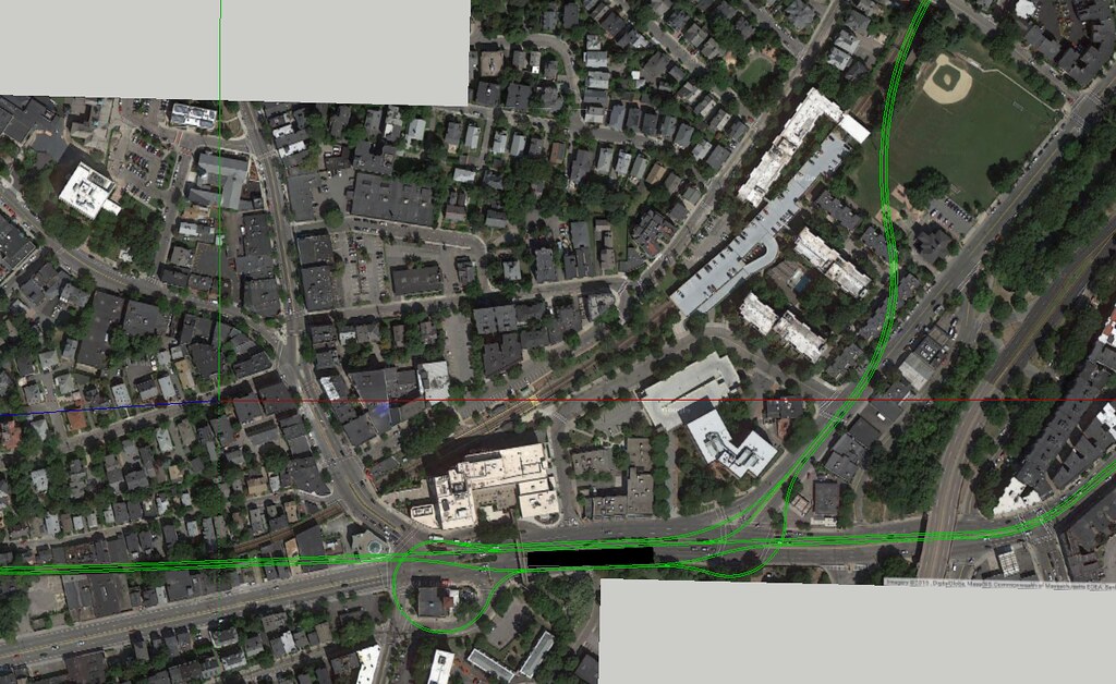
We should probably also remember some of the tunneling costs golden rules before Alon reads this and needs to punch a wall.
Pre-prepared areas are always cheaper than creating something out of nothing, where the megaproject costs sail into the stratosphere. The real UR Phase III grade separation is totally bonkers for ignoring that. So where, amongst limited options, is there any easy tunneling?
The B reservation.
-- Kenmore to BU Bridge has hosted continuous electric streetcar service since 1892. There's bare minimal crap underground between grade crossings/cross streets because there was never time to bury crap underground with electric trolleys running for pretty much the entire history Comm Ave. had has running water. We know we can cut-and-cover for that 1 mile framed by the reservation's footprint and not break the bank.
-- We know with a 200 ft. corridor width that we can fit at least 1 intermediate station under the roadway footprint. And that so long as the aesthetic opulence gets clamped down that the construction impacts shouldn't be a bear.
-- We know the only hard spot is the 1000 ft. x 250 ft. area centered over the bridge spanning Carlton St. and Amory St. where there'll be a junction, a B tunnel that has to slip under the Pike and Worcester Line before portaling-up around St. Paul Station, and a diverging split for the UR. We also know that Pike construction nuked everything in this rectangle except for the historic BU MET building and re-landscaped all areas below the level of Comm Ave., so the dig impacts aren't much of a variable...construction costs for the underground junction are.
-- We know that the UR portal itself is going to pop out the hillside
right here and that everything afterwards (GJ or Harvard spur) is on the surface. With the Harvard ROW traceable and unimpeded on the Campus Master Plan property maps out to the Stadium.
-- We know that at bare minimum...with zero modifications to Kenmore...that service to/from the UR and Harvard can be fed out of the Central Subway to here.
^This^ much we all know with reasonable confidence that we can do if the project is managed responsibly, with no major man vs. geology or man vs. building struggles.
The E reservation.
-- We know the 1 mile from Northeastern incline to Brigham Circle is an under-reservation dig relatively straightforward.
-- The under-street width is there for doing 2-3 rote-standard subway stops, as long as the opulence is kept in check.
^This^ much we know we can do if it's managed responsibly.
Less-favorable. . .
E under-street
-- We know that Brigham to Mission Park is the same tunneling distance as Red-Blue (MP being the furthest known-known point where we're 100% certain to be under Huntington, before Riverway trajectories come into play).
-- We know that street and sidewalk width are adequate: 75 ft. for Huntington, 90 ft. for Cambridge St. where the Red-Blue surgery was only going to close 2 lanes + parking rows at a time on any blocks that were cut open. We know that there are no buildings taller than 4-story brick apartments abutting the street. We know there is bedrock underground, much like there is with Red-Blue.
-- We know that the only plausible spot for a station on this segment (if there needs to be one) is where the Mission Park front lawn serves up 120 ft. of width, which is as wide as Huntington is at Symphony.
^This^ much we know has enough comparisons with well-studied projects of similar tunneling jobs to establish more or less reliable cost and feasibility bounds. And it'll look a lot more favorable if Red-Blue can be built at tolerable cost.
Much less favorable. . .
The question marks. . .
-- The Huntington-to-D interface. We don't yet know enough to even speculate. And several trajectories are viable. We have a rectangular study area, a place spanning the study area where the Emerald Necklace water table is at its slimmest that opens up the proverbial 'mountain pass' of minimal waterproofing, known building impacts, and known building ID's of what's a welcome nuke-and-redevelop (the car shops on Brookline Ave., the NEIA eyesore) and what's to be avoided (apartments).
-- The UR-to-D interface. For just what these last few posts have debated. There isn't an easy answer. Conceptual perfection goes off-scale on cost and impacts, lower-impact isn't conceptually perfect and may have some performance ceilings.
^This^ should keep us up at night, fuel years and years of healthy debate. cause us to choose battles carefully, and have the shortlist of things that can be compromised out while still achieving goals. If we have to deal with pain threshold, then pay attention to those rectangular 'study areas'...how self-contained are they, what are the landmines inside them to avoid, etc. We don't know what the final outcome is going to be, so grade these areas by sprawl of the study area and severity of the impacts within the study area. The "go for it" combination is smallest area of impact with fewest impacts within the area that accomplishes the most goals. Balance the ledgers accordingly.
And then. . .
The boondoggles. . .
-- Plowing across Brookline or BU. Any way it's a >$4B megaproject with disastrous impacts to tall buildings, incredibly difficult EIS'ing in the Muddy River floodplain, and the same exact monied interests that stopped I-695 dead.
-- Going down any 2-lane streets with close-abutting tall buildings. Longwood Ave., Francis St...impossible. Blandford Mall...doubleplus impossible.
No...just, no. A billion dollars per 900 ft. of tunneling is a project concept that's self-immolating. If these are the hangups between doing it at all and not doing it at all...then just don't do it at all.


