kz1000ps
Senior Member
- Joined
- May 28, 2006
- Messages
- 8,802
- Reaction score
- 10,056
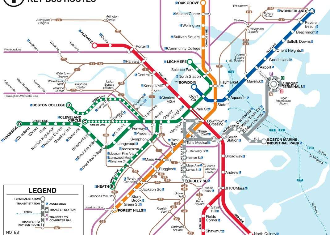
Below is a partial screen grab. The full map can be found here.

Take A Closer Look: T Has New Subway, Bus Maps
Sep 21, 2009 10:17 am US/Eastern
BOSTON (WBZ) ?
If you stopped looking at the T subway maps years ago because they never change, it's time to take another look.
The MBTA unveiled a new set of maps Monday to replace outdated ones across the city ? some of which are more than 40 years old.
"For the first time ever the maps will display connections to key bus routes to and from subway stations," the MBTA announced in a prepared statement.
T officials used the Government Station stop on the Green line as a prime example of why they maps were in dire need of an update.
Three brand new maps there will include:
* A line map identifying current stations along the Green Line that will replace a sign with outdated Green Line stops;
* A system map depicting connections to the subway and key routes;
* A neighborhood map identifying places of interest in the surrounding Government Center area that has not been updated since station modernization in 1967.
"These maps will replace outdated, incorrect maps and will for the first time ever provide commuters and tourists with up-to-date information about our network of subway, bus, ferry and commuter rail lines," outgoing Transportation Secretary Jim Aloisi said in the statement.
The MBTA is also working on updating its commuter rail maps.
Link

