Deck The Pike Herald St. Extension

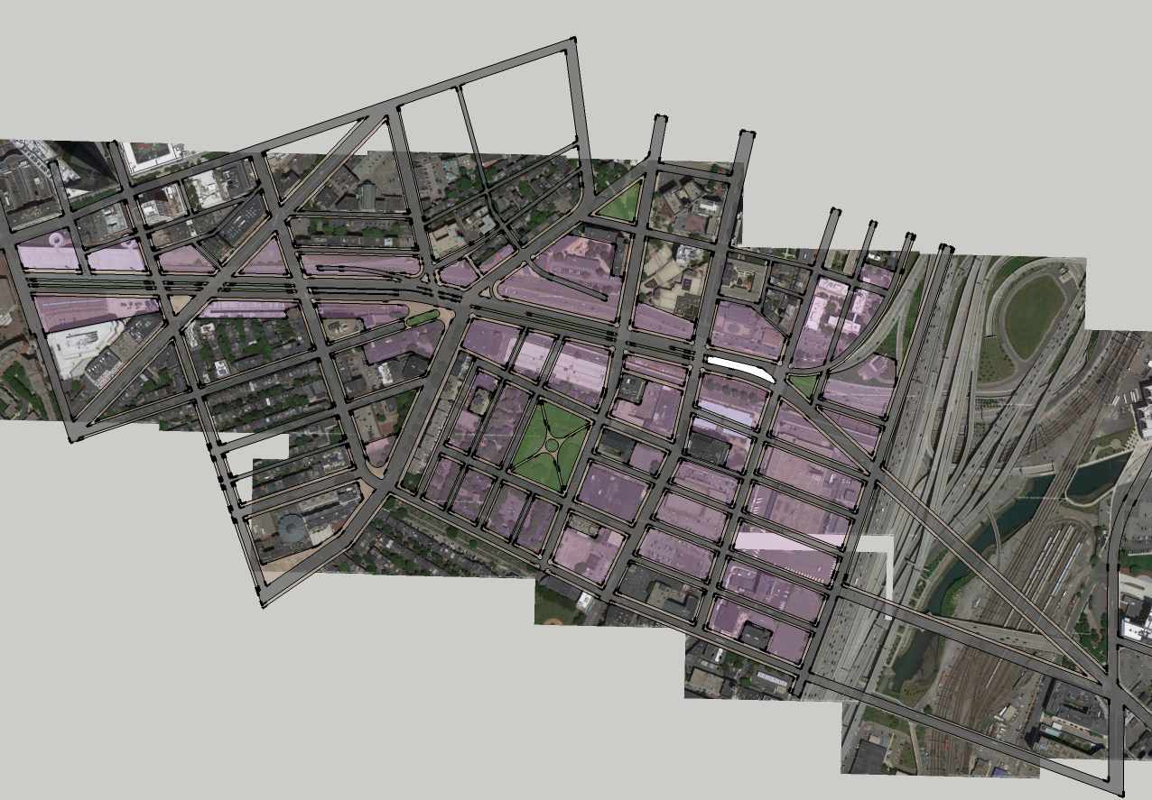
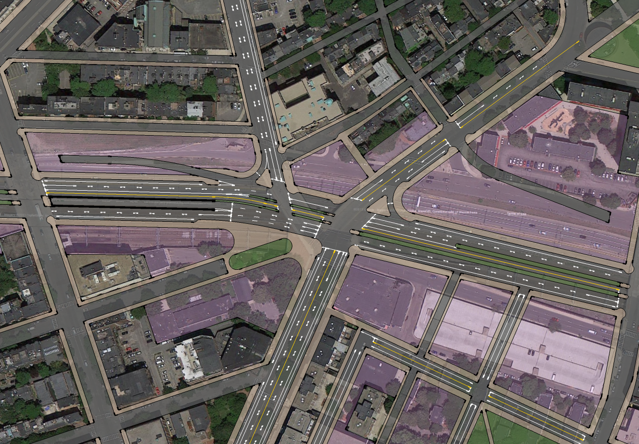
This would make boston much easier to navigate almost like a grid but just not completely straight lines. It doesn't change the urban fabric that much that boston is known for with its crazy roads, but it connects the south side of the high spine a lot more which the charles river side benefits from so much. It brings a much needed alternative route for people going from the back bay to downtown, and also creates a bunch of open parcels for development. The road is directly above the pike so that way the land on both sides would be easier to develop and the deck would use the pike centerline and sides as the spots where the supports would be located.

8y6q.png
 
Last edited:
I was thinking of adding a pike exit ramp also since there is an on ramp at arlington st. If this were to come to fruition we would have actually lucked out that columbus center was not built.
 
I think the key also would be to have a strip running down the middle with trees and shrubs to make it a gem to replace the eyesore. Also there could be 1-2 lanes each direction easily depending on what the final result would be after research, and there could be very wide sidewalks along the side as well as parallel parking spots running both directions because the pike is so wide it gives the road above a lot of space to work with to design whichever way would work the best. I can see it in my head now the view driving towards the hancock/pru surrounded by trees and new storefront as you make your way up to copley square.

iwhb.png
 
^ Bulldozing the garage beyond Clarendon would probably be difficult, but I agree that pulling this through to Copley would be great.

I can see the BRA's stunning new name for this road already: The Edward Moore Kennedy Turnpike Surface Artery. (It would be funnier if I were joking.)
 
I am not a huge fan of the green median (like something in the seaport). I think 1-2 lanes of cars is good (1 in most spots, 2 if it needs it) and wide sidewalks are great. I would like to see a smaller comm. ave mall type in the center, but that center lane be exclusively a dual direction cycle track. That way you don't have cyclists in traffic or on the sidewalk. They are protected and it also takes bikes off Boylston as people coming from Back Bay, JP, Southwest Corridor get right to downtown in a safe and efficient way for everyone.
 
You wouldn't really get a Comm Ave mall effect here no matter what, since it would be pretty impossible to grow tall trees on a deck. A nice aesthetic option could be an arboreal trellis along the entire length of the median. Cycle track would be a must. Combined with the SW corridor, you'd have a really sizable bike highway.
 
What would be really cool is if you had a cycletrack going from Albany Street to Arlington or Berkley Streets, and then have it ramp up onto a suspension bridge above this new "Kennedy Surface Road" (LOL), elevate through a modernized Back Bay Station, and then descend onto the SW Corridor Park after bridging over Dartmouth Street. Maybe a new Back Bay Station & tower could include a new 1,000+ capacity bike storage garage 30' or 40' above the main hall of the station, and then people could descend from there down escalators into the main ticketing/waiting hall of the station.
 
^ Bulldozing the garage beyond Clarendon would probably be difficult, but I agree that pulling this through to Copley would be great.

I can see the BRA's stunning new name for this road already: The Edward Moore Kennedy Turnpike Surface Artery. (It would be funnier if I were joking.)

I read on here a while ago that they wanted to bulldoze it im not sure when it was from, but I agree it would be difficut, but worth it in the end.
 
I think the key also would be to have a strip running down the middle with trees and shrubs to make it a gem to replace the eyesore. Also there could be 1-2 lanes each direction easily depending on what the final result would be after research, and there could be very wide sidewalks along the side as well as parallel parking spots running both directions because the pike is so wide it gives the road above a lot of space to work with to design whichever way would work the best. I can see it in my head now the view driving towards the hancock/pru surrounded by trees and new storefront as you make your way up to copley square.

iwhb.png

Very cool idea. My only concern (since you've made such a detailed map) is the traffic situations at both ends. I feel like such a major roadway (which would be wide only to prevent having to build buildings on the deck, I know, but still...) shouldn't be dumping traffic into a dead end at a freeway access road on one end and an impossible 5-way monster on the other.

I'm not sure how to handle the Copley end. It seems like it could be addressed in the design of the pavement in the interchange. On the SE Expressway end, would it be possible with the ramps to turn this road to the north and use Curve St, Hudson St. and that grassy strip (which may or may not be about to be developed) to try and feed this into Downtown?
 
The traffic situation is honestly better handled in Dave's map by dispersing the boulevard at Arlington Street and Berkeley street, and using part of the parcel in between the two to ramps to the Pike. The Albany Street end I don't imagine being that large of an issue. It will mostly be local traffic eastbound past Washington Street anyway. Make Surface/Albany two-way north of the new Boulevard and you have your feeder to Kneeland.
 
Very cool idea. My only concern (since you've made such a detailed map) is the traffic situations at both ends. I feel like such a major roadway (which would be wide only to prevent having to build buildings on the deck, I know, but still...) shouldn't be dumping traffic into a dead end at a freeway access road on one end and an impossible 5-way monster on the other.

I'm not sure how to handle the Copley end. It seems like it could be addressed in the design of the pavement in the interchange. On the SE Expressway end, would it be possible with the ramps to turn this road to the north and use Curve St, Hudson St. and that grassy strip (which may or may not be about to be developed) to try and feed this into Downtown?

Yea I was thinking also since there are so many roads along the way it would knock some cars off along the length as you go. Hudson st could be a one way that curves into the start of the road and no way to get on from the access ramp, and then the eastbound lane would end on the access ramp. In copley, stuart st is a one way so they would have to turn right at the end, and getting on would be a slight right off of stuart street onto this road.
 
What would be really cool is if you had a cycletrack going from Albany Street to Arlington or Berkley Streets, and then have it ramp up onto a suspension bridge above this new "Kennedy Surface Road" (LOL), elevate through a modernized Back Bay Station, and then descend onto the SW Corridor Park after bridging over Dartmouth Street. Maybe a new Back Bay Station & tower could include a new 1,000+ capacity bike storage garage 30' or 40' above the main hall of the station, and then people could descend from there down escalators into the main ticketing/waiting hall of the station.

Connect to the Southwest Corridor? Why stop there?
 
Im posting an update to my map soon. Im too much of a perfectionist and keep getting bogged down in details. As a teaser, im bringing broadway back through to connect to this new road. Im going down there irl tomorrow to look beneeth the ramps to see if its actually feasable, google streetview isn't much help.

Im also reversing the pattern of one ways. Washington is a two way with one travel lane and one bike lane in each direction as well as parallel parking on each side, and most importantly either stop signs or traffic lights timed to favor cross streets at every intersection (the silver line would, however, have signal priority). Harrison is one way northbound from dudley to downtown, with two travel lanes, parallel parking on both sides and a bike lane, with signals timed for a "sea of green". Tremont is the same, southbound. This way you have a logical one way pattern similar to normal cities, humanize and get traffic off washington street, add parking (I am a fan of parallel parking on city streets, for multiple reasons), and hopefully decrease traffic.
 
Oof that's a nasty tangle of ramps to try to snake through.
 
Update: People didnt like the trees in the center lane and knocking down the parking garage so I changed it a little. Heading down columbus ave you can take a right and then you can follow it east until wherever you need to go. Then once your at the end you can go left onto washington to get downtown or right at the end to get to the south end. The updated version has an entrance on curve st. but many other ways are available to get onto it. This also allows the tower part of columbus center to be built. I still think that the garage needs to go though because its taking up a vital piece of real estate right next to the hancock. I believe its very important for it to at least start at columbus avenue because that is another main route to get to the back bay and it would be easy to be on columbus and then hop right on this road.

smah.png
 
This would be the easiest and most cost effective way it could be realized. Extend the one way herald st up to Columbus Avenue. Across the pike extend the one way marginal up to berkley. To travel west to east take columbus or clarendon then travel along herald. To travel east to west get on to marginal and follow it to berkley. Then build an off ramp in the open space next to the pike. This would match the on ramp that arlington has, and also give another off ramp that serves the area between the prudential and downtown. Start the incline at the berkely st bridge and once it is up to grade at herald st have it cut across and link up with herald. Going east to west I also added and off ramp before tremont street because there is no way for that side to exit either. If both sides needed to get back onto the pike they would use the arlington on ramp because the arlington bridge allows herald street to also use that on ramp. This idea would allow columbus center to be built and also leaves the entire pike to use the median and sides to put columns into to built above it between marginal and herald. This would be in line with the small one way streets that boston has that are narrow and easy to walk/bike along. Obviously marginal and herald would probably have to be widened a little and the traffic lights would have to be fixed to not make it a pain in the ass.

bc18.png
 
Last edited:
I would say to keep cars off that new deck completely. Make it about the pedestrian experience. Make it into an extension of the SW Corridor and line it with shops and cafes. Could be an amazing new linear park.
 
^Meh. It's such a wide ROW even not counting the development potential on terra firma, that I think you'd need 'complete streets' to give it vitality.
 
I've still got to work out the details where it ends near Copley, but here's a revision of my idea, the Broadway Extension.

-Bidirectional ramps to I-90W on each side of Castle Square
-Offramp from I-90E into Castle Square
-Bidirectional cycle track in the center of the new Broadway (I'm designing it so where ever there would be left turning traffic there is a dedicated left turn lane and phase, that way cyclists can ride unimpeded.
-The WB ramps are in the middle of blocks so development can cover them relatively easily.

broadway_over.png


As you can see, I also brought back the New York Streets grid. Wishful thinking since the Herald project is making this pretty much impossible.

Close up of Castle Square (the one part I have basically finished):
broadway_castle.png


I decided on purple as my "redevelopment opportunity" color, its rough to get a color that contrasts well with everything on a google map at 25% transparency.
 

Back
Top