Rose Kennedy Greenway

Great change from when the Green Monster used to run along there! :cool:
 
^ A very attractive freeway median strip.

There was - and was always going to be a right of way for people and cars to interchange between the Downtown, North End, East Boston and parts unknown. Now, with the highway under there, they've put in some grass and trees and you can see the sky. But, you can't put in underpasses.... and arches would take space from the not-real-huge Greenway.

Utopia ain't easy, but, Wednesday night is a huge opportunity to show support for the Harbor Garage redevelopment project.... and if humanity can find the way, we'll get us a little bit closer to helping our land be healed from the terrible years.
 
I just wish the linear corridor could have been broken up a bit. A park here and a park there, rather than a continual corridor.
 
I just wish the linear corridor could have been broken up a bit. A park here and a park there, rather than a continual corridor.

Charlie -- i suggest that you get off at Scollay Square Station [here's a virtual nickel]

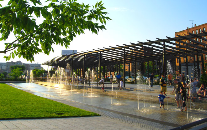
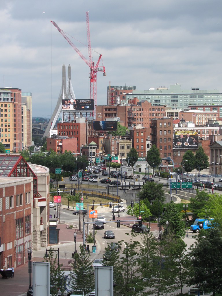
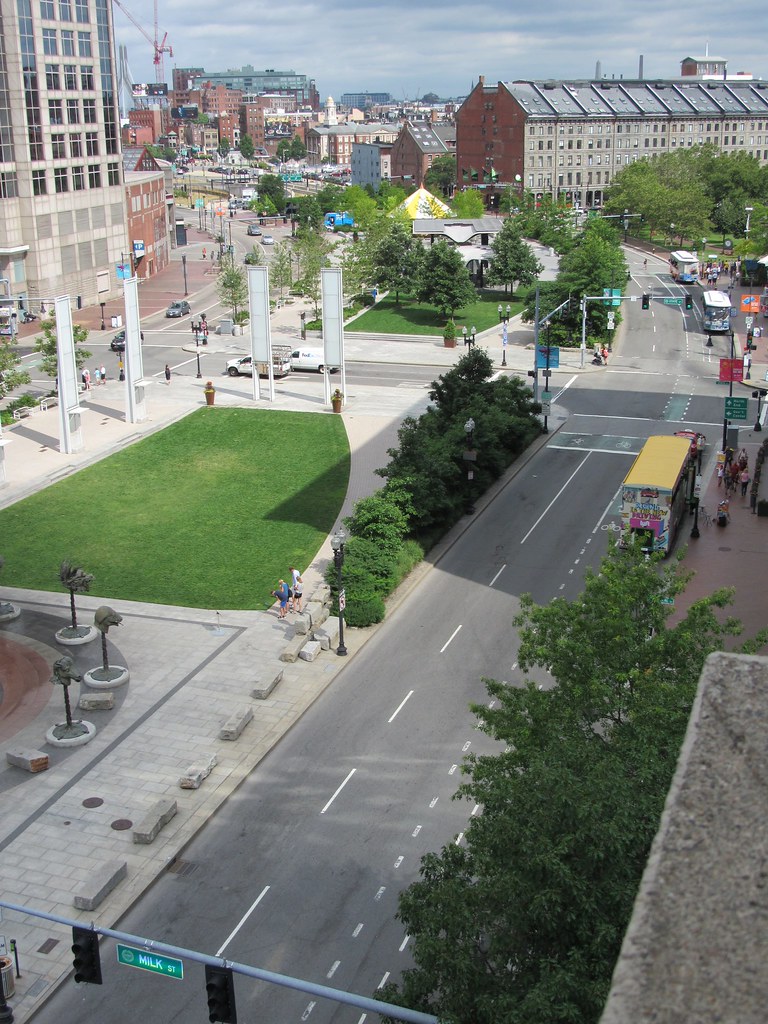
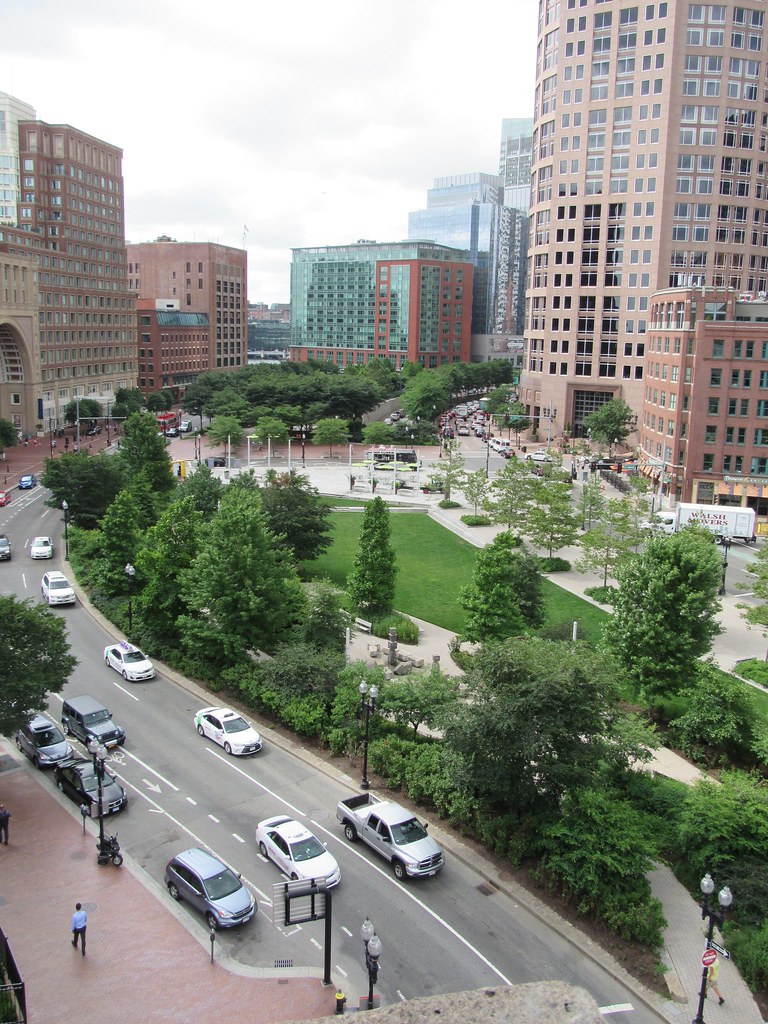
When you do -- walk toward the Harbor along State Street -- when you come to a road with a strip of grass to your left and a concrete square accompanied by kids water streams and Chinese Zodiac figures -- that's the Greenway
41980e9d-7f48-474d-9fee-91f0d3126758_500.jpg


In particular it is one of several of the quite independent Wharf District Parks
Food-Truck-Throwdown-in-Wharf-District-Greenway-Lawn-1280x853.jpg


if you stroll for a while to your left you will come upon two of the quite individual North End parks
north3.jpg
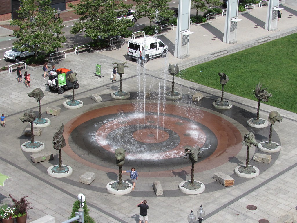
and if you then stroll on back past the Rings Fountain passing the Armenian Heritage Memorial [with its foundatin, labarynth, and dodecahedral sculpture]
1-ArmenHeritagePark1.jpg
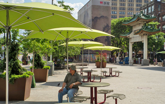
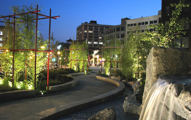
you will eventually come to the Chinese-themed Chinatown Park
china7.jpg
p34_ChinatownStream.jpg
china3.jpg


Along the way you will have seen a unique carousel with Lobsters
img_8554.jpg
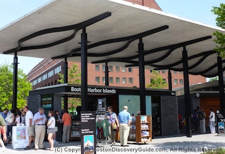
which your yungin can ride upon, a pavilion with information about the Boston Harbor Islands National Park
boston-harbor-islands-tickets.jpg
and a number of other things best experienced personally and with all of your sensory organs in action

Neither a highway median, nor the Emerald Necklace in miniature -- it has become itself -- and for the most part successfully
 
Parks are nice, greenery is pretty, no doubt; the default, politically easy option.

Mega-blocks, wide streets and towers in the park vs. well knit, connected, walkable, neighborhoods; which of these is the better urban setting? I don't think achieving the latter is well served by perpetuating a wide linear gap (the Greenway) running through downtown Boston. A few changes would have gone a long way toward re-knitting the city, such as: a transverse block here and there of commercial/residential/office development; replacing portions of the one-way surface street couplet with a two-way landscaped boulevard; and intermittent parks abutted on all sides by appropriate development. That's the kind of multi-use, 24 hour city that I would have liked to see, instead of just defaulting to a long, wide swath of excessive park land sitting between two straight-as-an-arrow highways.
 
IIRC, the Greenway is part of the environmental mitigation that was negotiated in the course of approving, funding, and designing the Big Dig. According to Bechtel, environmental mitigation accounted for $3 billion of the total Big Dig costs.

And the area of the tunnel where some in the past have suggested putting neighborhood-stitching buildings, the tunnel roof is so close to the surface, the buildings could not have a basement (or other sub-grade component).
 
And the area of the tunnel where some in the past have suggested putting neighborhood-stitching buildings, the tunnel roof is so close to the surface, the buildings could not have a basement (or other sub-grade component).

This worked for the Victor, Merano, and One Canal.
 
I'm with Charlie. The issue is that the greenway layout doesn't engage the existing fabric of the city. The parks are pretty good. People use them and like them.

But this remains the wrong treatment for this area. Surface Road is a freeway distributor. FFS - the fact that its called surface road is all you need to know.

I've said it before, I'll say it again - a better treatment would have been:

- Make Dewey square a defined public space - an outdoor urban 'room'
- Define a 'place' at the foot of moakley / northern ave bridges as a gateway to seaport ... and in front of rowes wharf ... with both better engaging the front of IP
- Define a place at town dock / long wharf
- Do something meaningful @hanover st.
- Re-define haymarket as a space.

Haymarket, hanover st, and dewey sq in particular continue to be in very rough shape. And of course, the ramp parcels are an ongoing fiasco.

And as far as traffic flow goes, it should have:

- enagaged congress st. better for cross-town traffic (e.g. multiple turn movements necessary to go from congress st in seaport to congress st @ state)
- engaged commercial st. better for traffic bound to charlestown and the tobin
- discouraged surface 'shortcuts' between off/on ramps (e.g. NB from atlantic ave and gov center to north end on ramp; SB gov center to dewey sq. / chinatown / albany st.)

Again: 1. The parks are great. 2. But the fabric remains torn (except in Bulfinch triangle, which illustrates the point) - and is torn in some new ways.

(Please consider that these two statements are not incompatible before you reply insisting that the parks are great)
 
Last edited:
Don't forget, the original plan for the Greenway was to be broken up...with a Garden Under Glass, The Boston Museum, and if memory serves me correctly, a new YMCA. All of those structures were to be built over the on/off ramps. The buildings were, sadly, scrapped due to lack of funds.
 
Westie - notice in all the pictures you posted, the great lengths the photographer took to keep out-of-frame the 3-lane surface streets, interstate highway signage, oversized traffic signals, on/off ramps, garage entrances, blank walls, parking lots...

Of course if you post photos of the best Greenway features taken at the best angles, the result looks fantastic. Unfortunately, while distinct parts may be very successful as parklets, the overall design is a failure as a cohesive public space. Nobody actually wants to "walk the Greenway" - and if they did. they'd find it to be a most inconvenient and frustrating walk, given the zigzagging ramps and traffic patterns. Even its raison d'etre is quite spurious. Do you really need a Greenway parallel to the Harborwalk?

One instant remedy might be to close half the ramps. For example: do you really need two southbound exits at both Purchase Street and South Station?
 
Don't forget, the original plan for the Greenway was to be broken up...with a Garden Under Glass, The Boston Museum, and if memory serves me correctly, a new YMCA. All of those structures were to be built over the on/off ramps. The buildings were, sadly, scrapped due to lack of funds.

+ 1 these were the heal the cross connection elements -- all planned, all scraped. Would also have made those parcels much nicer than ramps.
 
Don't forget, the original plan for the Greenway was to be broken up...with a Garden Under Glass, The Boston Museum, and if memory serves me correctly, a new YMCA. All of those structures were to be built over the on/off ramps. The buildings were, sadly, scrapped due to lack of funds.

Indeed.

But these, as planned, would have generally been as bad or worse as the status quo from a 'fabric' perspective (while of course being an improvement in other ways - and the Y@haymarket in particular could have been a whole different ballgame).

Maybe the most egregious example was the proposed performance facility which iirc was to extend halfway across the front of the arch at Rowes Wharf, several stories tall.

Many many internet points are available if any can track down ancient renderings (would that the Boston.com and MassDOT BigDig sites were still available, in all their web1.0 glory...)
 

Back
Top