RandomWalk
Senior Member
- Joined
- Feb 2, 2014
- Messages
- 3,792
- Reaction score
- 6,817
Construction as a progress bar: Were it a century later, the owner would put up a scrim with a cheeky “Loading… Please wait”.
I always thought the concrete el viaduct at Forest Hills was way cool, way ahead of its time and a prototype for later elevated systems in the Bay Area and others. We need some updated versions of this built around the Boston metro area.
yes! Down Comm Ave to start!I always thought the concrete el viaduct at Forest Hills was way cool, way ahead of its time and a prototype for later elevated systems in the Bay Area and others. We need some updated versions of this built around the Boston metro area.
Depends on what part of Comm Ave you're talking about.yes! Down Comm Ave to start!
Kenmore to BCDepends on what part of Comm Ave you're talking about.
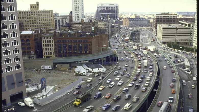
Ouch! That highway....
Amazing that anyone ever thought that would be a good idea...Ouch! That highway....
Originally there were plans for an elevated railway to connect the rail lines at North and South Stations a century ago. But the quick ascent of automobiles and trucks in the 1930s gave impetus to the idea of an elevated highway at the same location instead. I really wish they had stuck with the original elevated railway plan, but Robert Moses in NYC, followed soon thereafter by Los Angeles, unfortunately set the national template for sprawling urban expressway/freeway systems. Boston, not wanting to be left behind, soon followed suit in the 1950s with the elevated Central Artery dividing much of central Boston and Charlestown, and Storrow Drive wiping out much of the Charles River Esplanade.Amazing that anyone ever thought that would be a good idea...
Same! If you replace the elevated 93 in that photo with a far narrower elevated railway, suddenly the place looks like Gotham (albeit still quite dirty).I really wish they had stuck with the original elevated railway plan.
Wow, reminds me of workers' housing in the old industrial towns of north England during the industrial revolution.
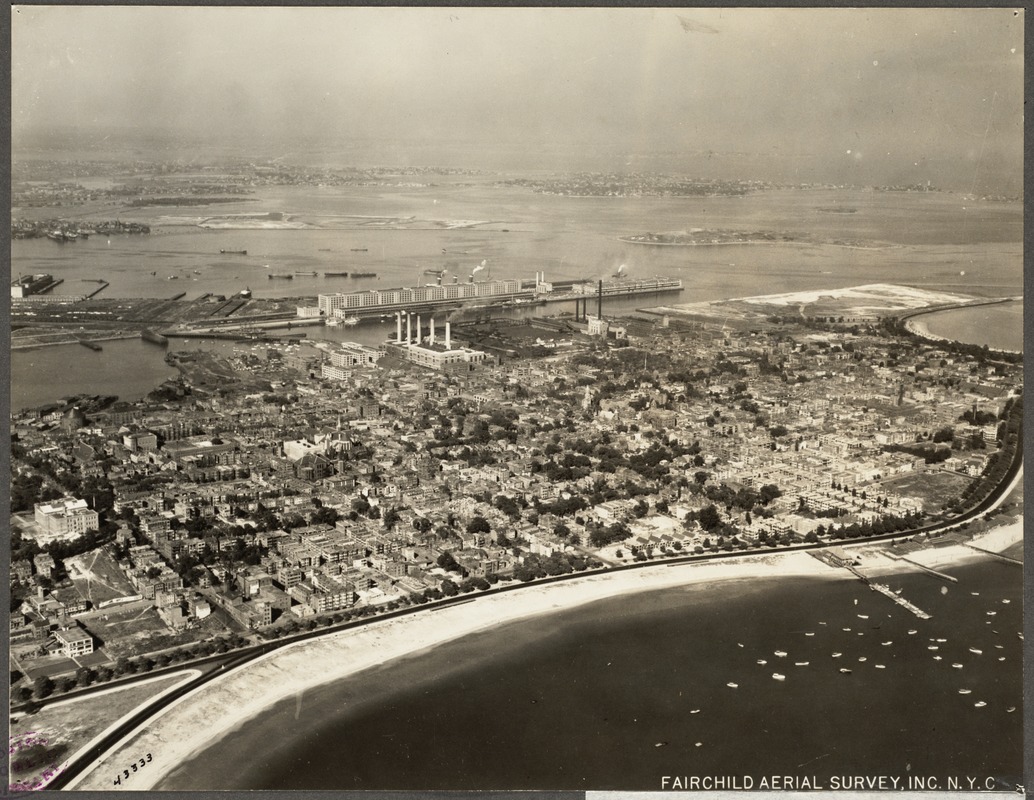
How could it lose with a beach like that, plus being close in to downtown. An ideal location and neighborhood.
1925 Southie aerial. Make sure you check out the full image: https://ark.digitalcommonwealth.org/ark:/50959/8k71nz55z
Sometimes I wish we could get back to our roots and start doing a few more land reclamation projects to add some new virgin land to the city for housing.How could it lose with a beach like that, plus being close in to downtown. An ideal location and neighborhood.