I-90 Interchange Improvement Project & West Station | Allston

Pray tell, when did the 'throat' and the whole at-grade hullabaloo start abutting Harvard-owned land?
I suspect because the Feds wouldn't even consider ponying up until the throat issue was resolved thanks to it being bundled into the same construction project.
 
I tend to agree with F Line that a giveaway to Harvard isn't really the exact top of the list for why the state's pushing this. Getting from BU/Allston to anywhere in Cambridge besides MIT is a drag despite them being geographically so close. People take the 57 to the 66 bus, and the 66 itself takes a circuitous route when really it should be going down Babcock St or somewhere near there. The connectivity is needed mainly for transit, ped, and bikes.
 
I tend to agree with F Line that a giveaway to Harvard isn't really the exact top of the list for why the state's pushing this. Getting from BU/Allston to anywhere in Cambridge besides MIT is a drag despite them being geographically so close. People take the 57 to the 66 bus, and the 66 itself takes a circuitous route when really it should be going down Babcock St or somewhere near there. The connectivity is needed mainly for transit, ped, and bikes.
Babcock isn't a spanning street in the current plan. BU objected to it. The only spanning street is incredibly-narrow Malvern with its horrifically bad intersection with Packards Corner. Supposedly that's where the buses and bikes are all going to go, but it's hard to see what transit routes would be able to take advantage of it without an expensive/controversial reconfig of the Packards intersection being put on the board to signalize and square-up Malvern. The plan for the Beacon Park street grid and transit in general is hopelessly half-baked and needs a lot of finishing work before it makes any sense as an urban fabric. Unfortunately the years of deadlock over the 'throat' have sucked all the oxygen out of the room for making advancements on those plans, and Harvard has been institutionally AWOL at providing backfill detail on exactly what it envisions for the land because they're cynically land-parking the BP slab for some future generation instead of jump-starting anything in the nearer term.

Next month this thread turns 10 years old. It's utterly amazing how much time, energy, and money has been sucked into the squabbling over this project in that span. And we're still not even close to getting a clear vision of what's supposed to come here. :(
 
I believe it was in the early 80’s i first read that when the opportunity comes the state will straighten out that part of the mass pike
 
  • Like
Reactions: FK4
Hell, my first ever post on this site 13+ years ago was about the potential unlocked by a straightened Pike.

As a newer user who started lurking here in 2018 and posting in 2019, I find it so cool that there's 10+ years of threads and history on this site. Lots of accumulated knowledge, photography, discussion, etc.
 
AAwwww shucks, if only we had a rep on the House Transportation and Infrastructure Committee to help...
1707166195725.png
 
Last August, StreetsblogMASS requested a copy of the Commonwealth's "Mega" grant application, first through MassDOT press office, then through a formal public records request.

The Healey administration rejected that request on Sept. 21, 2023. In their rejection, MassDOT asserted that the application was "exempt from disclosure... to avoid the premature release of materials that could taint an ongoing deliberative process."

A second request to USDOT for the same documents through the federal public records law is still pending.

In contrast, the Baker administration shared its 2021 grant application with StreetsblogMASS without a formal request through the Commonwealth's public records law. You can read that application here.
 
The project is totally and completely fucked between the lack of transparency and the throat issue which Massachusetts continues to bash its head into in the most stubborn way possible.

What the hell is going on here?
Is there a reasonable estimate for the cost savings if DCR road-dieted Soldiers Field Road to 2 or 0 lanes? Seems that would save a lot of cost in the throat area and remove cars from Storrow. Another idea would be to lift all zoning limits on developments that cap the highway here and use the air rights lease to fund the project.
 
Is there a reasonable estimate for the cost savings if DCR road-dieted Soldiers Field Road to 2 or 0 lanes? Seems that would save a lot of cost in the throat area and remove cars from Storrow. Another idea would be to lift all zoning limits on developments that cap the highway here and use the air rights lease to fund the project.
Narrowing SFR to one lane each way won't buy much narrowing, as you'd still need a breakdown lane in addition to the one travel lane to get around disabled vehicles, adding up to pretty much the same width as two travel lanes. So, the only opportunity for narrowing the roadway footprint in the Throat area is to reduce the Mass Pike from 4 lanes to 3 lanes each way, but MassDOT seems to be against doing this.

Of course, completely eliminating SFR through the throat area would be the best solution, but good luck with that, given the current car culture.
 
Of course, completely eliminating SFR through the throat area would be the best solution, but good luck with that, given the current car culture.
This is crazy, transit fantasy..........but I was looking at a map of the relationship between Charles Street MBTA Station and Kenmore. Extend the Blue Line to Charles Street Station and turn along the river. REMOVE Storrow Drive and replace it with cut/cover tunnel for the Blue Line subway to Kenmore. (The path actually lines up better with Beacon Street, but that would seem to be a non-starter.) Have a station at Dartmouth/Esplanade and an interchange with the Green Lines at Kenmore. Completely remove Storrow and SFR from the river and replace with expanded Esplanade parkland. Even better........extend Blue Line to West Station. Put I-90 at grade through the throat and I'll even compromise with 4 lanes each way if they remove SFR.

It seems like this whole I-90 project is an opportunity to think BIG with innovative transit ideas, and not just a bunch of roads at grade level. (OK, that's my rant for the day.)
 
This is crazy, transit fantasy..........but I was looking at a map of the relationship between Charles Street MBTA Station and Kenmore. Extend the Blue Line to Charles Street Station and turn along the river. REMOVE Storrow Drive and replace it with cut/cover tunnel for the Blue Line subway to Kenmore. (The path actually lines up better with Beacon Street, but that would seem to be a non-starter.) Have a station at Dartmouth/Esplanade and an interchange with the Green Lines at Kenmore. Completely remove Storrow and SFR from the river and replace with expanded Esplanade parkland. Even better........extend Blue Line to West Station. Put I-90 at grade through the throat and I'll even compromise with 4 lanes each way if they remove SFR.

This totally ignores the reality that Storrow and The Pike exist for traffic west of the city into the city and out. The Blue Line is basically for Eastie into the city. BLX extension should happen for reasons but it can't be done in lieu of this project because the people and traffic patterns it serves are totally different.

I really don't understand why MassDOT is so hellbent on not shrinking The Pike by a lane but nothing MassDOT does ever really seems to make sense.
I read once that post-Covid the traffic levels of SFR/Storrow could be absorbed by Pike since there's fewer cars. To summarize Pike (2019) = Storrow (2024) + Pike (2024). I could be totally wrong though. The question of connections SFR/Storrow provide over the Pike is another question, but the highways aren't that far apart, and transit riders lack many of the same connections, so fair's fair.
 
I really don't understand why MassDOT is so hellbent on not shrinking The Pike by a lane but nothing MassDOT does ever really seems to make sense.
I think most people (MassDOT, politicians, planners, voters) don't really believe you can have economic growth without automobile traffic growth. I think they don't really believe in changing mode share away from cars, even over long periods of time.
 
This totally ignores the reality that Storrow and The Pike exist for traffic west of the city into the city and out. The Blue Line is basically for Eastie into the city. BLX extension should happen for reasons but it can't be done in lieu of this project because the people and traffic patterns it serves are totally different.

I really don't understand why MassDOT is so hellbent on not shrinking The Pike by a lane but nothing MassDOT does ever really seems to make sense.
A few of the BLX-West suggestions (crazy transit pitches) have included running Blue on out the Riverside alignment -- bringing heavy rail to the west. Rail lines can serve two suburban populations at either end. Blue is actually the odd duck today, terminating downtown.
 
A few of the BLX-West suggestions (crazy transit pitches) have included running Blue on out the Riverside alignment -- bringing heavy rail to the west. Rail lines can serve two suburban populations at either end. Blue is actually the odd duck today, terminating downtown.

Sure, though, back to reality... we've gotta work with what we've got. We're not getting billions of dollars to extend the Blue Line anytime soon.

IMO, if I was the state I'd figure out a way to tax the ever living shit out of the Allston land Harvard wants to build on and put that towards the project. They're going to be the primary benefactor of this work.
 
Is there a reasonable estimate for the cost savings if DCR road-dieted Soldiers Field Road to 2 or 0 lanes? Seems that would save a lot of cost in the throat area

The "throat area" is likely not of particularly large expense itself. It's basically just asphalt at-grade, where there's already a road or flat area, at-grade. Adding or removing lanes here is not going to shift the cost of the project substantially that I can see.

I am not sure what the cost breakdown of any particular project element is (or if such a breakdown even exists), but from the current plans I'm guessing the large/potentially overbuilt elevated structures are a disproportionate portion of the cost relative to their seeming significance to the project. (like the "Cambridge St Bypass").

and remove cars from Storrow.

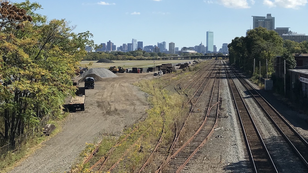
I have pointed this out before here, but Storrow moves a lot of volume through "the throat" and beyond, somewhere in the ballpark of ~55% of the Pike's traffic for the segment immediately east of the Allston tolls/ramps from the limited older data I can find. It is not an inconsequential amount of volume, and that of it coming in from the West on SFR doesn't currently have some other great option for getting places. Attempting to get from the NW of the metro area to destinations south of the Charles flows to here. Canceling the inner belt was a good decision but it makes this a pretty important half-assed version.

Even if the Pike had the capacity, many of the higher volume ramps seem to correlate to destinations not served well by the Pike - like Charlesgate/Fenway.

If we're in a world of much more significant transit expansions/improvements there's lots of things that are negotiable, but I don't personally view "just remove SFR/Storrow" as a realistic suggestion with only the existing "West Station" + misc local bus projects as substitute. They're basically at best going to handle new demand from this area - probably about as poorly as the Seaport's transit has.

-----

Anyway though, without redrawing a whole bunch of other things and blowing the scope of this project even further to the moon - I don't see how you make this work unless you're truncating Storrow at Charlesgate, which is not exactly realistic right now.

Otherwise you have to somehow merge it into the Pike at the throat and still have your (now higher-load) Allston interchange right after in a unsafely short distance, which would probably take lots of ramps and be much more expensive + ugly than even the current plan is through "the throat".

Another idea would be to lift all zoning limits on developments that cap the highway here and use the air rights lease to fund the project.

It's been difficult and taken decades to get air rights projects built next to some of the absolute highest value real estate in the city - like South Station + Newbury. I don't think air rights are going to sell for anything right now in an area still half covered in warehouses and underutilized parcels. If in 30 years it looks like the Seaport, maybe there will be demand then. But that won't fund the project now.

I read once that post-Covid the traffic levels of SFR/Storrow could be absorbed by Pike since there's fewer cars. To summarize Pike (2019) = Storrow (2024) + Pike (2024). I could be totally wrong though. The question of connections SFR/Storrow provide over the Pike is another question, but the highways aren't that far apart, and transit riders lack many of the same connections, so fair's fair.

Doesn't seem correct at all.

There is a daily 2-way counter on the Pike (AET13) by the Comm Ave underpass for the last few years:

AADT:

2017 - 141k
2018 - 145k
2019 - 150k
2020 - 94k
2021 - 114k
2022 - 125k

2023 summaries aren't out, but the average spit out by running a daily report against the year looks to be 131k, so 93% of 2017 volumes, 87% of 2019, up 6k.

----

Recent Storrow/SFR data is much more limited and not daily that I see, but summarized count locations:

- On the roadway before + after N. Harvard St.

- Charlesgate has counts for the ramps but not thru. (only looked at the to/from the West ramps)

- On the roadway again before Charles Circle.

All of these counters indicate that SFR/Storrow is back to pre-pandemic volumes pretty much in full, with them all being pretty much +/-5% of 2019.

Also worth noting that 2019 was in many cases the result of years of growth - so volumes somewhere like South of N. Harvard St (where there is long-term data) aren't just back to pre-pandemic levels - they're also a good 25% above the that of the late 2000s.
 
It's been difficult and taken decades to get air rights projects built next to some of the absolute highest value real estate in the city - like South Station + Newbury. I don't think air rights are going to sell for anything right now in an area still half covered in warehouses and underutilized parcels.
True, but I image that if the buildings or at least the podiums are build at the same time the highway is built there would be considerable cost savings compared to building over an active highway. Once the highway is active there is no advantage to these air rights parcels over the ones further into the city.
 

Back
Top