F-Line to Dudley
Superstar
- Joined
- Nov 2, 2010
- Messages
- 10,106
- Reaction score
- 12,863
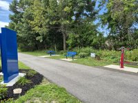
From an RR.net spotter...the former South Sudbury diamond has been put back in on display at the intersection of the Mass Central and Bruce Freeman trails:




 www.natickreport.com
The highly anticipated commuter rail-to-trail connection in Natick Center opened Feb. 6, paving the way for commuters, runners, and walkers alike to access the larger Cochituate Rail Trail.
The trail, now 3.7 miles long, runs from Framingham’s Saxonville neighborhood to the outbound platform of the Natick Center MBTA Station.
“This is something that will benefit thousands of people,” said Josh Ostroff, former Natick Select Board member and president of the board of the Friends of Natick Trails. “We know that it is important for better and safer mobility, and easier connections, and particularly for people with disabilities.”
Before the connection, the trail ended by Mechanic Street. Now, residents can bike directly to the commuter rail—although biking on the platform is prohibited. The new section of the trail is equipped with sheltered bike racks, security cameras, and a police call box.
The MBTA agreed to fund and pave the final component of the trail after completing its own renovation plans at the station.
Josh Ostroff, former Natick Select Board member and president of the board of the Friends of Natick Trails.

 www.eastbayri.com

 mass.streetsblog.org
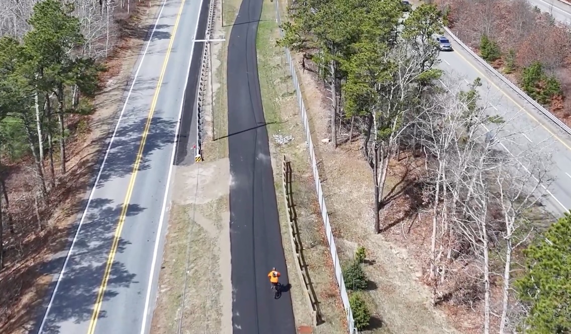
The path fills in a large gap in a proposed 88-mile network of car-free trails that would traverse the entire Cape, from Provincetown to Bourne to Woods Hole.
The new pathway in Sandwich fills in roughly a quarter of the gap between the existing Cape Cod Canal shared-use pathways in Bourne and the western end of the Cape Cod Rail Trail in Yarmouth.
MassDOT and the Town of Barnstable are currently building a 4-mile extension of the Cape Cod Rail Trail to connect it to Mary Dunn Road in Barnstable.
The next phase of the Cape Cod Rail Trail – filling the gap to the new Service Road path in Sandwich – is currently in design. Most of the proposed alignment would also run alongside Service Road and Route 6 through the town of Barnstable.
Finally, the Town of Sandwich has a conceptual plan to connect the new Service Road path to the existing Cape Cod Canal pathway with new pathways along Route 130 and along the Old King’s Highway through Sandwich’s village center. That project is currently in its early design stage.
Salem did add a crosswalk at the Route 28 and Rockingham Park Blvd intersection within the past few years. That was a pretty big barrier, but there are still some uncomfortable crossings at the larger shopping plazas to the south. I think a miss was the Tuscan Village development, the sidewalks and paths aren't very consistent to make it convenient to access the rail trail. Oh well, at least there are SOME sidewalks within their development.....Walked the Methuen bike trail from Lawrence. Unfortunately, Salem, NH is taking forever to connect it to the Windham and Derry trails.


Work has started on the rail trail extension between Grove Street and Union Street in Franklin. Workers have started the process of removing the rail infrastructure that is currently in place.
There's a Superfund site halfway down the Franklin Industrial Track, and it's known that the soil contamination there has seeped onto the trackbed. They might be removing the out-of-service rails now because of the town now owning the ROW, but it's probably going to be a long time before it's cleaned up enough to be a permissible recreational trail. There's no current EPA funding for cleaning up that ex- factory site.Rail trail extension work underway
Powered by citizen journalism, your daily source of information about what matters in Franklin, MA.www.franklinmatters.org
I just hope the rail trail doesn't preclude reactivating the tracks for Commuter Rail service to Woonsocket. It would also be nice if rail-with-trail on the Franklin Line is the long-term goal for this corridor. A safe, convenient cycling route connecting Franklin, Norfolk, Walpole, Norwood, Westwood, Dedham, and Readville would be huge for car-free mobility in this area.There's a Superfund site halfway down the Franklin Industrial Track, and it's known that the soil contamination there has seeped onto the trackbed. They might be removing the out-of-service rails now because of the town now owning the ROW, but it's probably going to be a long time before it's cleaned up enough to be a permissible recreational trail. There's no current EPA funding for cleaning up that ex- factory site.
The existing Franklin-Blackstone trail is very well-buffered. The ROW property lines range from 70 to 125 ft. wide, and there's hardly any abutters. It would be particularly easy to do up as rail-with-trail. And I doubt you'd need much double-track past Franklin Jct. for Woonsocket service; even at :30 minute service with no forking for the Milford Branch you could get by with single + passers way out on the tail.I just hope the rail trail doesn't preclude reactivating the tracks for Commuter Rail service to Woonsocket. It would also be nice if rail-with-trail on the Franklin Line is the long-term goal for this corridor. A safe, convenient cycling route connecting Franklin, Norfolk, Walpole, Norwood, Westwood, Dedham, and Readville would be huge for car-free mobility in this area.
mass.streetsblog.org
I hope that Millis, Medway, and Bellingham start work on their sections of the trail sooner rather than later. I've only heard some discussion about expanding the trail west of Medfield, but there aren't any serious plans as far as I know.
- Dover Rail Trail: $260,000 to complete shovel-ready design plans for Dover’s segment of the proposed Bay Colony Rail Trail from Newton to Medfield. When complete, Dover’s segment will link two existing trail segments to the south and north, in Medfield and Needham, respectively.
The Millis Industrial Track isn't abandoned yet. It's pretty much doomed as the last transload business died out about 5 years ago, and new operator Mass Coastal has next-to-no interest in running anything outside its South Coast + Cape base of operations, but they haven't formally petitioned the Surface Transportation Board for a discontinuation of service so the trail lobbies have no basis yet for planning anything.Finally, some movement on the Dover Rail Trail project:
Healey Administration Awards $8.6 Million in MassTrails Grants – Here's What's Getting Funded - Streetsblog Massachusetts
Trail advocates from all over the Commonwealth gathered yesterday at the Rauscher Farm in Clinton, next to a future segment of the Mass Central Rail Trail, as state officials announced this year's round of MassTrails grants to support the planning, design, and construction of new trails all over...
I hope that Millis, Medway, and Bellingham start work on their sections of the trail sooner rather than later. I've only heard some discussion about expanding the trail west of Medfield, but there aren't any serious plans as far as I know.