If You Were God/Goddess | Transit & Infrastructure Sandbox

I'm not sure what this part of the plan means. You mean reopening the abandoned train tunnel in Providence? Is this something that's been proposed before?
The NEC FUTURE commission proposed it about 8 years ago in one of their acid fever dreams of a bypass-filled NEC. It didn't make the first cut in scoping because the time savings weren't enormous.
 
This will probably be one of the most low-quality maps I'll ever post. As you can see, I was literally just drawing straight line segments.

Its main goal is solely to showcase ideas, as I combined and consolidated several exchanges on this board, as well as other ideas that I'd been thinking of for a while.

Disclaimer: This is not a full system map. Some other extensions that I'm considering were not drawn.

Revised (archBoston).png


The Brown Line (Braintree-Everett) is HRT, and all other lines are LRT that use Green Line rolling stock.

Here are the key components.

Recent ideas that had been mentioned on this forum:
Now, here are some new themes (which may have been discussed by others elsewhere):
  1. The "Kenmore model"applied to Nubian-Warren St and Chelsea
    • The "Kenmore model" means grade-separated "Metro-Lite" LRT to a main transfer hub, from which multiple streetcar branches diverge
    • TL;DR: Nubian is probably the most suitable for replicating the Kenmore model, followed somewhat distantly by Chelsea
    • Coincidentally, this is exactly the two terminals paired up in my "spoiler"
    • (Alternatively, you can have the "Pink Line" be HRT from Grove Hall to Revere Broadway / Northgate / Linden Sq)
  2. The cross-Charlestown Urban Ring (Sullivan - Charlestown - East Boston Sq - Airport BL - Airport Terminals)
    • Expensive, sure, but I believe this is the only way for an Urban Ring to do what everyone feels it should do (as opposed to Sullivan-Chelsea-Airport)
  3. The Sullivan-Union-Harvard Urban Ring, with new tunneling limited between Union Sq and Harvard
    • Even though I've never been convinced about its value proposition, it's only a 1-mile tunnel from Union Sq to Harvard
    • Uses GLX Union Sq branch and the East Somerville alignment east of Union Sq
    • Closing off the ring is nice, but not crucial
    • The alternative alignment via Central is shown, because I'm wondering if I've been underestimating Central
  4. The Seaport Wye
    • Primarily to allow all 3 patterns:
      • Airport - Seaport (- South Station - Back Bay): The most attractive airport subway ever?
      • Southie - Seaport (- South Station): OSR from Southie to downtown
      • Southie - Airport: The "proper" Urban Ring (although I haven't been convinced about its value)
    • I'm debating whether to put the wye near WTC or Design Center
      • Design Center is the hot topic recently, for sure, and it has good TOD potential
      • But it's still somewhat underwhelming today, and I'm not sure if height restrictions are at play that limit future developments
      • It allows for a better Southie station, though
  5. The Parkway Line: Revere Beach Pkwy - Mystic Valley Pkwy - Alewife Brook Pkwy
    • Intended as an El over all the Parkways
    • Beachmont is chosen over Wonderland, primarily for its TOD potential
    • A surprisingly decent way to serve Revere: 7-min walk to Revere Center
      • Perhaps even a "cheap" Chelsea radial line can do Route 1 - RBP - Wonderland/Beachmont?
  6. Using the Saugus Branch for a Malden-Everett-Chelsea Crosstown
    • Somewhat like converting the 104 bus to rail
    • Dedicated ROW, and frade separation seems feasible; but less ideal in serving Everett

Aside: Urban Ring headways, capacity needs, and demand

Making a continuous Urban Ring was not my actual intention, just a byproduct. That's the reason for various interlines, which limit capacity. In fact, I'd expect the circular "Cyan Line" to be limited to 16 TPH.

However, this gave me a chance to think more thoroughly about demand at each quadrant of the Urban Ring:
For this part, I'm using "32 TPH" loosely as "maximum capacity". That could mean 4 bullets for Green Line-like LRT, or 3-min headways for HRT (ala Red Line Transformation). Likewise, "16 TPH" means a line that can get by with "half capacity", or more generally, a line that doesn't require squeezing all available capacity out of it.

Keep in mind, "16 TPH" is still very usable for connections that are less popular (not anybody's lifeline) but still valuable. That's every 3.75 min for LRT, or every 6 min for HRT.

Now, my best guesses at where "32 TPH" is needed:
  • LMA - Ruggles - Nubian
    • LMA-Ruggles would be the primary means for OL South and Northeast Corridor riders to LMA
    • While Ruggles-Nubian is debatable in itself, LMA-Nubian will likely draw high demand from Roxbury/Dorchester riders, which will be merged with LMA-Ruggles. If an "extra 16 TPH" from the north needs to terminate somewhere, doing it at Nubian sounds better than Ruggles.
  • Cambridge - LMA
    • Can be split with 16 TPH to Harvard and 16 TPH to Kendall
    • However, it's possible that Kendall-LMA may warrant 32 TPH if there are really so many Allston/Brighton/Brookline residents working in Kendall; likewise for Harvard to a smaller degree (?)
  • Sullivan - Kendall
    • Urban Ring has insane advantage here -- any halfway reasonable alignment brings huge time savings compared to a Park/DTX transfer
    • I'd guess the demand for Harvard from the north is lower (unlike Harvard-Allston)
I argue that everything else is fine with "16 TPH": nowhere near useless, just not with insane demand. In particular:
  • Old Colony - LMA
    • Decent distance advantage over a South Station transfer
    • I'm not sure if demand from RL South and Old Colony lines is sufficient
    • If you can somehow force Fairmount Line riders to take this route, that would change the calculus a lot; but I'd expect them to continue to prefer Nubian, due to bus connections
  • Nubian - Old Colony - Seaport
    • I've never been truly convinced about its need: Does Seaport have that strong of a draw?
    • Also not the most geographically advantageous: Radial lines here already point NE-SW, so a route via South Station / Bay Village is almost as short
    • Seaport's demand in this quadrant probably stops at Nubian: anyone from Ruggles is better off
  • Airport (BL & Terminals) - Seaport - Old Colony - Nubian
    • For Airport cross-harbor service, I continue to prefer sending them to BBY-South Station-Courthouse, rather than Nubian-Old Colony-Southie
    • Factors against Nubian-Seaport above are still at play here: geography (ease of transfer near South Station) & influence stopping at Nubian
    • In addition, depending on where the Seaport station is, the ring would probably miss out where most action is at
  • Airport - Sullivan
    • Heavily depends on alignment
    • Going via Charlestown truly lives up Urban Ring's expectations, but even then, I don't think either Sullivan or Airport have insanely strong draws
    • Going via Everett-Chelsea makes it a radial wannabe
  • Sullivan - Harvard
    • Mentioned above; it might even be that most demand comes from intra-Camberville
    • Note that a Harvard-Sullivan-Charlestown-Airport line would bring Airport's influence all the way to Harvard; but even then, I don't think Airport is such a strong node
The 32 TPH segments had direct influences on this map. In particular:
  • The strongest segment, Nubian-LMA-Cambridge, is served by overlapping Cyan and Lime lines (16 TPH each)
  • Sullivan-Kendall is the only one not satisfied by the "ring system" alone -- but conveniently, our Kendall-BBY subway fills the gap
    • This also helps with Allston/Brighton/Brookline - Kendall, to some extent
  • The cross-harbor tunnel -- where quad-tracking is virtually impossible -- is split between the downtown/BBY oriented Magenta and the more "picture perfect" Cyan ring
  • Everything else is fine with 16 TPH (Cyan alone), mostly for filling new connections
With all that said... If we do want the full "32 TPH" on everything, or "64 TPH" for Cambridge-LMA-Nubian, there's always the $$ option to build two ROWs through LMA.

 
Last edited:
No one has touched this thread in almost a year?! Fixing that:

There's been a bunch of discussion here lately about Compass Rail and East-West Rail. It's all fixing up existing infrastructure, which is obviously the right thing to do.

But I have been thinking about what it would look like if we were willing to build new main lines dedicated to high(er) speed passenger rail. They would serve same Compass Rail cities, but take shortcuts and skip the many, many speed-limiting curves Has anyone else considered this? What are the big new lines you'd build? What are the small, cost-effective shortcuts? What's your criteria for what's best? Serves most people? Cost? Time savings? Least destruction?

I'll throw out one half-thought through example. the Boston to Springfield segment will be the busiest part (in Massachusetts), and so speed-ups there will help the most people. And Route 9 between Wellesley and Worcester is really remarkably straight. The proposal then is a new route that branches off the Worcester Line where it intersects Route 9 between Wellesley Farms and Wellesley Hills Stations. It would go west, running under Route 9 until probably the Natick Mall. There it would rise up to a viaduct that runs all the way to Worcester. It would rejoin the Worcester Line in Worcester near Shrewsbury Street. This would be 26 miles of new track, which is about 4 miles shorter than the existing track from Worcester to Wellesley. It would also allow much higher speeds. There are curves, but lots of them can be made wider by taking bits of parking lot and undeveloped land. I wish I had better tools for measuring this, but I think if you used something like the tilting Acelas, it could run 130mph for basically the whole route, and go the max of 160mph for a lot of it. The big caveat there is all the curves around Framingham, which.... I don't really know. How to best get through there depends if you want keep Framingham as a stop, which maybe not. Either way, I have no elegant solution to get around Framingham and the Foss Reservoir. For the whole thing, there are sections where the viaduct could run in the median (plus take out one lane), and long stretches where the viaduct could just run on the north or south side of Route 9 and not hit anything but a bit of parking lot.

Pros: Assuming other track upgrades the rest of the way into South Station, then Boston to Worcester in maybe 30 minutes. It would save time for Inland Route and East-West trains. And it would be maybe the least destructive high(er) speed rail lines to build in eastern Mass. It would take a lot of parking lot space, but buildings to be demolished would be in the dozens, not hundreds.

Cons: Tens of billions of dollars. Taking a lane from Route 9 in a lot of places. And I don't really know how loud it is to live near a HSR viaduct. I know there have been lots of improvements in construction and design to mitigate the noise, but I really don't know how good it gets.

Anyways, that just an example of what I've been thinking about. Criticize it. Improve it. But also, what other routes would be best, anywhere in Compass Rail? What abandoned ROWs are out there that I'm forgetting about?
 
No one has touched this thread in almost a year?! Fixing that:

There's been a bunch of discussion here lately about Compass Rail and East-West Rail. It's all fixing up existing infrastructure, which is obviously the right thing to do.

But I have been thinking about what it would look like if we were willing to build new main lines dedicated to high(er) speed passenger rail. They would serve same Compass Rail cities, but take shortcuts and skip the many, many speed-limiting curves Has anyone else considered this? What are the big new lines you'd build? What are the small, cost-effective shortcuts? What's your criteria for what's best? Serves most people? Cost? Time savings? Least destruction?

I'll throw out one half-thought through example. the Boston to Springfield segment will be the busiest part (in Massachusetts), and so speed-ups there will help the most people. And Route 9 between Wellesley and Worcester is really remarkably straight. The proposal then is a new route that branches off the Worcester Line where it intersects Route 9 between Wellesley Farms and Wellesley Hills Stations. It would go west, running under Route 9 until probably the Natick Mall. There it would rise up to a viaduct that runs all the way to Worcester. It would rejoin the Worcester Line in Worcester near Shrewsbury Street. This would be 26 miles of new track, which is about 4 miles shorter than the existing track from Worcester to Wellesley. It would also allow much higher speeds. There are curves, but lots of them can be made wider by taking bits of parking lot and undeveloped land. I wish I had better tools for measuring this, but I think if you used something like the tilting Acelas, it could run 130mph for basically the whole route, and go the max of 160mph for a lot of it. The big caveat there is all the curves around Framingham, which.... I don't really know. How to best get through there depends if you want keep Framingham as a stop, which maybe not. Either way, I have no elegant solution to get around Framingham and the Foss Reservoir. For the whole thing, there are sections where the viaduct could run in the median (plus take out one lane), and long stretches where the viaduct could just run on the north or south side of Route 9 and not hit anything but a bit of parking lot.

Pros: Assuming other track upgrades the rest of the way into South Station, then Boston to Worcester in maybe 30 minutes. It would save time for Inland Route and East-West trains. And it would be maybe the least destructive high(er) speed rail lines to build in eastern Mass. It would take a lot of parking lot space, but buildings to be demolished would be in the dozens, not hundreds.

Cons: Tens of billions of dollars. Taking a lane from Route 9 in a lot of places. And I don't really know how loud it is to live near a HSR viaduct. I know there have been lots of improvements in construction and design to mitigate the noise, but I really don't know how good it gets.

Anyways, that just an example of what I've been thinking about. Criticize it. Improve it. But also, what other routes would be best, anywhere in Compass Rail? What abandoned ROWs are out there that I'm forgetting about?
NEC FUTURE's Tier 1 Draft EIS, Alternatives D14 and D15, considered new HSR alignments through Worcester. Most of the MetroWest alignment went along the Sudbury Acqueduct ROW, and D14 did I-84 and the Mass Pike to Sudbury Acqueduct. They didn't live long in scoping because Worcester < Providence in ridership (and D15 even skipped New Haven for much smaller cities) and the cost (political and capital) of land acquisition to straighten the alignment was completely LOL-worthy.

1774372752267.png
1774372781201.png
 
Amtrak already has the Vermonter line running up through Greenfield MA from Springfield. Why doesn't the map show that as an "Existing Connecting Rail Corridor"?
The DEIS was published before the Vermonter's 2014 official line relocation from the Central Vermont Line to the Conn River Line (although the move was well under construction by then, so they should've marked it anyway).

It was not a well-researched report. Wild crayoning guesses all around with thin demographic sourcing for destination pairs, and every time they came up against a geological blocker or built-up community blocker they just went MOAR TUNNEL! to complete and total absurdity. Most of the FRA's study product on this came out during the Obama Admin's lame-duck period 2014-2016, and it was a very odd foray by that agency from its purely regulatory bread-and-butter to wistful empire-building so it ultimately was a lot of consultants cashing checks for absolute garbage, afterthought deliverables under little (or completely out-of-their-element) top-down oversight. It's largely been consigned to the dustbin of history there's so little in it to plausibly build further upon with follow-up study.
 
Assuming you had an unlimited budget, is there still anywhere left in Boston worth it to do some more land reclamation?

I always get a kick out of the land growth timelapses of Boston, but wasn’t sure if there were any proposals which would have kept that going, or how valid they would be.

From a purely crayon planning perspective, Pleasure Bay or a bay spanning coastal barrier with that wild highway pitch would be my guesses at the next two, but really curious what y’all would do
 
Assuming you had an unlimited budget, is there still anywhere left in Boston worth it to do some more land reclamation?

I always get a kick out of the land growth timelapses of Boston, but wasn’t sure if there were any proposals which would have kept that going, or how valid they would be.

From a purely crayon planning perspective, Pleasure Bay or a bay spanning coastal barrier with that wild highway pitch would be my guesses at the next two, but really curious what y’all would do


My one insane wish would be a Paris style island in the widest part of the Charles, with bike/pedestrian bridges (emergency and delivery vehicles excepted) focused on recreation and waterfront access. There were some examples I’ve seen, one below.

 
If I were a god one thing I would do is magically remove every nonfunctional dam in New England. There are literally thousands of them and it is a big problem. I am not talking about dams that have a commercial use, a recreational function or make electricity, but the ones that are no longer viable. They serve no purpose except to degrade the water quality, trap pollution, block fish passage, and contribute to algea blooms and beach closings. Some pose a threat to people and property. Unfortunately it would cost billions of dollars to remove them all. So I would demonstrate my benevolent omnipotence by starting locally with the poster child, the Watertown Dam on the Charles River that is down stream from the Natick Dam that is currently being removed. It is the biggest reason that there are relatively few fish in the Charles River. Then I would magically remove the two on the Neponset River that are currently a Superfund site but will take a decade or more to clean up and remove.
 
Assuming you had an unlimited budget, is there still anywhere left in Boston worth it to do some more land reclamation?

I always get a kick out of the land growth timelapses of Boston, but wasn’t sure if there were any proposals which would have kept that going, or how valid they would be.

From a purely crayon planning perspective, Pleasure Bay or a bay spanning coastal barrier with that wild highway pitch would be my guesses at the next two, but really curious what y’all would do
For the love of god, can we get the 20 ft (or whatever it is) necessary at the Charles throat to allow the pike reconstruction to be entirely at grade?

Also, put a new metro Boston port in Lynn and give it proper rail access.
 

Attachments

  • Lynn Port.jpg
    Lynn Port.jpg
    723.6 KB · Views: 42
If I were a god one thing I would do is magically remove every nonfunctional dam in New England. There are literally thousands of them and it is a big problem. I am not talking about dams that have a commercial use, a recreational function or make electricity, but the ones that are no longer viable. They serve no purpose except to degrade the water quality, trap pollution, block fish passage, and contribute to algea blooms and beach closings. Some pose a threat to people and property. Unfortunately it would cost billions of dollars to remove them all. So I would demonstrate my benevolent omnipotence by starting locally with the poster child, the Watertown Dam on the Charles River that is down stream from the Natick Dam that is currently being removed. It is the biggest reason that there are relatively few fish in the Charles River. Then I would magically remove the two on the Neponset River that are currently a Superfund site but will take a decade or more to clean up and remove.
I mean, it's a great thing to remove any of those unused dams, but is the Watertown dam that much of an impact singlehandedly?Less than 2 miles upstream and you'll hit the Bleachery and then the Moody Street dam, which is a much more significant impoundment, and for which I don't believe there is much advocacy to remove. The CRWA is probably the loudest and best resourced of the river advocates in the state, and the Watertown dam by dint of location is highly visible, but unless you can extend to at least the upper charles reservation I'm not convinced it's the highest priority for removal, simply because the area of habitat you're restoring is extremely limited and still urban. Theres a reason it scores a 0 on DER's Restoration Potential map - We're lucky to have a state agency that is taking dam removal seriously, but I'm also not too surprised this hasn't gotten much priority, when there's a lot of more impactful single dams elsewhere in the state I'd choose to delete - removal of the Ipswitch Mills dam has been wending it's way through permitting right now, and that one dam removal will restore over 49 miles of habitat - one more removal upstream will add 57 more.
Also, put a new metro Boston port in Lynn and give it proper rail access.
The question here is, do we need another port? While container volumes at Conley continue to grow, it's got expansion potential on site, and more or less it doesn't need rail drayage - our container volumes are low enough, and destined for regional destinations such that trucks are more than sufficient. We don't do significant bulk cargo, RORO transferring to rail goes to Quonset and Seaview RR, Break bulk goes to ProvPort and the P&W, etc - Anything containerized that needs rail drayage almost certainly goes to Baltimore, NYNJ, Halifax or even Montreal. Plus... It's not as if Boston doesn't have rail to sea access - but there's a reason there hasn't been much impetus to improve these deep water wharfs in everett.
 
Last edited:
"Removing the 180-foot Watertown Dam on the Charles River provides major ecological, safety, and financial benefits. The removal would allow migratory fish to reach upstream spawning grounds, restore natural water flow to cool water temperatures, prevent future dam failure, and eliminate long-term maintenance costs"
 
Assuming you had an unlimited budget, is there still anywhere left in Boston worth it to do some more land reclamation?

I always get a kick out of the land growth timelapses of Boston, but wasn’t sure if there were any proposals which would have kept that going, or how valid they would be.

From a purely crayon planning perspective, Pleasure Bay or a bay spanning coastal barrier with that wild highway pitch would be my guesses at the next two, but really curious what y’all would do
Yeah - it really is striking how coastal US cities used to consistently keep growing via land reclamation until that all ground to a halt in the 70's. There's a case to be made that lightening up the permitting and environmental requirements for land reclamation could allow cities to grow in a net more environmentally friendly way. And it's not an issue of money, as historical land reclamation projects actually turned a profit.


For the love of god, can we get the 20 ft (or whatever it is) necessary at the Charles throat to allow the pike reconstruction to be entirely at grade?

Also, put a new metro Boston port in Lynn and give it proper rail access.
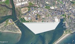
Lynn seems like a contender, and could pair well with extending the northern bounds of Charlestown into the Mystic.
 
I was thinking the same. I would also incorporate a seawall and transit line.
I think for a major international airport you are going to need more forms of access than just a transit line (but seawall and transit are clearly important).
 
I think for a major international airport you are going to need more forms of access than just a transit line (but seawall and transit are clearly important).
I would locate all parking on the mainland, and have a fixed-rail people mover system from there to access the air terminals out on the new island. Also a sea wall and perhaps a regular rail transit line spanning Boston Harbor, tied into the Urban Ring line via the Logan Airport site. And of course a multi-use path along the entire corridor, including along the seawall.
 
I would expect that a new Boston airport would be located in the bay, east or northeast of Graves Light. Could it work with a Kansai-style parallel runway configuration, or are we stuck with a crosswind configuration?
 
Assuming you had an unlimited budget, is there still anywhere left in Boston worth it to do some more land reclamation?

I always get a kick out of the land growth timelapses of Boston, but wasn’t sure if there were any proposals which would have kept that going, or how valid they would be.

From a purely crayon planning perspective, Pleasure Bay or a bay spanning coastal barrier with that wild highway pitch would be my guesses at the next two, but really curious what y’all would do

This is the old school AB crayoning stuff I love. On my breaks at work over the years Ive crayoned out a few different land rec ideas of what else could have been filled in if we kept going… or started again.


This version is the maximalist option. Many of the barrier islands off quincy are connected with seawalls and then filled in with fill over time to create our own “long island” over 2x as big as peninsular boston itself in new land.
IMG_6123.jpeg

Then on the boston side the rugged shoreline is straightened with seawalls from port norfolk to umass boston and umass boston to the castle island causeway and filled in to essentially extend the neoponset river mouth out to around the castle island causeway. Carson beach is moved out to the new riverbank. Across the harbor a seawall is built from revere to logan airport and the land around logan is filled in along with logan being repurposed into new developable land. Logan is moved to a new island in mass bay northeast of hull. Any one of these could have been done alone or in combination.
IMG_6143.jpeg


A different variation would not extend quincy out to long island but instead to spectacle island and instead would use long island and peddocks island as the basis for a new logan airport in the middle of the harbor. Then a barrier would be built from revere to logan, the sea filled in, and logan redeveloped. In this case you end up with a shorter quincy extension, redeveloped logan, but logan is moved to the middle of boston harbor where it could still be protected by a seawall between hull and revere in the future.
IMG_6144.jpeg

IMG_6145.jpeg


For the love of god, can we get the 20 ft (or whatever it is) necessary at the Charles throat to allow the pike reconstruction to be entirely at grade?

Also, put a new metro Boston port in Lynn and give it proper rail access.
In all my years brainstorming/crayoning where to put a new port in MA thats relatively close to the boston metro and has rail access, I never thought of that spot. I like that idea a lot.

As far as the throat…. just chop off magazine beach from the cambridge side and paste it onto the boston side lol.
IMG_6129.jpeg

IMG_6130.jpeg

IMG_6128.jpeg


Somehow the path of the river ends up even looking more natural in the process too. You only need a couple feet of land next to the throat to fit the ped path on land so the rest of the new land could be used as a park to make up for the loss of magazine beach. (Obviously cambridge wouldnt allow this so I guess well just have to annex them… and brookline).
 
Last edited:
As far as the throat…. just chop off magazine beach from the cambridge side and paste it onto the boston side lol.

1784777406516.png
Not a bad idea IF the pubic swimming pool at Magazine Beach is replaced with a new one in the same neighborhood on the Cambridge side.
 

Back
Top