A bit of area history:
Mid-19th Century
Plympton Street was originally a part of the South Bay, the body of water that separated the Boston Neck from Dorchester Heights. During the filling in of the South End in the 1840s, the city realized that the sewers leading from the new neighborhood to the shoreline of the bay would discharge their sewage too close to the planned residential areas. It therefore began exploring the possibility of filling in the flats southeast of Harrison Avenue in 1845 and executed an initial contract for the work at the end of the year, commencing the so-called South Bay Lands Project. In 1848 the city signed a new contract with William Evans to fill more than 67 acres of marsh and flatlands between Chester Park (Massachusetts Avenue) and Malden Street; six wharves were subsequently added to the project plans. To provide the fill, Evans built a temporary railroad bridge connecting to the Old Colony route running through South Boston, enabling the shipment of gravel from Mount Home Farm in Quincy. The relationship between the city and Evans during construction proved to be an acrimonious one; Evans consistently failed to live up to the schedule or budget, one of the wharves he built collapsed almost immediately after completion, and he repeatedly filed for damages against the city, necessitating multiple renegotiations of the contract. The project was only completed in 1862, seventeen years after it had begun.
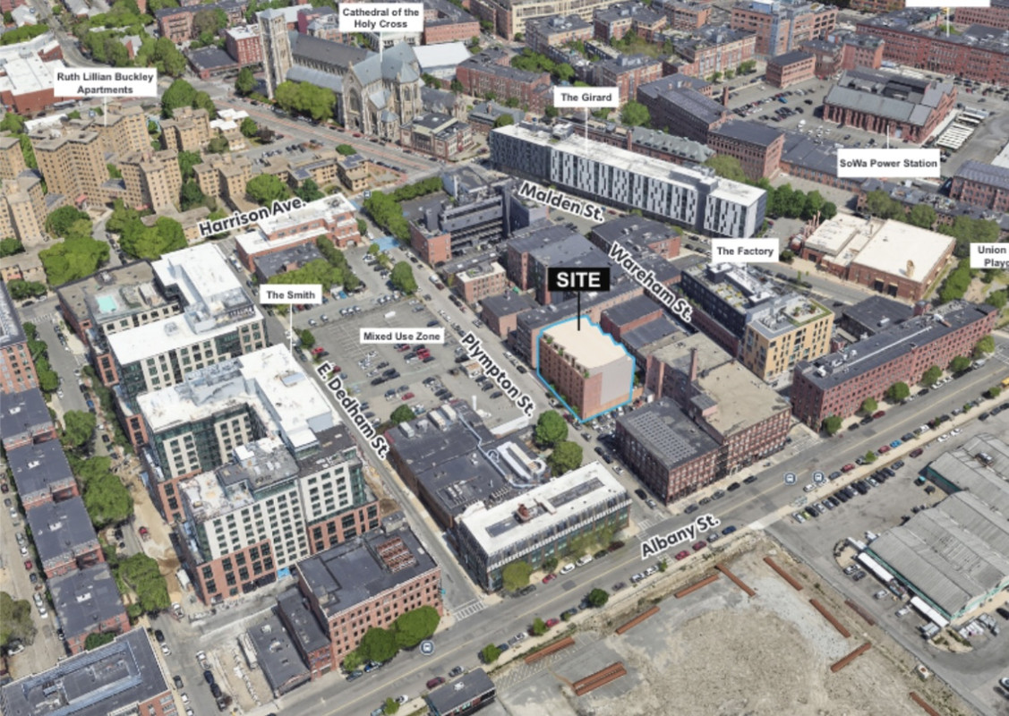
(Note: 52 Plympton's location is marked with a red dot; Cathedral of the Holy Cross on Washington Street is marked with a green one for context)
The South Bay in 1845 (published 1850), prior to the commencement of the South Bay Lands Project. The bay had been significantly enlarged during the 1830s, when about 60 acres of marsh and flats had been excavated to fill in the South Cove

----
The South Bay in 1852, showing land filled to that point (shaded)

----
The South End and South Bay in 1852, showing (aspirationally, not realistically) the progress on the Lands project, as well as the temporary railroad tracks leading to the Old Colony's line in South Boston. Though still largely in the water, the future path of Plympton Street is shown

----
Late-19th/Early 20th Centuries
The new land between Malden and East Brookline Streets was largely leased to private interests. The area was almost immediately given over to commercial uses, with the neighborhood becoming defined by its industrial buildings along with related tenements and worker housing. Many of the industries, attracted by the proximity of rail and the wharf facilities, were engaged in trades such as woodworking, stonecutting, shoe, piano and organ manufacturing.
Plympton Street, situated in the middle of the industrial district, was no exception to this trend. Many of the lots in the middle of the street became lumber and marble yards, or served as rear annexes to the buildings of carpenters, molders, and other manufacturers on Wareham Street (50 Plympton Street was one of the latter, initially acting as a rear property for the Morton & Chesley carpentry shop at 71 Wareham Street). Given the usage of the buildings and the prevalence of wooden structures, fires were a consistent occurrence in the first decades of the street's history. Near the Harrison Avenue end of the street, the city built a brick armory for the Second Light Battery in 1867 which later became the headquarters of the municipal wire department. At the head of the Plympton Street, the South End House settlement organization built the South Bay Union clubhouse in 1903 at 636-640 Harrison Avenue, while on the other side was a small chapel that the city later acquired to convert into a gymnasium. On the other end of Plympton Street, a building housing a riding school and later a veterinary hospital was established at 545 Albany Street.
----
The South End in 1879, showing the development of the filled in area and the six wharves that had been built as part of the Lands project. Note the significant difference in density between the largely residential area north of Harrison Avenue and the largely commercial/institutional area to the south of it

----
Plympton Street in 1868 and 1870, showing the progress of development in the area after the completion of the Lands project. By the later date, the 50 Plympton Street site was home to a wooden lumber shed for the adjoining carpentry building on Wareham Street


----
Harrison Avenue in 1903, looking southwest. The head of Plympton Street is on the left, between the South Bay Union (first building on left) and the City Gymnasium (second building left)

----
The South Bay Union at 640 Harrison Avenue (corner of Plympton Street), built in 1903 by the South End House. Formed in 1892, the South End House (originally the Andover House) was the first settlement house in Boston and the fourth of its kind in the United States. It eventually merged with other settlement houses to form the United South End Settlements (USES) in 1960
 ----
The former armory building on Plympton Street, later the headquarters of the Boston Wire Department, 1906
----
Construction on Albany Street looking west, circa 1900. The head of Plympton Street is on the right; the large building on the corner lot is the Boston Veterinary Hospital
----
The former armory building on Plympton Street, later the headquarters of the Boston Wire Department, 1906
----
Construction on Albany Street looking west, circa 1900. The head of Plympton Street is on the right; the large building on the corner lot is the Boston Veterinary Hospital

----
Mid-20th - Early 21st Centuries
In the early 20th century the city contemplated filling in the now-truncated South Bay, which was by then described as an unsanitary cesspool of offensive odors, floating sludge and gas bubbles. In 1956-1959 the Southeast Expressway was built over the bay, and in 1967 the last remnants of South Bay were filled in, eliminating lower South End's access to the water.
During this period, the South End industrial district largely marked time. As with most of the rest of the neighborhood, Plympton Street was declared a blighted area by the city in the runup to urban renewal in the 1960s, but it was largely exempted from redevelopment. In the following decades the buildings on both Plympton and Wareham Streets were largely left to languish, although several of them have since been rehabilitated and suited to new uses. In 2001 a new District 4 headquarters for the Boston Police Department opened at the corner of Harrison and Plympton Streets.
----
601-603 Harrison Avenue, 1940, opposite the head of Plympton Street. These buildings were shortly after replaced by the Cathedral housing project

----
Plympton Street, looking north towards Harrison Avenue, circa 1954-1959

----
Plympton Street, looking north towards Harrison Avenue, circa 1954-1959. The Cathedral housing project (now the Ruth Lillian Barkley Apartments), built in 1951, is visible in front of the Cathedral of the Holy Cross

----
The South End and Back Bay in ca. 1960-1964, showing Plympton Street and the Cathedral housing project

----
The infilled South Bay area in ca. 1960-1964, showing the new Southeast Expressway and city incinerator built on site. The railroad tracks leading towards the lower left of the photo are now used by the MBTA Fairmount Line. The large vacant land at the bottom of the photo is the future site of the South Bay shopping center.

----
Wady David, a local gangster described here as "the biggest supplier of heroin in Greater Boston" in the early 1950s, was found shot to death in an alley outside 42 Plympton Street in 1965

----
50 Plympton Street, 1972

----
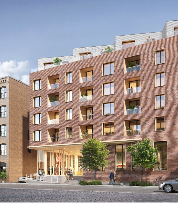
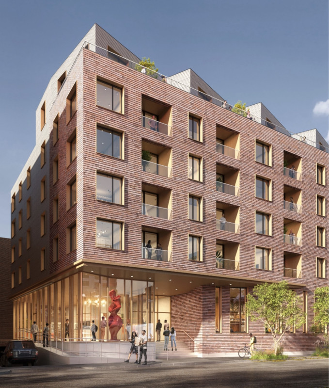
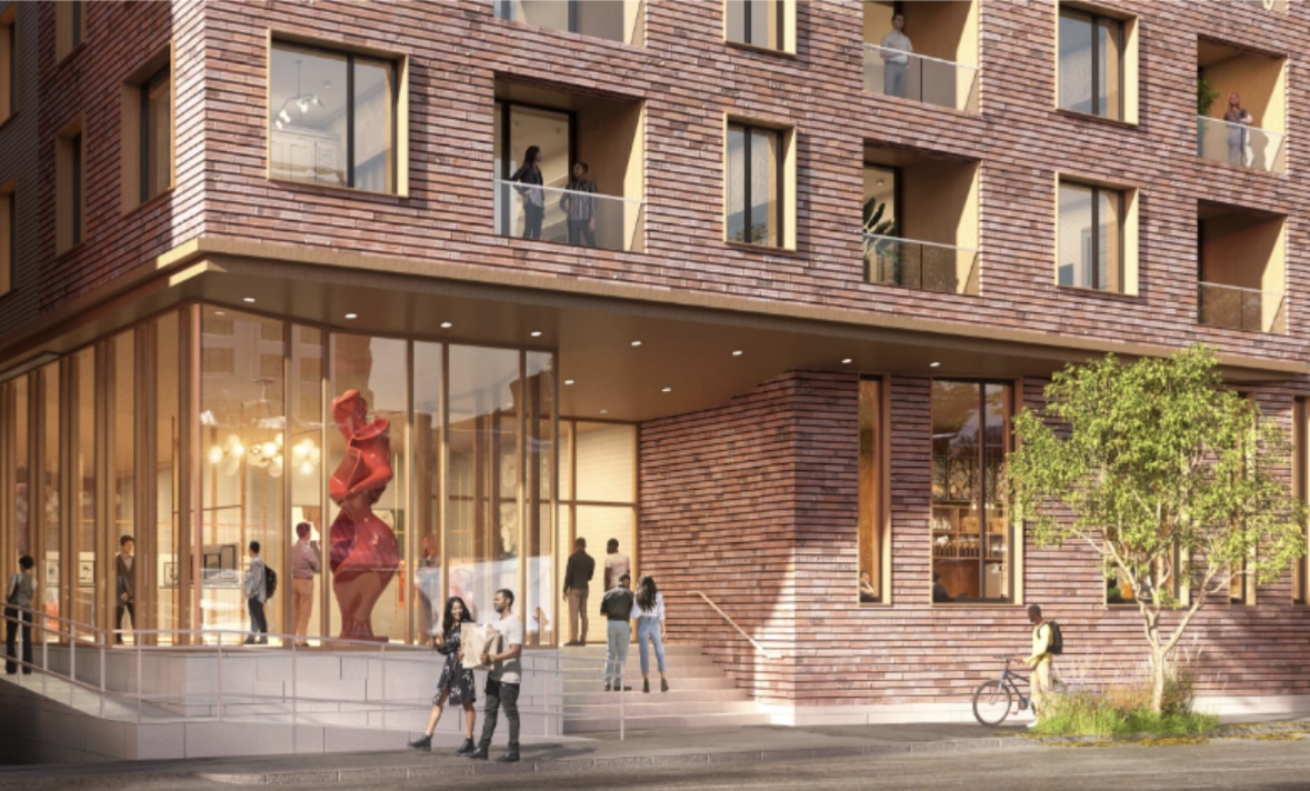
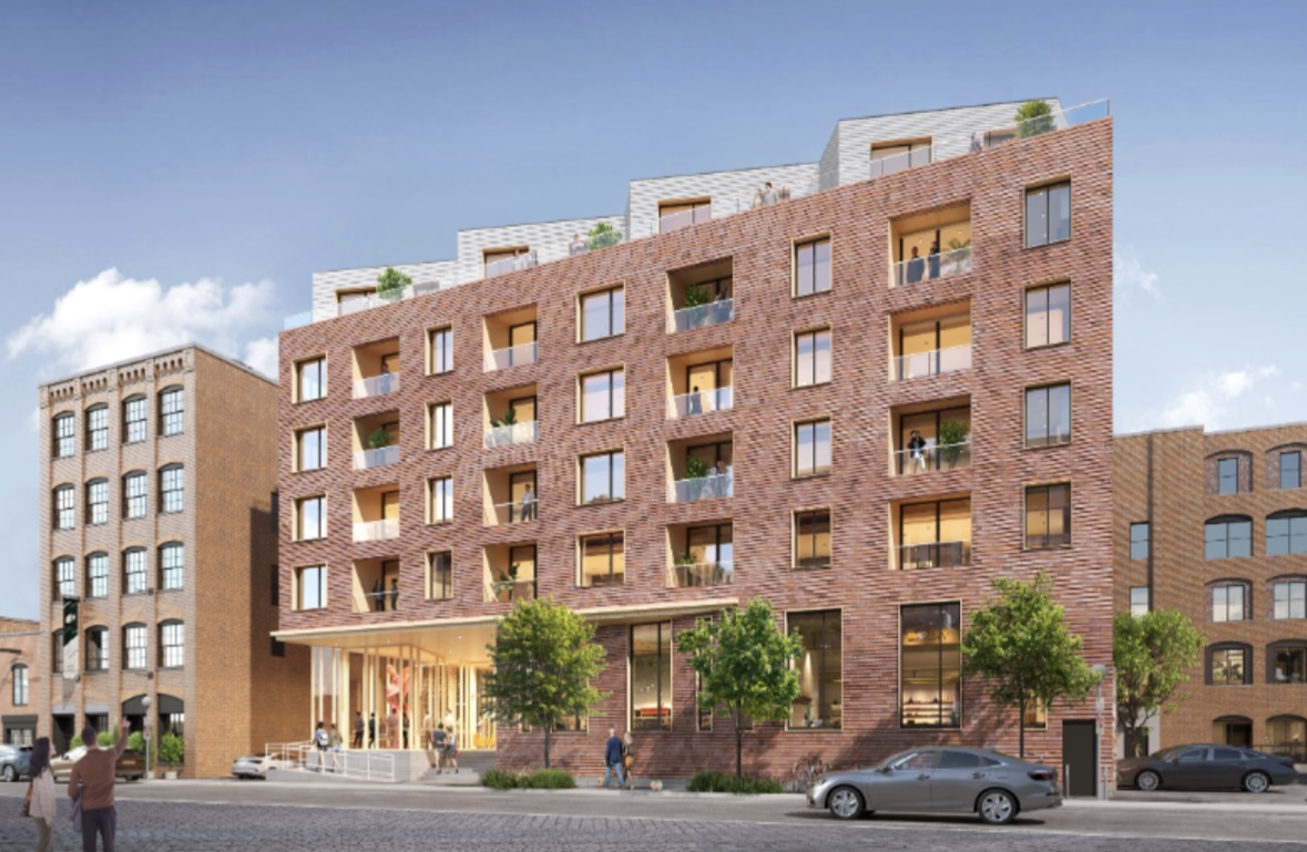
50-52 Plympton Street, 2025