I would rather see Washington St be served by streetcar, the Tremont St corridor and the BCA are close enough to the Orange and Green lines for service there to be effective. Not to mention, since it is possible to walk from Berkeley St to Dalton St with a roof over your head, there are good pedestrian connections as well.
You are using an out of date browser. It may not display this or other websites correctly.
You should upgrade or use an alternative browser.
You should upgrade or use an alternative browser.
Abandoned T tunnels
- Thread starter statler
- Start date
Ron Newman
Senior Member
- Joined
- May 30, 2006
- Messages
- 8,395
- Reaction score
- 13
I know how to get to the Clarendon Street side of Back Bay station by walking indoors from Dalton St, but how do you get to Berkeley Street?
HenryAlan
Senior Member
- Joined
- Dec 15, 2009
- Messages
- 4,184
- Reaction score
- 4,450
I know how to get to the Clarendon Street side of Back Bay station by walking indoors from Dalton St, but how do you get to Berkeley Street?
it's not exactly inside, but the platforms serving the NEC (tracks 1-3) are covered and have a Berkeley St. exit. Technically it's an emergency exit, but lots of commuters (including myself) use them daily.
And they're always open from Berkeley St.it's not exactly inside, but the platforms serving the NEC (tracks 1-3) are covered and have a Berkeley St. exit. Technically it's an emergency exit, but lots of commuters (including myself) use them daily.
JohnAKeith
Senior Member
- Joined
- Dec 24, 2008
- Messages
- 4,337
- Reaction score
- 82
I give up. I can't find "Pleasant Street" on any old map of Boston.
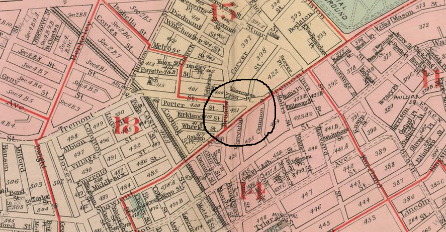
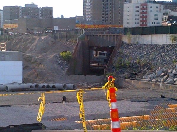
The Tremont Street Portal had the "Pleasant Street Incline" coming out of the tunnel at Eliot Norton Park - but where was Pleasant Street? I looked at 1920s maps but could not find.
I agree that there doesn't seem to be a pressing need for more transit on Tremont but using the tunnel (and re-opening the pedestrian tunnel between Boylston inbound/outbound) sounds like a great idea.
Last edited:
I give up. I can't find "Pleasant Street" on any old map of Boston.

The Tremont Street Portal had the "Pleasant Street Incline" coming out of the tunnel at Eliot Norton Park - but where was Pleasant Street? I looked at 1920s maps but could not find.
I agree that there doesn't seem to be a pressing need for more transit on Tremont but using the tunnel (and re-opening the pedestrian tunnel between Boylston inbound/outbound) sounds like a great idea.
http://www.wardmaps.com/viewasset.php?aid=297
Looks like Pleasant Street had been renamed to Broadway.
Ron Newman
Senior Member
- Joined
- May 30, 2006
- Messages
- 8,395
- Reaction score
- 13
The streets in the Park Square area have been realigned and moved so much in the last 40 years that I'm not sure any statement of the form "X Street became Y Street" can be totally true. At one point, there was a Carver Street in this area, and I think at least part of it became Charles Street South.
Ron Newman
Senior Member
- Joined
- May 30, 2006
- Messages
- 8,395
- Reaction score
- 13
Which was, at one time, continuous with the Broadway Bridge and West Broadway in South Boston.
F-Line to Dudley
Senior Member
- Joined
- Nov 2, 2010
- Messages
- 9,546
- Reaction score
- 10,407
I give up. I can't find "Pleasant Street" on any old map of Boston.

The Tremont Street Portal had the "Pleasant Street Incline" coming out of the tunnel at Eliot Norton Park - but where was Pleasant Street? I looked at 1920s maps but could not find.
I agree that there doesn't seem to be a pressing need for more transit on Tremont but using the tunnel (and re-opening the pedestrian tunnel between Boylston inbound/outbound) sounds like a great idea.
The portal's readily visible in any pre-1975 (the year it was sealed) Historic Aerials view of Eliot Norton Park: http://www.historicaerials.com/aeri...3490896818307&lon=-71.0657200746457&year=1971.
It was below street level with the surface stop for the Lenox St./Egleston line on the 3-way corner of Tremont and Charles, right at the sidewalk. The City Point surface stop was on the corner of Tremont/Shawmut and Oak, also right at the sidewalk. If the tunnel were to be re-used for Washington St. light rail the easiest way to use it would be a 2-block tunnel extension down Shawmut, under the Pike, spit up on the surface on the NEC ROW in the trackless gap where the Worcester tracks start peeling away, and incline-up to the corner of Washington and Herald on a small flyover ramp: http://goo.gl/maps/EoUln.
JohnAKeith
Senior Member
- Joined
- Dec 24, 2008
- Messages
- 4,337
- Reaction score
- 82
Soooo. I just finished reading what must have been the best-selling book of 1896, "Second Annual Report of the Boston Transit Commission for the Year Ending August 15, 1896".
It was quite fascinating.
It covered everything about the under-construction subway - costs, construction materials, etc.
Then, there's the photos. I had only seen two of these before.
I'm including several below. For the album, click here: http://s369.beta.photobucket.com/user/JohnAKeith/library/Boston Subway 1896
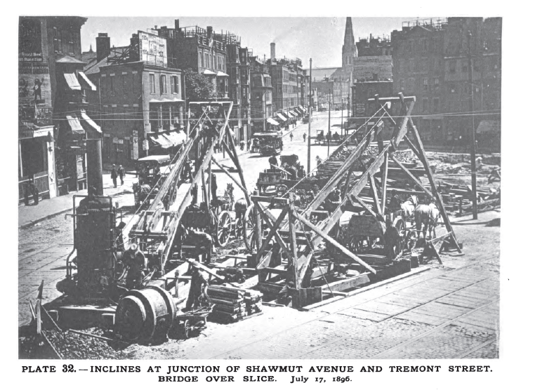
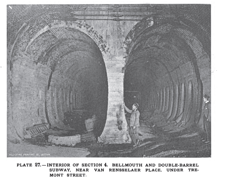

While excavating, the workers uncovered graves. The book says they were put in safe storage somewhere. Many appear to have been infants.
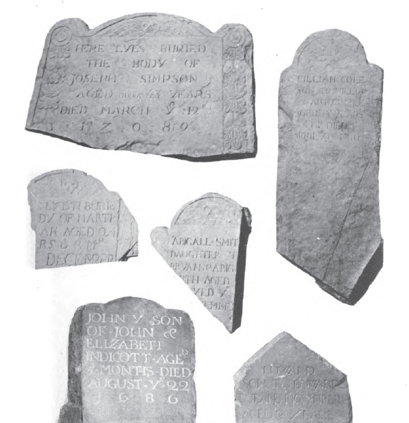
It was quite fascinating.
It covered everything about the under-construction subway - costs, construction materials, etc.
Then, there's the photos. I had only seen two of these before.
I'm including several below. For the album, click here: http://s369.beta.photobucket.com/user/JohnAKeith/library/Boston Subway 1896


While excavating, the workers uncovered graves. The book says they were put in safe storage somewhere. Many appear to have been infants.

JohnAKeith
Senior Member
- Joined
- Dec 24, 2008
- Messages
- 4,337
- Reaction score
- 82
JohnAKeith
Senior Member
- Joined
- Dec 24, 2008
- Messages
- 4,337
- Reaction score
- 82
I'm batting a thousand today!
F-Line to Dudley
Senior Member
- Joined
- Nov 2, 2010
- Messages
- 9,546
- Reaction score
- 10,407
Nope, just the abandoned freight spur used by the Herald.
Yep. CSX used to deliver occasional rolls of newsprint to them out of Beacon Park until the Herald outsourced all of their printing to suburban papers and the Globe. I don't know when that stopped...probably not long after 2000.
The Globe's siding on the Old Colony is still active, but they've also outsourced so much printing to the 'burbs it's rare they get deliveries more than once a month...if that.
- Joined
- May 25, 2006
- Messages
- 7,033
- Reaction score
- 1,865
This is what you are looking for http://goo.gl/maps/Pn0cF
bigeman312
Senior Member
- Joined
- Jul 19, 2012
- Messages
- 2,359
- Reaction score
- 2,360
F Line, the Globe doesn't outsource any printing. In fact, they've taken on a bunch more, including the Quincy and Brockton papers, and will take on the Herald run full-time shortly (or they may already have).
That's what he said. The Herald outsourced printing to the Globe.

