Boston and Beyond: A Bird?s Eye View of New England

briv

Senior Member
Joined
May 25, 2006
Messages
2,083
Reaction score
3
i_exhibit_banner.jpg

A Bird?s Eye View of New England

January 8 through June 30
1st Floor McKim Building, Copley Square

[FONT=verdana,helvetica,arial][SIZE=-1]Up, up and away! The Norman B. Leventhal Map Center at the Boston Public Library presents great bird?s eye view maps of the 19th century and celebrates their recent preservation.
[/SIZE][/FONT]
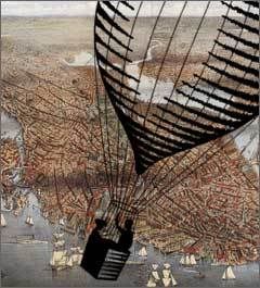
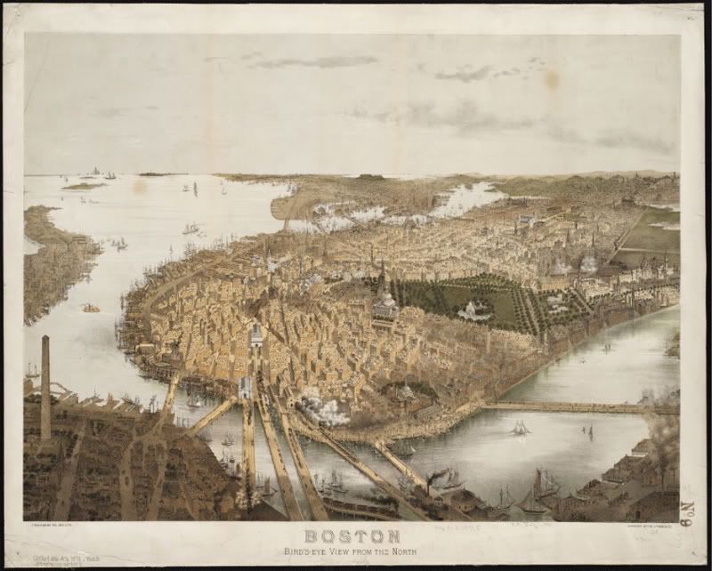
Unlike conventional flat maps, bird's eye views are a fascinating kind of specialty map that presents an urban area as if the observer hovered over the community at an elevation of 2,000 to 3,000 feet. The town "below" appears as if in a kind of imaginative snapshot of an historical moment, revealing the factories, homes, parks, cemeteries, churches, even details of vernacular architecture. The story told in the exhibit is of the growing economic vitality and urbanization of the Boston and New England region during the last half of the 19th century, when industrialization and immigration were the primary engines of urban growth.
NBLMC_boston.jpg


This free exhibit at the Boston Public Library, Copley Square will run daily from January through June 2008. A virtual tour of Boston and Beyond will appear on our website when the exhibition opens in January 2008. In February 2008 you will be able order beautiful reproductions of maps on our website.


Central Library Hours

Monday - Thursday​
9 a.m. - 9 p.m.​
Friday & Saturday​
9 a.m. - 5 p.m.​
Sundays​
1-5 p.m.​
 
If you're lazy, you can also find a lot of these 19th century aerial views on the Library of Congress website, I believe.
 
If you're lazy, you can also find a lot of these 19th century aerial views on the Library of Congress website, I believe.

This is true. But, for those who find themselves in the Copley area, I think it is well worth popping in the BPL to take a look at these in person. Even if that means just doing a quick lap through the exhibit during lunch or whatever.

Boston is the real star of the show here, but there are also views of other New England cities and towns like Lowell at its industrial peak. They have a few foreign cities on display as well, including a huge bird's-eye-view of 19th century Paris. The pieces are not only fascinating, but jaw-droppingly beautiful to boot.
 
That is what makes Boston so great. Unlike most american cities, boston started small, and then grew out, and finally grew up.

Most american cities grew somthing like this.

1. find land
2. make grid
3. build 3 supertalls
4. build many griddy suburbs around them

done.
 
That is what makes Boston so great. Unlike most american cities, boston started small, and then grew out, and finally grew up.

Most american cities grew somthing like this.

1. find land
2. make grid
3. build 3 supertalls
4. build many griddy suburbs around them

done.


Out of curiosity, could you name a few of these american cities that followed your four steps of growth pattern. I have had the oppurtunity to travel not only all over the country, but also to many foreign locals and I have never really been in a city that was built by following your four rules of growth pattern.

Sure there are planned cities, our nations capital being the on that stands out the most ,which by the way doesn't have any "supertalls". Many of the sunbelt cities that I believe you are refering to when you say "most american cities" have actually been around for hundreds of years. People in Nashville, Charlotte, and Dallas didn't didn't just say ok lets plot a grid, build some tall buildings, and then lets finish it off with some nice griddy suburbs. These cities evolved over hundreds of years just as Boston did, they just grew slower at first and have really taken off during the age of the automobile, while Boston's growth happened for the most part pre-automobile.

If its the fact that you believe that having a "grid" is strictly an american phenomenon, than you should consider the fact that planned cities as far back as ancient Mesopotamia had cities that followed a planned grid. I believe the first city was Ur way back in about 3000 BC.
 

Back
Top