Boston to update its zoning code

stick n move

Superstar
Joined
Oct 14, 2009
Messages
10,407
Reaction score
11,830
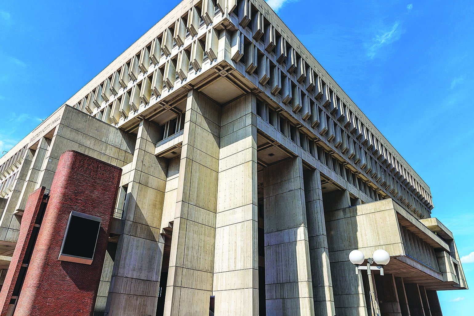
Wu unveils plans to revamp Boston’s decades-old rules for what can be built where

1694617830160.jpeg


“The city of Boston will update its zoning code — a labyrinthine, nearly 4,000-page document guiding what’s allowed to be built and where — for the first time in nearly six decades, Mayor Michelle Wu said Wednesday.

The overhaul will start with restructuring the Boston Planning and Development Agency’s planning department to create teams focused on zoning reform and compliance, with the hopes of relying less on the Zoning Board of Appeal in the future.

Almost every new real estate development of any size in Boston requires a zoning variance — just a handful are “as of right,” or allowable under the current zoning parameters — and the majority of projects, large or small, end up in front of the ZBA. (Indeed, the board has decided on 220 projects just since June.) Wu’s plan aims to streamline that, creating clearer, modernized rules for what can be built where that would reduce the amount of time many projects spend in permitting and community review.

Some of Bronin’s suggestions include reversing the city’s “longstanding practice of neighborhood-specific zoning” and culling the code to 500 pages, creating a mixed-use zoning district, and emphasizing growth and additional housing near MBTA stations.

“A significant contributor to the zoning code’s current state is the dominance of neighborhood-specific, rather than citywide, planning,” Bronin’s report states. “This proposal requires a significant mindset shift, given the entrenched nature of the neighborhood-planning to-neighborhood-zoning pipeline. But neighborhoods, and the people who live and work in them, will be better off without convoluted, outdated code provisions interfering with their plans and their property rights.”

Arthur Jemison, whom Wu tapped as both BPDA director and Boston’s chief of planning, said the agency would seriously consider the report’s recommendations — including incorporating design recommendations “that improve equitable access but protect the ability for neighborhoods to maintain their unique character.”

“We need a solid policy foundation and a modern zoning code to enforce a structure of accountability for growth,” Jemison said in a statement.”

https://www.bostonglobe.com/2023/09/13/business/boston-zoning-code-wu-revamp/
 
LOVE to see the effort to get rid of arbitrary friction points by having almost everything non-compliant. Will hold final judgment until we see what's in the damn thing. Obviously the goal of streamlining and clarifying zoning is great, but if net residential zoning capacity isn't meaningfully higher after the revisions...
 
To stimulate housing production, it recommends elimination of all minimum parking requirements, expanding as-of-right approvals for residential projects, rezoning squares and transit hubs for higher-density housing and legalization of accessory dwellings up to 1,200 square feet.

 
While I agree with almost everything in the Bronin report regarding zoning, this seems rather alarmist and assumes nothing will be done in the next 50 years to address this issue:

The report also says Boston should consider a moratorium on new development in neighborhoods vulnerable to coastal flooding.

“Bostonians must come to grips with the fact that much of their city will be underwater in 50 years, including beloved neighborhoods and historic buildings, particularly in the downtown, the flat of Beacon Hill, South End, East Boston, South Boston and the waterfront,” the report states. “The city must get a handle on sea level rise scenarios and must seriously explore a moratorium on new development in those areas which will be flooded at high tide.”

Beyond new limits on development, the city should start to consider a managed retreat from the most vulnerable waterfront areas, Bronin’s report states.


If Boston actually enacts a moratorium on new development in Downtown, Beacon Hill, South End, East Boston, South Boston, and the Seaport then I look forward to the city allowing up to FAA limit height in all other neighborhoods.

Isn't most of Boston's and Somerville's affordable housing stock located directly in the floodplains that will be essentially wiped out sometime between 2035 and 2050?

Boston hasn't had a category 1 - 3 hurricane storm since 1991, 1954, or 1938, and is long overdue for such a storm. Those kinds of storms would essentially wipe out half of the city. Even if sea levels are increasing 3 - 5 feet, or up to 10 feet over the course of 30 - 75 years; a storm surge could be much higher, such as 8 - 14 feet, meaning no place within 16 - 24 feet of sea levels would be safe.

I don't disagree about the floodplains and the climate risks the region is facing, I disagree that the response should be to accept the inevitable and abandon half the city.
 
...assumes nothing will be done in the next 50 years to address this issue...

What needs to be done is Hurculean, but I didn't realize we already decided we were doing nothing : ( . Sounds like this report was written by someone not from here, and therefore with less personal or emotional connection.

If Boston actually enacts a moratorium on new development in Downtown, Beacon Hill, South End, East Boston, South Boston, and the Seaport then I look forward to the city allowing up to FAA limit height in all other neighborhoods.

More broadly, your response points to the fact that climate change affects everyone, including the neighborhoods and properties that are ostensibly less vulnerable: we are an interconnected system, there's no such thing as one area being affected and another area getting off scot-free. You tell 100,000 people to move, yet they need somewhere to move to (do we have 100,000 spots ready and waiting?). You tell one street they are on high enough ground not to flood, yet all of a sudden most of their access routes are cut off even though they're dry. You tell recreation, cultural, historic, and museum sites they are at risk, yet you need new sites to reestablish them at. Same goes for our prestigious universities. We have major roads, highways, and railways, that have great stretches on high/dry ground - yet their routes also dip down low at certain points, cutting themselves off and bottlenecking vehicular motion; shall we reroute them all? I suppose you could say, shut 100% of Boston down and move everything far, far away and many feet above sea level, but that's even more Herculean, and we've spent far too little effort exploring more feasible options first. The point: this is a societal problem, not solely individual landowners' problems.
 
What needs to be done is Hurculean, but I didn't realize we already decided we were doing nothing : ( . Sounds like this report was written by someone not from here, and therefore with less personal or emotional connection.


More broadly, your response points to the fact that climate change affects everyone, including the neighborhoods and properties that are ostensibly less vulnerable: we are an interconnected system, there's no such thing as one area being affected and another area getting off scot-free. You tell 100,000 people to move, yet they need somewhere to move to (do we have 100,000 spots ready and waiting?). You tell one street they are on high enough ground not to flood, yet all of a sudden most of their access routes are cut off even though they're dry. You tell recreation, cultural, historic, and museum sites they are at risk, yet you need new sites to reestablish them at. Same goes for our prestigious universities. We have major roads, highways, and railways, that have great stretches on high/dry ground - yet their routes also dip down low at certain points, cutting themselves off and bottlenecking vehicular motion; shall we reroute them all? I suppose you could say, shut 100% of Boston down and move everything far, far away and many feet above sea level, but that's even more Herculean, and we've spent far too little effort exploring more feasible options first. The point: this is a societal problem, not solely individual landowners' problems.

Yea. I'm not sure how will MA be able to cut automobile car use by 90% or something along those lines by heavily investing in bike lanes, public transport and passenger rail in 30 years, fix the decaying MBTA; AND try to build gargantuan flood protection infrastructure the likes of the Netherlands at the same time. The flood protection infra may or may not withstand a cat 3 hurricane (the Netherlands doesn't get those kinds of storms), and it may end up obsolete in 20 - 25 years when sea levels and storm surges outpace it by the end of the century. There's already skyrocketing construction costs, and every passing year, storms continue to eat away at infrastructure across the United States faster than they can be kept up to a state of good repair or expanded upon.

If we keep people in the coastal floodplains by damming the whole city with one giant dike stronger than that of NL's, if the dam fails, then it'll be a lot more chaotic abandonment of the coastal floodplains.

We're talking about a lot of transit-dependent people whom live on the coastal floodplains with nowhere to go. Where will they go if they can't find a home accessible by public transport or bike lanes, if all of that transit-accessible affordable housing stock can only be found on the coastal floodplains? Chinatown, South Boston, Clarendon Hill, Mystic Ave; all come to mind. Most lands on high ground have essentially no public transport or bike lanes.

All of the neighborhoods marked for a suspending of any future development all have the best public transport anywhere in the region. Chinatown and South End's got the Orange Line, CR, and SL. Downtown/Beacon Hill with the RL/GL. The Blue Line and SL3/116/117 in Eastie.

We could be in a housing crisis now, but by the time we build the missing units to solve this first housing crisis, then there are large amounts of them underwater already with people with nowhere to go.

I don't disagree about the floodplains and the climate risks the region is facing, I disagree that the response should be to accept the inevitable and abandon half the city.

All of the highways and railways that go from one end of Boston to the other end pass through flood prone areas. The GLX cuts across the East Somerville floodplain separating Gilman Sq. and Lechmere. I-93 is bisected by the tunnel in downtown at sea level.
 

The concern you share makes some sense, but I will point out an additional consideration: any physical climate resiliency measures, strategies, or migrations at any magnitude only make sense if we (the world) super aggressively combat climate change at a global level through elimination of carbon emissions. Everything is toast if we don't; and no "moving a few miles inland" sort of measure is going to hold up in the actual long run.

So my perspective, above, assumes parallelism: Boston building some resiliency measure and the world actually, meaningfully reversing our carbon emission behavior in the very near future. I do not think we should avoid making steps toward local resiliency measures just because we (very rightfully) doubt the world; I think we should make them because even if the world fails at this, everything fails anyway, so the only action that might matter is if we solve things locally to buy ourselves a few years in the meantime.
 
BPDA Releases Analysis of City’s Out of Date Zoning Code
Michelle-Wu-Official.png


“BOSTON–The City of Boston released a report commissioned by the Boston Planning & Development Agency (BPDA) to assess the Boston Zoning Code.

The report, authored by Cornell University professor and Director of the National Zoning Atlas Sara Bronin, details issues such as extreme length and inconsistencies that make the code inaccessible to most Bostonians.

The City and BPDA also announced a significant restructuring of the Planning Department, creating Zoning Reform and Zoning Compliance teams and replacing the previous neighborhood planning team with a new Comprehensive Planning team. These new teams will support the City’s ability to modernize and enforce the Code, which has not been comprehensively updated since 1964, and will lead the next major planning and zoning initiative: Squares & Streets. Mayor Wu announced the restructuring of the Planning Department during her keynote address at the Greater Boston Chamber of Commerce Government Affairs Forum.

“One of the most impactful responsibilities of city government is to set the rules for how our neighborhoods grow,” said Mayor Michelle Wu. “But for decades, our system in Boston has been built on a confusing and inconsistent process of handing out exceptions. Reforming our planning process and zoning code will be a sea change for our city, helping to fulfill a commitment for predictability and equity to meet the needs of our communities.”

“We take seriously the recommendations in the report and will tailor our response to Boston’s needs – including exploring how to build design recommendations into the code that improve equitable access but protect the ability for neighborhoods to maintain their unique character,” said Chief of Planning Arthur Jemison. “We need a solid policy foundation and a modern zoning code to enforce a structure of accountability for growth.”

Having an antiquated Zoning Code limits the City’s ability to address the current housing crisis by creating steps and costs to the creation of new housing. The report released today shows that Boston’s code is abnormally long compared to cities of comparable size by geography and population. At nearly 4,000 pages, Boston’s code is nearly 40 percent longer than that of New York City, which has 13 times Boston’s population and six times its land area. By every form of comparison to comparable size cities, Boston’s code is significantly longer.

The analysis also shows that length does not result in a clearer or more effective code, but rather, a more complex, inconsistent, and inequitable Code. The report indicates that the length of the code and its many contradictions impede residents from making even small changes to their home or business without hiring a lawyer. This creates barriers that prevent Bostonians from being able to participate meaningfully in the planning process.

The BPDA’s newly restructured Planning Department includes three new teams: Comprehensive Planning, Zoning Reform, and Zoning Compliance, in addition to the existing Transportation & Infrastructure Planning division. The Comprehensive Planning team will reform and expand the former neighborhood planning team’s capacity to focus exclusively on long term, Citywide visioning, in partnership with other City departments. The previous neighborhood planning team was also responsible for reviewing development proposals in their assigned neighborhoods, which consumed a significant portion of the planners’ time and limited the team’s capacity to complete proactive, Citywide planning. Zoning Compliance, a new division of the Planning Department, will work with the Development Review Department to support planning-led development. The Zoning Compliance team will root their approach to reviewing projects within a clear planning and zoning context from prefile through approval, ensuring that development projects comply with plans and new zoning recommendations, and facilitating fewer exceptions to the Code.

Finally, the reorganization has doubled the capacity of the Regulatory Planning & Zoning team, renamed Zoning Reform, in order to allow planners to amend the code proactively. Many of the issues in Boston’s Zoning Code have been well-known and documented for decades, but the Planning Department lacked the capacity to take on large scale change. The Zoning Reform team will also provide recommendations to the Zoning Board of Appeal (ZBA). With a dedicated focus on providing more clear context to the ZBA, and in concert with future changes to the code, this team will reduce the City’s reliance on the ZBA….”

https://bostonrealestatetimes.com/bpda-releases-analysis-of-citys-out-of-date-zoning-code/
 
More broadly, your response points to the fact that climate change affects everyone

If they expect those neighborhoods to be functionally underwater in a few decade, I wonder what they think about the subway lines running through them and how we can be expected to keep our mass transit online.
 
While I agree with almost everything in the Bronin report regarding zoning, this seems rather alarmist and assumes nothing will be done in the next 50 years to address this issue:

The report also says Boston should consider a moratorium on new development in neighborhoods vulnerable to coastal flooding.

“Bostonians must come to grips with the fact that much of their city will be underwater in 50 years, including beloved neighborhoods and historic buildings, particularly in the downtown, the flat of Beacon Hill, South End, East Boston, South Boston and the waterfront,” the report states. “The city must get a handle on sea level rise scenarios and must seriously explore a moratorium on new development in those areas which will be flooded at high tide.”

Beyond new limits on development, the city should start to consider a managed retreat from the most vulnerable waterfront areas, Bronin’s report states.


If Boston actually enacts a moratorium on new development in Downtown, Beacon Hill, South End, East Boston, South Boston, and the Seaport then I look forward to the city allowing up to FAA limit height in all other neighborhoods.
If those neighborhoods are underwater then there’s no city anymore. It’s just some highways and an airport.
 
So I was listening to the radio Boston podcast today and they were discussing the mbta communities act and how it was implemented and how towns are fighting against it and I learned a few interesting things about Newton and the region as a whole. I also was able to find this very interesting presentation detailing the history of newtons zoning efforts.

In the early 1900’s anti immigrant sentiment was gaining steam across the country. Newton started having conversations about exactly “who” they wanted to allow to reside in their community.

In 1926 the supreme court in Village of Euclid Ohio v. Ambler realty co ruled that zoning restrictions on the design and use of buildings fell within the scope of governments police power. This opened up the entire country for zoning laws to be implemented.

In 1925 newton adopted its first single residence district. By 1930 the majority of the general residence areas had been changed to single residence or private residence.

In the 1930’s Newton mandated that new houses had to be built out of masonry. They used a cover story of “fire risk” but in reality the wooden triple decker was spreading through working class neighborhoods and they knew masonry structures were too expensive for working class immigrant families to afford.

In the 1940s minimum lot sizes are introduced.

https://www.newtonma.gov/home/showpublisheddocument?id=67274

From the podcast:

In 1987 Newton eliminated multifamily as a by-right option.

They reduced from 6 stories as allowed by right in the business districts to only 2, with no special permit option.

They prohibited housing above retail in the village center districts.

The greater Boston area in the 1960’s and 70’s also were following many of these same trends as seen in Newton. The period is even referred to as “the great down zone” period. Some towns put a moratorium on development all together (framingham recently did the same thing). Many other “wealthy” suburbs of Boston took after Newtons 2 story rule and eliminated all building development over 2 stories when they came out of the moratoriums.

https://podcasts.apple.com/us/podcast/radio-boston/id304273909?i=1000636679317

This goes to show that for as segregated as the city is a lot of it was done purposefully and strategically over the years, its no accident why the cities and towns look the way they do.
 

Back
Top