Brookline Infill and Small Developments

There was a plan to add a mid rise tower above that building as part of the original few parcel 15 proposals. Hopefully whenever parcel 15 is returned to they try to do it again. Maybe break it off from parcel 15 if need be, or do it in phases.

6a0105367f07d8970b017c374bfa5a970b-pi.jpg


5dnytKMh.png
 
Strongly disagree. It is popular retail and it fills that odd corner perfectly, and it's a gorgeous building that works well as a gateway marker. Not sure what it's killing since everything sort of stops at rt9 anyway, and it's not because of the dispensary.


Why would you want to turn this stretch into a highway? Setbacks aren't possible due to train tracks and Walnut St., so you'd basically have to obliterate everything just to delay the transition from major regional surface artery to local road by a few blocks? I always thought the intersection with Cypress is where you officially enter the city and the highway zone ends. That intersection is a vital pedestrian connection and a highway isn't compatible. This corridor should be built up like the Fenway section of Boylston, which shares a lot more in common with this stretch other than the street name.

I consider that stretch of Rt 9 a highway already because it’s four lanes wide and the speed limit is 30mph. I guess it would be considered an intermediate highway? But the sidewalks and storefronts are not pedestrian friendly being very narrow and when cars are not parked at the meters the pedestrian is exposed to traffic. The current architecture and zoning along that stretch between Cypress and the Village should be; 4 to 5 stories on each side (similar to the hotel), first floor set backs would allow for pedestrian walking areas set back from traffic. To go a step further, underground parking in order to lose the meter parking and replace with landscape barriers (trees lamposts). Basically the archetype that is happening between Washington and Brookline Ave.
 
There was a plan to add a mid rise tower above that building as part of the original few parcel 15 proposals. Hopefully whenever parcel 15 is returned to they try to do it again. Maybe break it off from parcel 15 if need be, or do it in phases.

It's a different parcel all together from 15 and owned by Berkley. There was a different plan for a mid-rise alongside the original Parcel 15 proposal that they Back Bay neighborhood got nuked which then sank the P15 parcel's economic feasibility.
 
Yes, its parcel 14. I said it was a part of the parcel 15 proposal, not that it was parcel 15.
 
I dig it. I'd rather start with the Art Institute.

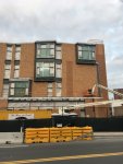
I get what you're saying about the bank, but I can imagine something like what you describe along the back wall of the building that could bridge the gap between Washington and Boylston. As an example, I had in mind this corner, where there's plenty of activity around this dead streetwall, but I've never thought to myself that the building needs to go. In fact I've never thought anything about it other than it being a handsome building that adds a sense of identity to the area.View attachment 20356
Yeah, but you really cant compare this because the location is so different. While Mass & Boylston isn't the best corner in Boston, it's still got 1) tons of toot traffic from Berklee, Newbury, the Number 1 bus, tourists, etc and 2) proximity to all the amenities nearby. So when you're on a dead corner but you can look down the road and see the commercial district of Boylston and know that there's shops in all directions, that's very different from looking up Rt 9 and knowing there's pretty much nothing for miles.

If Brookline were my SimCity, this is what I would, though (my compromise with you ;)
- take over the the elbow of the Art Institute (the bend of Wash) and develop that as a parcel with a streetfront shop
- do *something* to beautify the intersection (it's better than it was, but the Jersey barriers that divide Washington on the approach to the bridge over the D line are awful), something to define the intersection better would go a long way
- beautify Rt 9 median with something art related (maybe from the nearby institute, lol)
- consider air rights over the T (probably unrealistic even in a SimCity world)
- and finally, I still would boot out NETA from the bank. If MA weren't an absurd police state and you could just have weed shops the way we have liquor stores, it wouldn't be a problem, but all the ridiculous regulations on what you can and cant do, separation of customers with medical cards, the stiff security, and the fact that half the customers are from all over the region, makes this a business that does not contribute adequately to the streetscape. I would: hire an architect to design a way to fit multiple businesses in the building. Maybe something like the Arcade in Coolidge Corner (which is an awesome and underappreciated space). But this would draw more foot traffic and less car traffic. All of these things would bring this area into a new life. But as is? Not for me. And I spent grades 6-12 living on Pill Hill, I am very well familiar with this part of town. It's better than it was then, but has a long way to go.
 
Front of Driscoll School along Washington St. looking towards Beacon St.
IMG_6257.JPG

Front of Driscoll School along Washington St. looking North away from Beacon St.
IMG_6269.JPG

The East side of Driscoll School. (alley in back of Stoked pizza)
IMG_6273.JPG
 
Last edited:
Back of Driscoll School looking from Westbourne Terrace looking towards Washington St.

IMG_6284.JPG


Back of Driscoll School looking from Westbourne Terrace. (West face of the building to the right)
I had to take a second look, I thought the finish material was wood shingles! Nice choice of masonry material.
IMG_6297.JPG


West side of Driscoll School looking from Westbourne Terrace.
IMG_6305.JPG
 
Last edited:
Driscoll School in Washington Sq. Washington Street looking towards Beacon St.

IMG_9143.JPG


Side alley, Washington St on left side
IMG_9174.JPG


Pic of back of school from Westbourne Terrace
IMG_9186.JPG


Terra cotta pattern details
IMG_9191.JPG


IMG_9193.JPG


North side from Westbourne Terrace
IMG_9206.JPG


North side Back of school at playground
IMG_9214.JPG


IMG_9231.JPG
 

Attachments

  • IMG_9160.JPG
    IMG_9160.JPG
    1.5 MB · Views: 28
Coolidge Corner Theater expansion. The brick was changed from white in the rendering to a roman brick color. I think the color change is disappointing but the undulating brick patterns work is amazing!

IMG_0968.JPG
IMG_0969.JPG


IMG_0989.JPG


The cut steel to form the wave in the wall looks a little pricey$$ The weld on that masonry lintel looks a little sketchy though. A continuous weld would let me sleep better at night.

IMG_0987.JPG
IMG_0981.JPG


That is a big addition! Looks like its doubling the size of the building!

IMG_1009.JPG
 
Last edited:

Back
Top