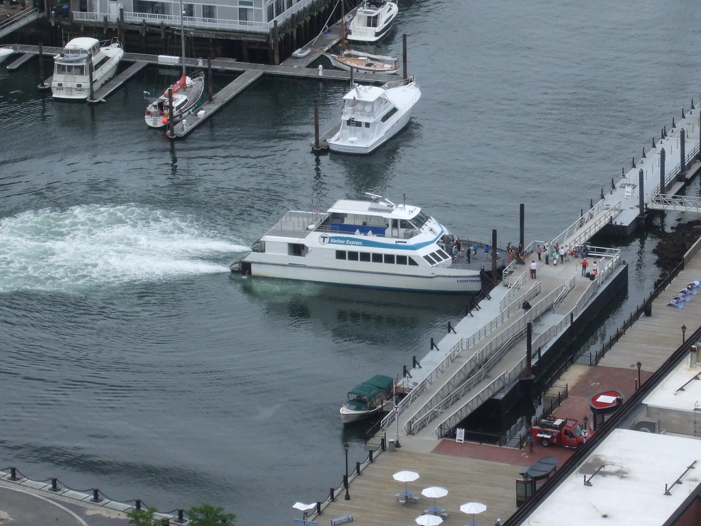
Charles River water taxi

I think your harbor routes are more viable than your river ones b/c they can serve travel patterns that are both unwalkable/unbikeable and also poorly served by transit.

Chelsea: Your proposed location would serve the neighborhood much better than past efforts to run boat service out of the dock at the bottom of Admiral's Hill. The closer you could get the downtown end of the route to South Station, the better I think.

Eastie: Since even a ferry out of Central Square would be in competition with the Blue Line, I think you would want to bring the downtown end of that route closer to South Station as well. Having it serve Long Wharf means you've provided a comparable trip for everyone who lives as close to Central Square as they do to Maverick, and are also destined for the Long Wharf area. For everyone else destined for other parts of downtown or other rapid transit lines, a Central Sq-Long Wharf ferry would not be competitive with the Blue Line. Providing a connection to the Red Line at South Station and that end of the Financial Dist would start to increase the size of the market I think.

Winthrop: Maybe shift the Winthrop dock 1/4 mile west so it serves a larger walk in market and provides decent access to Winthrop center?

Yeah, I was thinking of how to connect them with South Station though, as it doesn't seem viable given the low bridges (assuming these will be decent sized ferries). Assuming they eventually remove the Northern Ave Bridge, or even replace it with a lofty pedestrian bridge, you can only go as far as Seaport Blvd.

North Station is an option, though, if access is improved. Long Wharf can probably see more service with or without improvement. Maybe split the Chelsea service between the two while all Central Square service goes to North Sta.

Also, combined with my hopes and dreams of Aquarium being the future Central Station and I thought Long Wharf was best.
 
For places like Chelsea and Eastie that have direct transit connections into downtown already, you're going to primarily be serving trips that can be completed with a walk on both ends. I don't think these ferries would need to be very large, so you might be able to get them as far as Congress Street in the Fort Point Channel. And since you want to serve downtown destinations that can be accessed on foot, North Station's not ideal. Chelsea and Eastie's links to the Red Line and the southern half of the Financial Dist/Fort Point are not strong, so I think that's where the opportunity is.

Winthrop's ferry would be its only one-seat ride into downtown, so you could have it land almost anywhere downtown. It might also merit a small park and ride lot in Winthrop (given the size of Winthrop, hopefully heavily weighted towards bicycle parking).
 
4712085769_70f48a6d88_b.jpg
 
F2 - Quincy-Boston Logan experiencing 60 min delays due to the Weymouth Fireworks. 7/3/2010 9:46 PM


The captain was distracted by the colors.
 
Squantum Point Pier in Quincy
to expand for ferry service

http://www.boston.com/yourtown/news/quincy/2010/07/squantum_point_pier_to_expand.html


Final design and permitting work to renovate the Squantum Point Park Pier is scheduled to begin today, paving the way for expanded ferry service that officials say will boost tourism along the Massachusetts coast.

Officials including US Representative William Delahunt [pictured here, on right] and Lt. Governor Timothy Murray lauded the project at a groundbreaking ceremony at Marina Bay on Monday afternoon.

Initial plans include shortening the pier, adding new ramps, and relocating a weather shelter, allowing for ferries that could travel all the way to Cape Cod, officials said. It will also allow for a new fishing pier, boat ramps, and timber boardwalk, officials say.

?I can envision this location, this venue, as being a marine highway,? Delahunt said.

A final cost for the improvements was not provided, but the Seaport Advisory Council, a state body chaired by Murray and charged with developing the state?s ?commercial maritime resources,? has appropriated $350,000 for the project.

Additional funding for the project is expected to come from the state Department of Conservation and Recreation, the Division of Waterways, and the Massachusetts Cultural Coast, a non-profit organization.

The final planning phase will take two or three months, and construction, which could begin this fall or late winter, would require approximately the same amount of time, said Carlos G. Pena, vice-president at CLE Engineering who is supervising the project.

The pier, which officials said was built 20 years ago to ferry workers to the MWRA?s Deer Island Water Treatment plant, is now used mostly for recreational fishing and boating.

As a drizzle began and wind blew over the shovels for the groundbreaking and whipped a blueprint for the site right off its easel, representatives from cultural organizations all around the coast said they were optimistic about the idea of finding new ways to deliver visitors to their historical venues.

?We are excited about the possibility of getting visitors...to take this historic boat ride,? said Paula Peters, director of marketing for Plimoth Plantation. ?It?s going to be incredible.?

Governor Deval Patrick hailed the development for the possible jobs it could develop.
?This project is an excellent example of the critical collaboration and investment that leads to both construction and jobs,? he said in a written statement.

On the pier itself, 87-year-old John Hause, who said he lives in Germantown, was sitting in a folding chair, holding a fishing rod, and listening to music from a nearby radio. Far from the crowd of about 35 assembled to listen to speeches, Hause said he comes to the spot to relax and fish, but thinks improved ferry service would be a convenient improvement.

?I?d be into that,? he said.

While officials say they hope to expand ferry service down the coast, they also hope to expand it within Boston Harbor? which brought out a romantic sentiment in Marianne Peak, superintendent of the Adams National Historic Park, who said that President John Adams used to court his wife, Abigail, on Rainsford Island.

?When you think of the value that the Adams placed on water transportation,? Peak said, ?We?re really looking we?re really looking at a means of exploring our community.?
 
Interesting that the impact on Marina Bay itself isn't mentioned. Currently it's a fairly successful (though not to my personal taste) New Urbanist-ish bubble in the middle of nowhere and connected to nothing; year-round ferry service to downtown could change that. I think I remember hearing that Marina Bay was looking to expand westwards, but the protection of the Squantum Point park prevented that. Not sure if there are any expansions slated for the near future.
 
I don't quite understand how shortening a pier makes it more usable, though.
 
Probably gives more berth for larger vessels, especially if it's a deep water pier. More room to maneuver. Just a guess, though.
 
Currently it's a fairly successful (though not to my personal taste) New Urbanist-ish bubble in the middle of nowhere and connected to nothing; year-round ferry service to downtown could change that.

I don't think it's in the middle of nowhere. I mean, yeah, it's a self contained community but it's right off I-93.
 
^ That tends to militate against its success as a "New Urbanist-ish" community, though.
 
Right; I meant connected in terms of transit or walking.
 

Back
Top