Crazy Transit Pitches

How much of it really needs to be tunneled? A surface reservation on Kneeland seems like it would fit (but no clue how to connect that to the Tremont tunnel...)

3 problems:

1) Kneeland's way too congested, especially by the 93 ramps. No way you can do street-running anywhere in downtown; there's a good reason Mass Ave. is the dividing line for surface LRT.


2) The only way to get to the Seaport is by linking into the Transitway, which requires some amount of tunneling. There are not any viable surface paths across Ft. Point Channel because of street congestion. The Transitway loop is deep below ground under the Essex/Lincoln/Surface intersection. You only entry points into it are: (a) due west on Essex or (b) in the middle of Chinatown Park. And because it is deep below ground the portal has to be a solid 2 blocks back.

2a) Not gonna fit a portal on Essex anywhere in this vicinity. Go any further back and you're building SL Phase III all over again by underpinning the Orange Line and being mired in building mitigation hell. You also have no nearby access to the Central Subway with the Tremont Tunnel ending under Eliot Norton Park more than 3 blocks south of Boylston station on a one-way Tremont St.

2b) For the other Transitway trajectory you still end up digging under the Kneeland-Beach block all the same. Your single most delicate and expensive block of tunneling on the all-tunnel South End route...happens anyway.


3) As mentioned, Eliot Norton Park is end of the Tremont tunnel. So you're pointing due south towards South End. Oak St. ends at Harrison, and Harrison is a SB-only one-way. That won't work. Washington is ridiculously crowded near Tufts...that won't work. So your only free-flowing route is...Marginal St.. The same exact route the tunnel was going. And the same dig off Hudson from Kneeland to Beach to Chinatown Park to get into the Transitway.


ALTERNATIVE:
You can get to SS on the surface...but not the Transitway and not the Seaport.

1) Reactivate the Tremont tunnel.

2) Build Tufts station...a single 2-track part of it at least (but I'd structurally do up the whole triangular cavern so you can use the whole space later for diverging routes).

3) Build the 1-block Shawmut St. tunnel to Marginal and dip under the Orange Line. Build the 1-block under-Pike tunnel and portal-up the Herald St. wall to the Washington intersection, exactly as planned for the final Dudley LRT alignment. Leave a little cut in the wall under Marginal for adding the Transitway connecting tunnel later.

4) Dudley trolleys hang a right onto Washington. SS trolleys hang a left over the bridge, then right onto Marginal. Difficulty: you MUST change Marginal/Curve on these blocks into 2-way streets and ban parking on 1 side to fit trolleys here. That really doesn't introduce much new traffic because Marginal from Washington west is still a one-way...doesn't really tap much of a source for more cars.

4a) OR...air rights! Get some shit built over the Pike on the Washington-Harrison block, reservation to the side of Marginal so it can stay a one-way from Harrison, then glide onto Curve and turn that into a 2-way and whack the parking.

5) Up Hudson to the S. Station Connector block, then right turn onto SS Connector. Minor cosmetic difficulty: that pretty park behind One Greenway now has a trolley reservation splitting its middle.

6) Go up SS Connector and loop in the bus terminal at top.


Pros: It's something. Not real expensive, gets you to SS where the highest demand is. Significant load relief for Red/Orange. Dead minimal neighborhood impact. Gives you a full-build trajectory for Dudley LRT and tidies up the cheaper stuff like ducking the OL tunnel and building Tufts station. You can add the Transitway connecting tunnel later.

Cons: You don't get a Seaport direct...at all. Or a free transfer to Red or Silver because you're way upstairs in the bus terminal. There's now going to be unbearable pressure now to fund and build that connecting tunnel, so have to weigh how much shelf life this kludge surface loop really has before it gets abandoned.


FYI: What I would NOT do to save more money is dig up the park and just restore the old incline verbatim. I would spend the money to do the tunnel as far as the Pike portal and get everything settled up for the complete Dudley alignment. It's not expensive; this costs quite a bit less than Red-Blue. Difficulty with portaling straight up like the old days: Shawmut's a one-way, Oak ends at one-way Harrison with no easy way of getting around the block, and you go on a wild goose chase if you stick to Tremont and have to backtrack for a block. NO direct Orange Line transfer, negating most of the load-spreading to Red/Orange at DTX. Many more traffic lights any which way. And even if you can get Pike air rights dev on the Shawmut-Washington block and a reservation to keep you from having to make Marginal a 2-way...it's just all-around fugly on ops and will take noticeably longer to get to SS than if you just git 'r dun as far as the Herald/Washington portal.

So I wouldn't cheap out THAT much if you're looking for interim solutions to at least get to SS, punting Seaport directs to a second phase, or just flat-out slashing budgets to the bone. Build Tufts and those extra 2 tunneled blocks under the Pike.
 
Well I was thinking of a hybrid approach, where you stay at the surface until the last block to get into the transitway tunnel. Even if that's the hardest place to tunnel, at least the rest is relatively cheap. Perhaps Oak St + Tai Tung St could be used as a dedicated transitway as well (with a stop at Tai Tung park for mitigation)...
 
Well I was thinking of a hybrid approach, where you stay at the surface until the last block to get into the transitway tunnel. Even if that's the hardest place to tunnel, at least the rest is relatively cheap. Perhaps Oak St + Tai Tung St could be used as a dedicated transitway as well (with a stop at Tai Tung park for mitigation)...

Not going to work. This adorable thing is what Oak turns into on the block between Harrison and Tyler. Yeah...um, no. And Harrison's a one-way southbound. Even if you could 2-way it (which you really can't), the next available block is...Marginal @ Curve. Back to the Pike-hugging alignment we started with.

Your only other option on fully 2-way streets is Oak-->Washington-->Kneeland. No way with those traffic levels.

So...all roads point to Marginal.


The other thing to consider is how deep the Transitway is. Even on steep grades the trolleys can handle with aplomb you'd need a good 500-600 ft. runup to plumb those depths. Tracing back from the point it punches into the Transitway, that puts you close to the back parking lot of Ginza Japanese Restaurant as your first chance to pop the surface. 150-200 ft. from the Hudston/Kneeland intersection. And you've already mitigated two-thirds of the buildings on Hudson for the Kneeland-Beach block to get this far.

So it's extremely awkward to stop there. The trolleys have a nightmarish Kneeland intersection to contend with, and the Kneeland-Beach block has to go car-free to fit the 2 trolley tracks that run on-street that last couple hundred feet. Not cool when all those storefronts and restaurants are served by delivery trucks from on-street.

In all likelihood you can't stop there, and have to keep going across the intersection. Next opportunity to portal-up is that park that's going behind One Greenway on the SS Connector block. +500 ft. of extra tunneling from the 600 you already dug...this time at level-grade, standard-depth with that One Greenway promenade offering up more breathing room. Consider it 90% likely you're going to have to reach this far because the impacts of scurrying to the surface on the other side of Kneeland and banning autos from that block of Hudson is too much punishment for the neighborhood. And really lousy for the trains that have to now cross Kneeland. It's a near non-optional.

So, for all practical purposes if you want into the Transitway you have to build 1100 ft. of tunnel and mitigate ALL the hard parcels in Chinatown.

That leaves only:
-- Tremont St. tunnel reactivation + Tufts station + 900 ft. of tunnel to the Herald side of the Pike to get the base build serving either/both the Seaport and Dudley legs.
-- 1700 ft. of the easiest digging of them all from the Marginal/Shawmut intersection where the Dudley and Seaport legs would split to your Transitway portal-in-the-park.

Really...if front-loading the Transitway incline you've done almost two-thirds of the work and cost; it's silly to leave a gap in the rest when the rest is all the easy digging.

I could see the phasing working the opposite way like I described in the last post: 1) getting Tufts + the Dudley portal built, 2) going SS surface or bus station from there in the interim, 3) THEN building the hard part. But not in reverse when the feat of completing the way into the Transitway puts the wind well at your back for the rest. That's sort of a rough and much more expensive analogue for "Eh, fuck it. Let's just end the Transitway here, make the Silver Line cross D Street, and not put any direct ramps onto the Ted." Giving up on it right on the cusp of the follow-through...after they've already pulled off the feat of doing the hard part.

What about going deep-bore under Boylston/Essex, from the Green Line to the transit way.

Start back between Arlington and Boylston Stations, where the tunnel is wide for the former portal to the surface, and go down. Deep under Boylston, under Essex, then rise up to the transitway. Avoid the utilities and foundations. Many other locations have done the tunneling ROI and suggest this type of deep bore has a payoff versus all the surprises coming down from the surface.

Only drawback is the alignment only connects Back Bay to the Seaport -- there would be no running from downtown to Seaport. You have to connect at Boylston, Chinatown or South Station.

Before F-Line gives a Master's thesis on this ( :) ), the short answer is that deep boring is only possible when you have bedrock to bore through. Downtown Boston is built on a foundation of - literally - trash, in addition to lots of other fill, with bedrock too far down for a subway. Outside of some suburban examples, the T is pretty much stuck with cut-and-cover forever.
 
Before F-Line gives a Master's thesis on this ( :) ), the short answer is that deep boring is only possible when you have bedrock to bore through. Downtown Boston is built on a foundation of - literally - trash, in addition to lots of other fill, with bedrock too far down for a subway. Outside of some suburban examples, the T is pretty much stuck with cut-and-cover forever.

Sorry, but this is no longer true.

I've posted on this before, and gotten slammed, but Parsons Brinkerhoff successfully deep bores in glacial till, sand, gravel and clay. They competed the North Dorchester Bay CSO tunnel, a 17 foot stormwater storage tunnel, 2.1 miles long, 35 ft. under Day Boulevard in South Boston for the MWRA in 2010.

I know a water storage tunnel is not a subway tunnel, but the speed and success of the Dorchester Bay CSO tunneling operation (it was fast and pretty cheap) shows that deep bore can be done (with soil stabilization) in Boston blue clay and glacial till, sand and gravel.

So taking the technical excuse that it cannot be done off the table, why not go deep bore?
 
My understanding is that the issue isn't so much "building the Essex St. Subway is impossible", it's "building the Essex St. Subway is so disruptive and expensive it should be taken off the table if there are other options".

I can only imagine that even in that deep-bore scenario, supporting Boylston Station during construction is going to be a huge engineering challenge... not an impossible one, perhaps, but not an affordable one.
 
So..the takeaway for me from this thorough examination of the options is that we should add another one to the table - piggybacking on the NSLink / SSUnder digs to put the incline under or adjacent to the SS platforms (even if it means abandoning the existing transitway stub and even reconfiguring the SS silverline platforms...)
 
My understanding is that the issue isn't so much "building the Essex St. Subway is impossible", it's "building the Essex St. Subway is so disruptive and expensive it should be taken off the table if there are other options".

I can only imagine that even in that deep-bore scenario, supporting Boylston Station during construction is going to be a huge engineering challenge... not an impossible one, perhaps, but not an affordable one.

That's exactly it. Nothing is impossible, but the costs skyrocket exponentially with each additional tough engineering challenge you take on. The amount of mitigation matters the world on whether a single block of tunneling is going to cost you $500M or $75M. Therefore it is critical to take the most unconstrained route possible that accomplishes the basic service goals. Otherwise it's just not buildable for the cost, the time of construction, and the amount of mitigation. Diminishing returns kill projects, not lack of imagination.

I posted this on another thread that went off the Transit OCD perfectionism deep end: http://en.wikipedia.org/wiki/Perfect_is_the_enemy_of_good

That says it all. If you are spending 5x the time and money to reach the same destination for the same basic service and same basic purpose...and the only difference between the builds is that the more "perfect" one is pushing far far greater than 80% a share of the resources at far far less than 20% of the task, at escalating diminishing return...then something is very very wrong.

This is exactly what they found wrong with Silver Line Phase III on the Essex route. The building mitigation was bad enough, but interfacing with Boylston station required ripping up that entire corner of the Common and radically altering the station, and underpinning all of Chinatown station in incredibly tight confines was its undoing. You would face the same problems on a trolley on that alignment. You would face the same problems on a deep-bore where getting that far underground requires 2-3 blocks runup of maximally painful incline construction that requires a giant hole (or two, if inclining back up the other end) left in the street between skyscrapers for years on end as a TBM access point.

Yeah...you could do this. But WHY? What is it about that 20% of the task that is so worth pushing for at all cost? In this case, does underpinning Chinatown matter when the transfer +1 Orange stops down at Tufts with the South End routing accomplish the same service to the same neighborhood without need to touch one single solitary pre-existing station? Or have any impacts to existing subways other than a single-point dip under the Orange Line at one 100 sq. ft. point under one intersection? Nobody says that's without complications, but break out the cost/benefits of the various routings and ask yourself what in that 20% of the task is worth the extra effort. QUANTIFY it.

The state didn't game out this particular scenario because they were still clinging to BRT before they threw in the towel, but privately this is what officials meant in their off-the-record remarks that it "should have been light rail from day one". They simply could not come up a justification for a BRT-mode tunnel build that answered WHY all that extra construction pain and cost was worth it vs. finding some path of lesser resistance. When chasing the 20% is adding $2B or more to a project total without changing the goals of the project, failing to justify it isn't a failure of will. It's common sense.


http://en.wikipedia.org/wiki/Perfect_is_the_enemy_of_good

^^ This is a basic check-and-balance against Transit OCD run-amok...or anything civil engineering run-amok...to hold yourself to when brainstorming. It is not a matter of possibles. Or political motivation to tackle the possibles. It's answering WHY chasing perfection at all cost is necessary. The state could not answer that question with their SL III preferred routing and mode after the cost bloat accumulated. That sets some pretty realistic limits for the alternatives. Frame your pro arguments on why it's a good value for the key goals of the service. Quantify the differences. And refrain from attacking the need to quantifycost/benefit as somehow being an indictment of another party's lack of will to want good things.
 
How about this brand of crazy... Sub to elevated at the Tremont portal under Elliot Norton. Elevated all the way to the Pike then parallel to the Pike along the downtown side access street I cannot name at the moment. It goes back underground somewhere in the mess of ramps for CAT.
 
Sorry, but this is no longer true.

I've posted on this before, and gotten slammed, but Parsons Brinkerhoff successfully deep bores in glacial till, sand, gravel and clay. They competed the North Dorchester Bay CSO tunnel, a 17 foot stormwater storage tunnel, 2.1 miles long, 35 ft. under Day Boulevard in South Boston for the MWRA in 2010.

I know a water storage tunnel is not a subway tunnel, but the speed and success of the Dorchester Bay CSO tunneling operation (it was fast and pretty cheap) shows that deep bore can be done (with soil stabilization) in Boston blue clay and glacial till, sand and gravel.

So taking the technical excuse that it cannot be done off the table, why not go deep bore?
I completely agree.

Particularly with respect to "deep boring is only possible when you have bedrock to bore through". This statement is simply wrong.

I notice lots of comments around these forums, like this one, that suggest that various forms of tunnelling are 'impossible'.

There are dozens, maybe even a few hundred, of various types of soft ground tunnel examples from around the world. They include every type of clay, sand, water conditions (incl. below the water table), fill, urban conditions, etc. Examples include London, Washington, Seattle, Seoul, Rome.

Projects like London Crossrail involve far more difficult site conditions including historic buildings, archaeology, unknown existing services (e.g. utility, sewer, gas). The unknown conditions in London exceed by an order of magnitude any in Boston and this project is being completed just fine.

It would be wodnerful for a knowledgeable and experienced geotechnical engineer or tunnelling contractor to provide some further insight into conditions in Boston, but as a matter of engineering/technology these tunnels can definitely be built.

The primary problem with subway tunnelling as a transportation solution in Boston is cost and financing. These forms of tunnelling are relatively expensive, and the amount of demand generated is much less in Boston than NY, London, Tokyo, Shanghai. Meanwhile, the interest of the public, through its government, to finance these projects is a lot less than in these other places.

FWIW, for many of these reasons the Green/Silver Essex Phase III project does not seem cost effective to me. But for discussion purposes, particularly in these fora, where we are ‘brainstorming’ transit solutions, I don't think we should rule out all future non cut and cover tunnelling in Boston forever.
 
So..the takeaway for me from this thorough examination of the options is that we should add another one to the table - piggybacking on the NSLink / SSUnder digs to put the incline under or adjacent to the SS platforms (even if it means abandoning the existing transitway stub and even reconfiguring the SS silverline platforms...)


You can never get to the Seaport that way.

1) The trajectory points in entirely the wrong direction (north-south, not east-west). The Link tunnel and SS Under platforms are located deep underneath Dot Ave. by Summer St.

2) SS Under, as envisioned by the Link, is so deep underground that it's below the Transitway. And it is locked onto its N-S trajectory by having to thread between the Silver, Red, Pike, etc. tunnels, splitting and underpinning all the bridge abutments, and underpinning the retaining wall for the Ft. Point Channel. Then it starts making a wide NNE to due-north sweep straddling the Channel and underpinning some bridge abutments while splitting others, so that it can get on-alignment to slip under I-93 at approx. Independence Wharf and Northern Ave.

3) Because of all of the above, Seaport Blvd. to Northern Ave. is the first opportunity to turn out a rapid transit branch east. This is at the Link's near maximum depth, so the Seaport branch has to incline up a long distance to get close enough to the surface to build any stations. Factor in runup for incline with the due-north to due-east curve and that can't be a particularly tight curve. So you will either: 1) miss the tip of the Seaport entirely and land a few feet past the Harborwalk in open water; or 2) miss the Seaport side of Northern Ave. by wide enough margin to land smack in the middle of the Courthouse's courtyard, necessitating a much wider several-block sweep under the Harborwalk to get near the street grid.


Either of those trajectories forces you to do a gigantic 180-degree loop around the Harborwalk to ICA and miss the entire central area of the Seaport. You could get on-alignment to Silver Line Way at this point after ICA, but you have now built nearly a mile of mostly underwater tippy-top cost tunneling forked off the Link to go a half-mile on the Transitway. With ICA being the only unique destination served by a new stop (and not by very much, either). That flunks the cost/benefit ratio HARD.


Sorry, guys...there just aren't any easy answers for this. It has to be Green-Transitway and answering the cost/benefit question re: the 80/20 rule outlined in the last post. All the Big Dig-era transportation infrastructure around SS only leaves enough wiggle room for a N-S link that goes north and south and a Transitway link that leaves only paths due-west or southwest. There isn't room for free-forming off those alignments without cost bloat approaching ⅓ to ½ a Big Dig. And at least 1 of those provisioned alignments--Essex w/Chinatown Under + Boylston Under--ended up pricing out almost ¼ a Big Dig all the same.
 
How about this brand of crazy... Sub to elevated at the Tremont portal under Elliot Norton. Elevated all the way to the Pike then parallel to the Pike along the downtown side access street I cannot name at the moment. It goes back underground somewhere in the mess of ramps for CAT.

If Els weren't completely a nonstarter in this town, I would totally agree.

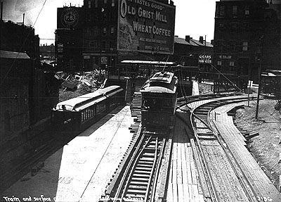
The original El, of course, used the Tremont tunnel for 8 years while the Orange Line tunnel was being built.

Pleasant St. incline with Orange Line cars using the City Point tracks on the temporary alignment to Washington St.:

Main_Line_train_at_Pleasant_Street.jpg


And the original plans for what became the Red Line called for total integration with the El both in Cambridge and downtown. The book When Boston Rode the El is archived in Google Books and has a map on p.9 showing the Harvard Sq. and South Boston branches all tied in with the Charlestown, Atlantic Ave., and Dudley Sq. Els: http://books.google.com/books?id=FXsLiV1aNRUC&lpg=PA9&dq=Boston Elevated&pg=PA13#v=onepage&q&f=false.


But, alas...we didn't get a fledgling Chicago-style system built before the area's first transportation revolt beat back the Els.

It's too bad they didn't save the El to Dudley, rehab it, and re-connect it to the Green Line while demolishing the Chinatown and Dudley-Forest Hills legs. We could've had most of what we want with the Silver Line right there and still been able to find a way to get to the Seaport (junction where the GL connector met the old alignment for a new El segment in the SS direction built over the Pike, then portal-down into the Transitway same general spot around One Greenway?).
 
I completely agree.

Particularly with respect to "deep boring is only possible when you have bedrock to bore through". This statement is simply wrong.

I notice lots of comments around these forums, like this one, that suggest that various forms of tunnelling are 'impossible'.

There are dozens, maybe even a few hundred, of various types of soft ground tunnel examples from around the world. They include every type of clay, sand, water conditions (incl. below the water table), fill, urban conditions, etc. Examples include London, Washington, Seattle, Seoul, Rome.

Projects like London Crossrail involve far more difficult site conditions including historic buildings, archaeology, unknown existing services (e.g. utility, sewer, gas). The unknown conditions in London exceed by an order of magnitude any in Boston and this project is being completed just fine.

It would be wodnerful for a knowledgeable and experienced geotechnical engineer or tunnelling contractor to provide some further insight into conditions in Boston, but as a matter of engineering/technology these tunnels can definitely be built.

The primary problem with subway tunnelling as a transportation solution in Boston is cost and financing. These forms of tunnelling are relatively expensive, and the amount of demand generated is much less in Boston than NY, London, Tokyo, Shanghai. Meanwhile, the interest of the public, through its government, to finance these projects is a lot less than in these other places.

FWIW, for many of these reasons the Green/Silver Essex Phase III project does not seem cost effective to me. But for discussion purposes, particularly in these fora, where we are ‘brainstorming’ transit solutions, I don't think we should rule out all future non cut and cover tunnelling in Boston forever.

The bold is the key part. "Impossible" might be mixing messages a bit. It's a somewhat clumsy catch-all word for telegraphing "improbable" or "infeasible". By dictionary definition nothing is impossible. And stuff has been engineered at that difficulty level. But cost/benefit for Boston demand just does not work for tunneling on straight lines on a map. The ONLY way to get justifiable costs is to shoot for "good enough" on the path-of-least-resistance routes.

It doesn't matter if the political will ever does mount to build all the radial links in the rapid transit system that we need. Rational planners can't look at these mapmaker perfection proposals and recommend them. That would be irresponsible. Just as irresponsible to the opposite extreme as turtling under from the city's needs. We will simply never have anything that generates the demand at levels of a 2nd Ave. Subway or NYC's grid-like transit system. Ever. Because we're an order of magnitude below New York City in demand and always will be.

I just think some of this Transit OCD stuff forgets what city we're living in when it aims for that rarified air of perfection at any and all cost. Are these Crazy Transit Pitches for Boston as it exists and as its 21st century growth trajectory exists, or Crazy Transit Pitches for looking at pretty maps? There's a difference.
 
Citing Crossrail as grounds for feasibility of rail tunnels is like citing the Central Artery/Tunnel as grounds for feasibility of highway tunnels.
 
You can never get to the Seaport that way.


2) SS Under, as envisioned by the Link, is so deep underground that it's below the Transitway. And it is locked onto its N-S trajectory by having to thread between the Silver, Red, Pike, etc. tunnels, splitting and underpinning all the bridge abutments, and underpinning the retaining wall for the Ft. Point Channel.

I'm thinking of this differently. If the NS link incline goes under the transitway, wouldn't 'stacking' a green line incline (roughly parallel to Atlantic and DOT aves) above the NSLink incline (or somewhere in the profile of the link / SSunder excavation) put the green line extension on trajectory into the current SL footprint (somewhere around the lobby under dewey sq. or slightly slightly east or west of that, depending on the specific alignment )?

Didn't we discuss something like this a few months ago - as an Atlantic ave alignment, feeding from tremont and marginal via the southbay spaghetti bowl? Did i miss the reason that got dropped from the consideration set?
 
Particularly with respect to "deep boring is only possible when you have bedrock to bore through". This statement is simply wrong.

I notice lots of comments around these forums, like this one, that suggest that various forms of tunnelling are 'impossible'.

Not literally impossible, but rather, "too expensive to bother when there are less expensive options that do a fine job of reaching the goal."
 
I'm thinking of this differently. If the NS link incline goes under the transitway, wouldn't 'stacking' a green line incline (roughly parallel to Atlantic and DOT aves) above the NSLink incline (or somewhere in the profile of the link / SSunder excavation) put the green line extension on trajectory into the current SL footprint (somewhere around the lobby under dewey sq. or slightly slightly east or west of that, depending on the specific alignment )?

Didn't we discuss something like this a few months ago - as an Atlantic ave alignment, feeding from tremont and marginal via the southbay spaghetti bowl? Did i miss the reason that got dropped from the consideration set?

We did, and it proved infeasible because of the mass of highway tunnels hugging SS and the depth/angle of the Transitway there vs. what has to be threaded around. It took digging up the actual hard-to-find diagrams of where the Transitway is actually located under Summer St. to figure "Oh, shit. That's not going to work at all."

The bus loop under the Essex/Surface/Lincoln wide wedge intersection is the only point of entry. And that was intentional design co-mingled with the Big Dig's design. It was the only way to build the Transitway with wiggle room for an east-west connection to downtown. Just like the South Bay spaghetti bowl was intention design leaving just enough wiggle room for the N-S Link. Every other crevice or contiguous path for N-S-E-W thru transportation was filled by the Big Dig and Pike/Ted approach.

It's actually a very good thing they had that much foresight, because if the highway and transit projects recent and future weren't co-mingled we'd be absolutely S.O.L. here. Don't get too hung up about there only being 2 hard to extreme-hard options here when the alternative is 0 options. There was never an "option" to be had for leaving 3+ options.
 
Also Seattle may be a bad example too, considering that they're having a lot of difficulty with their tunnel-boring machine for the new underground waterfront highway getting stuck: http://seattletimes.com/html/localnews/2022626441_berthashaftsxml.html

Please do not learn the wrong lesson from Seattle.

The Alaskan Way deep bore project hit a snag early in the TBM deployment due to an undocumented large steel pipe in fill/urban renewal land at the start of the tunnel.

Lesson 1 -- we do not know what is in the way of even 1960's urban renewal land, because the utilities and underground structures were not well documented (F-Line -- note) -- urban renewal land is not well documented!

Lesson 2 -- per Seattle's analysis, deep bore tunneling thru clay, glacial till , gravel and sand is worth the investment.

We are unwilling to deploy deep bore tunneling in Boston. because we are "old school engineering" and uninformed. We need to learn modern tunneling to get with the program. Others throughout the world can do this, even if we "cannot" (will not because of local prejudice).

FYI, I am not associated with any of the deep bore tunneling companies, but I am an MIT trained civil engineer. I know BS excuses when I smell them.
 
Last edited:

Back
Top