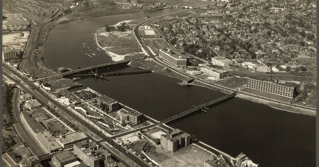
"Dirty Old Boston"

"Now and then" today vs 1988 really doesn't look too much different from this angle.
'Cept the park on the right is really cool... and that green truss is gone (was it fer oil?). Oh, and the highway was raised a bit... aaaand also the cars don't suck as bad as they did then. Everything looked like a K Car.
 
Everything looked like a K Car.

And thus why the Honda Accord became America's best selling car by 1989. Just mentioning a K Car makes me recall the smell of those interiors like it was yesterday. I don't miss those shoddy domestic boxes one bit. :poop:
 
Not sure if this has been posted before... Helicopter ride over Boston from the GBH Archives, looks like late 1980s.

This is fantastic, thanks for sharing! Appropriately enough, it really reminds me of what you'd see at the start of any Mugar Omni Theater show at the Museum of Science during the mid and late 80s. As a kid, I'd enjoy the Boston helicopter flyover intro more than the actual movie every time. The first few seconds always made me feel like I was about to fall out of me seat and plummet 1000 feet into Back Bay. Loved it!
 
Rush hour on 1A on the last day of September 1988 from Flickr

51384764938_346038f639_k.jpg
Only one mile to the legendary Chris Costionis " The Coffee Busta" the Big Dig put this Boston Legend out of business. The ultimate coffee drive thru.

 
^---- Just look at how empty Cambridge is.

The aftermath of the false-start eminent domain takeover of the Kendall area for a NASA facility, a fraction of which became the Department of Transportation's Volpe facility. That area was filled with old industrial buildings, fabrication shops, and warehouses prior to the 1960s.

From a City of Cambridge CDD document (p. 4):​
The urban renewal plan used Federal, local, and other private and institutional resources to assemble and clear land so that it could be redeveloped to new uses such as offices and laboratories. A substantial portion of the Kendall Square Urban Renewal Area was originally planned to be developed as an Electronics Research Center for NASA, and several buildings were built for that purpose in the 1960s. However, construction of federal facilities ceased when NASA relocated its operations from Cambridge to Texas in 1969.
 
Last edited:
The aftermath of the false-start eminent domain takeover of the Kendall area for a NASA facility, a fraction of which became the Department of Transportation's Volpe facility. That area was filled with old industrial buildings, fabrication shops, and warehouses prior to the 1960s.
I remember when the Kendall Square area was full of factories in the late 1950s/60's. My mother worked at the Carr Fastener factory in Kendall Square when I was in grade school until about 1962, working the evening shift to put food on our table due to my dad being ill and unable to work for awhile. Toward the end of her years there she was injured on the job hurting her back, and spent the next several years trying to get a payment out of the company. I remember picking her up at the factory at the end of her shift many times with my dad, and all the sweet candy smell in the air from the nearby candy factories. Bittersweet times. A big fear I had growing up was that I would end up spending my life working in a factory, which fortunately I did not.
 
It never ceases to amaze me that Cambridge would have been NASA HQ if Kennedy hadn't been killed. As I understand it though, MA is a bit too north for ideal shuttle landing, especially for orbits started above Florida. So I guess we would never have seen Atlantis touching down at Hanscom or Otis.
 
It never ceases to amaze me how badly City Square and that whole area of Charlestown was carved up by the elevated expressway. So glad that blight was removed and City Square transformed into something great.
The renewed City Square is one of the many benefits of having undertaken the BIg Dig. When people criticize the Big Dig has having been too expensive I think about City Square, the Ted Williams Tunnel, the Zakim Bridge, and more.
 
In the first photo, what is the squat, staggered building sitting in the vacant expanse of land in between the North Station RR tracks and the Green Line El?
 
In the first photo, what is the squat, staggered building sitting in the vacant expanse of land in between the North Station RR tracks and the Green Line El?
That was the HQ of the Mass DPW (or MassDOT as it's called now). Mass DPW moved out of it to the Park Square State Transportation Building in the early 80s, It was demolished a few years later for the "Big Dig" Central Artery project.
 
Last edited:
WinthropSquareToday.jpg

Great find.
Using the green as a reference and a little axis adjustment I think I'm where the cameraman was flying (balloon? Zepplin? Biplane?)
Almost unrecognizable. Nowhere near the same city at all. And that was a drastic difference from pre-1872!
 

Back
Top