Charlie_mta
Senior Member
- Joined
- Jul 15, 2006
- Messages
- 5,150
- Reaction score
- 7,778
Wish that model had been followed when GC was planned.Exactly. Present-day Frankfurt is also very much a byproduct of intelligent and purposeful rebuilding post-WWII.
Wish that model had been followed when GC was planned.Exactly. Present-day Frankfurt is also very much a byproduct of intelligent and purposeful rebuilding post-WWII.
I realize I'm a broken record on the topic, but the "fix" to Governent Center -- the plaza, anyway -- is really simple and obvious. The thing was allegedly inspired by Piazza Navona, Plaza Mayor, Piazza del Campo, etc. What's the big difference (aside from the age and architectural style of surrounding buildings) between those squares and GC plaza? Those beautiful European plazas are ENCLOSED with buidings on all four (or at least three) sides and those buildings have restaurants, cafes, stores. GC is *sort of* enclosed on two sides, but by government buildings with no ground-level interaction, other than the Sam Adams taproom thing (which is a move in the right direction). Build along Cambridge Street and fill those structures with aforementioned bars, cafes, restaurants and do the same here and there along Congress Street and the Court Street side and you'd have an enclosed, activated public space. It's not real advanced math.
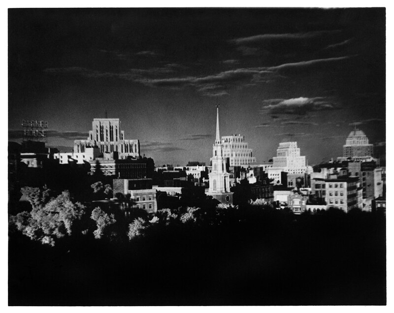 pp-03 15 by nick dewolf photo archive, on Flickr
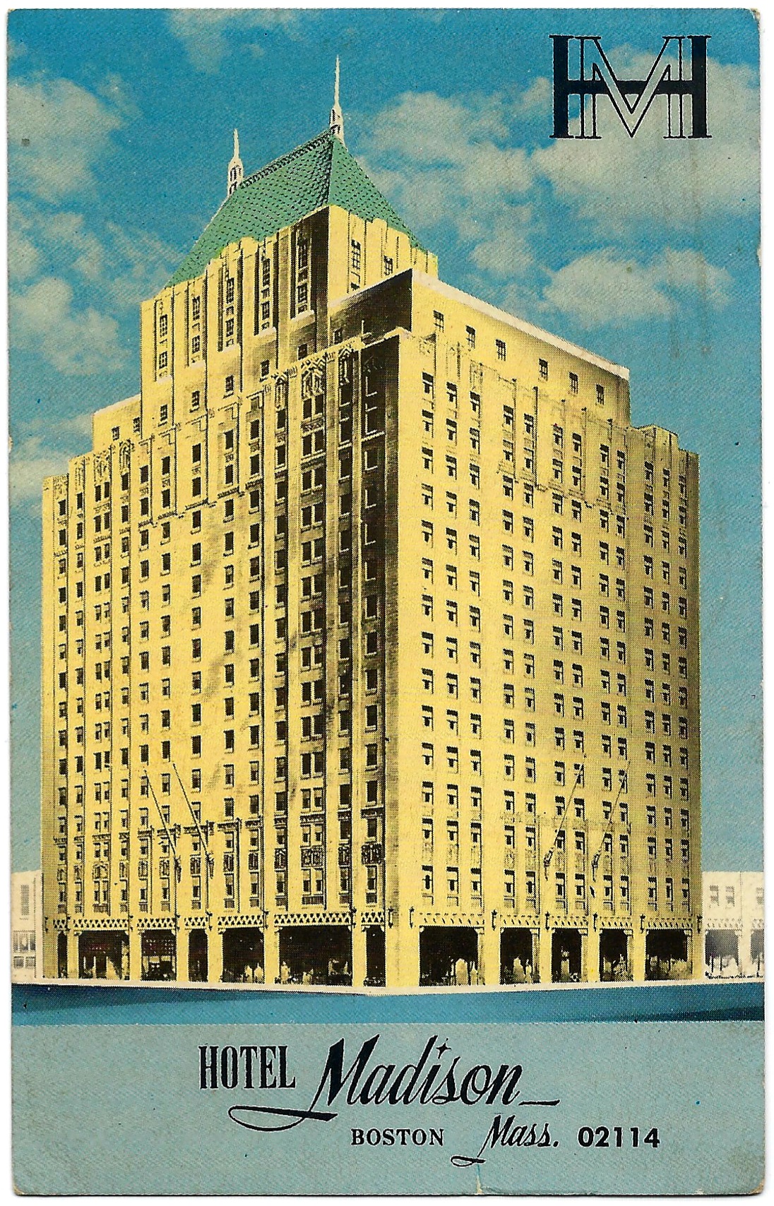 Hotel Madison. Boston, Mass. Postcard. by Brandon Legvold, on Flickr
Yeah, I remember the Hotel Madison (I'm 72). It was a beauty, and we don't have many large buildings left of that style. The O'Neil building that replaced it is, of course, a faceless monstrosity. Fortunately today we seem to be more attuned to preserving historic buildings like this (the WHOOP building abomination wiping out a fine old building at Kenmore Square notwithstanding).
Cambridge. Kendall Square by Boston Public Library, on Flickr
")
I wish North Street had some of that alignment to go up to Tremont Street instead of keeping the stupid City Hall carport and Garage combo.
I wish North Street had some of that alignment to go up to Tremont Street instead of keeping the stupid City Hall carport and Garage combo.
It would be cool to superimpose on this the current Central Artery/RKG,, plus the newer buildings and skyscrapers, but leave out Government Center and Charles River Park. I'd use a compatible aerial view from Google maps. It would be an alternative history for Boston; one in which GC and Charles River Park were not built, but the other developments were.
The beginnings of the current Quincy Market, before the 200 State St market building. Plenty of parking for all.
View attachment 21730