Downtown Greenway and Waterfront District Zoning

PaulC

Senior Member
Joined
May 27, 2006
Messages
1,617
Reaction score
0
This newest planning process, which is expected to last 18 months to two years, involves the redevelopment of the Downtown Waterfront area, from Long Wharf down to the Evelyn Moakley Bridge (Seaport Boulevard) and the James Hook & Co. lobster business, said Chris Busch, waterfront planner for the Boston Redevelopment Authority.

The first event in the Downtown Waterfront project will be a project overview meeting, scheduled Wednesday, March 13 from 6:30-8 p.m. at the New England Aquarium IMAX Theater, 1 Central Wharf.

At that meeting—which is open to the public along with the other two events—the BRA will introduce consultants from Utile Inc. and discuss the scope, process and timeline of the planning project.


The second event is a series of three walking tours of the Downtown Waterfront area that will be addressed in the planning project. The tours are scheduled for Thursday, March 14 at 10 a.m., 11:30 a.m. and 1 p.m., starting at Christopher Columbus Park in the North End and extending down to the Hook & Co. site.


The third event, the “Waterfront Activation and Public Realm Visioning Charrette,” will be held on Friday, March 15 from 8-11 a.m. at the Boston Harbor Hotel, 70 Rowes Wharf, in the Atlantic Room.

http://southend.patch.com/articles/downtown-waterfront-planning-begins-march-13-93f9ae50

BRA site:

http://www.bostonredevelopmentauthoritynews.org/2013/02/21/help-us-plan-the-downtown-waterfront/
 
Seems to me the problem with this area is it doesn't know what it wants to be yet has the potential to be great. The waterfront walk and pedestrian areas are fantastic but need work, need to be expanded and upgraded. The Greenway needs some major infill. You can't have this much open space and expect people to use it effectively. But of course I highly doubt the powers that be will recognize that and this whole thing will probably be just another waste of time and money (even if some good ideas do come out of it).
 
Seems to me the problem with this area is it doesn't know what it wants to be yet has the potential to be great. The waterfront walk and pedestrian areas are fantastic but need work, need to be expanded and upgraded. The Greenway needs some major infill. You can't have this much open space and expect people to use it effectively. But of course I highly doubt the powers that be will recognize that and this whole thing will probably be just another waste of time and money (even if some good ideas do come out of it).

Nothing will change for the Greenway. Harbor Garage is the most crucial development to make the park more vibrant and connect the waterfront to the park.

The negative aspect I see is the BRA & the city are crying shadows, winds when they actually should be promoting a development. Let the NIMBYS complain about these issues. When the city & the BRA are promoting these problems you know this nothing more than political garbage.

The only way Harbor Garage gets built in the future with a reasonable development is when Menino leaves or dies in office or the project is sold to one of his friends.

Harbor Garage development = will solve 50% of the problems for the Greenway.

Still can't figure out how the city can justify to promote all these tax-breaks for all these projects being built in the city but then stops talking to a private developer looking to give the city money to help justify the height of his project. With Towers just as tall as he is proposing all around the development area.

This is where the BRA completely lost all creditability for me was this scenario. Just a political puppet show
 
Speaking of this area, are there any plans to expand the NE Aquarium?
 
Boston’s Chief Planner: Mayor Walsh Not Tied to Greenway Guidelines or Heights for Downtown Development

Chief Planner, Kairos Shen, of the Boston Redevelopment Authority presented “Planning Area Urban Design Context” on Wednesday, March 26th, to the Downtown Waterfront Municipal Harbor Planning Advisory Committee.

Shen began by comparing the key role of New York City’s Central Park to that of the Inner Boston Harbor after the cleanup. Both the Inner Harbor and Central Park approximate 900 acres. He followed up with an aerial image timeline of downtown Boston from 1630 through today to highlight changes in the land mass and the impact of defining characteristics such as the Central Artery and today’s Rose Kennedy Greenway.

Within the Downtown Waterfront planning area, Shen highlighted recent developments at the Intercontinental Hotel and Russia / Atlantic Wharf by explaining the unique forces that molded their designs. In a similar way, the BRA is looking for creative ideas to support continued parcel development as part of the Downtown Waterfront Municipal Harbor Plan.

Key parcels for development include the Harbor Garage and Hook Lobster sites where zoning will be codified at the end of the planning process. In reviewing the methodology of the planning effort, Shen referred to the Rose F. Kennedy Greenway District Planning Study (GDPS) Guidelines, approved by the BRA in 2010.

Shen shared his recent discussions with Mayor Walsh’s office that the new mayor is “neither retreating nor endorsing those conclusions (from the Greenway District Planning Study) because he did not have the benefit of a public process that he is responsible for.” The Chief Planner said that Walsh is looking for the current advisory committee and BRA to put new ideas on the table so he can review the Municipal Harbor Plan in the context of his own policy initiatives for the downtown area.

With regards to height, Walsh asked, “How high can you go?” according to Shen, in reference to the development parcels. Within the planning area, this could open the door to greater heights for developers at the Harbor Garage and Hook Lobster parcels, among others. In the GDPS, these heights were established at 200 feet.

Members of the committee discussed with Shen whether the mayor’s comments should broaden its mission beyond simply creating zoning recommendations based on the 2010 Greenway District Planning Study.

http://northendwaterfront.com/2014/...es-or-heights-for-downtown-development-video/
 
I really hope Mayor Walsh fires Shen. What a clown.
 
I really hope Mayor Walsh fires Shen. What a clown.

Shen just works at the whim of the mayor's desires so I don't think it matters a ton. I read that quote from Walsh as basically: "I don't care what Menino told you to do in the past. I'm in charge now."
 
Boston Globe
Waterfront revival sought by City Hall
By Casey Ross
Globe Staff April 12, 2014

Restaurants, outdoor cafes, floating docks, and spaces for music concerts and festivals would be added to Boston’s waterfront under a City Hall plan to rejuvenate a section of downtown that planners say has fallen short of its potential.

The Boston Redevelopment Authority this week unveiled plans for a 40-acre strip of land and water between the North End and Fort Point Channel. The area is dotted with small parks, open spaces, public walkways, and wharves that are rich in history, but poorly connected and often not as crowded as newer attractions nearby.

“We want to tie the whole area together,” said Richard McGuinness, deputy director of waterfront planning for the Boston Redevelopment Authority. “It’s not just cleaning it up, it’s making some real changes so that it becomes a year-round destination and connects the downtown to the water’s edge.”
Related


Though begun under the administration of former mayor Thomas M. Menino, the waterfront project presents the new mayor, Martin J. Walsh, with one of his first opportunities to reshape the city’s landscape. Walsh has already signaled a willingness to consider tall buildings on waterfront parcels where Menino insisted on smaller structures.

The proposed updates, included in a 50-page plan from the BRA, would be financed largely through improvements by private land-owners and some public funds. It could take a decade or more to complete the most significant changes. The city’s plan must be approved by state regulators.

The downtown waterfront has improved gradually over the last 20 years, but some of its architecture dates to an age when buildings were designed to shield people from the exhaust and noise of the old elevated Central Artery highway. Some parts of the area also remain rooted in its maritime past, when private industry — not the general public — controlled access to the water.

Some environmental groups are pushing the city to move swiftly on smaller improvements, such as adding public art and improving The Harborwalk, a path that runs along the waterfront from Charlestown to Dorchester. The Harborwalk’s downtown portion is cramped in some places and difficult to access in others, and it also needs attractions to make it livelier for visitors, planners say.

“We can do things that are fun and whimsical, like a play structure or a light display,” said Vivien Li, president of the Boston Harbor Association, an environmental group that advocates better access to the harbor. “I think this report is a start, but we can be even more creative, and some things could be put in place as quickly as this summer.”

The proposal was drafted with the aid of Boston architecture firm Utile Inc. after months of public meetings. It focuses on three distinct sections of the waterfront: Long and Central wharves, Rowes Wharf and India Row, and Northern Avenue, which connects downtown to the South Boston Innovation District.

Each section would receive improvements such as new parks, additional water taxi stops, and floating docks and piers that would expand access to the water. At Long and Central wharves, for example, a wider pedestrian path would be added between the Rose Fitzgerald Kennedy Greenway and the New England Aquarium, and new art installations and restaurants would help enliven some of its dead spots.

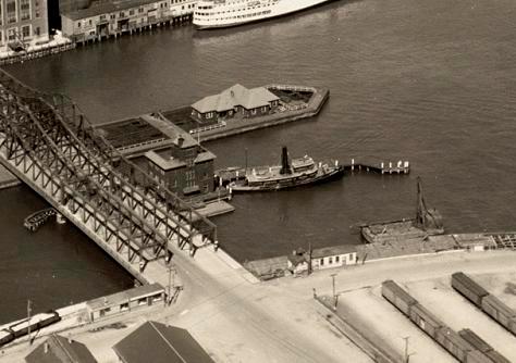
At Northern Avenue, the historic bridge would be reopened to vehicle traffic while preserving a lane for bicycle and pedestrian traffic. It would also be raised to allow more boat traffic in out of the channel.

McGuinness said the effort will seek to call greater attention to some of the area’s history. For example, better historical markers would be added to note that State Street, previously named King Street, served as the departure point for the British on Evacuation Day, the day of the first Colonial victory of the Revolutionary War.

Already the city has installed new signs for various water taxis, MBTA boats, and ferries. New way-finding signs will also be added to direct visitors to the aquarium, nearby public parks, and other attractions.

The report also envisions barriers to protect downtown from a storm surge, as planners begin to prepare for the likelihood of rising sea levels due to global warming.

The BRA is still soliciting public comment on the upgrades, which will be incorporated into a broader waterfront redevelopment plan to be submitted to the state by the end of the year.

Meanwhile, Walsh’s position on taller buildings may factor into his ability to get many of the waterfront changes implemented during his tenure.

For example, the waterfront area also includes several locations where developers are awaiting City Hall approval for massive complexes. One is Don Chiofaro’s Harbor Garage project, near the New England Aquarium, where Walsh has indicated he would permit taller buildings than what Menino would allow for the site.

Chiofaro has said he would make the kind of improvements to the area that would fit neatly into the city’s new vision for the waterfront: a beach area, swimming pool, waterfront park, and even a canal running from the harbor to the Greenway.

In a statement Friday, Chiofaro’s firm said, “The Harbor Garage site can be opened up to provide direct access and views from the Greenway to the harbor, while enlivening this part of the downtown with new restaurants, retail and other destination activities to draw people to the water’s edge.”

The owners of the fortress-like Long Wharf Marriott have also proposed to ring the hotel with glass storefronts that could host new restaurants and other retail operations. And another potential building site is the Hook Lobster property on Atlantic Avenue overlooking the mouth of the channel.

However, the city plan does not make specific recommendations for those development sites. Moreover, the improvements probably will unfold over the next decade or even longer, as funding for them will be largely paid for by private developments that are still years from starting construction.

“Those projects really could help bring us to the next level and make the waterfront even better,” said Greg Vasil, chief executive of the Greater Boston Real Estate Board. “I think building higher is the next frontier and we’re going to be looking long and hard at that.”
Casey Ross can be reached at cross@globe.com.

Q9lnXXu.jpg
 
Please dear god someone stop the from opening the Northern Ave. Bridge to cars.

EDIT: Reading through the draft plan. it says "Thee Northern Avenue Bridge has the potential to become a model Complete Street. The renovation of this bridge could alleviate traffic congestion in South Boston and increase pedestrian and bicyclist connections to the Innovation District."

HOW ABOUT A MODEL OF A STREET THAT DOESN'T NEED CARS BUT STILL PROVIDES ACCESS. /rant
 
Opening that bridge to cars literally makes no sense... It's not like it's going to fix the Seaport's traffic issues.

Just make it a beer garden already.
 
Thinking that opening the bridge will solve the Seaport's traffic issues is the same as thinking that adding a solitary lane to the Moakley will solve the Seaport's traffic issues. That's beyond insane.
 
I don't think it will help or hurt traffic much (people making a right onto Atlantic are the only ones who will see a benefit, perhaps those making a right onto 93N with some cars removed.

What it will do is make the gross kind of desolate parking lots on each side of the bridge one hell of a lot better. I also like the idea of the bridge being reused for it's designed purpose instead of being incased in glass or something stupid. It will also require a structural rehab that will probably ensure it survives longer then if it was just art. There is also the hopeful possibility they will reopen the real sidewalks that are cantelevered over the side of the bridge, which give a much better view of the channel.

What I really wish would happen, and no one has addressed, is to lease all the space the former bridgetenders cottage sat on. It had a MASSIVE pier that would be a killer deck for a restaurant/bar right on the water. There was also an old fireboat station (later Ross Sea Tow) at the SE side of the bridge, that could also be rebuilt. Both of these structures were on the harbor side, which is also the side that will have the pedestrian path.

13996729754_8b06f761e1_o.jpg


13996295975_f9e1765221_o.jpg


13993090512_a2c3991d3d_c.jpg

The old Fire Boat building could have retail opening up right onto the bridge.
 
Heard back about the bridge.

"we need to open some of the lanes on the bridge to vehicular traffic if the city is to receive needed federal funds for the bridge rehabilitation."
 

Pretty pretty please can we rebuild these two structures? Making the Fort Point Channel a unique space should be focused as much on activting the channel itself as the area along the edge.
 
Yes please. Those poor docks are so decrepit and such an eyesore.
 
I always look at the Northern Ave, Congress St & Summer St bridges, with their distinct methods of opening, and wish that they were all still operable. They would make a neat outdoor engineering museum of sorts.

The Moakley bridge, with it's pathetic 80's FHA detailing just doesn't compare.
 
I always look at the Northern Ave, Congress St & Summer St bridges, with their distinct methods of opening, and wish that they were all still operable. They would make a neat outdoor engineering museum of sorts.

The Moakley bridge, with it's pathetic 80's FHA detailing just doesn't compare.

The N. Ave bridge does still open. It's operated from the trailer sitting on one of the lanes. Summer and Congress Streets don't need to move anymore since the Moakley's fixed span made opening them useless.

Summer St had it's operating gear and controls removed I believe, but the tracks below were restored (it's also the only remaining oblique double-leaf retractile bridge in the country). Same deal with Congress St, operational stuff was removed but the overall structure is still there. I think the old Tea Party museum was in the former bridge tenders shack, but that of course burned.
 
Yes please. Those poor docks are so decrepit and such an eyesore.

There's a ton of old, ugly, decrepit docks around the Boston waterfront from South Boston to East Boston. Hopefully they'll slowly be replaced, or rebuilt.


I wonder what they could do (with the parcel) if a brand new aquarium were built, say over by the marine terminal in South Boston?
 

Back
Top