Fall River, MA-- The rebirth of a mill town

It's ambitious in scale, not so much in content.

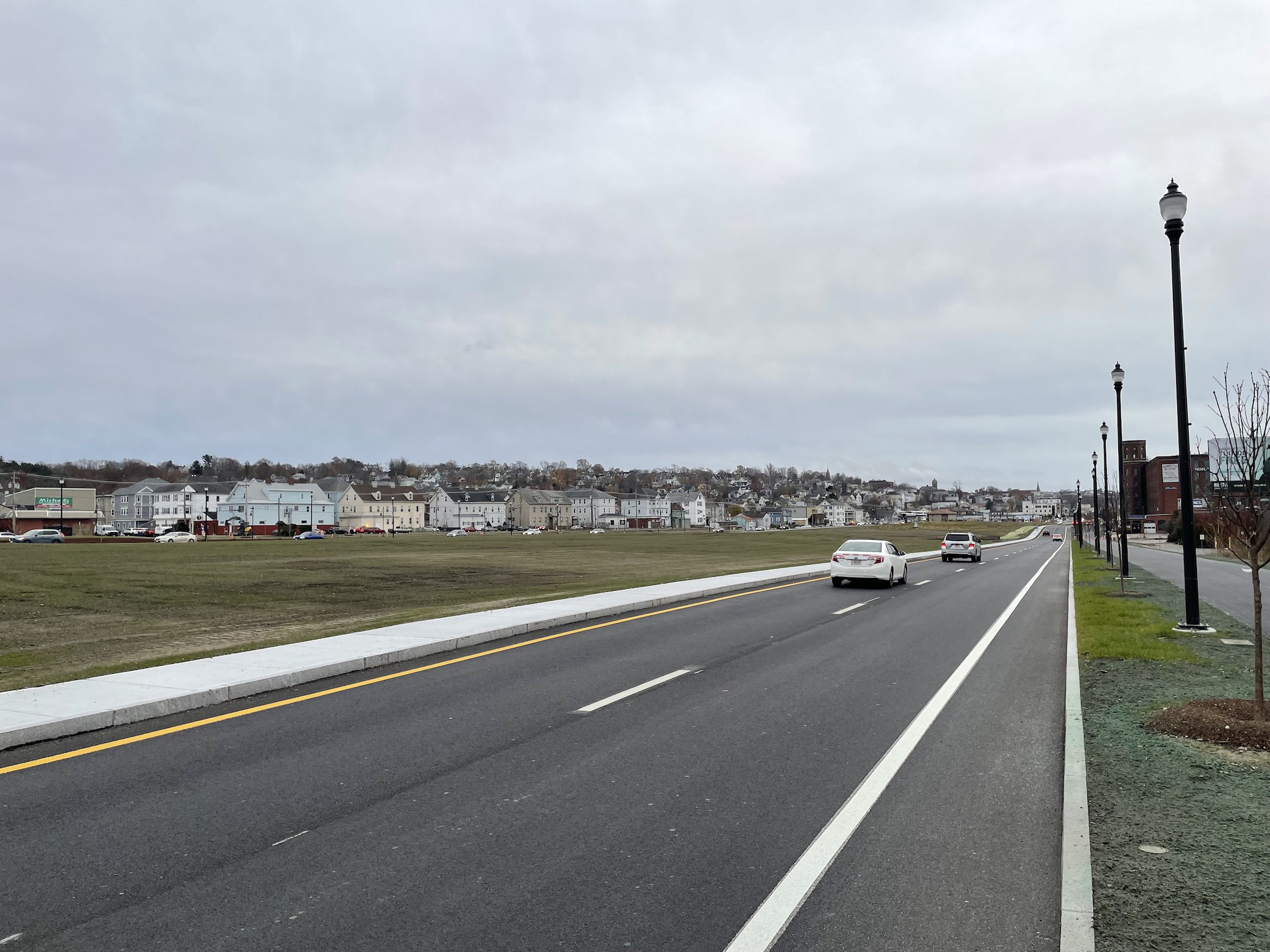
My big question is how serious they are about "walkability." Particularly between President Avenue and Brightman St. where there appear to be no crosswalks, no signals, and Davol St. NB/SB are 2 lanes of one way traffic.

The street alignment as rendered largely in place already as the 79 project that created it nears completion. And in my experience, it's a speedway funneling traffic from the Braga Bridge/Battleship area to the highway portion of Route 79 that begins around the Veteran's Memorial Bridge. Without adding additional several controlled pedestrian crossings along that stretch, it's not going to be "walkable" at all. It'll just be another walled off neighborhood.
I share your concern that without deliberate pedestrian crossings and signalization, Davol St could end up being a barrier that pedestrians find difficult or unpleasant to permeate. There’s no significant extension of the adjacent street grid into the corridor of redevelopment parcels, and that would have been a way to bring average vehicle speeds down and introduce more opportunities for pedestrian crossings.

Without cross-streets, Davol St visibly frames the redevelopment parcels and frames them as a standalone corridor. The parcels themselves are then drawn to be much larger than the average lot size you see on adjacent neighborhood streets.

I’m not especially bothered by the massing of the buildings shown on the conceptual plans, but the massing PLUS the lack of street grid extension is probably going limit how well the new development integrates into its surroundings.
Good point about the cross streets. Closer to downtown, it makes sense that there aren't any because of the grading (essentially there's a giant retaining wall to the east of the tracks), but extending the existing streets across the new parcels would have gone a long way toward reconnecting the city to the new neighborhood (and waterfront).
 
In March, the decades-long wait for the expansion of South Coast Rail ended. The new commuter rail gives the city’s residents the ability to jump on a train and be in Boston in 90 minutes. In the era of hybrid or work from home culture that accelerated during the pandemic, that option has made Fall River a compelling option for prospective property owners.


“The younger generation, the new buyer, in their late 20s, early 30s, they want to be within a few miles of a train station that heads into the city,” Sullivan said.

For Fall River Mayor Paul Coogan, the expansion of the rail is an opportunity for the city’s economy.

”We want people moving into the city," Coogan said in a recent interview. “South Coast Rail is gonna be a link for us to bring down people that are gonna move to our city.”

I just cringe reading stuff like this. I am all for more and more commuter rail, but the public messaging — from mayors who love to be positive about their always expanding tax base, from realtors who always make it look like the very best, from developers who will cash in regardless of whether the development is successful or not — that tracks connecting two lines on a map, regardless of how easy it is to get to each of the termini, or how long the ride takes — just proves the wrongheaded thinking that drives so much of our government's planning projects. The story is putatively about a guy who lived in Roslindale and works as a firefighter in Sharon. Pretty sure he's not taking the commuter rail to Sharon (or Boston, when he goes). But it's like the Globe has this agenda to make the commuter rail this great thing and wrote that story first, then the only example they provide of the new person moving to Fall River has nothing whatsoever to do with the rail and everything to do with high prices.

I have always hoped the silver lining in unaffordable cost of living in Boston will lead to revitalizing the gateway cities. That's a good story. And yes, having good transit can and should be a part of that story. But since this reporter didnt bother to interview someone who moved to Fall River so that they can utilize the commuter rail, it makes me skeptical these people exist at all.

And I think for many people, it's a tough sell if your job isn't close to South Station to have their commute be [time to get to Fall River Station] + 90 min + [commute from South Station to job]. All the more reason to do this project the right way and have these trains passing through Ruggles and Back Bay as well—shorter trip, less issues with the Dorchester Old Colony pinch point, and much better access to the jobs bases in Boston (LMA, Back Bay, etc).
 
Last week, MassDOT declared that the new roadways, sidewalks, and bike paths that replaced the former expressway were officially available for "full beneficial use," and released a "request for information" to begin marketing the empty land to potential developers.
[...]
The Fall River Redevelopment Authority's plan for the area envisioned that about 19 acres of land between Turner Street and Brightman Avenue would be available for redevelopment. However, MassDOT's "request for information" (RFI) describes about 25.1 acres, spread across 8 parcels, that could potentially be available for development.
Unlike the Fall River Redevelopment Authority's plan, the MassDOT RFI includes narrower wedge-shaped parcels north of Brightman Avenue and south of Turner Street. The RFI notes that several of those parcels have encumbrances, like drainage easements, that will likely limit their potential for redevelopment.
[...]
MassDOT intends to issue a formal "request for proposals" for the actual sale or lease of the properties later this spring, after the agency reviews its responses to the current RFI.
fall river.png
 

Back
Top