pelhamhall
Active Member
- Joined
- Jan 4, 2008
- Messages
- 855
- Reaction score
- 0
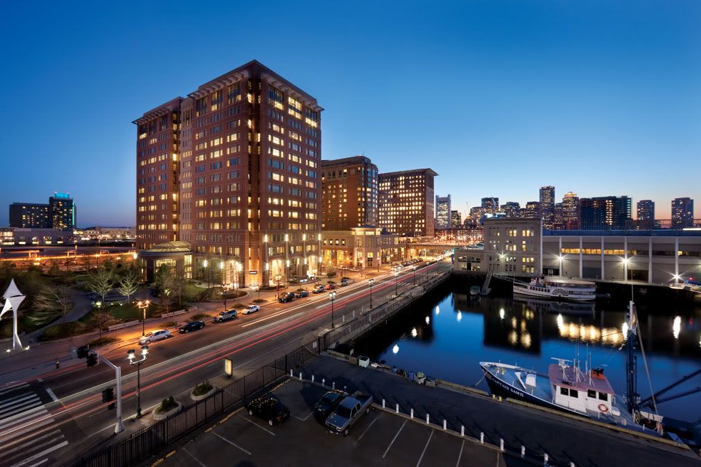
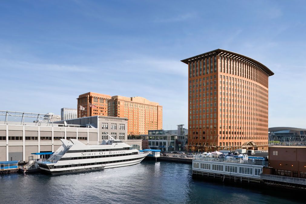
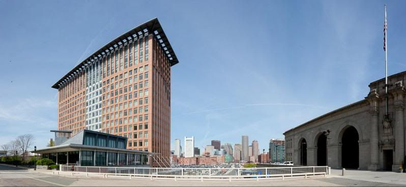
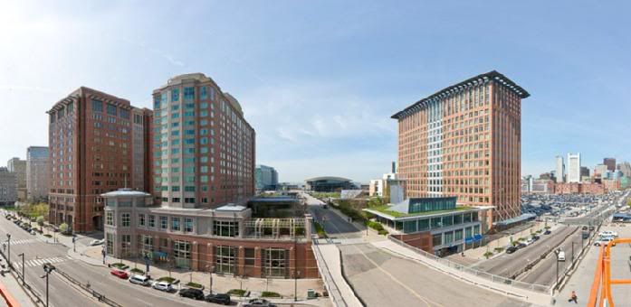
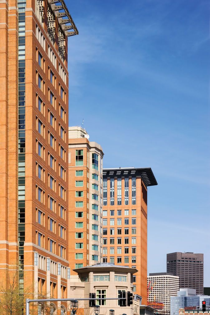
I just got a package from the developers of the former World Trade Center complex buildings - they've re-branded and re-launched as "Seaport Place"
The office towers are renamed ?Seaport East? and ?Seaport West? - Boring name, but understated and conservative like the developer.
Surprising features about the complex:
- Office tenants get to order room service to their offices ? whenever! They get hotel services from the office towers (I think this is incredibly cool and can?t believe it?s not done elsewhere)
- 15 on-site shops, 7 on-site restaurants
- Almost 20 restaurants within just ONE block of the campus (the campus itself is four blocks).
- All the buildings are connected through skywalks or underground passages
- Boston?s first commercial green roof
- On-site MBTA Silver Line station and on-site water taxi dock
- New England?s second largest parking lot (Prudential is #1 biggest)
- Entrance/exit to BOTH I-90 and I-93 are immediately at the edge of the campus
- Full-block footprints allow retail shops to abut the street
http://www.SeaportPlaceBoston.com
For everyone?s bitching about the horribleness of the Seaport District, I ask of you this? is Seaport Place the best example of this new urbanism manifest in Boston today? I'm not asking if it's great architecture, I'm asking if it is our best example of the "walkable, full-lot building footprint, retail shops with awnings, entrances and signage at pedestrian level, all built directly on a transit hub" style of architecture that we think we want to see?
Or does the stubbiness of the FAA-chopped buildings inherently doom these buildings - and all buildings forever in this district?
Curious for thoughts. I am working on an unrelated project in the Seaport and laugh how buildings like Park Lane are "on paper" everything we say want on this board, and then in reality... the execution is crap.
One of my best friends worked on this branding exercise, he sent me the pics - taken by John Horner, a very awesome and brilliant architectural photographer:
