- Joined
- Jan 7, 2012
- Messages
- 14,173
- Reaction score
- 23,688
 IMG_1939 by Bos Beeline, on Flickr
 IMG_1941 by Bos Beeline, on Flickr
 IMG_1940 by Bos Beeline, on Flickr
 IMG_1946 by Bos Beeline, on Flickr
 IMG_1948 by Bos Beeline, on FlickrIMG_1939 by Bos Beeline, on FlickrIMG_1941 by Bos Beeline, on FlickrIMG_1940 by Bos Beeline, on FlickrIMG_1946 by Bos Beeline, on FlickrIMG_1948 by Bos Beeline, on Flickr
Gone lab:
However, I didn't know they were putting $75k toward the restoration of Charlesgate. That's not this, I suppose? Likely bridge repairs?
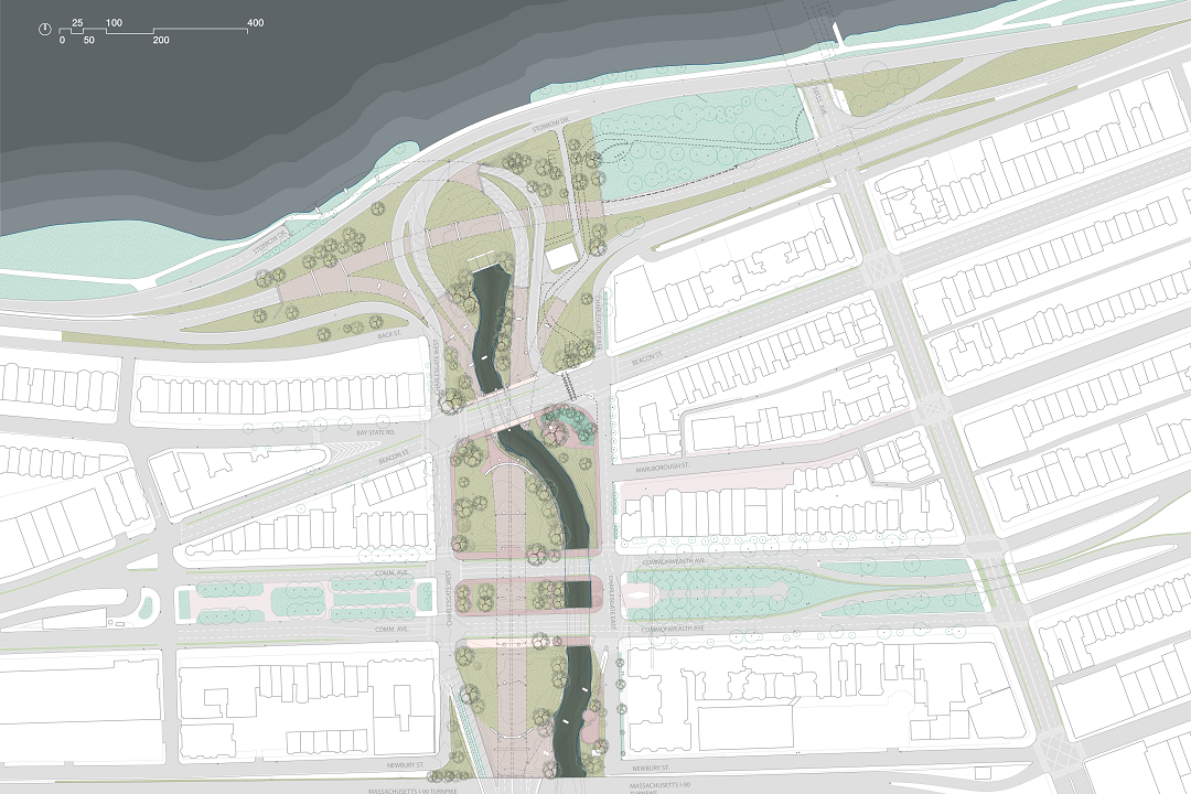
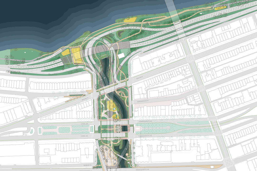
It is indeed the wider revitalization project. I helped work on it until recently. You can find out more here: https://charlesgatealliance.org/events/pdf-files-of-our-work/
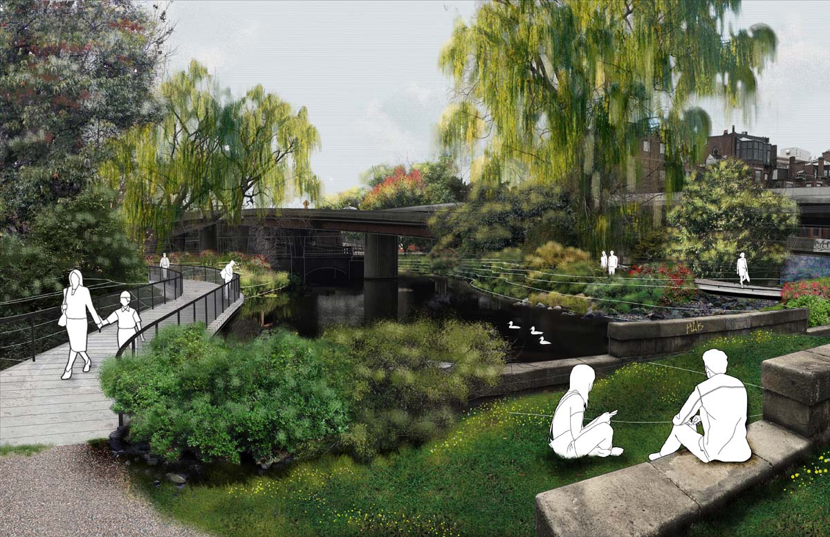
Wow. That Charlesgate project is awesome. So cool to see this historic photos of the riverfront. Especially the little footbridge over the Muddy River which is still there now, half buried under the overpasses...
A few years ago here on AB there was quite a discussion on tearing down this POS 1960's elevated highway. Arborway at Forest Hills is down, hopefully someday the Mcgrath will be, and this ugly SOB needs to be wiped out as well. The local NIMBY's don't want it down for fears of increased surface traffic, but how can that justify the smothering of the Emerald Necklace and Muddy River?Wow. That Charlesgate project is awesome. So cool to see this historic photos of the riverfront. Especially the little footbridge over the Muddy River which is still there now, half buried under the overpasses...
View attachment 8183
It's also fascinating seeing how open/exposed Cambridge is without the tree lines along the river and Mass Ave. MIT looks like a palace sitting over there.
Now I'm sad again that Storrow exists. What a blight on the city.
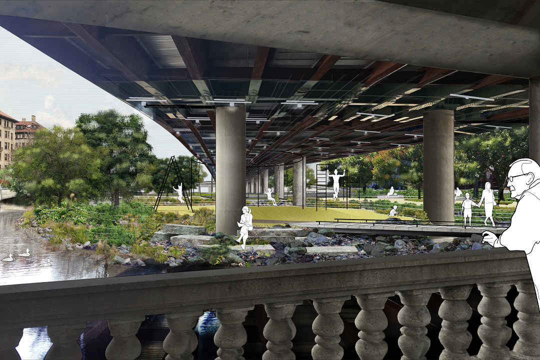
Also as a tangent to this (and because I'm remembering it being brought up for the new Greenline viaduct), but looking at the photos of the underside of the Charlesgate overpasses that cross over Commonwealth and Beacon. Isn't is sad that we can't afford to just paint all the beams instead of just selectively so where a column occurs? Are we really that stingy? Not that the rest of it is any better, but that patchwork of gross rusting steel and paint looks so damn ugly.
View attachment 8184
A few years ago here on AB there was quite a discussion on tearing down this POS 1960's elevated highway. Arborway at Forest Hills is down, hopefully someday the Mcgrath will be, and this ugly SOB needs to be wiped out as well. The local NIMBY's don't want it down for fears of increased surface traffic, but how can that justify the smothering of the Emerald Necklace and Muddy River?
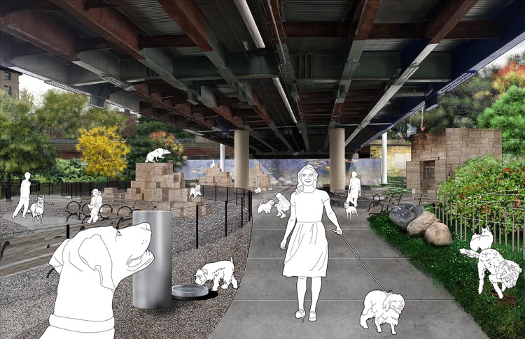
Replace it with something like this (my concept):I'm not even sure where you'd begin to repair this and maintain the connection without astronomical costs.

There have been a few similar proposals that involved demolition of the overpass. This 2015 Massachusetts Turnpike Boston Ramps and Bowker Overpass Study essentially diverts the overpass to the ramps connected to Comm Ave, and then uses Charlesgate E/W to connect to Storrow:Replace it with something like this (my concept):
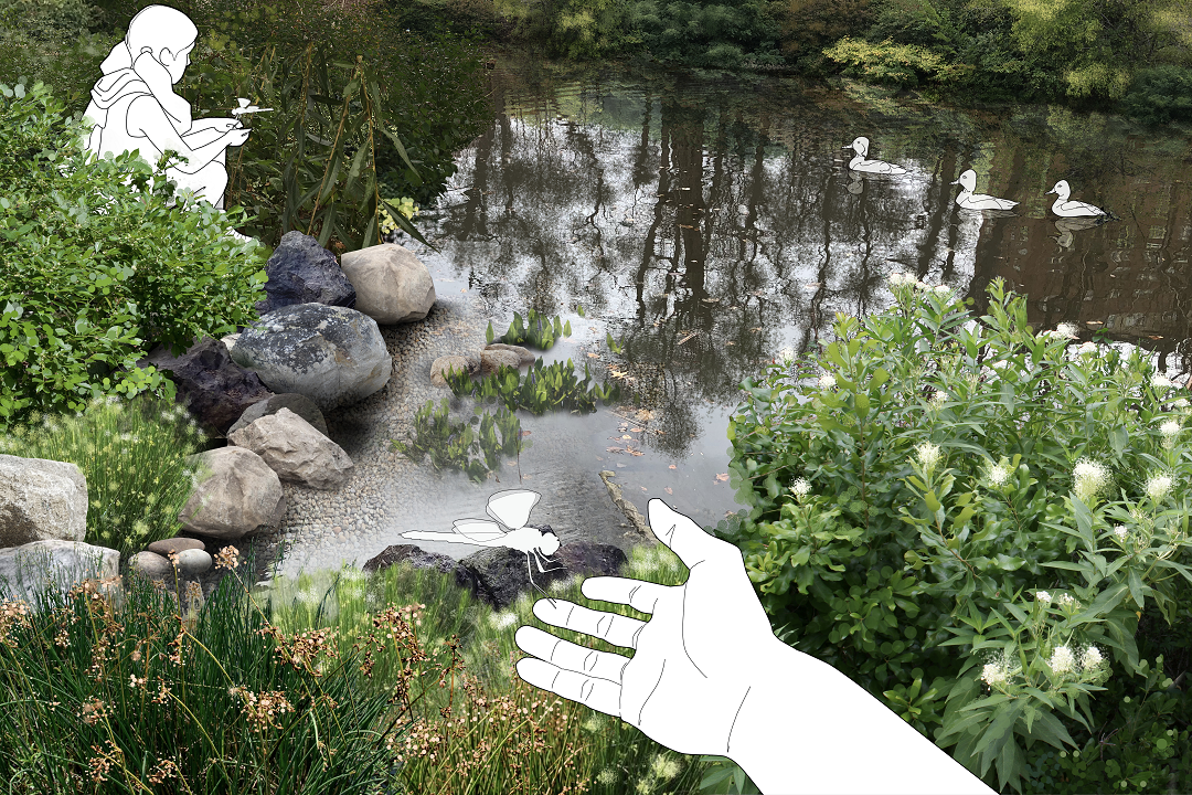
• Carries all the existing traffic – with good LOS
• Provides for pedestrian crossings
• Reconnects Charlesgate Park with the Esplanade
• Widens usable part of Esplanade
• Expands the usable part of Charlesgate Park
• Reduces highway impact on Muddy River


The usage moves to the surface streets, just like it was pre-1963. This issue comes down to a choice between: 1) freeways for suburbanites to zip quickly through the city, or 2) real parks (not shoe-horned underneath an elevated highway) and a functional, healthy Muddy River.What are the knock-on effects of dumping the whole overpass, without replacement? Where does the existing usage move to?
 IMG_2355
 IMG_2359