Not Just Bikes & Strong Towns | Stories of Great Dutch Cities & Better Urban Planning

Delvin4519

Active Member
Joined
Oct 8, 2022
Messages
557
Reaction score
1,105
Wanting to extend/save the discussion piece from the 400+ page long General MBTA thread. Original launching point discussion is here: https://archboston.com/community/threads/general-mbta-topics-multi-modal-budget-massdot.971/page-421

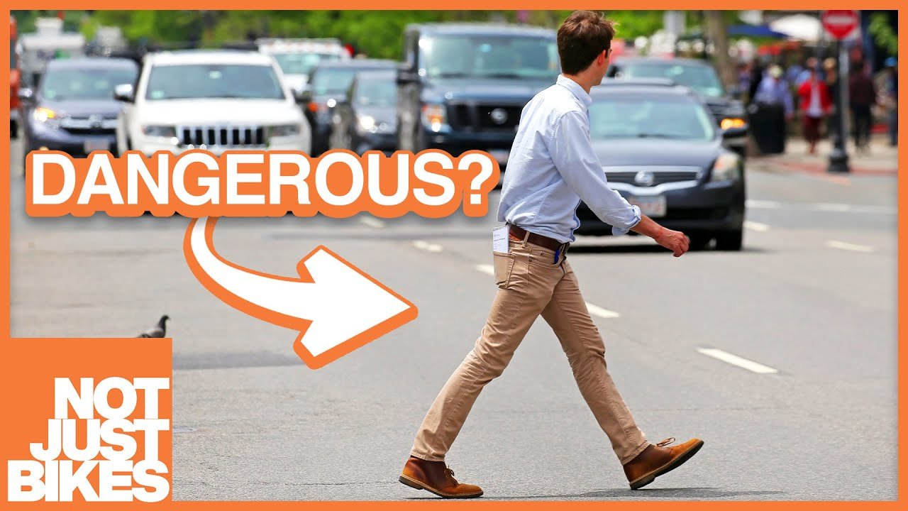
This thread is for discussing various urbanist Youtubers such as Not Just Bikes - stories of great urban experiences and urban planning in the Netherlands & as well as Strong Towns concepts/approach to building better cities in the US and Canada, including applying these NJB/Strong Towns concepts in Boston.

---

Not Just Bikes (NJB) is one of the more well known urbanist Youtubers. The channel covers urban planning concepts that make cities in the Netherlands one of the most livable and visited in the world. Its cities have good public transit, and urban planning practices that make walking, biking, and public transit; easy, comfortable, and straighforward.

Interestingly, the quest of NJB to undestand what attributes make a good city, is identical to the Strong Towns approach/concepts to building better cities in the US & Canada. Strong Towns is a US organization that was founded with a goal to fix and improve cities in the U.S. (as well as those in Canada). For those who want better cities in the US and Canada, Strong Towns is very important and a key part for such a goal.

Here are some of the more niche urban planning concepts covered by Not Just Bikes & Strong Towns:

* Suburban sprawl is a massive infrastructure and financial liability at a very large scale/magnitude for cities and states in the U.S. and Canada.
* Public transit should be used as a tool to build great cities, NOT just as a "band-aid" to traffic congestion. There is a hidden difference between these two purposes of public transit.
* The "Stroad" was a term coined by the founder of Strong Towns, Charles Marohn. Transporting people and goods at high speeds should be separated from productive urban places, which should typically be incremental and multi-purpose, and move at a human scale/pace. Street design should be intiuative and match such natural human intuiation.
* Parking and storage of motorized vehicles - large two-ton fuel/oil tanks; is hugely distructive to the urban fabric. It can also cause traffic generation/induced demand.
---
There are many reasons why the Netherlands today has one of the most livable and visited cities in the world. Some little known tidbits:

* After WWII, Several cities in the Netherlands were devastated, especially south of Amsterdam. This provided a clean slate for rebuilding the cities for cars; especially the case for Rotterdam. Unlike the US, the Netherlands was impovershed after the war, and so couldn't begin suburbanization for several years after the US began suburbanization, post WWII.
* There were multiple years of very violent riots in Dutch cities in the 1970s, related to traffic violance, and highway expansion, and massive monetary costs for doing so. Dutch cities were being bulldozed to make room for cars, traffic fataltiies were rising by an alarming rate, and the country was going broke doing so; just 25 years after being bombed in WWII and forced their surrender. This eventually led to the near complete halt of suburbanization and highway expansion in the mid 1970s. The votes to cancel and end all highway expansion & suburbanization was won by only 1 vote or so, by just the right people in city council and Dutch leadership.
* The Netherlands has been using Sustainable Safety standards since 1991 for road design/redesign, being updated several times since then. The 1990s standards changed the approach to traffic fataltiies from reactive to preventative/forgiving. These standards were initially only to reduce traffic fatalties, NOT to build a cycling city/country. However, the fact that cycling numbers are increasing and rebounding, post suburbanization era, means that it's a side effect of the efforts to improve traffic safety; and it is improving.
* The Netherlands makes extensive use of raised, continous sidewalks, and bollards. (Bicycle Dutch)
* Reducing conflicts in intersections in the Netherlands. (Bicycle Dutch) Traffic lights are also positioned at the near side of the intersection to reduce box blocking.

---

This means the US and Canada has had about 75 - 80 years of suburbanization and increasing, since 1945. Many US cities are still continuing down their path of suburbanization today. For comparison, the Netherlands had only about 15 - 20 years of suburbanization between the 1950s and early 1970s. The Netherlands is already about 50 years past the decison to end the 15-20 years of suburbanization/highway expansion, about almost 2 life cycles of road-resurfacing. It's also 1 full road resurfacing cycle past the initial 1991 standards for Dutch road design standards, which, being updated since then, means the Dutch are now starting their 3rd generation of road redesign/resurfacing projects to further improve traffic safety and bicycle infrastructure.

1680834002852.png
 
Last edited:
Extending discussion from the MBTA thread (p422) regarding transportation safety at the MBTA, vs. road safety:

I know this is a MBTA forum but driving fatalities are not transparent though. We continually make news reports with headlines like “Car collides with pedestrian in fatal accident” signifying that it was an unavoidable reality of cars and driving. These are not accidents and not committed by a car, they’re made by drivers and could’ve been preventable. We obfuscate fault away from drivers and get them back on the road as soon as possible unless there’s alternative factors like being an unregistered vehicle (or person). We do away with the transparency when we cover up the factors of traffic collisions and violence with language like that.

To bring it back to the T, we hold our public transportation to such high standards of safety that we have this much outrage towards close calls where nobody was actually hurt, and that’s a good thing. Everyone using, operating, and maintaining our transit should be entirely aware of the safety measures taken and the T has failed to do that. But this is something everyone knows due to the reporting on it. What they don’t know is the preventable dangers everyone is put in by almost every factor surrounding automobiles.

And that is the important comparison here to be made to the T’s safety and reporting on it. Safety is so important so why do we criticize something, rightfully, for potential dangers while letting known and anctive auto-related dangers go largely unaddressed?

Here is the centralized place for resources for understanding problems with street design, and discussion of these concepts:


Extending discussion from the MBTA thread (p422) regarding transportation safety at the MBTA, vs. road safety:

I realize I left out an important qualifier in that it’s the degree of safety measures taken for the mode of transportation that should be comparable. Transit operates mostly on fixed routes with fixed schedules and fixed guideways (obv not buses and the like) making it something that’s very predictable and trackable. This means that making it safe is something requiring much less than making our streets safe. As we should with something so predictable, we hold it to the standard that there should be zero fatalities and only minor injuries in the rarest of emergency situations, something the T is failing to do. That’s the utmost degree to which we can make public transit safe.

As you said, roads and streets are populated with people in complete control of their own movements and comes with many degrees of unpredictability. Therefore it is not realistically possible for the absolute peak of safety to be zero fatalities and minor injuries in emergencies. But what we don’t do is hold roads and streets to the same degree or standards of safety as we do transit. Like how Not Just Bikes and Strong Towns repeatedly talk about traffic calming, shorter raised pedestrian crossings, and protected bike lanes to make streets safer for all road users. Instead we cast overwhelming and increasing fatalities and collisions as “just an inevitability of driving.”

That’s hopefully a better way of describing what I mean by “same safety standards.” Doing the most we can for safety and criticizing when we’re not on all fronts.

I think the bigger problem with comparing public transit safety incidents with road incidents (i.e. comparing MBTA incidents with MA road incidents), is simply the difference with public transit being a service to customers, vs. people being in control of their own movements by walking, cycling, or driving a dozen gallons of oil inside a giant metal pod. They can't exactly be compared apples to apples. Public transit being a service to customers means it has a reputation it needs to maintain in order to retain customers using such service for transportation, which is not the case for the other, since people are on their own course of action otherwise.

For roads and streets, it is unfortuantely a huge problem here in the US/Canada. US and Canadian cities, including Boston, are almost completely addicted to private metal pods of oil tanks for transport. It is far too easy for someone to drive an oil tank around, and when accidents occur, the driver is almost always allowed to drive again the next day. Investigations into car accidents seem to always be towards "were people being resposible?", including, but not limited to "pedestrians and cyclists are not being visible enough". Yet, no one ever investigates whether infrastructure design is ever a cause, or "is it intuitive and safe by design?". If it is ever done, it is always reactive: "a live has to be lost before the road can be redesigned". In other cases, US and Canadian infrastructure is designed to be forgiving to drivers... at high speeds, to move slightly more metal pods in slightly less time; with no mandated safety standards/connectivity for pedestrians/cyclists.

Safe and intuitive design is the main principle used in street design and traffic engineering in the Netherlands. Since it's not possible to eliminate all forms of human error on the streets when people are in complete control of their own movements (walking/cycling), the Dutch design streets to match human intuition and subconcious mind. Streets there are designed with more complexity in order to slow motorized vehicles down. They are to be as forgiving as possible when accidents do occur, so they are as minor as they can be when the happen.

All of these differences make it so the US is the only country with rising fatalities for pedestrians and cyclists, unlike other countries (Netherlands being one the safest/most multimodal, completely opposite). Adding insult to injury, Boston also has worsening safety/reliability on transit simultaneously; the city is quite literally going in the wrong direction in both metrics.
 
Last edited:
Not Just Bikes posted an video about the silliest excuse "The country is too big for trains", and mentioned something I only realized while watching.

The United States, Canada, Australia, and New Zealand outright waste A LOT of land. So much New England farmland and forest get destroyed and knocked down to make way for strip malls and single family homes and 6 lane stroads.


I decided to double check this using the EU's handy tool to fetch every single bit of sprawl, and it could not be any more clearer to me. https://ghsl.jrc.ec.europa.eu/visualisation.php#

Here's Southern New England, vs. the central Netherlands. The maps are the same scale. I had to downscale the Netherlands map to only 82.69% of the original scale to compensate for the mercator projection. The downscaled smaller image is the same map scale as such.

All the sprawling mess should stick out immediately to one's eye. And keep in mind there's no public transport except for maybe a rudimentry commuter rail station with maybe an RTA bus or so in the largest 10 cities or so in MA. In the Netherlands and Germany, there is public transport everywhere.

So even if the Commuter Rail was eletrified into a regional rail network, it would stilll have so many residents who are too far to be able to access it conveniently, the sprawl just sprawls out. Infill development is better but that still doesn't really fix sprawl in a sense, but it can't be fixed really.

It's why there isn't a good boundry for "the edge of Boston". The maps below are sourced from the visualization map linked above.

1687480846987.png

1687480866593.png


Source for the maps are linked above.
 
Last edited:
People in the US love to shout about how "each state is like an individual country" and "the federal government should not meddle in state affairs" but then come crying to the federal government to fund anything and everything transportation related. To which they do so at the drop of a hat for highways. But I say if the states want to act independently, then they should set themselves up to function as such.

Massachusetts is roughly the same size as Belgium. Belgium is home to about 5 million more people than Massachusetts and has a GDP of $600bil according to US World Bank. Massachusetts despite being home to millions fewer people than Belgium has a GDP of $688bil. On a per capita basis MA has a lot more to work with economically than Belgium does yet Belgium's rail public transportation network at the very least looks like this.
1687643124724.png

"Belgium is an entire country, not a state, and has multiple large cities containing hundreds of thousands of people that need to be connected," some might say, but there are only 10 cities in Belgium with over 100k people. MA has 9 with Fall River likely to join in about a decade. The two places are very comparable in their size, economies, and city population distribution but where MA comes in with a huge advantage is its geography.

While Belgium is a blob-like shape with settlements all over the place to be connected, MA is for the large part a rectangle with its three most populous cities and metro areas in a straight line from each other. The remaining "gateway cities" are also not very randomly scattered but in a few somewhat clustered areas. Connecting these cities to each other is much less of an ask than in Belgium as there are much fewer lines and infrastructure needed to cover everything. Better still, it's all already connected!
1687644383741.png
1687644326624.png

Almost every place that should logically be connected via rail already is, just not with usable, frequent, all-day passenger service. With how much less infrastructure is needed, the state could do so at much less operating cost than Belgium's system. Despite the sprawl, MA is so small and contained within certain historic corridors centered around denser population centers that, if you combine rail with statewide bus services focused on connecting communities to each other and rail stations, MA would be a small state with a transportation network that rivals entire European countries. The further effects of this would be an even more prosperous economy, making operations of such a system a much smaller percentage of an expense, and saving money on the current sink that is roads and bridges as they wouldn't take such a pounding from vehicular traffic. It's so frustrating to see the potential of what could be achieved in this state.
 
I often think similarly in comparing Massachusetts with the Netherlands, and Belgium is another great comparative country. But there are some differences that might disadvantage us. First, the majority of taxes generated by our state economy go to Washington, not Beacon Hill. That's less of an issue in Europe, where there is an EU federal layer, but one that is much weaker and less funded than is the case in the US. Second, Belgium has a geographically centered focal point in Brussels, making trips to the core economic and political power structure be shorter distances compared to Boston, which is located on the edge of our land mass.

That said, I think the largest obstacle to a state like Massachusetts or New Jersey (also a place that should be able to pull this off) having a European style rail system, is a lack of vision and leadership. We definitely could build something amazing, our leaders choose not to see it.
 
Another great map showing the level of sprawl of Greater Boston

From here.

That was the map I found originally, and they actually source the data from GHSL, which were the maps I posted (the purple magenta colored ones). Population density is a good tool, but the pop. map has only 1 km resolution, and the map source originally has 10m resolution.

Also, another thing, Belgium is notorious for having really bad roads. Goes to show that the more people drive, the worse the roads get. Belgium also has more sprawl.

NJB mentioned something in his "dumbest excuse for bad cities", how the Netherlands had to have good land use, in order to protect natural farmland. You can see the border in the urbanized areas map.

1688223207818.png
1688223248688.png
 
Just another excuse for bad bike lanes and bad public transportation, I can't stop laughing.


1689529734729.png


Boston is mentioned on this list. Most cities in the Netherlands have 200k people in a 5km radius, with larger ones at 500k. Boston is mentioned in this video with 500k people living within 5 kilometers of the BU bridge (Boston University West GL B station). Downtown is not chosen since Logan Airport and Boston Harbor don't have people living there.

BU West and the LMA seem to be more centrally located with larger commuting reach, if our transit system could make it into a hub. Revere and East Boston would get the short end of the stick and longer travel times.

1689529988486.png
 
Interesting video. I think the key point that they focus on at the end is pretty important -- that having a cycling culture matters more than weather or topography. I also liked the suggestion of using non-Netherlands examples of bike infrastructure success when they are available. I haven't been to Montreal, but I know it's considered to be a better example than most North American cities. Likewise, I find New York to be extremely bikeable, at least within Manhattan. Maybe we should talk about that more.
 
Few things for this roundup.

1. Some concepts in this NJB video, namely the ratio of building height to street width, canopy, and making facades intresting for people walking. Regarding building height and street width, plazas can get away with it a bit. Some touristy parts of North America are mentioned, of course, mentions that they're still much more car friendly.


2. Came across this post. left me thinking quite for a bit with strong feelings. Had to share
1691631396733.png
 
New video from CityNerd, came across this minefield of old railway timetables for Boston. The site with the information is Timetable World. Links are below the 1st image

Boston - Lynn was scheduled to take 18 minutes. Today's commuter rail system now takes 27 minutes between the two points.

Driving between Boston and Lynn takes 18 minutes at 3:45 A.M. on a Sunday morning, during rush hour it takes anywhere from 45 minutes to 1 hour and 25 minutes.

1694023554493.png


https://timetableworld.com/ttw-viewer.php?token=701a7926-825b-4256-b2e9-6c4dad04b79d <---- Links to timetables and CityNerd here and below:


1694022875941.png

1694023009654.png
 
New video from CityNerd, came across this minefield of old railway timetables for Boston. The site with the information is Timetable World. Links are below the 1st image

Boston - Lynn was scheduled to take 18 minutes. Today's commuter rail system now takes 27 minutes between the two points.

Driving between Boston and Lynn takes 18 minutes at 3:45 A.M. on a Sunday morning, during rush hour it takes anywhere from 45 minutes to 1 hour and 25 minutes.

https://timetableworld.com/ttw-viewer.php?token=701a7926-825b-4256-b2e9-6c4dad04b79d <---- Links to timetables and CityNerd here and below:


18 - 19 minutes from Boston to Lynn

12 - 13 minutes from Medford/Tufts to North Station, and that's making all of the stops along the way.

1694024034449.png

1694024136075.png
 
New video from CityNerd, came across this minefield of old railway timetables for Boston. The site with the information is Timetable World. Links are below the 1st image

Boston - Lynn was scheduled to take 18 minutes. Today's commuter rail system now takes 27 minutes between the two points.

Driving between Boston and Lynn takes 18 minutes at 3:45 A.M. on a Sunday morning, during rush hour it takes anywhere from 45 minutes to 1 hour and 25 minutes.

View attachment 42467

https://timetableworld.com/ttw-viewer.php?token=701a7926-825b-4256-b2e9-6c4dad04b79d <---- Links to timetables and CityNerd here and below:


View attachment 42464
View attachment 42465
It'd be so cool if someone dumped all this into a database so you could have a modern trip planner website with historical data.
 
It'd be so cool if someone dumped all this into a database so you could have a modern trip planner website with historical data.
Wikimedia has some full timetables archived.

Boston & Maine: https://commons.wikimedia.org/wiki/Category:Timetables_of_the_Boston_and_Maine_Railroad
New York, New Haven & Hartford: https://commons.wikimedia.org/wiki/...the_New_York,_New_Haven_and_Hartford_Railroad
Boston & Albany: https://commons.wikimedia.org/wiki/Category:Timetables_of_the_Boston_and_Albany_Railroad
 

It's not as comprehensive as the ones on Timetables World https://timetableworld.com/ttw-viewer.php?token=701a7926-825b-4256-b2e9-6c4dad04b79d, that's where I could get full timetables for places such as Medford/Tufts. Although it is good for fetching a timetable in the shortest amount of time if it doesn't matter which specific timetable one needs.
 
I was just thinking the start-stop nature of such a service. I guess steam is better at that than I had imagined.
 

Back
Top