Roads and Highways General Development Thread

stick n move

Superstar
Joined
Oct 14, 2009
Messages
10,387
Reaction score
11,752
Looking for a spot to put this I realized there is no catch all thread specifically for road developments/construction, theres just a bunch of individual threads. Instead of making a thread for roads in Lynn which is pretty niche I figured Id just make a general road development thread.

Anyways:

“It ain’t for sale!’: Lynn florist, neighbors oppose property takings through eminent domain”

RS202909_12_3_21_SRH_Lynn_Wyoma_Square_changes-1300x650.jpg


“LYNN, Mass — A well-known florist in Lynn says he will do whatever it takes to prevent his property from being infiltrated for an upcoming construction project.

Boston 25 News has learned that the $5.4 million proposed MassDOT project could also impact at least 20 homeowners on a busy stretch of Broadway Street.

Salvy Migliaccio, owner of Salvy the Florist & Steve’s Greenhouses, said the neighborhood was left blindsided by recent letters from the city of Lynn.

A statement from Lynn’s Department of Public Works said the state-funded project would provide much needed upgrades for better traffic flow, enhanced pedestrian safety and increased handicapped accessibility.


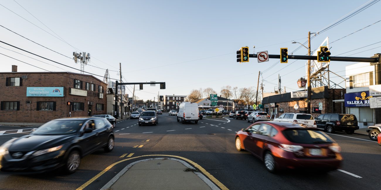
It would span a nearly half mile stretch of Broadway Street from Jenness Street to Wyoma Square.

“The state first targeted this area for improvements five years ago and the plans are now coming to fruition,” said the statement from Lynn DPW Commissioner Andrew Hall. “It is critical that the City does what is necessary to ensure that this funding is utilized.”

Migliaccio said he worries that the project would cause him to lose parking spots out front of his business.

A city spokesperson pointed out that those some of those spots are technically supposed to be a bus stop.

However, Migliaccio said that the bus stop is rarely used….”

https://www.boston25news.com/news/l...OXJ_xV9vjmUj2uAyUNbVpxdO_wgAtHBQcxT0ku0qxrglQ

https://www.itemlive.com/2021/12/06/new-look-being-considered-for-wyoma-square-in-lynn/
IMG_8565.jpeg

https://www.mass.gov/doc/massdot-hearing-handout-lynn-121421/download
 
Makes it sound like they going to take half their property to widen the street when in reality it's probably just adding a signal pole to their property?? Does anyone have any info on the design, this is all I could find on MassDOT project info: " The proposed project will reconstruct approximately 0.3 miles of Broadway, from Wyoma Square to Jenness Street. The project is intended to provide safety and operational improvements at two high crash clusters; the intersections of Broadway with Euclid Avenue and with Jenness Street. The project will generally include targeted safety improvements including replacement of outdated and non-MUTCD compliant traffic signals and other traffic control devices; reconstruction of sidewalks, crosswalks, and wheelchair ramps; addition of bicycle facilities; improvements to transit stops; and roadway resurfacing. The preliminary concept design includes signalizing the stop-controlled intersection of Broadway at Jenness Street. "
 
Makes it sound like they going to take half their property to widen the street when in reality it's probably just adding a signal pole to their property?? Does anyone have any info on the design, this is all I could find on MassDOT project info: " The proposed project will reconstruct approximately 0.3 miles of Broadway, from Wyoma Square to Jenness Street. The project is intended to provide safety and operational improvements at two high crash clusters; the intersections of Broadway with Euclid Avenue and with Jenness Street. The project will generally include targeted safety improvements including replacement of outdated and non-MUTCD compliant traffic signals and other traffic control devices; reconstruction of sidewalks, crosswalks, and wheelchair ramps; addition of bicycle facilities; improvements to transit stops; and roadway resurfacing. The preliminary concept design includes signalizing the stop-controlled intersection of Broadway at Jenness Street. "

Per MassDOT, project is going to Final Design (100% design package was submitted last month).

I frequent this corridor and the intersection at Euclid is really tight, with insufficient storage space on Broadway for vehicles looking to make a left onto Euclid. And Jenness Street is used as a means of getting over to 128/95/1 in Peabody.

My best guess is that the state is looking to put a mast arm foundation on the corner at the florist's property, requiring a permanent easement. In addition, it's probable that the state wants a temporary construction easement on the property to allow for construction operations. These easements are not permanent.

But the biggest thing not reported in this story is the Right-of-Way (ROW) procurement process that the State is required to adhere to. All affected properties with proposed easements and takings identified by MassDOT are subject to an appraisal for damages (land costs, retaining walls and fences that have to be removed, plantings, etc.). Appraisals are conducted by professionals and then the appraisals are subject to a review by another appraiser as sort of a peer review to ensure fair value is determined. Property owners are first asked they want to donate the easements and/or takings. They have no obligation to do so. If they choose not to, the state then presents them with an offer for the determined fair market value. Sometimes owners take this, sometimes they ask for extras and sometimes they hold out completely. Eminent Domain takings are a last resort in this case. But even with ED, fair market value is ultimately paid out.

The Globe just goes straight to the eminent domain part, and leaves out the fact that the owner was offered money for the presumed damages.

Adding to this, the owner can say he's been blindsided, but there's a requirement that property owners affected are sent certified mail packages with the entire ROW acquisition process laid out. And furthermore, there was a MassDOT Design Public Hearing way back on 12/14/2021 where the 25% design plans were shared.

I get it - people worry about their property being taken. But as someone who designs these types of projects for a living (and tries to minimize impacts on private property as much as possible), I've seen these stories of people claiming to not know what's going on over and over again. Sometimes it's legit - stuff gets mailed to a property owner who leases/rents to a different person or business. Sometimes properties get sold between design phases. Sometimes owners get this and get all confused and don't know who to talk to. But a lot of times, sadly, it's people that don't take the time to read what they've been mailed and/or ignore community meetings where this is laid out in the open for their benefit.
 
Last edited:
Am I missing something here, or is it impossible to go from Rt 16/MVP East to Middlesex/Fellsway North/9th?

Or is the plan that the only way to make that movement in the future is to loop at River's Edge or something?
 
Last edited:
Am I missing something here, or is it impossible to go from Rt 16/MVP East to Middlesex/Fellsway/9th?

Or is the plan that the only way to make that movement in the future is to loop at River's Edge or something?
I'm seeing the same thing as you: no left turn from Rt 16 EB to Fellsway NB or Middlesex. Looks like a drafting mistake for the arrows. Or maybe it's intentional.
 
Am I missing something here, or is it impossible to go from Rt 16/MVP East to Middlesex/Fellsway North/9th?

Or is the plan that the only way to make that movement in the future is to loop at River's Edge or something?
I believe you are correct, and from earlier documentation it's intentional to reduce the signal phases.
 
I don't see how turning one big intersection into 5 smaller intersections in the same footprint and making it so traffic can't go east to north is better. Then again there's not really a great solution for this area since people are going to continue to use the Fellsway as a way to get around backups on 93 and use 16 as a pseudo-inner belt. I also read through the draft design and it looks like they also want to put a pedestrian bridge over route 16 between the Kappys and Station Landing. I guess that's safer since you won't get run over by a car but ped overpasses are old-school thinking that just discourages people from walking.
 
The proposed roadways look like an auto-centric dystopian nightmare. What was originally intended to be a system of PARKways spanning the metro area has been sliced and diced into dozens of lanes of intertwined gridlocked roads. WTF?
 
Ultimately, traffic signalized intersections and overly complicated junctions are for cars, since without cars, you don't need traffic lights or complicated junctions.

Tens of millions of dollars to try to fix a messy intersection for cars in Medford.
 
Ultimately, traffic signalized intersections and overly complicated junctions are for cars, since without cars, you don't need traffic lights or complicated junctions.

Tens of millions of dollars to try to fix a messy intersection for cars in Medford.
Cars are driven by people, who are trying to go about their day. In this case, the intersection also serves lots of trucks, which prvide critical goods to many, many people.
 
Cars are driven by people, who are trying to go about their day.

This intersection redesign is about 35 million dollars, to redesign a single intersection.

In 2019, the Boston Cyclists Union proposed increasing Boston's budget for bike lanes to 8.2 million dollars (9.6M 2023) to build 8.2 miles of new bike paths. 8.2 miles would cover a lot more ground with 8.2M dollars than 35M for a single intersection.


In Amsterdam, an underground parking garage for 600 cars cost the same as half the entire bike lane budget Amsterdam spends on bike infrastructure.

Car infrastructure is just ridiculously expensive, and MA is spending 35 million to build brand new 6 lane stroady intersections on these "Parkways". "At least now, there's a bus-bike lane". There just shouldn't be roads wider than 2 car lanes (per direction) in cities, ever.

Sounds like there's a need for rail transport, active transport, and public transport.
 
There just shouldn't be be roads wider than 2 car lanes (per direction) in cities, ever.

Sounds like there's a need for rail transport, active transport, and public transport.
I agree. Put this gargantuan intersection, and the approach roads up to it as well, on a road diet. Reduce Routes 16 and 28 to 2 lanes per direction. Use the additional space thus created for green space, walkways and bike trails. Then these corridors would actually be Parkways, as originally intended, and not the wannabe expressways they morphed into in the 1950s.
 
MDC was so dysfunctional that the water and sewer services were extracted into the MWRA. A couple of decades later Romney decided to shove the remaining parts into the DCR. Maybe it’s time to clean house and clearly delineate what a parkway is and what sort of traffic volumes they are designed for.
 
Car infrastructure is just ridiculously expensive, and MA is spending 35 million to build brand new 6 lane stroady intersections on these "Parkways". "At least now, there's a bus-bike lane". There just shouldn't be roads wider than 2 car lanes (per direction) in cities, ever.

Sounds like there's a need for rail transport, active transport, and public transport.

I was pointing out that transportation discussions often treat pedestrians and bikes as people and cars as inanimate objects, which both dehumanizes drivers (and denigrates the very real and good reasons someone might be driving) and removes responsibility for their actions (a particular problem in conversations about safety, which this is not).
 
Last edited:
I don't disagree with anything you said here, but I was pointing out that transportation discussions often treat pedestrians and bikes as people and cars as inanimate objects, which both dehumanizes drivers (and denigrates the very real and good reasons someone might be driving) and removes responsibility for their actions (a particular problem in conversations about safety, which this is not).

There is actually a Strong Towns article about this problem of the lack of forgiveness in American infrastructure planning and construction. This is the relevant article for that discussion. https://www.strongtowns.org/journal/2023/6/6/to-the-40000-drivers-who-cause-car-crashes-every-year

Anyways, my original response was about the insane amount of engineering and asphalt in the proposed redesign of Wellington Circle. In any case, people have tendency to drive out of habit, since they're used to it. As such, driving should be made more inconvenient and a bigger hassle, in order to reduce the need for insane amounts of over-engineering for redesigned roadways that are still 95% land use for asphalt for private two-ton fuel tanks with a driver inside.
 
I wish that the Federal 4F prohibitions on taking of park land for expansion of roads could be made retroactive. During the 1950s and 60s, many of the originally 4-lane (2 lane each direction without a median) MDC parkways were widened into divided highways, some 2 lanes each way, some 3 lanes each way. In my dreams I wish MassDOT was forced to restore all the park land that was taken to widen these parkways.

Note: corrected 4R to 4F.
 
Last edited:

Back
Top