Ah, I see. This was wayy older than I had thought. However, it seems they never would have been able to finish it back then because it didn't even fit!That is not correct. The neighborhood was considering asking for MORE parking by creating angled parking, and painting the bike lane would have eliminated that possibility.
> “Some of our businesses on Main Street have been closing because people couldn’t park,” said Cunha. And the neighborhood council had been discussing ideas for angled parking along the street to increase those parking opportunities.
> Cunha relayed these concerns from his constituents to the city and a public, well-advertised meeting was called. According to Cunha and Charlestown Patch, only four or five members of the neighborhood council showed up. They asked that the city stop painting the bike lane in order to discuss some other options, at the time it was only half painted. According to Cunha, they did not ask directly for its removal. But after this meeting, the city decided that the correct thing to do, “out of respect,” and perhaps due to safety concerns about a half-painted lane, was to remove the bike lane so that a full and transparent public process could take place. And that may have been a good call.

The real story on Charlestown's bike lane removal - Boston Cyclists Union
From director Pete Stidman, The recent removal of the bike lane in Charlestown has been largely misunderstood and poorly reported in the biking blogosphere. A more accurate account has been published at Charlestown Patch, and I give some details on the situation on the ground below. But most...bostoncyclistsunion.org
You are using an out of date browser. It may not display this or other websites correctly.
You should upgrade or use an alternative browser.
You should upgrade or use an alternative browser.
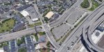
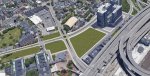
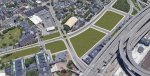
Rutherford Avenue to go on a diet!
- Thread starter BostonUrbEx
- Start date
real_EthanHunt
Active Member
- Joined
- Jul 18, 2019
- Messages
- 265
- Reaction score
- 428
just take a stroll down 'street view' memory lane.
the article has a pic of bike temp markings down (and not complete) in Dec 2010. the road is repaved in spring 2011 and bike lanes go in. 7 years after that, the outbound bike lane is taken out.
I didnt use the outbund one when it was in and still dont use the inbound one.
the article has a pic of bike temp markings down (and not complete) in Dec 2010. the road is repaved in spring 2011 and bike lanes go in. 7 years after that, the outbound bike lane is taken out.
I didnt use the outbund one when it was in and still dont use the inbound one.
BeyondRevenue
Active Member
- Joined
- Mar 13, 2020
- Messages
- 553
- Reaction score
- 1,157
I thought this belonged here:
Charlestown Infill and Small Developments
Lol...no way that ever gets approved/built.
archboston.com
Attachments
Charlie_mta
Senior Member
- Joined
- Jul 15, 2006
- Messages
- 5,150
- Reaction score
- 7,778
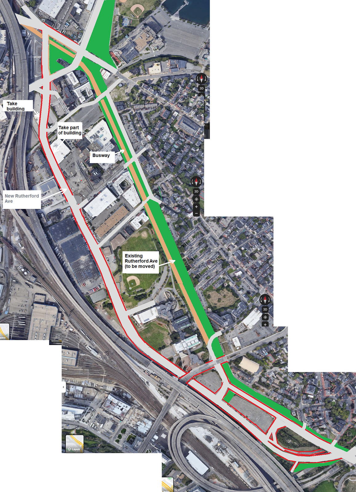
My idea for Rutherford Ave is to shift it over towards I-93, thus freeing up open space and developable area so they adjoin Charlestown, and aren't separated from it by Rutherford Ave. Here's my concept, with green as open space and yellow as developable parcels:I thought this belonged here:
Charlestown Infill and Small Developments
Lol...no way that ever gets approved/built.archboston.com
Last edited:
BeyondRevenue
Active Member
- Joined
- Mar 13, 2020
- Messages
- 553
- Reaction score
- 1,157
More fun: The way to improve on mine is to connect Education Street (North Point) to Arrow Street in Charlestown, which would make for a nice shortcut to the Tobin from 28 and allow more East West access that would not have to go through the Gilmore Gauntlet. No need to worry about a rail crossing if we go full in on the NSRL, amirite?
No need to worry about a rail crossing if we go full in on the NSRL, amirite?
I know you're making a joke, but I'm pedantic for a living (ha!): even in the most elaborate full-build NSRL proposals, the surface stations at North Station and South Station remain. For the foreseeable future, an NSRL tunnel would only support non-diesel trains, and there are some parts of the commuter rail network which will not be electrified for a while (if ever). Plus, there are operational benefits to maintaining the surface terminals -- not every train needs to be sent into the tunnel.
So I think we can count on there still be a rail crossing there for a long time to come!
Not to be a downer on this thread, but it's all Sim City.
Case in point, the first post in this thread from eight years ago begins: "After the completion of a thorough and lengthy community process..."
This has been in an active planning process since the Bush Administration. By comparison, I-93 was planned and built in a little over half that length of time. Say the serenity prayer and enjoy some nice pictures of Assembly or the Seaport. This one ain't moving.
BeyondRevenue
Active Member
- Joined
- Mar 13, 2020
- Messages
- 553
- Reaction score
- 1,157
A boy can dream. Continuing with the dream, I'd like to build another new neighborhood where the tracks behind North Station with the drawbridges converted for regular traffic, connecting the new North Station neighborhood to North Point and beyond. I would guess that if we sold off all the surface parcels for development we could electrify everything from here to Portland ME. I would likely need benevolent dictator level powers though. And I'd have to move Boston Sand and Gravel, which I suspect would be harder than any other task in Metro Boston. More Gordian than Sisyphean.I know you're making a joke, but I'm pedantic for a living (ha!): even in the most elaborate full-build NSRL proposals, the surface stations at North Station and South Station remain. For the foreseeable future, an NSRL tunnel would only support non-diesel trains, and there are some parts of the commuter rail network which will not be electrified for a while (if ever). Plus, there are operational benefits to maintaining the surface terminals -- not every train needs to be sent into the tunnel.
So I think we can count on there still be a rail crossing there for a long time to come!
BeyondRevenue
Active Member
- Joined
- Mar 13, 2020
- Messages
- 553
- Reaction score
- 1,157
You're right. But I hate everything about this area and needed to vent. The accompanying text with my images...Not to be a downer on this thread, but it's all Sim City.
Case in point, the first post in this thread from eight years ago begins: "After the completion of a thorough and lengthy community process..."
This has been in an active planning process since the Bush Administration. By comparison, I-93 was planned and built in a little over half that length of time. Say the serenity prayer and enjoy some nice pictures of Assembly or the Seaport. This one ain't moving.
>>
I was walking through the Austin/Rutherford intersection last week and felt compelled to do some bad photoshop to purge the obvious demons. This intersection has more in common with where Adams flies over 93.
This is an awful, out of place remnant, an unmoving obstinance, running down property values and serving no one local group particularly well. All destined to fall apart before somebody sacks up to build it like a city intersection, not a series of off-ramps. Having this intersection in your city is like having a tumor on your arm and not treating it.
"Oh, that? That's a big freckle."
"You should see a doctor."
"Nah, it's fine."
Just how long has I-93 been operational, supplanting the need for this vestigial appendage? Why are we still acting like we need 2/3 of the intended function there? To look close at that suspended rotary - the expansion joints smashed together pushing the rubber gooified gap filler above the tilting, the safety-glass strewn sidewalk, the rust permeated concrete, the marginally functional and hideous adjacent pedestrian overpass, the ossified driver's faces unmoving at each of the ill-timed 10-way traffic signals -
All a monument to an unspoken fatalist failure. It's a reminder that we all suck and deserve the worst. We have no power and the state doesn't care. And we have no interest in doing any better because deep down, we know were done for.
Not simcity - they just presented last week on the 25% design. $175 million project planned to be started in spring of 2023, and finished by the end of 2026.


real_EthanHunt
Active Member
- Joined
- Jul 18, 2019
- Messages
- 265
- Reaction score
- 428
2 reasons,
people get off 93 SB at Sullivan and use 99 to get to North End/Downtown. In the NB reverse, its more advantageous to get on the cantilever on ramp at Sudbury St.
Also, coming along 99 from Everett to 93 SB the Sullivan Tunnel gets to 93 (either at City Sq or North End) but in the northbound there is the exit from 93 NB right onto Cambridge St.
Equilibria
Senior Member
- Joined
- May 6, 2007
- Messages
- 7,229
- Reaction score
- 8,759