Transit Planning $h!tposting (Ideas so bad, they're good)

I got carried away and converted the aformentioned map to the MetroDreamin interface as well as Google MyMaps (edited the original post above to add the Google MyMaps version). (Yeah, I spent a few days of my time converting the map)

Link to converted map: https://metrodreamin.com/view/cXhmSU9IMGtIcFE4QWcyeHZyV3ZEQTNYU1gyMnww (Map is best viewed in light mode (disable dark mode) and open fullscreen. I also recommend hiding buses/trams/streetcars to just see the lines)

Apparently, Metrodreamin simulates a single roundtrip for every single dream subway/streetcar/ferry/bus line drawn on it's interface. So I converted the map to use the format mostly to see the satisfaction of watching the subways on all the mainline ROWs go super fast/high-speed on the B & A and B & L right-of-ways, while all of the buses creep along street-running in Allston-Brighton and Somerville.

Also I deleted a few lines and rearranged others. Since it's a metro map maker, I essentially just drawn the lines as I saw fit with no regard to realism. (It should be easier to clone and reconfigure the map on this platform than Google MyMaps as well)
Great map. It looks like an alternative reality that could have happened, especially the Blue Line to Harvard Sq, which was the original plan when the Longfellow Bridge was built.
 
Yeah, to be clear, if the test is, "Does a rapid transit line avoid using a mainline ROW to go from the Inner Belt to downtown, a la Kenmore, Sullivan, or Harvard?", then the northern Green Line definitely would have passed before the opening of GLX.

With GLX open, I think it's less clear where the "Inner Belt" is; if we keep it at Lechmere, then Green continues to pass the test. But if we think the Inner Belt is actually the Harvard <> Sullivan axis along Washington St, then both the Medford and Union branches would be debatable at best. (Particularly Union, which relies heavily on the Fitchburg RR ROW.)


I like to use the idea of "the fastest crosstown loop that follows only existing bus routes" to find the inner belt loop (and the outer belt loop, where I don't exit original BERy territory).

Such maps give me these results (black lines are inner and outer belt, red are major bus termini or intersections). Kendall MIT being a growing hub these days makes it bit harder now to determine if Central should still be considered the bounds of the inner loop, or if it should be shifted to Kendall. BNRD rerouting to Charlestown will only make this more messy.

I've also thought about the outer loop of the inner core quite a bit. Revere kinds of makes it tricky with Revere St./Revere Center. I'm tempted to route the outer loop to Arlington, but since the 74, 75, and 73 buses in Belmontdon't meet until Harvard, it essentially causes Harvard to be considered "the outer loop". The same issue also exists for Brookline Village and urban density dropping off SW of Brookline Village.

View attachment 49576
Just want to say that I think this is a super interesting idea and I hope to come back and comment on it further!
 
I got carried away and converted the aformentioned map to the MetroDreamin interface as well as Google MyMaps (edited the original post above to add the Google MyMaps version). (Yeah, I spent a few days of my time converting the map)

Link to converted map: https://metrodreamin.com/view/cXhmSU9IMGtIcFE4QWcyeHZyV3ZEQTNYU1gyMnww (Map is best viewed in light mode (disable dark mode) and open fullscreen. I also recommend hiding buses/trams/streetcars to just see the lines)
Very cool!

I've been working on a diagram version of the original map I described, so I'll use this opportunity to tease that:

1713617214644.png
 
Well, it's certainly no longer a shitpost, but I now offer not one, not two, but three versions of the map I described upthread, of a system I've called the Boston Metropolitatn Railway. Full versions (and background and explanation) on my blog.

1713830184721.png


1713830208118.png


1713830232645.png


View attachment BMR Map v1.0.png
View attachment BMR 22TPH Map v1.2.png
View attachment BMR Dual Tunnels Map v1.0.png

I'm gonna write a separate blog post later on the pros and cons of the BMR's approach, but I do want to be clear that, in general, this idea remains a shitpost in spirit. There definitely are aspects of this "Suburban Rail Link" concept that are interesting and worthwhile, but ultimately this idea would have been only marginally sufficient 100 years ago, and certainly woefully inadequate today.
 
Well, it's certainly no longer a shitpost, but I now offer not one, not two, but three versions of the map I described upthread, of a system I've called the Boston Metropolitatn Railway. Full versions (and background and explanation) on my blog.

View attachment 49888

View attachment 49889

View attachment 49890


View attachment 49885
View attachment 49886
View attachment 49887

I'm gonna write a separate blog post later on the pros and cons of the BMR's approach, but I do want to be clear that, in general, this idea remains a shitpost in spirit. There definitely are aspects of this "Suburban Rail Link" concept that are interesting and worthwhile, but ultimately this idea would have been only marginally sufficient 100 years ago, and certainly woefully inadequate today.
Looks very good!

Looks more fleshed out than my idea. Some things I notice:

(The Fairmount Line is harder to analyze in this context, since it lost most of its passenger stations much earlier on, and has current stations in greenfield locations. However, it could easily be added to the purple “Franklin Suburban” network, with 6 min headways to Fairmount, and 12-min to Braintree and Mattapan.)

(The Fairmount Line was also going to be harder to map as a full line, so I admit I took the easy way out to avoid mapping it.)
Is this due to the nature of the map itself not having enough space, or some other factor?

I wonder if there would be room to map the Fairmount line if the Southwest Corridor is mapped diagonally to the southwest instead of due south. On my maps, the Fairmount line is given a lot more room, and the whitespace showing the underserved areas of the Boston neck/Roxbury. The area looks a lot more squished while the Highland Branch is given a lot more room (probably to avoid diagonal text and to make the streetcar lines more neater).

I had first mapped out the "mainline rail link" concept on top of the existing present day map, only readapting it later on. I took a lot of influence from the offical MBTA system map on how it depects present day rail corridors, and mapped the mainline railways akin to the offical MBTA approach (The B & RB & L's Blue Line and the SW corridor's Orange Line always appear diagonal NE-SW, northside Orange Line and RL to JFK UMass fully vertical N-S, GLX/Arlington are diagonal to the NW).

I'm gonna write a separate blog post later on the pros and cons of the BMR's approach, but I do want to be clear that, in general, this idea remains a shitpost in spirit. There definitely are aspects of this "Suburban Rail Link" concept that are interesting and worthwhile, but ultimately this idea would have been only marginally sufficient 100 years ago, and certainly woefully inadequate today.
I would be very interested! I don't know why, but the "mainline rail link/suburban rail link/mainline rail metro service concept" is super fascinating and interesting to me. It's like an endless rabbit hole and can of worms for me. I can understand that it would be woefully inadequate and not practical/realistic by the present day though.

One key difference is the character of the SUAG frequencies: in a well-functioning version of today’s MBTA, the SUAG headways on its subway lines are usually 5-6 minutes, whereas the BMR’s Metropolitan headways would be roughly 12 minutes. The Suburban branch lines to Braintree, Riverside, and Malden would be relegated to roughly half-hour headways. On the other hand, stations like Newtonville, Hyde Park, and Chelsea would see much higher frequencies than they do today.
I have tried figuring out what frequencies and tracks would be needed to give a minimum 7 tph for "SUAG" frequencies for all branches as far as the BERy territory extended, in the most radical approach Tokyo-style. (I wouldn't accept anything less than 7 tph for "SUAG"; anything 6 tph or below was "SUAW" or "PDTW", in my radical concept, as 6 tph is a "clockface" 10 minute timetabled service. If 7 tph was "evening service", then 8 tph could be midday service and 9 tph rush hour).

Essentially, this would require a minimum 14-18 tph to reach Wellington on the northside, Sweetser Circle in Everett, Magoun Sq. in Somerville, Porter in Cambridge, Lansdowne near Brookline, Forest Hills in the south, and Harrison Sq. in Dorchester. (In a more radical sense I could make the case that 2 branches in West Roxbury (inside BERy territory) could use 14-18 tph to West Roxbury, since without it would cause the branch stations inside BERy territory on the outskirts of West Roxbury to only have branch headways of 3.5-4.5 tph; to meet the 7-9 tph standard for all BERy territory stations would mean 21-27 tph just to get to Forest Hills. Reactivation of the abandoned Harvard and Milton branches would also give 21-27 tph to Prospect Hill Somerville and Harrison Sq. Dorchester as well).

the core tunnel would need a capacity of 40 tph or more in each direction. SEPTA’s Center City connection, and recent analysis of the proposed NSRL, suggest that a realistic capacity for a single dual-track mainline tunnel would be about 22 tph. This imaginary “Suburban Rail Link” would need to be quad-tracked
I had thought to make the maximum service (shortest headway) for each branch's stations within the BERy service area to max out at 11 tph for peak service, where each 2 branches would share tracks, for 22 tph maximum. Interesting my thoughts on my insane idea of "mainline ROW metro service to the radical extreme" matches what is seen here.

I have been tinkering around with this unrealistic impractical concept, I came up with this map of frequencies so far. Pink is any service less than 7 tph, Red is 7-9 tph, Orange 14-18, Yellow 21-27 (including some abandoned branches). A hugely impractical/unrealistic mega-trunk extends from Sullivan Sq. down to Back Bay and Andrew with 28-36 tph or more. The Harvard-Maverick-B & RB & L line is marked as 7-9 tph but I suppose it would have more service than categorized in my silly map. (On this map, all Waltham, Lynn, and Quincy routes are extended past their BERy terminals, as well as Highland Branch. In a every-other-train short turn service at Reservior, Urban rail services would only be 1.75 tph off peak/2.25 - 2.75 tph peak, to Needham Junction/Riverside (every 22-27 min peak/34 min evenings) on the Highland Branch, or they can be served by commuter rail service instead).

1713883648225.png
 
Last edited:
Is this due to the nature of the map itself not having enough space, or some other factor?

I wonder if there would be room to map the Fairmount line if the Southwest Corridor is mapped diagonally to the southwest instead of due south. On my maps, the Fairmount line is given a lot more room, and the whitespace showing the underserved areas of the Boston neck/Roxbury. The area looks a lot more squished while the Highland Branch is given a lot more room (probably to avoid diagonal text and to make the streetcar lines more neater).
You're totally right about turning the Southwest Corridor diagonal, I think that would work. Yes, I wanted to avoid diagonal text at all costs, and yeah, I was worried about the streetcar lines looking messy so did try to focus on making them clean. But, if I turn the Southwest Corridor diagonal at Heath or Roxbury, I could turn the Egleston Streetcar directly vertically, which would be pretty clean (and would maintain the vertical axis running down from Causeway station). You are right that there is lots of available real estate within both the Needham and Newton Circuits.

Actually, one thing that could be very interesting is to adjust the Washington St El to the left and make it part of the vertical axis, and shift everything in the lower left quadrant over a bit. There's definitely space, and yeah that would open up space for the Fairmount Line's labels. (I could also adjust the Braintree and Mattapan Lines over -- I drew those early in the process when I wasn't sure how much space I would have on the right edge of the map, but never circled back later.)
I would be very interested! I don't know why, but the "mainline rail link/suburban rail link/mainline rail metro service concept" is super fascinating and interesting to me. It's like an endless rabbit hole and can of worms for me. I can understand that it would be woefully inadequate and not practical/realistic by the present day though.
I'll try to get to it soon!

And yeah, I think the topic remains relevant both in terms of the North South Rail Link and in terms of the continued reuse of the original ROWs. For example, I think the current capacity pinch on the Old Colony Lines makes a lot more sense when you realize that both branches of the Red Line and all three Old Colony branches were originally built and run as a single system, with all of its traffic funneled through what is now JFK/UMass. There's a reason that the (bad) idea of converting the Braintree Branch to high-freq Regional Rail looks good on paper -- it's how the system was literally designed to run, waaaaaay back when.

I think the B&A and Boston & Providence also present a something interesting: Back Bay Station seems oddly close to the core to be a branching point.... which makes sense when you realize that it wasn't built as a branch point, but as a crossing between the two railroads (when the B&P ran to Park Square). The B&P and B&A didn't have their own branchpoints until Brookline Junction (Kenmore) and Forest Hills... again reinforcing those as demarcation points a la the Inner Belt. (And I still need to reply to your comments on that topic!)

Your frequency map looks cool! I need to read the analysis more carefully, but looks interesting too!
 
Your frequency map looks cool! I need to read the analysis more carefully, but looks interesting too!
My analysis wasn't really that much fleshed out. It's mostly just a rough thought exercise idea that really fascinates me for some reason, (since it's just really impractical and I wanted to take it to the most extreme, I have little intent to ever make this concept semi-plausible). Anyhow, if you would like the detailed thought process, here goes:

Regarding the Old Colony corridor, my initial map did not include Quincy Center as part of the core "mainline ROW metro service for all BERy stations" network at all, as it was outside the original BERy territory. While I could easily add corridors to Lynn and Waltham with simple extensions from the BERy terminals to reach Lynn and Waltham's major terminals, adding in Quincy Center essentially had me redoing through running for the entire BERy area.
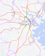
My original map (on the first page), had 9 northside and 9 southside routes (I piggybacked the abandoned Harvard branch to use the very impractical Track 61 terminal (which had actual proposals for passenger service); every single radial ROW that ever existed, even once, was going to assigned a route via NSRL).

This gave me the following: (this does NOT match the frequency map above)
* 2 branches to West Rox, Harrison Sq, Lansdowne, Porter, Magoun, Wellington, & Encore/Sweetser Cir.
* 3 branches to Forest Hills, Prospect Hill
* 4 branches to Sullivan, Broadway
* 5 branches to Back Bay
(The minimum 7 tph frequency standard for BERy stations was going to be strict, so West Rox's VFW Parkway and Spring St stations needed to hit that standard despite being past the fork, but still inside BERy territory; 11 tph would be the max so 2 branches could share a duel track at 22 tph)

To slot in Quincy Center into the network. I opted to reuse/reactivate the original Saugus Branch's abandoned connection from Malden Square/Linden Sq. to Edgeworth/Wellington. This gave me a Linden Square via Wellington & Edgeworth instead of via Encore/Sweetser Circle; that I could use as the 10th route pairing on the northside, so I could send a Quincy Center route as a 10th route piling into the NSRL tunnel (which already had 9 branches feeding into it, so I guess that'll be 110 tph just for metro-style urban rail services downtown, or 10 tracks dedicated for such purpose. Yeah, I'm being insane/impractical/unreasonable 🤣)

(Is that a Linden Square <> Davis Square service I spy? :D)
And in that process of slotting in my extension of the "mainline ROW metro network" to Quincy Center, I would have cannablized this quoted route (though I could start it from Jeffries Point and run through the Grand Junction, then do the loopy Sullivan --> East Somerville). One of my major problems is that the Grand Junction does not have a direct connection to the East Somerville - Magoun Sq corridor unless I either:
1. reroute the B & L mainline coming from Magoun Sq./East Somerville to use the GLX <---> Fitchburg ROW alignment to reach North Station, which violates the "only follow mainline ROWs principle" concept.
2. Build a station in the middle of the inner belt to facilitate transfers from Grand Junction <--> East Somerville/Magoun Sq. (this is NE of the proposed "Brickbottom" station from TransitMatters along McGrath Hwy).

(Getting a direct connection from Grand Junction in Cambridge/Chelsea/Eastie <---> East Somerville/Magoun Sq., would allow me to cannabalize 2 of the 3 crosstown routes and only have a single crosstown route with single transfers, which would allow me to properly have enough capacity on the main branches to feed into the NSRL tunnel. Right now I've got capacity eaten up along the B & A and B & L for crosstown services that currently are separate routes, due to the lack of this connection)

Anyhow, with a Quincy Center branch. This changes my calculus completely, with the changes in bold:
* 2 branches to West Rox, Neponset, Lansdowne, Porter, Magoun, & Encore/Sweetser Cir.
* 3 branches to Forest Hills, Prospect Hill, Harrison Sq, and Wellington
* 4 branches to <none>
* 5 branches to Back Bay, Sullivan, Broadway

Since my primary goal of my thought exercise was to serve the densely populated BERy service area with metro frequencies with 7 tph minimum, for all BERy stations/all day, my thought was that the last terminal serviced by BERy routes, or town lines (Oak Grove, West Medford, Revere St., VFW Parkway, Arlington Heights, Readville, Newton Corner, etc.), would become the route terminals, or at least every other train turning around. The only exceptions would be to service the Waltham, Lynn, and Quincy terminals with full metro frequencies of the 7tph minimum standard for metro style service. The reason being is that once one exits the BERy service area, the longer distances and less density between stops would be unsuitable for full 7 tph (of either mainline trains or metro trains) at all service hours. Only the BERy service area, and the Lynn/Quincy/Waltham terminals could justify full frequencies. (I would be curious of additional corridors that could justify this minimum freqency target, but the T's market analysis suggests otherwise).

This means that for the Highland Branch, everything west of Reservior (the last BERy terminal where either the line terminates, or every other train would turnback) would be restricted to a minimum standard of 3.5 tph (which can be increased to either 4.5 tph or a max ceiling of 5.5 tph). If the Highland Branch was going to split west of Newton Highlands, that would be 1.75 tph (up to 2.25 - 2.75 tph rush hours) to Riverside or Needham Junction. I'm not so sure if the Highland Branch west of Reservior were to have 4 car trains, or 6 car trains, seen on metros (or high capacity trains like that of commuter rail), that they could justify >=7 tph of 4-6 car trains from 5am- midnight, whether that's today or in 1920.

And yeah, I think the topic remains relevant both in terms of the North South Rail Link and in terms of the continued reuse of the original ROWs. For example, I think the current capacity pinch on the Old Colony Lines makes a lot more sense when you realize that both branches of the Red Line and all three Old Colony branches were originally built and run as a single system, with all of its traffic funneled through what is now JFK/UMass. There's a reason that the (bad) idea of converting the Braintree Branch to high-freq Regional Rail looks good on paper -- it's how the system was literally designed to run, waaaaaay back when.

For the Quincy Center branch, following the BERy terminal + Lynn/Waltham/Quincy guidelines, means that the minimum 7 tph standard (maximum of 11 tph) only applies and runs to Quincy Center only. South of Quincy Center, the line would either terminate, or if every other train turned back at Quincy Ctr., it would only allow 3.5 tph (up to 5.5 tph maximum), for any fork that exists south of Quincy Center. With 4 branches south of Quincy Center, that's only going to allow 68 minute headways for all those 4 branches. If Quincy Center could pull the maximum capacity of 11 tph to Boston during rush hour of my insane "metro style network" concept, every other train looping would still only give 44 minute headways for the 4 branches.

One other thing of note: Waltham and Lynn each actually have 2 possible routings from the BERy service area to their route terminals using mainline railway ROWs. Quincy Center only has only 1 single possible routing (via Neponset). I have the option of extending either one, or both terminals, from the BERy service area to Waltham or Lynn. To get to Waltham, I can extend either the Waverley Branch or the Watertown Branch (or both). To get to Lynn, I can use the Eastern Route and/or the B & RB & L routing from Revere St.. This means that, extending both branches for each, I can theoretically allow 14 - 22 tph to extend to Lynn, and to Waltham 10.5 - 16.5 tph (the Waverley Branch has a fork, but including or abandoning the Central Mass. fork would mean a full 14 - 22 tph anyways, Watertown would send the full 7 - 11 tph to Waltham terminal since it has no fork at all).

Quincy Center, on the other hand, is stuck with only the 7 - 11 tph of a single branch. There is no second branch like that of the Waltham or Lynn terminals. Otherwise, one way to get around this limitation, is cancelling the "every other train turnback" concept for Quincy Center only, and run every single train at Quincy Center, past it and continue south, to get any meaningful service south of it. The other solution is essentially run the Quincy Center branch's 7 - 11 tph independently of the commuter/intercity rail service, which would essentially mean quad tracking to Quincy Center all the way from Boston (and north of Harrison Sq. would need 6 tracks, since 3 branches needing 7 - 11 tph would need a quad track itself; in my insane, impractical, unrealistic concept).
 
Last edited:
I think the B&A and Boston & Providence also present a something interesting: Back Bay Station seems oddly close to the core to be a branching point.... which makes sense when you realize that it wasn't built as a branch point, but as a crossing between the two railroads (when the B&P ran to Park Square). The B&P and B&A didn't have their own branchpoints until Brookline Junction (Kenmore) and Forest Hills... again reinforcing those as demarcation points a la the Inner Belt. (And I still need to reply to your comments on that topic!)
Back Bay Station is one reason why I'm wary of a Blue Line extension along Storrow Drive, as such a HRT corridor would miss such a major transfer node. Back Bay station itself essentially developed into a major transfer hub/node after South Station became the terminal for intercity services, and streetcars being busituted eventually terminated at Back Bay. It's got connections from many of the major westside routes to many of the major southside routes. It's got a connection with the 39/Arborway route, a high frequency route, as well as the 9 bus (the major route serving South Boston). BNRD will add another frequent route extending to Boston Medical Center as well. The express buses such as the 501 and 504 all serve Back Bay with such a connection.

On my map, Back Bay essentially becomes the major node for transferring from westside metro-style routes to southside routes. Without a southside version of the northside's Grand Junction, it's location as the junction from the B & P with B & A routes, means it's the only rail connection from the west to the south. The other alternative being slow buses and streetcars like the 65, 66, and 47 to travel from the west to the south (again, following the "only follow mainline ROWs concept to the T"). (And of course, South Station to access Old Colony Lines, and my map utlizes South Cove for connections to the Nubian El/Streetcar/etc. line)
 
Last edited:

Back
Top