East Boston Infill and Small Developments

Wouldn't it be great if part of the mitigation was the need to install a zip line from the Don Orione shrine to the hotel roof?
 
Beautiful building! Dare I say it.... a new landmark for the entire Boston area?
 
Beautiful building! Dare I say it.... a new landmark for the entire Boston area?

Haha. Got me to click through to the rendering, I have to admit.
 
They'll probably build it out of 2x4's like they did the Residence Inn in Chelsea too.
 
What parcel of land is this being built on?
 
*sigh*

I wish the entire area between Saratoga, Addison, Boardman and 1A would just get bombed and then have a street grid put in place for real development. Hands down the WORST place in all of East Boston.

1A has numerous quasi-express buses to the Financial District, the 120 bus runs by this area pretty closely, the Blue Line is pretty damn close, and Bennington is just begging for bike lanes soon enough.
 
Bennington has bike lanes (since 2010 -- not on StreetView yet).
 
I wish the entire area between Saratoga, Addison, Boardman and 1A would just get bombed and then have a street grid put in place for real development.

That might be a tough sell in some respects. Part of the area in question are the valuable athletic fields of Noyes Park, that have been a neighborhood amenity since my father's childhood. I wouldn't object to upzoning the Brandywine housing development with something that feels more urban (it's easily walkable to the Heights T station), but I imagine vocal resistance from many voices.

Addison Street is an interesting zone that should be transformed from industrial to residential use. Unfortunately, the residents of Addison Street don't seem to want any new neighbors. About two years ago, I attended a community meeting that addressed a developer's application to change an industrial-zoned lot to residential use; he was interested in building a four story, 12-unit building here (the building on the left of the empty lot would have been demolished). The abbutters behaved as if a nuclear reactor was being proposed.

Hands down the WORST place in all of East Boston.

For me, it's the water-side of Central Square.
 
The playgrounds/ballfields/etc can stay. But the meglots have got to go. And that public housing does to. If it's too politically toxic to remove them, then fine, whatever, but at least make it urban. Looks exactly like public housing I'd find in friggin' Burlington or something.
 
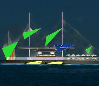
Peter, Michael, and Samir crit the new airport hotel design:
421304_10152163438885603_1814900812_n.jpg
 
Maverick Square E.Boston

Was down in this area today grabbing a bite to eat.
Maverick Square has the best views of the city I have ever seen.

Besides 80% of the entire area is probably assisted living. The other 20% is owned by Massport.

What will it take for this land to get into the private markets and get developed? Is this area that political?

I believe Maverick Square is priceless land
 
Maverick Square E.Boston
What will it take for this land to get into the private markets and get developed?

A way to get from there to downtown after midnight that does not include:

1) A car (this includes a place to park it downtown, at your residence, and the pass to get the toll discount)

2) Getting yelled at by cabbies

3) A five mile detour through the absolute worst parts of Eastie, Chelsea, Everett and Somerville (which also warrants a car, because no one in their right mind would walk through the tank farms after midnight, and I believe Beacham Street eats bicycles)

4) A boat


I looked for a long time at buying property over there. Almost did when a cute rowhouse came on the market for $140K a block away from the waterfront. The few restaurants that are there are also rocking, and the architecture is great. But once the T stops you basically can't get anywhere without a car.

3) I drive through those parts besides traffic I don't fine them as bad parts. Maybe very industrial and traffic congestion is unbearable.

The city of Boston should also build a bridge to overlap to Eastie.
4) All night Boat and Ferry service should be available.
The city of Boston should be open 24 hours including Transit.

Maverick really has the potential to blow up. I think Massport is the reason why the development in the area sucks.

Talk about missed opportunity.
 
A simple pedestrian bridge would be nice. I wonder why Boston, after all this year, never seriously consider constructing a bridge to connect one of its neighborhood. They could at least connect it to the Charlestown Navy Yard, unless their plan is to squeeze as much money as possible from the tolls. I understand the passage of an L.N.G. is partially the reason, but maybe they can construct some sort of draw bridge?
 

Back
Top