Seaport Neighborhood - Infill and Discussion

Re: Innovation Dist. / South Boston Seaport

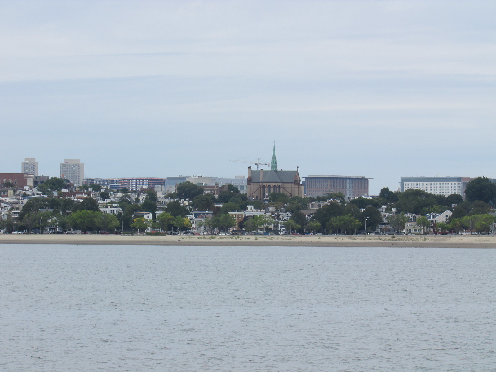
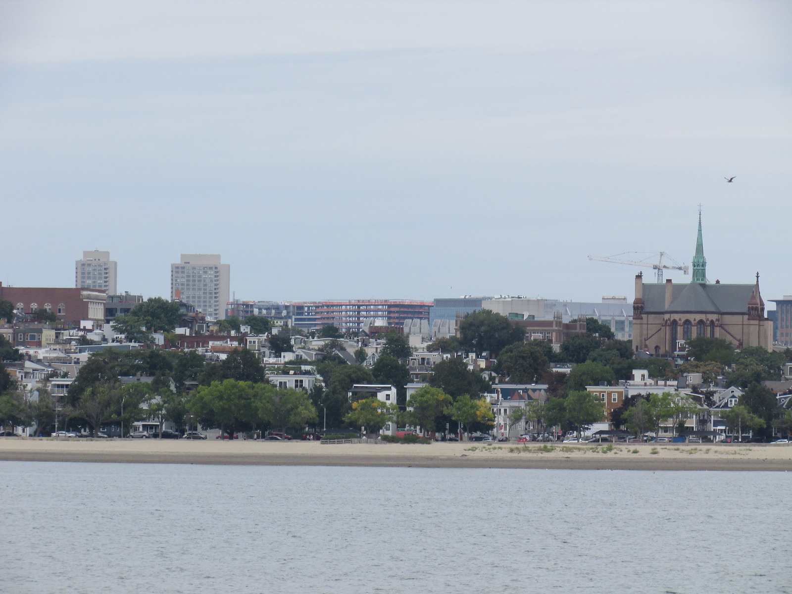
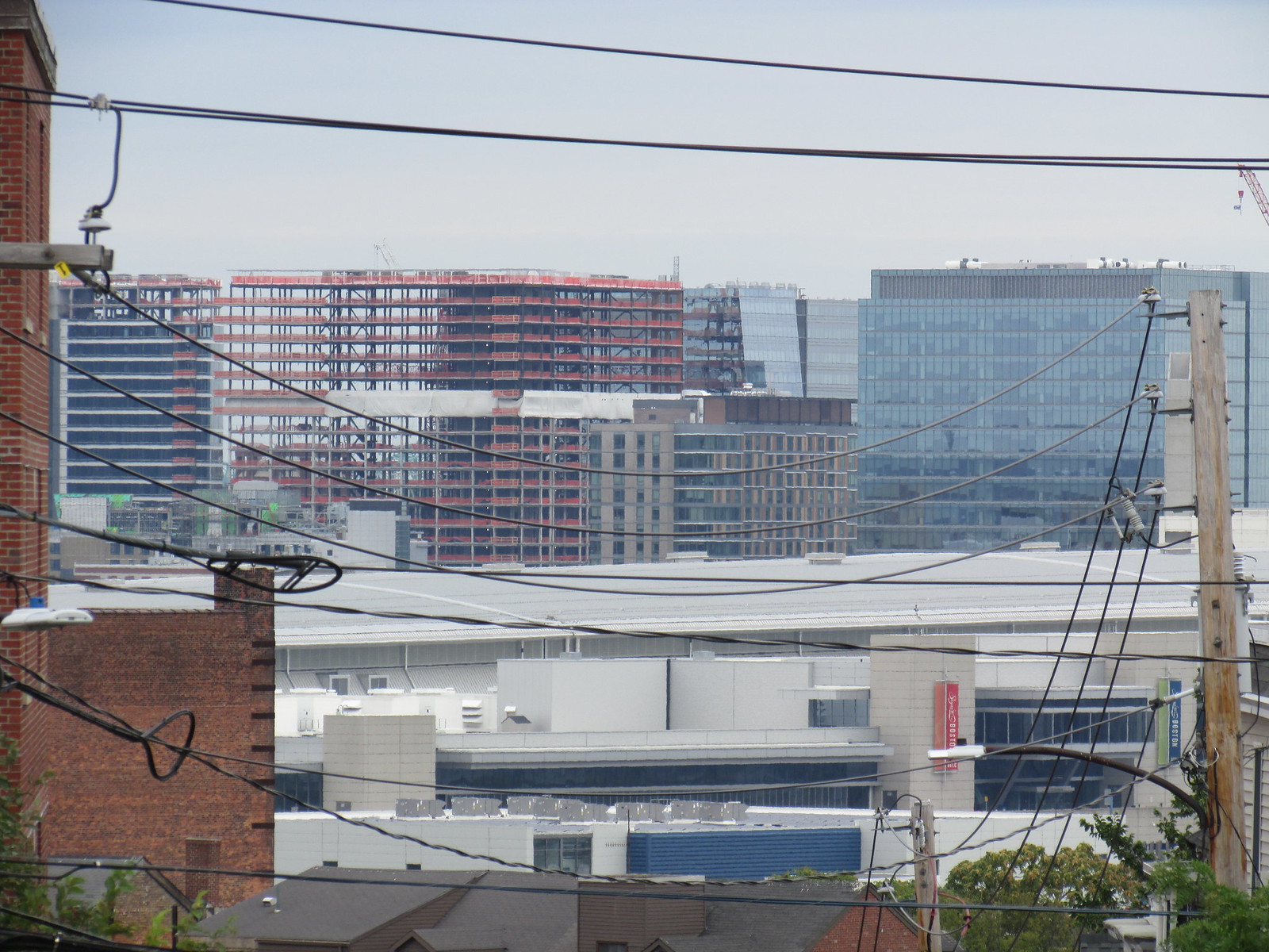
Neither city used the same type of landfilling in every place. Build-to-suit, so you need to Google the geological history of Boston to make sense of what filling technique was used where and why. Seaport's not nearly as fucked in a flood event as the South End despite facing the open water. Its drainage properties are very different: not nearly as good as the spots that used to be peninsula and Harbor islands, not nearly as bad as the tidal estuaries.

There is a phenomenal book on this topic that covers the land making in great detail:

Gaining Ground: A History of Landmaking in Boston by Nancy Seasholes

https://www.amazon.com/Gaining-Ground-History-Landmaking-Boston/dp/0262194945
 
Re: Innovation Dist. / South Boston Seaport

There is a phenomenal book on this topic that covers the land making in great detail:

Gaining Ground: A History of Landmaking in Boston by Nancy Seasholes

https://www.amazon.com/Gaining-Ground-History-Landmaking-Boston/dp/0262194945

JeffDowntown -- very much so -- and nancy is a well founded author on th subject

Still -- from having a discussion with her after a lecture at the Old State House -- i think that she piuts too much academic faith in documents

Back when most of the filling was done -- there was very little in the way of knowledge of geo-technical matters nor much in the way of standards let alone regulations -- so we really don't know what they dumped where until we dig it up.

In the case of the Back Bay things were done on such a massive scale that a rail line was built for the purpose of carrying Needham to Boston -- but in the seaport district -- did they dredge the bottom of the harbor in addition to throwing in the proverbial kitchen sink?

More specifically we know that several railroads built what amounted to causeways and embankments to cross the marshy squishy ground to get to the water and to Boston proper. These rail trails then got expanded into the low rise warehouses and more rail yards that one time covered that whole area
May 1958
Boston-Naval-Shipyard-1958-Annex.jpg

Boston. South Boston, Commonwealth Pier
Photographer:
Fairchild Aerial Surveys, inc.
Name on Item:
Fairchild Aerial Survey, Inc. N.Y.C.
Date:
1925
content
 
Re: Innovation Dist. / South Boston Seaport

Looks great, where is that model?
 
Re: Innovation Dist. / South Boston Seaport

I found it on the bra website it looks like its in a wind tunnell.
 
Re: Innovation Dist. / South Boston Seaport

I believe its shadows, not wind. the whole model is on a turn table to mimic the sun in different locations throughout the year.
 
Re: Innovation Dist. / South Boston Seaport

I believe its shadows, not wind. the whole model is on a turn table to mimic the sun in different locations throughout the year.

Wind tunnels do the same thing to mimic wind blowing from different locations as well. ;)
 
Re: Innovation Dist. / South Boston Seaport

Wind tunnels do the same thing to mimic wind blowing from different locations as well. ;)

Except that in a wind tunnel you would see smooth walls with no indented windows and minimal protrusions, as well as a gradual plenum flair at the end of the tunnel
 
Re: Innovation Dist. / South Boston Seaport

btw, who sold Menino on the Innovation District/city inside a city thing? i confess; i was underwhelmed by 'the concept' at the time. :banghead:
 
Re: Innovation Dist. / South Boston Seaport

btw, who sold Menino on the Innovation District/city inside a city thing? i confess; i was underwhelmed by 'the concept' at the time. :banghead:

Not sure-- but I like SEAPORT District much better.

The only innovation Menino knew was corruption.
 
Re: Innovation Dist. / South Boston Seaport

Except that in a wind tunnel you would see smooth walls with no indented windows and minimal protrusions, as well as a gradual plenum flair at the end of the tunnel

Wind tunnels for building wind studies have a textured floor to simulate the boundary layer of the surrounding cityscape.

A quick google shows that that is the Cermack Peterka Petersen ABL wind tunnel.

coverturntable-web.jpg

Caption: A model of NYC in one of CPP’s ABL wind tunnels
http://www.cppwind.com/blogs/wind-tunnels
 
Re: Innovation Dist. / South Boston Seaport

Looks good enough, ground level side with the benches looks real good.
 
Re: Innovation Dist. / South Boston Seaport

I believe its shadows, not wind. the whole model is on a turn table to mimic the sun in different locations throughout the year.

BKNA -- its a wind tunnel -- why would something for shaddows care about all that empty space toward the back
 
Re: Innovation Dist. / South Boston Seaport

Screen Grabs.


Boston Biz Journals.
 
Last edited:
Re: Innovation Dist. / South Boston Seaport

Was probably the end of world trade center or a boat
 

Back
Top