The basic concept of a floodgate seems like an obvious no-brainer, and is the kind of thing that astounds me hasn't been already prioritized. Fund and build it as fast as possible, in that sense. It has significant benefits today, not just for future-proofing. It also looks like it makes sense to combine it with the Northern Ave Bridge, as that does seem like about the spot you'd want it for maximum utility.
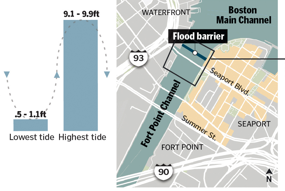
It's a narrow channel and a skim through Climate Ready Boston Map Explorer appears to indicate that it's one the most obvious major risk points for Coastal Flood Risks in large sections of the city, especially going forward into the 2050s/2070s.
So I'm on board with all of that.
----------
What I don't entirely understand is why the "idea" seems to be focusing on "collecting" stormwater and the tides in terms of getting rid of that stormwater. It's certainly convenient when it works out that you can just hold all the water until later and let it out by natural flow then.
But...there's also a solution to too much water building up on the wrong side of your floodgate with an ocean on the other side, it's called some big pumps and some big outfalls above the level of said ocean. This is pretty normal practice everywhere floodgates are used on bodies of water that have a flow that also builds up behind them. I don't really see why we're emphasizing the storage as the big thing about this, the floodgate is the big thing.
 IMG_6874 by Bos Beeline, on Flickr
 IMG_6881 by Bos Beeline, on Flickr
 IMG_6875 by Bos Beeline, on Flickr
 IMG_6882 by Bos Beeline, on Flickr
 IMG_6876 by Bos Beeline, on Flickr