I-90 Interchange Improvement Project & West Station | Allston

Much of the B&T article can be found here.
https://6park.news/massachusetts/harvard-seeks-development-of-air-rights-over-mass-pike.html

State Rep. Michael Moran, D-18th Suffolk, has asked Harvard to schedule a public meeting before the summer to provide details of his talks with Boston and state officials. “Given the additional development that the covers will generate for Harvard, my constituents would like to know the University’s intentions for the development of air rights,” Moran wrote in a May 9 letter to Harvard Executive Vice President Katie Lapp, obtained by Banker & Tradesman.

Harvard has committed to building a platform over the Turnpike and the former CSX rail yard for the project, according to the correspondence. In his letter, Moran said a “high-level development plan” is needed and asked for more details on the type, size and density of future Harvard development.

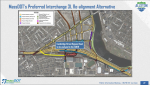
MassDOT is discussing cost-sharing options and “creative financing techniques” for the I-90 project with Harvard and the city of Boston, according to an agency statement.

Boston Mayor Michelle Wu’s office did not immediately respond to a request for comment.
 
The NPC (Notice of Public Change) for the At-Grade Alternative officially kicked off today with the public information meeting (PDF), and the public comment period kicking off soon. As far as I can tell, the only substantive changes to the plan from that of Sept 2021 is that they managed to narrow the overall cross section from 221.5 ft to 217.5ft by pinching SFR lanes to 10.5ft instead of 11 (from current 10ft) and by reducing horizontal clearances on the GL and WML from 9ft to 8.5ft, effectively getting SFR pavement "out of the river." (see attached plan from 9/29/21) Timeline wise it looks like it got pushed out another year or two, with the final EIS only expected in summer 2024.

Other than that, only new things are that:
1) FHWA has determined that the depressed segment where I-90 passes below the GJ bridge is a floodplain at risk of flooding, and therefore requires further refinement.
2) adjustments to the West Station area have been made to better accommodate a shared use path, whose inclusion appears to be more certain.
3) a potential connection from the west station "loop" over the yard tracks to Cambridge Street as a "bypass road" to be further analyzed. (see 2nd attachment)

1655428513102.png
 

Attachments

  • 1655430332752.png
    1655430332752.png
    1.5 MB · Views: 174
  • 1655430505822.png
    1655430505822.png
    381 KB · Views: 159
Last edited:
The NPC (Notice of Public Change) for the At-Grade Alternative officially kicked off today with the public information meeting (PDF), and the public comment period kicking off soon. As far as I can tell, the only substantive changes to the plan from that of Sept 2021 is that they managed to narrow the overall cross section from 221.5 ft to 217.5ft by pinching SFR lanes to 10.5ft instead of 11 (from current 10ft) and by reducing horizontal clearances on the GL and WML from 9ft to 8.5ft, effectively getting SFR pavement "out of the river." (see attached plan from 9/29/21) Timeline wise it looks like it got pushed out another year or two, with the final EIS only expected in summer 2024.

Other than that, only new things are that:
1) FHWA has determined that the depressed segment where I-90 passes below the GJ bridge is a floodplain at risk of flooding, and therefore requires further refinement.
2) adjustments to the West Station area have been made to better accommodate a shared use path, whose inclusion appears to be more certain.
3) a potential connection from the west station "loop" over the yard tracks to Cambridge Street as a "bypass road" to be further analyzed. (see 2nd attachment)

View attachment 25516

I really don't like the current 4' foot bike path along that stretch of Storrow Drive now as it is. I like the river platform; it will be a plus to be away from the traffic. EAs for the pavement; either way you look at it, elevated or at grade, it will be the same amount of pavement. And the area under the highway will not be useful.
 
The NPC (Notice of Public Change) for the At-Grade Alternative officially kicked off today with the public information meeting (PDF), and the public comment period kicking off soon. As far as I can tell, the only substantive changes to the plan from that of Sept 2021 is that they managed to narrow the overall cross section from 221.5 ft to 217.5ft by pinching SFR lanes to 10.5ft instead of 11 (from current 10ft) and by reducing horizontal clearances on the GL and WML from 9ft to 8.5ft, effectively getting SFR pavement "out of the river." (see attached plan from 9/29/21) Timeline wise it looks like it got pushed out another year or two, with the final EIS only expected in summer 2024.

Other than that, only new things are that:
1) FHWA has determined that the depressed segment where I-90 passes below the GJ bridge is a floodplain at risk of flooding, and therefore requires further refinement.
2) adjustments to the West Station area have been made to better accommodate a shared use path, whose inclusion appears to be more certain.
3) a potential connection from the west station "loop" over the yard tracks to Cambridge Street as a "bypass road" to be further analyzed. (see 2nd attachment)

View attachment 25516
Looks like they included a 2-lane road from West Station to connect with Malvern Street, for buses, bikes, and pedestrians, which is a big plus. The "Cambridge Street Bypass Road" also looks like it would be only for buses. bikes and pedestrians, based on it tying into West Station and it's narrow width. That would be great for bus and pedestrian access to West Station.
 
Given that they're now building some wacky pavement to ensure access for the Doubletree, might it be a good idea to check with that property owner as to their future plans? Will that hotel still exist in 2040? What will its driveways need to look like? Could they land swap with Harvard and build a new hotel elsewhere in this massive property?
 
Given that they're now building some wacky pavement to ensure access for the Doubletree, might it be a good idea to check with that property owner as to their future plans? Will that hotel still exist in 2040? What will its driveways need to look like? Could they land swap with Harvard and build a new hotel elsewhere in this massive property?
I presume the majority of the existing pavement is over existing utilities serving the extant hotel and chemical plant, and the new stub to hotel way about tieing those into the new utility grid. If we're going to be talking about pre-existing land users, we should talk about that chemical company that's adjacent to the Doubletree. It wasn't a bad location when that was Beacon Park Yard, especially since they had a spur, but I would fully expect them to sell during the redev. Given that its exclusively a Glycols (antifreeze) operation that serves all of New England, a non Boston site would probably be sufficient. Of course ownership is local, and they're probably holding out for a large payday, + whether or not the environmental remediation is a killer.

As for the hotel itself, it's not a local franchisee - it's actually owned by Hilton Corporate, who I must assume would be loath to give up the closest hotel to HBS. That said, that's also ~40 years old. Building a new hotel on the same site better aligned to the new Harvard neighbors is also something I would expect Hilton to do eventually, and I don't think the new access pavement would be massive blockers to redevelopment.
 
Last edited:
Given that they're now building some wacky pavement to ensure access for the Doubletree, might it be a good idea to check with that property owner as to their future plans? Will that hotel still exist in 2040? What will its driveways need to look like? Could they land swap with Harvard and build a new hotel elsewhere in this massive property?

Not sure they're really building much of anything. The little stub down to "Hotel Way" is basically the only thing new there. The rest of that is pretty much the current road configuration unmodified.

And I suspect the impetus for that spur is more to get a better route for trucks to Houghton Chemical. The current inbound truck access is solely from the SFR on-ramp. I don't think it's in anyone's interest to have chemical tankers taking the SFR ramp and potentially causing a major incident (at minimum, a major traffic delay) if they miss one turn as long-term plan. Past discussion on this forum has indicated that they are uninterested in moving at present, and I suspect it would be rather difficult to get permission to site a significant chemical storage/distribution facility anywhere near as advantageous for them - so I'm guessing a buyout would have to be pretty generous.
I keep thinking there's someone at the Harvard University Real Estate Office who is acting like Daniel Day Lewis in "There Will Be Blood" pointing at the Doubletree and Houghton Chemical'
1655479262375.png
 
Last edited:
Thought this should be posted here:


“There are a lot of needs that force us to look at the project this way. This particular phase, with the temporary viaduct, our hope and our goal is to eliminate the need for it all together,” he said. “My gut tells me there is a way to do that.”

Break out your Gantt Charts, kids. Let's see how it could be done!
I'm thinking that if one direction of Soldiers Field Road (SFR) were closed during construction, there'd be enough room to avoid a temporary viaduct. SFR would be one-way only, with Inbound traffic on SFR allowed in the morning and outbound in the afternoon, and the other direction closed during these times. Also obviously reduce the Mass Pike to 3 lanes, or even 2 lanes at times, in each direction during construction. I think these measures should enable avoidance of a temporary viaduct.
 
I'm thinking that if one direction of Soldiers Field Road (SFR) were closed during construction, there'd be enough room to avoid a temporary viaduct. SFR would be one-way only, with Inbound traffic on SFR allowed in the morning and outbound in the afternoon, and the other direction closed during these times. Also obviously reduce the Mass Pike to 3 lanes, or even 2 lanes at times, in each direction during construction. I think these measures should enable avoidance of a temporary viaduct.

The design of this thing just seems all-in-all car centric with the #1 priority being to preserve all road capacity. Given that the project won't be completed well into next decade anyway (when climate mandates to reduce carbon footprint will near their deadlines), it seems highly reasonable to design this with a future mode-shift in mind (converting some car drivers to regional rail, BRT from west station, whatever). But no, we have to keep all 12 lanes of cars while the rail mainline gets two unelectrified tracks, with stroads completely covering the walkshed near west station.

Also, Soldiers Field Road is overbuilt between fenway and the river street exit as it stands anyway. One general travel lane with some sort of on/off ramp with the pike should be plenty.
 
It certinately would be a lot easier to give Harvard what they want and just build a new aqueduct only at the throat.
 
The design of this thing just seems all-in-all car centric with the #1 priority being to preserve all road capacity. Given that the project won't be completed well into next decade anyway (when climate mandates to reduce carbon footprint will near their deadlines), it seems highly reasonable to design this with a future mode-shift in mind (converting some car drivers to regional rail, BRT from west station, whatever). But no, we have to keep all 12 lanes of cars while the rail mainline gets two unelectrified tracks, with stroads completely covering the walkshed near west station.

I remain skeptical of the potential of West Station to be much more than Boston Landing in terms of transit utility as currently proposed, and it remains very unclear what the bus purpose/component of it is. As of now, the only bus connections actually proposed for it are a rerouted 64, and maybe the 66 making another detour. I guess if you get "Indigo"/frequent service going on the line with rapid-transit like service to downtown or some transit thing over the GJ, maybe there'd be demand to route more services to it. But a commuter rail train to downtown once or twice an hour isn't it IMO.

I do agree that temporary reductions in lane counts during construction periods shouldn't be some kind of unthinkable thing, though.

the rail mainline gets two unelectrified tracks

Worcester Line electrification seems outside the scope of this project - all for it, but other than making sure that this project is built in a way that's compatible with it, I don't know that that's the fault of this project? And the Worcester Line is constrained to 2 tracks by....a lot more than this project stretch.

Also, Soldiers Field Road is overbuilt between fenway and the river street exit as it stands anyway. One general travel lane with some sort of on/off ramp with the pike should be plenty.

What are we defining overbuilt as? Underutilized? Personal preference?

While they're ancient, the (2006) CTPS traffic diagrams for the area are easy to look at and suggest peak hour volume for the entire stretch between the Eliot Bridge and Fenway is roughly maxing out both lanes, and volumes are generally well above what a single lane can handle throughout the entire wider commuting periods. - ~3,900 cars per hour EB peak, ~3,550 cars per hour WB peak. The 1977/87/97/06 traffic counts were continually ticking up and the couple points I can find recent volumes for to compare against also don't look lower.

If fewer cars is an inherent objective for you/you're a big "induced demand" person - I can't argue with that.

But as simple matter - the road is being utilized to maximum theoretical capacity throughout the stretch in peak periods. (In contrast - SFR underutilized relative to it's lane count west of the Eliot Bridge and a lane drop will by itself have no effect on throughput there). A lane drop on this stretch of SFR would require ~50% of peak traffic to disappear or go elsewhere.
 
But a commuter rail train to downtown once or twice an hour isn't it IMO.

Where West Station would be located isn't very far from B. The GJ talk is only really because of the massive importance of Kendall. If it wasn't for Kendall nobody would bother.
 
I remain skeptical of the potential of West Station to be much more than Boston Landing in terms of transit utility as currently proposed, and it remains very unclear what the bus purpose/component of it is. As of now, the only bus connections actually proposed for it are a rerouted 64, and maybe the 66 making another detour. I guess if you get "Indigo"/frequent service going on the line with rapid-transit like service to downtown or some transit thing over the GJ, maybe there'd be demand to route more services to it. But a commuter rail train to downtown once or twice an hour isn't it IMO.

I do agree that temporary reductions in lane counts during construction periods shouldn't be some kind of unthinkable thing, though.


Worcester Line electrification seems outside the scope of this project - all for it, but other than making sure that this project is built in a way that's compatible with it, I don't know that that's the fault of this project? And the Worcester Line is constrained to 2 tracks by....a lot more than this project stretch.


What are we defining overbuilt as? Underutilized? Personal preference?

While they're ancient, the (2006) CTPS traffic diagrams for the area are easy to look at and suggest peak hour volume for the entire stretch between the Eliot Bridge and Fenway is roughly maxing out both lanes, and volumes are generally well above what a single lane can handle throughout the entire wider commuting periods. - ~3,900 cars per hour EB peak, ~3,550 cars per hour WB peak. The 1977/87/97/06 traffic counts were continually ticking up and the couple points I can find recent volumes for to compare against also don't look lower.

If fewer cars is an inherent objective for you/you're a big "induced demand" person - I can't argue with that.

But as simple matter - the road is being utilized to maximum theoretical capacity throughout the stretch in peak periods. (In contrast - SFR underutilized relative to it's lane count west of the Eliot Bridge and a lane drop will by itself have no effect on throughput there). A lane drop on this stretch of SFR would require ~50% of peak traffic to disappear or go elsewhere.

Thanks for sharing some of that data - I was speaking from anecdotes in that stretch of SFR always seems less congested (compared to east of fenway, etc) and free flowing even during peak periods. However, it seems that dropping lanes either from the pike or SFR will reduce capacity to some extent.

However, this is a transit forum and the MBTA and commuter rail have service interruptions, reduced capacity, slow-zones that affect peak travel periods all the time. Cars can also tolerate some reduction in capacity during construction, especially if the state treats this as an opportunity to boost Worcester line capacity with more trains.
 
Thanks for sharing some of that data - I was speaking from anecdotes in that stretch of SFR always seems less congested (compared to east of fenway, etc) and free flowing even during peak periods. However, it seems that dropping lanes either from the pike or SFR will reduce capacity to some extent.

I'm certainly not the highway engineer, but most of what I can find suggests that around 2-2.2k vehicles per hour is the typical per-lane capacity of a multi-lane highway, and Storrow/SFR is probably at least a bit lower with the narrow lanes and other constraints. Moving well with 2 lanes can still equal a lot more than a single lane could handle, is my point of sorts.

Obviously, elsewhere in the region you've got plenty of multilane roads/parkways roads that are de-facto 1 lane in real-world throughput because turning traffic winds up blocking a lane so frequently - which makes lane diets between intersections of little consequence, but I don't think that's the case here.

Cars can also tolerate some reduction in capacity during construction

No disagreement and especially for shorter periods. I'd much rather see a year of 8-10 lanes than spending $100m on temporary structures to maintain 12, as a hypothetical.

Where West Station would be located isn't very far from B. The GJ talk is only really because of the massive importance of Kendall. If it wasn't for Kendall nobody would bother.

I guess the more I look at it, the more I don't get the way it's being talked about some kind of major transformative thing.

Some people can make a short walking transfer from the B to the Worcester Line for a faster ride to downtown, at least if they time the transfer right/it's when the line is running frequently, and some people can get off the Worcester Line for a job/thing to do in the area. That's all fine, just like Boston Landing and Lansdowne have had their purpose.

But we're supposedly building some kind of hefty bridge for buses to use at Malvern and what looks like some kind of sizeable elevated bus station on a bridge spanning Seattle St to Cattle Dr - it's a lot of space, especially since there's little reason for any private cars to be there other than maybe dropoff/pickup if they're not allowed to use the Malvern bridge.

As far as I can tell we appear to have absolutely no actual ideas for what bus we'd want to route over it or why we'd need that level of infrastructure there, we're just building it in the hope that it'll have some future point when Harvard does vague future things. The 64 reroute in the bus network redesign feels as much like it's done just to show something on the bridge than any actual point, and one bus per half-hour is....a rather low return on said bridge.

I'm not opposed to building these things, but literal "we'll build it and figure out something to do with it later" also doesn't seem like sensible planning.

We've got a road network design (for better and worse) now and I'm sure there's some sort of loose idea of future intended density level on the blocks. So between knowing the existing city, the future road layout to work with, and some loose guesses as to the future infill development....it seems like we should at least have some concepts and proposals of what we're going to do with this bus terminal, and I haven't really seen any from anyone. Maybe I've missed it. If it's just a couple buses an hour you certainly don't need the blocks of elevated bus terminal. Just do the Seattle/Malvern St bit and have a couple curbside berths + a little bulb out for a turnaround if that's ever a useful.
 
Thought this should be posted here:


“There are a lot of needs that force us to look at the project this way. This particular phase, with the temporary viaduct, our hope and our goal is to eliminate the need for it all together,” he said. “My gut tells me there is a way to do that.”

Break out your Gantt Charts, kids. Let's see how it could be done!

The better way to do this is not to do this.

Just reduce speeds and go down to two lanes on the Pike in both directions for however long it takes to demolish the existing raised structure. Shift the four lanes to the ground, then demo the other side. Grade and pave. Done.

The aggregate of all the shifts and temporary closures during multiple extra years of temporary realignments never gives you the benefit you think it will and wastes years of schedule and hundreds of millions. People and businesses will simply adapt to the temporarily reduced capacity better than they would to random closures and realignments over a longer term project.

Would be a good time to move to a reservation based system for driving into the city also. People can pay for access and demand can be limited to capacity or else pay a fine to drive into the city without a reservation.

People paying for capacity rather than people being taxed for construction projects is a better way to improve the system.
 
Last edited:
The better way to do this is not to do this.

Just reduce speeds and go down to two lanes on the Pike in both directions for however long it takes to demolish the existing raised structure. Shift the four lanes to the ground, then demo the other side. Grade and pave. Done.

The aggregate of all the shifts and temporary closures during multiple extra years of temporary realignments never gives you the benefit you think it will and wastes years of schedule and hundreds of millions. People and businesses will simply adapt to the temporarily reduced capacity better than they would to random closures and realignments over a longer term project.

Would be a good time to move to a reservation based system for driving into the city also. People can pay for access and demand can be limited to capacity or else pay a fine to drive into the city without a reservation.

People paying for capacity rather than people being taxed for construction projects is a better way to improve the system.
I do wonder how quickly they could move with the "everything on one side of the highway" and then flip to the other side like they did with the Comm Ave Bridge Replacement project. Yes, it was a much smaller project, but with the COVID effect on the reduction of in-office workers, would it be feasible to do in a 6 week from say mid-July to just before Labor Day to get one side demolished and linked to the already at-ground portion that could be built today for the western 2/3 of the project?
 
I don't think you would be able to take down one side without threatening the stability of the other side.
 
I don't think you would be able to take down one side without threatening the stability of the other side.
It would obviously take an engineering study, but the two sides of the viaduct look like they are independently supported. I'm guessing that demolishing one half of the viaduct would boil down to if the other half can safely accommodate 4 lanes if traffic (two lanes each direction) while the demolition is occurring.
 

Back
Top