BronsonShore
Active Member
- Joined
- Feb 13, 2014
- Messages
- 520
- Reaction score
- 1,645
Because canals are cool as shit:

Tell us more about your chosen route.
Tell us more about your chosen route.
In the "woulda, shoulda, coulda" alternative reality, Boston, Cambridge and Somerville really should have kept some of the marshland intact that was filled-in in the 1800s, and constructed some canals to go along with those, throughout the area between Cambridge/Somerville and Charlestown, as well as the South Boston waterfront and Widett Circle area. But even just 30 years ago, I'm disappointed the South Boston waterfront and Cambridge Crossing developments didn't retrofit and restore some marshlands/canals into their planning and layout process. A painful lack of vision and foresight at play there.Honestly? I mostly played a game of connect-the-empty-lots, with the notable exceptions of the WB Mason distribution center, which surely won't survive the eventual urbanization of this neighborhood anyway, and the Gilette facility, which is as good as gone as it is. These lots -- which are plain evidence of how poorly this land is being used -- make this neighborhood the only spot in the city where something like this would be remotely feasible.
Is this thing supposed to have 5+ movable bridges at the major cross streets? High-concept and all, I can't see how it could ever possibly be useful if you've got to open multiple pretty freaking low bridges to get a craft larger than a rowboat through there. I mean, Ft. Point Channel is a longstanding boating dead zone in large part because the now-fixed movables were too much of a P.I.T.A. to maneuver.
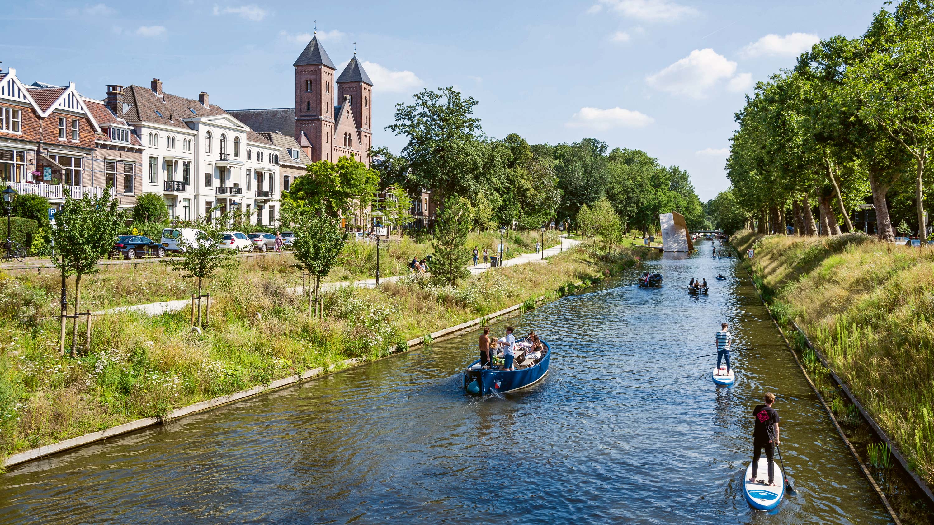
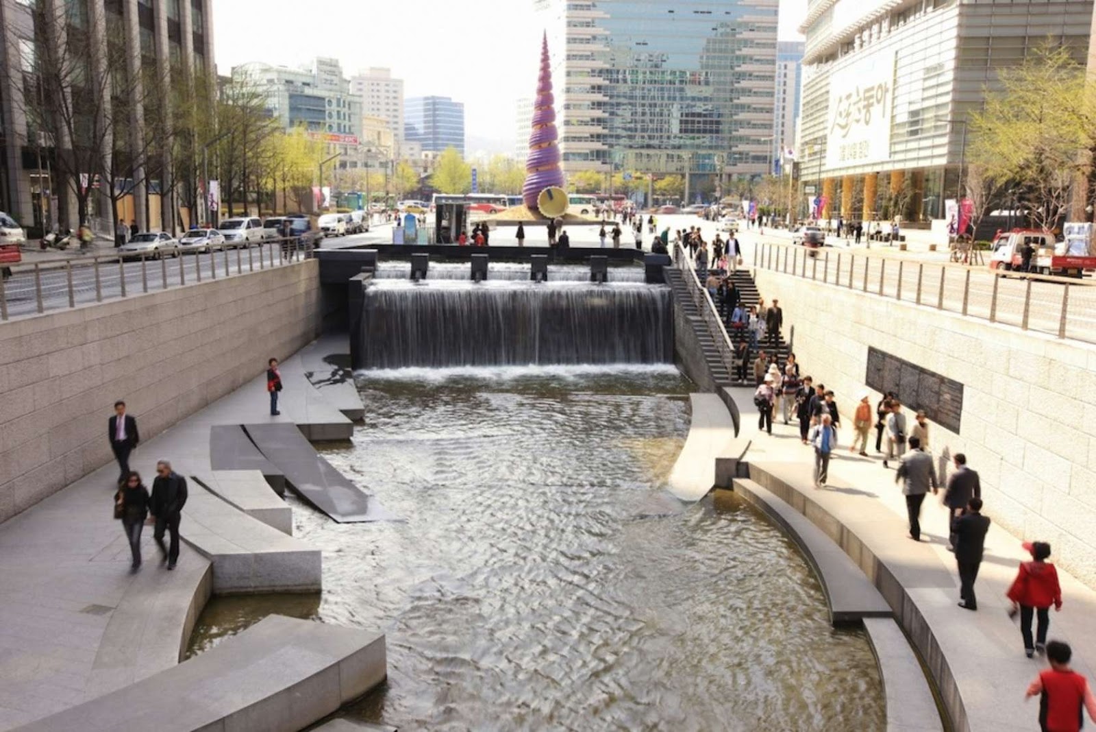
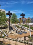
When the Mass turnpike gets flooded in the next couple years this type of public space can happen between the Seaport and West Station. Maybe 2080?It's not supposed to be navigable for merchant ships -- it's supposed to be an amazing urban place. Picture Utrecht's Catharjinesingel Canal, or Seoul's Chongae:
When I play connect-the-parcels here, it is usually for a surface light rail line and pedestrianway.
The problem with actual water is that it becomes an actual channel for superstorm inundation...I'd want to make sure it isn't an end run around the Fort Point Channel flood barrier.
When I play connect-the-parcels here, it is usually for a surface light rail line and pedestrianway.
The problem with actual water is that it becomes an actual channel for superstorm inundation...I'd want to make sure it isn't an end run around the Fort Point Channel flood barrier.
Nor I, but intuitively it seems like it would provide more circulation which would help give dead-end canals like Fort Point an occasional flush. I often wondered if the reason why Wollaston is the absolute worst beach is because the marshes and causeway out to Squantum allow shit to collect due to lack of circulation, because it's lovely on the far side of Squantum. Anyway, bit of a digression but that second photo shows pathways into the water and my first thought was "gross". But it would be amazing if you could swim in the channel, provided there are some submerged platforms or pool-like enclosures.I'm nothing even close to a civil engineer, but my understanding is that it's possible that a properly managed canal can actually help to mitigate flood risk. I know this is what they're looking into doing in Corpus Christi, at least.
Can anyone really plagiarize a pie in the sky recipe?
<<cough cough>>Thwaite's Glacier <<cough cough>>We don't really need to do anything for this to become a reality. Sea level rise is going to create multiple Seaport Canals.