Green Line Reconfiguration

I went on a Green Line adventure a couple of weeks ago, and have some assorted observations.

Crossovers (switches): yeah, I noticed the same southbound crossover situation you did; to be honest, I assumed (perhaps naively) that it would be trivial to add a new diamond along there [between the soutbound tracks south of Park St]. If we're talking about building a new subway along Marginal Road (to say nothing of the more elaborate suggestions in this thread), my hope is that it would be easier to add a new crossover in an existing tunnel. But it's totally a fair point that I don't know any of the potential complexities around that.
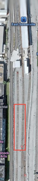
The set of stairs just south of the platform does push any potential new crossovers a bit further south. The other major barriers to new crossovers are the vertical beams holding the tunnel up, which run between the southbound tracks. However, there is a break in those beams for the existing crossover (with a new set of beams "picking up the slack" along that stretch, between the center two tracks), so my hope is that it would be easy enough to convert that from a merging crossover to an X crossover.

Longwood: I walked across Longwood on Longwood Ave going from Longwood station to Longwood Medical Area station. (My kingdom for some variation in names.) I wanted to compare it to a commute I used to do from South Station to the Old State House which, at 11 minutes, felt like a useful point of comparison as a walk that teeters on the edge of convenience; as a young able-bodied person, on a good day the walk across the Financial District was fine. If it was raining, or snowing, or hot & humid, or just really cold (those streets become goddamn wind tunnels), it was a real bummer.

(In theory, that commute should've been done by changing for the Orange Line at Back Bay. In the morning, the problem was that the Orange Line was often overcrowded and delayed. In the afternoon, I prioritized being able to get a good seat for the ride back to Providence, which was a lot harder at Back Bay.)

In any case, my personal reaction was that the "last mile" from the D's Longwood station was generally comparable to the Financial District one: a 10-12 minute walk itself is okay, and it increasingly sucks as the environmental conditions get worse. In this respect, the situation in Longwood is not ideal, but not unprecedented. That 10-12 minute walk would also get you to most of the major hospitals, including all of the Beth Israels as well as the Yawkey Center; Boston Children's teeters on the edge of that range. This brings me back to the Francis St ("Netherlands") infill concept: a new stop at Francis St would put Brigham & Women's within a <10 min walkshed of the D Line, which would cover the majority of the hospitals.

One thing that did really strike me: as we've discussed many times before, damn those streets are narrow. I don't know what the answer is, but funneling large numbers of people through small areas is what transit is good at, so...

And speaking of narrow: those E Line platforms, e.g. at Longwood Medical Area, are bracingly narrow. I know this is obvious to everyone who uses them, but I hadn't myself in a while, and it's really arresting to see firsthand.

Overall, these were all useful datapoints for me. I don't think my mind has particularly changed on any of the proposals in this thread (which I suppose is concerning, suggesting confirmation bias), though I think the narrow platforms are a good additional justification for building a proper subway.

The C Line: man, that train goes slowly. The crossing through Beacon Junction was taken at walking speed. At street level, my app measured in-motion speeds between 7 and 10 mph. The stop request system was in full-force (this was a Sunday), and the train glided through skipped stops at that same andante 7-10 mph. But the train also stopped and held at a bunch of traffic lights.

Both of these reflect the extremely porous nature of the surface branches with respect to their built environment. You really do get the sense that a pedestrian might suddenly appear, crossing the ROW, at any time. (The very narrow pre-renovation platforms also contribute to this.) The B & C represent the extreme of this, but all of it speaks to (in my opinion) the defining characteristic of light rail: how quickly can a train stop and how much damage will a collision cause.

On a more whimsical note, I was reminded just how gorgeous the C Line is. The canopy of trees along the ROW is really beautiful.

St Mary's St and Park Dr: we have periodically discussed the possibility of some kind of circumferential service running via Park Drive, with a walking transfer to the C Line at Audubon Circle (Beacon St & Park Dr). This has always been recognized as less than ideal. That being said, the conditions "on the ground" make me relatively unconcerned about the distance itself. There is clear line of sight between the station and the intersection -- it doesn't "feel" like it's that far away. Additionally, with some reconfiguration and reclamation of the street, it would probably be possible to build a sidewalk along the median, extending from the platform to the intersection, providing a direct route while still remaining in the "transit zone". (This sidewalk could also be covered to provide protection from the elements, reducing inconvenience further.)

I've previously suggested that a transitway along Park Dr could provide a minimally interrupted ROW from B to D, by reclaiming the western two lanes, and closing the Park & Medfield intersection and the western end of the Park & Buswell intersection. That would enable a single crossing at Beacon St (potentially plus a pair of on-request pedetrian crossings at the closed intersections) while providing an otherwise unimpeded ROW from Mountfort St to Riverway. I didn't see anything in particular that would cause a problem for such an alignment along Park Dr (although there were a lot of trees -- seemingly more than I see on the satellite right now -- along Park Dr, which would need to be relocated).

Mountfort St and crossing the Mass Pike: I didn't spend as long poking around here, but unfortunately I didn't see anything that made this particular problem any easier to solve. The intersection of St Mary's & Mountfort is elevated, with a modest incline to the west on Mountfort. BU's College of Engineering strikes an imposing figure on the other side of the Pike. Some sort of decked ROW over the Pike -- possibly intersecting the existing St Mary's St overpass at-grade -- could maybe work, but that's a fair amount of money to spend for a connection that still won't be ideal.

One dynamic that emerged more clearly is how surprisingly restricted this area is for north-south circulation, whether transit or traffic. For almost an entire mile, from Amory St to Kenmore Sq, there are essentially only two paths to travel south from the Pike. The first is at the Mountfort/Essex/BU Bridge expanded intersection, which feeds into Carlton St (as well as a more roundabout route you get funneled on to along Mountfort and then Park Dr). The second is St Mary's St. And... that's it. Essex St deadends at a playground before it can reach Beacon St, and Cummington, Hinsdale, and Blandford Malls are all truncated, producing a whole half-mile where Comm Ave is completely cut off. Combined with the River to the north, and it actually turns that part of Comm Ave into a bit of a "pedestrian peninsula", with very limited egress.
 
^ Great comments!

In theory, yes, the walk from the D branch's Longwood station seems tolerable. But as I just posted in the Transit Data & Analysis thread, when LMA riders face a choice between the two branches for inbound trips, much more riders choose the E's LMA and Brigham Circle stations.

My current impression is that: The walk from Longwood (D) can be tolerable if that's the only option, but it's still less attractive than even a Huntington Ave station, never mind one in "LMA interior".

Also, the D branch can't capture any of the academic institutions: it's not a deal-breaker, but should still be kept in mind.

I'll reply to the other points at a later date.
 
Does anyone know what happened to the art on the signs at the BU West stop after the consolidation? Did it get sold to the MBTAgifts store out in Cambridge?

 
Does anyone know what happened to the art on the signs at the BU West stop after the consolidation? Did it get sold to the MBTAgifts store out in Cambridge?

So I actually know the answer to this question. They were put in a dumpster. I know some guys on campus that found the dumpster and may have rescued a couple items but the art was too big to move and so it is in some landfill somewhere now.
 
So I actually know the answer to this question. They were put in a dumpster. I know some guys on campus that found the dumpster and may have rescued a couple items but the art was too big to move and so it is in some landfill somewhere now.
Oh that's disappointing to hear. I thought the BU vs other school art was pretty neat.
 
What if the ridership at Green Line surface stops are merged onto a single station?

This grew out of an attempt at understanding how dense the B and C branches are, and whether any grade-separation with "metro-level" stop spacing is justified.

In this main text, I use Fall 2024 weekday data at all time periods and all directions. Importantly, this includes both boardings and alightings. This is because the E branch's boardings vs. alightings are heavily skewed; but a side effect is that these numbers will be 2x as large as what you typically see (which usually only include boardings).

Color scheme: <1k, 1-2k, 2-3k, 3-4k, 4-6k, 6-10k, 10-18k, >18k

  • Boston College: 786
  • "Chestnut Hill Ave": 2016 (up to Chiswick Rd, 3 stops)
  • "Washington St": 2259 (2 stops)
  • "Allston St": 3331 (up to Griggs St, 3 stops)
  • Harvard Ave: 2694
  • Packard's Corner: 1208
    • 3902 if Harvard Ave and Packard's Corner are combined into one
  • "Amory St": 1622 (2 stops)
    • 2830 if the three stations from Packard's Corner and Amory St are combined into one
  • "BU East": 2482 (up to Blandford St, 3 stops)
  • "Cleveland Circle": 1412 (up to Englewood Ave, 2 stops)
  • "Washington Sq": 2899 (up to Fairbanks St, 4 stops)
    • Dean Rd is near the midpoint between Cleveland Circ and Washington Sq; I arbitrarily put it towards the latter (more inbound). Same for Brandon Hall and Hawes St below.
  • "Coolidge Corner": 5007 (up to St. Paul St, 4 stops)
  • "St. Mary's St": 1889 (3 stops)
  • "Heath St": 904 (up to Back of the Hill, 2 stops)
  • "Mission Park": 1724 (2 stops)
    • Riverway has higher ridership than Mission Park
  • "LMA": 4130 (3 stops)
    • If Fenwood-Brigham and LMA are separate, they have 2433 and 1697 respectively
  • "MFA-Northeastern": 3238 (2 stops)
    • If separate, they have 1158 and 2080 respectively
  • Symphony: 3002
  • Prudential: 4946
  • Riverside: 2410
  • Woodland thru Eliot: 463, 420, 540
  • Newton Highlands thru Chestnut Hill: 803, 915, 843
  • Reservoir and Beaconsfield: 1065, 781
  • Brookline Hills and Village: 752, 1456
  • Longwood and Fenway: 1433, 1276
  • Kenmore: 12076
  • Hynes: 15416
  • Copley: 19909
  • Arlington: 12819
  • Boylston: 10612
  • Medford/Tufts through Magoun Sq: 2777, 1248, 1072
  • Gilman Sq through East Somerville: 2817, 737
  • Union Sq: 1423
  • Lechmere and Science Park: 3485, 1906
  • North Station and Haymarket: 18270, 8833 (incl. transfers from OL)
  • Maverick 21497, Airport 14029
  • Wonderland and Orient Heights ~10k
  • Revere Beach and Beachmont 6-7k
  • Wood Island and Suffolk Downs <4k
  • Harvard, Central, Kendall ~20k
  • Charles/MGH 16151
  • Alewife, Davis, Porter ~10k
  • South Station 31801
  • JFK/UMass 14383
  • Ashmont 10822
  • Broadway, Andrew, Fields Corner, North Quincy, Quincy Center ~7k
  • Wollaston 4701
  • Savin Hill, Shawmut, Quincy Adams, Braintree 3-4k
  • North Station 19381
  • Malden Center 14622
  • Sullivan Sq 9645
  • Oak Grove, Wellington, Assembly, Community College, Haymarket 7.5-8.5k (Haymarket incl. transfers from GL)
  • Back Bay 20986
  • Forest Hills and Ruggles ~15k
  • Tufts Medical Center and Chinatown 8.5-10k
  • Jackson Sq, Roxbury Crossing, Mass Ave 7-8k
  • Green St and Stony Brook ~4.5k
Caveat: I suspect that ridership figures at non-gated Green Line stations may be bugged -- the GL counts all seem too low, considering the actual experience at these stops and onboard.

Note: A few stations have chunks of their ridership come from their roles as job destinations, such as E branch, "inner D branch", B branch in BU, RL North to Harvard, and Airport. I did a separate analysis that aims to focus primarily on residences. I won't share it now, but can post it if there's interest.


Among the "surface" branches, the biggest winners are:
  • Coolidge Corner, Prudential, and "LMA Combined"
    • Yes, Prudential is somewhat cheating
  • Allston St, and the general Allston Village/BU West area (depending on how they're combined)
  • MFA-Northeastern and Symphony
How do these combined stations compare to others systemwide?
  • Higher than all GLX stations, except Lechmere
    • Surprising given how dense Somerville is
    • But could be due to bugs and/or people still getting used to GLX
  • But worse than most HRT stations, and only comparable to the lowest-tier ones, such as:
    • Suffolk Downs, Quincy Adams, Shawmut
    • Wollaston, Stony Brook
So yeah, the comparison to HRT isn't encouraging. When Coolidge Corner, with one of the highest (localized) densities in the region, only has ridership comparable to much less populous stations like Wollaston and Stony Brook... That's weird.

(continued below)
 
Does this necessarily argue against grade-separating the surface branches (such as a Huntington subway or a B branch subway)? I don't think so:
  • Green Line data may be bugged
  • Better speed and reliability will naturally increase ridership in itself
  • Frequency is another factor: Stations with shorter wait time can also draw more riders
    • Each individual GL branch today doesn't run that frequently: every 8 minutes, almost as bad as each RL branch
    • Hynes and Kenmore get 3-5x as many riders as Prudential and Symphony walksheds -- I suspect frequency is a reason
This exercise does give us some takeaways, however.


Further justification of Huntington subway

The E branch's 4 reservation stops (Norheastern through Brigham) are very strong, as shown here yet again. Out of the consolidated stops that I proposed, the E has the closest stop spacing, yet each of them has consistently high ridership.


Adding Coolidge Corner to the conversation?

The fact that Coolidge Corner ranks #1 among my consolidated stations is a nice surprise. Combining this and its high density, it suggests that a holistic Green Line improvement proposal may need to give it more consideration.

Many questions remain, however:
  • Should an "improved Coolidge Corner service" be the C branch itself, or something independent of the C branch, or even something that replaces the (outer) C branch?
  • Does it suffice for the "improved service" to only offer crosstown connections? Such a route won't help riders heading to downtown Boston, which is likely the majority.
  • If a radial "improved service" is implemented -- and is not entirely via Beacon St -- then what should happen to the original C branch and the rest of Beacon St?
  • How strong of an argument do Coolidge Corner and the C branch really make, in light of the entire region?
    • Many other neighborhoods don't even have a rapid transit line to downtown Boston yet, and desperately need one: Roxbury, Dorchester, Chelsea, Everett, (most of) Revere, etc.
    • Compared to them, Coolidge Corner is already privileged
  • Build a TBM tunnel from Coolidge Corner to LMA, which feeds into the Huntington Ave subway that continues to downtown (as opposed to Kenmore)
  • Have the outer C branch feed into this subway, as the primary pattern for Coolidge Corner
  • A shuttle train runs on the inner C branch, between Coolidge Corner and Kenmore
  • If you really want to spend the $$, the TBM tunnel can have another branch that continues north to Harvard Ave or Allston St areas, forming "66-Huntington" or "57-Huntington" patterns

(continued below)
 
Is the Green Line trunk also too slow, not just the branches?

Coolidge Corner and Quincy Center having the same travel time really surprised me, so I took a closer look.

Within a fixed time (5 min, 10 min, ...), how far can you go on each line?

For this analysis, I used the period of January 6-24, 2025, to avoid slow zones before and after. All travel times are taken from TransitMatters dashboard,

TimeGreen (from Park or GC)Orange (from DTX or State)Blue (from State)Red (from Park or DTX)
5 minCopley, 11.6 mph
North Stn-Science Pk, 7.8 mph
Mass Ave, 17.7 mph
Comm. College-Sullivan, 20.6 mph
Airport, 21.0 mphCentral, 24.5 mph
Andrew, 23.4 mph
10 min(B/C/D) Kenmore, 10.7 mph
(E) Symphony, 9.9 mph
(GLX) North of Lechmere, 10.1 mph
Roxbury Crossing, 17.5 mph
Wellington, 19.4 mph
Orient Heights, 21.6 mphHarvard, 20.6 mph
(A) Savin Hill, 21.0 mph
15 min(B) BU East, 9.8 mph
(C) Hawes St, 10.9 mph
(D) Fenway-Longwood, 10.5 mph
(E) MFA, 9.0 mph
(GLX) Union Sq, 9.8 mph
(GLX) Gilman Sq, 12.6 mph
Green St-Forest Hills, 18.0 mph
Malden Center, 20.7 mph
Revere Beach, 20.7 mphDavis, 19.7 mph
(A) Shawmut, 19.8 mph
(B) North Quincy, 26.0 mph
20 min(B) Babcock St, 9.2 mph
(C) Coolidge Corner, 10.4 mph
(D) Brookline Hills, 12.0 mph
(E) Brigham Circle, 8.2 mph
(GLX) Medford/Tufts, 13.7 mph
17 min to Forest Hills, 17.4 mph
19 min to Oak Grove, 18.3 mph
17 min to Wonderland, 19.3 mph19 min to Alewife, 18.6 mph
(A) 18 min to Ashmont, 18.7 mph
(B) Quincy Center, 25.2 mph
25 min(B) Harvard Ave, 9.1 mph
(C) Washington Square, 9.6 mph
(D) Reservoir, 12.3 mph
(E) Riverway, 7.4 mph
(B) Quincy Adams, 24.3 mph
30 min(B) Warren St, 8.9 mph
(C) Englewood Ave, 9.4 mph
(D) Chestnut-Newton, 14.4 mph
(E) 28 min to Heath St, 7.4 mph
(B) 29 min to Braintree, 23.8 mph

Almost all heavy rail lines finish their entire half-line trips from downtown within 20 minutes, and reach their 2nd last stop within 15 minutes. The only exception is the much longer Braintree branch, which still only takes 29 minutes.

But 20 minutes on the Green Line barely gets you to the "66 bus zone", sometimes even less. This is what happens when the Green Line runs at half the speed of the HRT lines.

But this is true even for the core Green Line tunnel within downtown!
From Park St, the Green Line still takes 10 minutes to get to Kenmore, at a measly 10.7 mph. The HRT lines have all advanced beyond their analogous "first transfer nodes", consistently running 17+ mph.

Why? We can first make a few guesses:
  1. Human-imposed speed limits. According to anonymous Green Line operators, there's a speed limit of 25 mph through almost the entire GL system, even including grade-separated tunnels. The D branch and GLX are the only exceptions.
  2. Stops are too close together. Between North Station and Copley, Green Line stations are roughly 1,300-1,700 ft apart, which is too close by rapid transit standards. Whereas for HRT, southside Orange Line has stops consistently every 2,500-3,000 ft. Even that is on the shorter side for rapid transit, both in Boston and worldwide.
  3. Interlining, congestion signals. Due to factors such as Government Center loop and the flat junction as Copley, trains may face more hurdles than HRT would through their core trunks. They're also likely to be waiting for another train right ahead. A presumably older signal system certainly doesn't help.
  4. Dwell times. Due to much lower capacity per vehicle, trains may take more time within the stations.
In my opinion, #2 and #4 can be largely ruled out as primary factors:
While #2 (stop spacing) is a factor, it's far from the worst. Orange Line has similar stop spacing between North Station and TMC, and it still runs 12.6 mph. The analogous Green Line segment, from North Station to Arlington, only runs 7.9 mph.

#4 (dwell times) can obviously be improved with Type 10s, but a quick look suggests that Green Line's dwell times are fairly typical:
  • Green Line (westbound): North Sta 62s, Haymarket 45s, GC 54s, Park St 70s, Boylston 39s, Arlington 39s, Copley 67s, Hynes 55s, Kenmore 46s
  • Orange Line (southbound): North Sta 34s, Haymarket 47s, State 59s, DTX 51s, Chinatown 44s, TMC 16s, Back Bay 62s
  • Red Line (southbound): Harvard 68s, Central 61s, Kendall 55s, Charles 59s, Park St 67s, DTX 64s, South Sta 14s (??)
  • Blue Line (eastboun): GC 49s, State 51s, Aquarium 42s, Maverick 56s, Airport 47s
Between #1 and #3, I'm not sure which one is more detrimental. But I think the learning point is:

Any GLR proposal should be coupled with advocacy to speed up Green Line trains in the main tunnels themselves.
 
Last edited:
Is the Green Line trunk also too slow, not just the branches?

Coolidge Corner and Quincy Center having the same travel time really surprised me, so I took a closer look.

Within a fixed time (5 min, 10 min, ...), how far can you go on each line?

For this analysis, I used the period of January 6-24, 2025, to avoid slow zones before and after. All travel times are taken from TransitMatters dashboard,

TimeGreen (from Park or GC)Orange (from DTX or State)Blue (from State)Red (from Park or DTX)
5 minCopley, 11.6 mph
North Stn-Science Pk, 7.8 mph
Mass Ave, 17.7 mph
Comm. College-Sullivan, 20.6 mph
Airport, 21.0 mphCentral, 24.5 mph
Andrew, 23.4 mph
10 min(B/C/D) Kenmore, 10.7 mph
(E) Symphony, 9.9 mph
(GLX) North of Lechmere, 10.1 mph
Roxbury Crossing, 17.5 mph
Wellington, 19.4 mph
Orient Heights, 21.6 mphHarvard, 20.6 mph
(A) Savin Hill, 21.0 mph
15 min(B) BU East, 9.8 mph
(C) Hawes St, 10.9 mph
(D) Fenway-Longwood, 10.5 mph
(E) MFA, 9.0 mph
(GLX) Union Sq, 9.8 mph
(GLX) Gilman Sq, 12.6 mph
Green St-Forest Hills, 18.0 mph
Malden Center, 20.7 mph
Revere Beach, 20.7 mphDavis, 19.7 mph
(A) Shawmut, 19.8 mph
(B) North Quincy, 26.0 mph
20 min(B) Babcock St, 9.2 mph
(C) Coolidge Corner, 10.4 mph
(D) Brookline Hills, 12.0 mph
(E) Brigham Circle, 8.2 mph
(GLX) Medford/Tufts, 13.7 mph
17 min to Forest Hills, 17.4 mph
19 min to Oak Grove, 18.3 mph
17 min to Wonderland, 19.3 mph19 min to Alewife, 18.6 mph
(A) 18 min to Ashmont, 18.7 mph
(B) Quincy Center, 25.2 mph
25 min(B) Harvard Ave, 9.1 mph
(C) Washington Square, 9.6 mph
(D) Reservoir, 12.3 mph
(E) Riverway, 7.4 mph
(B) Quincy Adams, 24.3 mph
30 min(B) Warren St, 8.9 mph
(C) Englewood Ave, 9.4 mph
(D) Chestnut-Newton, 14.4 mph
(E) 28 min to Heath St, 7.4 mph
(B) 29 min to Braintree, 23.8 mph

Almost all heavy rail lines finish their entire half-line trips from downtown within 20 minutes, and reach their 2nd last stop within 15 minutes. The only exception is the much longer Braintree branch, which still only takes 29 minutes.

But 20 minutes on the Green Line barely gets you to the "66 bus zone", sometimes even less. This is what happens when the Green Line runs at half the speed of the HRT lines.

But this is true even for the core Green Line tunnel within downtown!
From Park St, the Green Line still takes 10 minutes to get to Kenmore, at a measly 10.7 mph. The HRT lines have all advanced beyond their analogous "first transfer nodes", consistently running 17+ mph.

Why? We can first make a few guesses:
  1. Human-imposed speed limits. According to anonymous Green Line operators, there's a speed limit of 25 mph through almost the entire GL system, even including grade-separated tunnels. The D branch and GLX are the only exceptions.
  2. Stops are too close together. Between North Station and Copley, Green Line stations are roughly 1,300-1,700 ft apart, which is too close by rapid transit standards. Whereas for HRT, southside Orange Line has stops consistently every 2,500-3,000 ft. Even that is on the shorter side for rapid transit, both in Boston and worldwide.
  3. Interlining, congestion signals. Due to factors such as Government Center loop and the flat junction as Copley, trains may face more hurdles than HRT would through their core trunks. They're also likely to be waiting for another train right ahead. A presumably older signal system certainly doesn't help.
  4. Dwell times. Due to much lower capacity per vehicle, trains may take more time within the stations.
In my opinion, #2 and #4 can be largely ruled out as primary factors:
While #2 (stop spacing) is a factor, it's far from the worst. Orange Line has similar stop spacing between North Station and TMC, and it still runs 12.6 mph. The analogous Green Line segment, from North Station to Arlington, only runs 7.9 mph.

#4 (dwell times) can obviously be improved with Type 10s, but a quick look suggests that Green Line's dwell times are fairly typical:
  • Green Line (westbound): North Sta 62s, Haymarket 45s, GC 54s, Park St 70s, Boylston 39s, Arlington 39s, Copley 67s, Hynes 55s, Kenmore 46s
  • Orange Line (southbound): North Sta 34s, Haymarket 47s, State 59s, DTX 51s, Chinatown 44s, TMC 16s, Back Bay 62s
  • Red Line (southbound): Harvard 68s, Central 61s, Kendall 55s, Charles 59s, Park St 67s, DTX 64s, South Sta 14s (??)
  • Blue Line (eastboun): GC 49s, State 51s, Aquarium 42s, Maverick 56s, Airport 47s
Between #1 and #3, I'm not sure which one is more detrimental. But I think the learning point is:

Any GLR proposal should be coupled with advocacy to speed up Green Line trains in the main tunnels themselves.
Don't neglect dwell times. When the Green Line is busy trains take a long time in stations allowing passengers to fight their way out of and onto the tight aisle cars. And there is a corner of every car that is "trapped" away from an active door when the boarding changes sides (shift from side to island platform -- Government Center, Park). The dwell time is absolutely long compared to the number of passengers being shifted off and onto the cars.
 
Last edited:
Is the Green Line trunk also too slow, not just the branches?

Coolidge Corner and Quincy Center having the same travel time really surprised me, so I took a closer look.

Within a fixed time (5 min, 10 min, ...), how far can you go on each line?

For this analysis, I used the period of January 6-24, 2025, to avoid slow zones before and after. All travel times are taken from TransitMatters dashboard,

TimeGreen (from Park or GC)Orange (from DTX or State)Blue (from State)Red (from Park or DTX)
5 minCopley, 11.6 mph
North Stn-Science Pk, 7.8 mph
Mass Ave, 17.7 mph
Comm. College-Sullivan, 20.6 mph
Airport, 21.0 mphCentral, 24.5 mph
Andrew, 23.4 mph
10 min(B/C/D) Kenmore, 10.7 mph
(E) Symphony, 9.9 mph
(GLX) North of Lechmere, 10.1 mph
Roxbury Crossing, 17.5 mph
Wellington, 19.4 mph
Orient Heights, 21.6 mphHarvard, 20.6 mph
(A) Savin Hill, 21.0 mph
15 min(B) BU East, 9.8 mph
(C) Hawes St, 10.9 mph
(D) Fenway-Longwood, 10.5 mph
(E) MFA, 9.0 mph
(GLX) Union Sq, 9.8 mph
(GLX) Gilman Sq, 12.6 mph
Green St-Forest Hills, 18.0 mph
Malden Center, 20.7 mph
Revere Beach, 20.7 mphDavis, 19.7 mph
(A) Shawmut, 19.8 mph
(B) North Quincy, 26.0 mph
20 min(B) Babcock St, 9.2 mph
(C) Coolidge Corner, 10.4 mph
(D) Brookline Hills, 12.0 mph
(E) Brigham Circle, 8.2 mph
(GLX) Medford/Tufts, 13.7 mph
17 min to Forest Hills, 17.4 mph
19 min to Oak Grove, 18.3 mph
17 min to Wonderland, 19.3 mph19 min to Alewife, 18.6 mph
(A) 18 min to Ashmont, 18.7 mph
(B) Quincy Center, 25.2 mph
25 min(B) Harvard Ave, 9.1 mph
(C) Washington Square, 9.6 mph
(D) Reservoir, 12.3 mph
(E) Riverway, 7.4 mph
(B) Quincy Adams, 24.3 mph
30 min(B) Warren St, 8.9 mph
(C) Englewood Ave, 9.4 mph
(D) Chestnut-Newton, 14.4 mph
(E) 28 min to Heath St, 7.4 mph
(B) 29 min to Braintree, 23.8 mph

Almost all heavy rail lines finish their entire half-line trips from downtown within 20 minutes, and reach their 2nd last stop within 15 minutes. The only exception is the much longer Braintree branch, which still only takes 29 minutes.

But 20 minutes on the Green Line barely gets you to the "66 bus zone", sometimes even less. This is what happens when the Green Line runs at half the speed of the HRT lines.

But this is true even for the core Green Line tunnel within downtown!
From Park St, the Green Line still takes 10 minutes to get to Kenmore, at a measly 10.7 mph. The HRT lines have all advanced beyond their analogous "first transfer nodes", consistently running 17+ mph.

Why? We can first make a few guesses:
  1. Human-imposed speed limits. According to anonymous Green Line operators, there's a speed limit of 25 mph through almost the entire GL system, even including grade-separated tunnels. The D branch and GLX are the only exceptions.
  2. Stops are too close together. Between North Station and Copley, Green Line stations are roughly 1,300-1,700 ft apart, which is too close by rapid transit standards. Whereas for HRT, southside Orange Line has stops consistently every 2,500-3,000 ft. Even that is on the shorter side for rapid transit, both in Boston and worldwide.
  3. Interlining, congestion signals. Due to factors such as Government Center loop and the flat junction as Copley, trains may face more hurdles than HRT would through their core trunks. They're also likely to be waiting for another train right ahead. A presumably older signal system certainly doesn't help.
  4. Dwell times. Due to much lower capacity per vehicle, trains may take more time within the stations.
In my opinion, #2 and #4 can be largely ruled out as primary factors:
While #2 (stop spacing) is a factor, it's far from the worst. Orange Line has similar stop spacing between North Station and TMC, and it still runs 12.6 mph. The analogous Green Line segment, from North Station to Arlington, only runs 7.9 mph.

#4 (dwell times) can obviously be improved with Type 10s, but a quick look suggests that Green Line's dwell times are fairly typical:
  • Green Line (westbound): North Sta 62s, Haymarket 45s, GC 54s, Park St 70s, Boylston 39s, Arlington 39s, Copley 67s, Hynes 55s, Kenmore 46s
  • Orange Line (southbound): North Sta 34s, Haymarket 47s, State 59s, DTX 51s, Chinatown 44s, TMC 16s, Back Bay 62s
  • Red Line (southbound): Harvard 68s, Central 61s, Kendall 55s, Charles 59s, Park St 67s, DTX 64s, South Sta 14s (??)
  • Blue Line (eastboun): GC 49s, State 51s, Aquarium 42s, Maverick 56s, Airport 47s
Between #1 and #3, I'm not sure which one is more detrimental. But I think the learning point is:

Any GLR proposal should be coupled with advocacy to speed up Green Line trains in the main tunnels themselves.
To chime in on this as an operator, yes, the tunnel is 25 mi/h -- at maximum. There are long stretches where it is even less at 15, 10, or even 6. Some of the signals could also be reconfigured to smoothen the operation out. There's a timelight at Park Street on the west where if you approach it at the correct speed it now (as of a few weeks ago) makes you wait 43 seconds. The double yellows at Government Center and Haymarket that allowed trains to follow departing trains into the station were converted in the winter to be single reds until the train ahead is fully clear, which only serves to increase the interstation time (though following a train in is hardly a consistent practice at the stations where it's still permitted).

The actual interstation time can also vary wildly from the mean. All it takes is one train to have a long dwell at Boylston east and all of a sudden you have 3 trains waiting outside the station; that signal is one of the larger and more unexpected logjams in the station.
 

Back
Top