Stations would be where? Will this be another tedious bus route like the Silver Line?From other info I've seen, the eventual route of the light-rail urban ring line tunnel through the Harvard Allston campus is as marked by the red dashed line. It would tie into the abandoned Red Line subway tunnel near the Charles Hotel in Brattle Square.
You are using an out of date browser. It may not display this or other websites correctly.
You should upgrade or use an alternative browser.
You should upgrade or use an alternative browser.
Harvard - Allston Campus
- Thread starter statler
- Start date
Well see what BU has to say about that. Their plan is for the urban ring to cross by the BU bridge, and tie in with commuter rail and the green line.
Note that this is where CT2 crosses. CT1 CT2 and CT3 are phase 1 of the urban ring. Honestly, theyre something like phase 0.01, but they follow routes that the MBTA thinks should have urban rong access.
Note that this is where CT2 crosses. CT1 CT2 and CT3 are phase 1 of the urban ring. Honestly, theyre something like phase 0.01, but they follow routes that the MBTA thinks should have urban rong access.
Charlie_mta
Senior Member
- Joined
- Jul 15, 2006
- Messages
- 5,150
- Reaction score
- 7,779
Ablarc,
Harvard University wants the route I indicated to be light rail in a tunnel It would connect to and utilize the portion of old tunnel under Brattle Square that used to be the Red Line. When the Red line was extended, the old tunnel plus a portion of the old Harvard Square station were preserved for this purpose.
The main reason they want this is to give a fast, traffic-free connection between their original campus and the new one in Allston.
I haven't seen station locations, but there would definitely be the one in Harvard Square, plus I assume a few spaced appropriately south of the river.
stellarfun
Senior Member
- Joined
- Dec 28, 2006
- Messages
- 5,726
- Reaction score
- 1,586
Here is another map, taken from the draft Harvard IMP. The dotted purplish line would be the Urban Ring route, and would be either a tunnel or surface route on or under the new street, Stadium Way. Note that the route crosses Cambridge St. and angles southeastward toward the proposed transportation center near the BU Bridge.From other info I've seen, the eventual route of the light-rail urban ring line tunnel through the Harvard Allston campus is as marked by the red dashed line. It would tie into the abandoned Red Line subway tunnel near the Charles Hotel in Brattle Square.

Harvard owns all the land covered by the route, both the land in white and the land in yellow at Allston Landing. The land in white is land that Harvard plans to build on at some point during the IMP timeframe, which goes out decades.
In the draft IMP, there is mention of a station at Western Ave., near the former WGBH building. Kz in the earlier post narrating the conversation he had with a construction manager at the Science Complex site made mention that the north side WGBH building and the former New England Book Depository building may be demolished next year. That timing might make sense if they were planning on tunneling under Stadium Way and making provision for a station in that general area.
stellarfun
Senior Member
- Joined
- Dec 28, 2006
- Messages
- 5,726
- Reaction score
- 1,586
Ablarc,
I haven't seen station locations, but there would definitely be the one in Harvard Square, plus I assume a few spaced appropriately south of the river.
Charlie_mta, if they go to a tunnel, I can envision one new station near the stadium, a second at Western Ave near the Science I complex now being built, a third eventually somewhere around Allston Landing, and a fourth on Comm Ave near the BU Bridge. If they went tunnel, I think they'd transition to an at-grade or elevated structure once the track / roadway was near Cambridge St. and Allston Landing.
I can understand the interest in light rail, particularly if there is little or no ability to turn buses at the Harvard / Brattle end. Whether the frquency of service would necessitate dual roadways or tracks the entire route would be another factor.
IMO, it would be in Harvard's interest to construct the basic box for any tunnel at the time they are digging up the campus for new buildings and streets, rather than finish building and landscaping, only to then then tear it up anew. I wouldn't expect Harvard to do the tunnel under the Charles, but it would be easier and cheaper to put in a tunnel box while they are doing heavy construction along some of the route, rather than defer tunnel construction until 20 or 30 years from now.
stellarfun
Senior Member
- Joined
- Dec 28, 2006
- Messages
- 5,726
- Reaction score
- 1,586
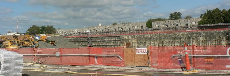
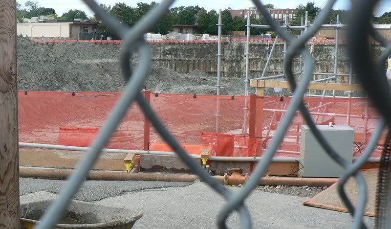
Pictures are from Sept. 7.
First, a future Harvard wind farm? Only a cad would suggest that Harvard would build a windfarm along the north side of Western Ave. between Soldiers Field Road and N. Harvard St. on all that commercial property it bought and is now doing geochemical and geophysical drilling on. But if not there, then where?
The base of the new anemometer in a stormwater runoff and filtration pond near Soldiers Field Road, west of the stadium.
The mast of the new anemometer. Must be at least 100-120 feet high. Measuring wind velocities at that height suggests they are not measuring the wind to ensure that track and field times are not wind-aided.
Trying to outguess Harvard; Part A. Harvard is clearing out businesses from Harvard-owned property that is slated to be the site of the Science II complex. Science II is to the west of Science I, which is under construction. Why is Harvard doing this now? Do they soon intend to construct the utlities and subgrade infrastructure for Science II? Is Harvard going to move certain Harvard administrative operations from the properties it owns at the NW corner of N. Harvard St and Western Ave, which are sited where future athletic venues are supposedly to be built? Is Harvard simply going to use this space to stage construction activities for Science I.
The VW dealership on Western Ave. Leaving as of the end of this month.
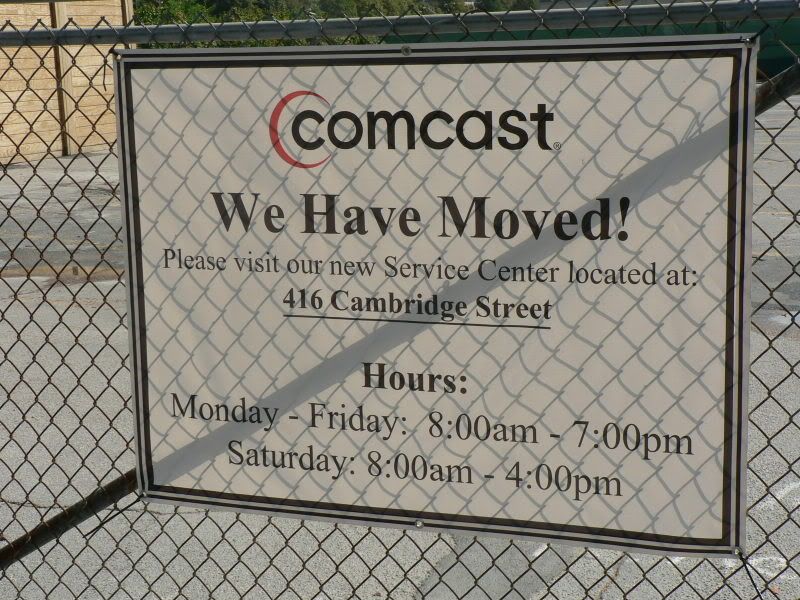
The Comcast service center. Harvard demolished the eastern half of the Comcast building for Science I construction, and did some rehab on the remaining western half. Coimcast stayed a while, but its now hone.
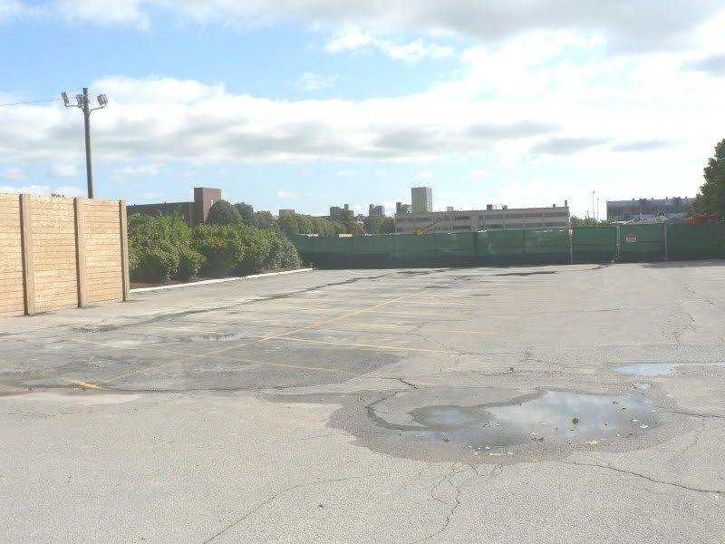
Note more of the Great Wall of Allston (south of the VW dealership).
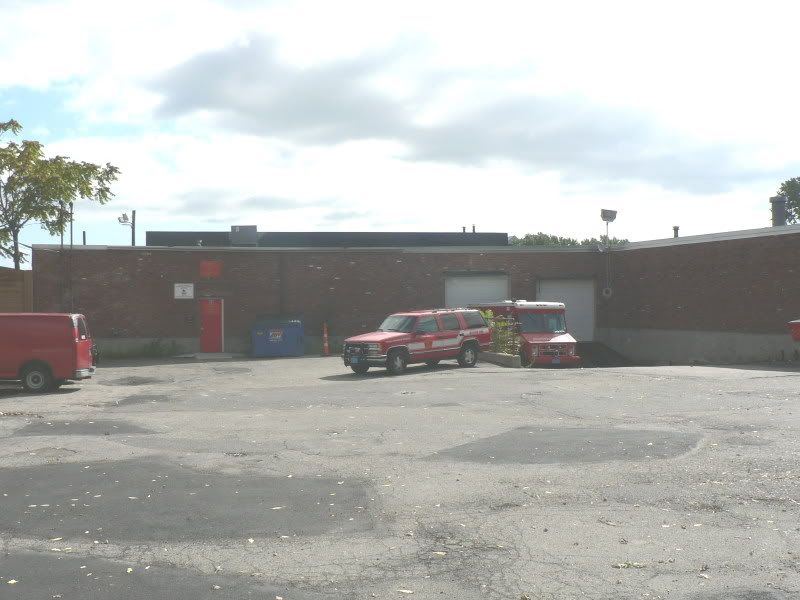
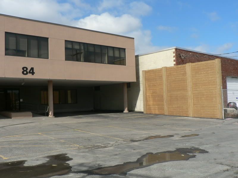
A Boston Fire Dept. facility. This is to the south of Comcast, and part of the back of 84 Seattle St, which Harvard also owns. Harvard is moving the BFD facility to another location west of N. Harvard St. (A dead giveway to Harvard owned commercial buildings in this area was the use of large address numerals.)
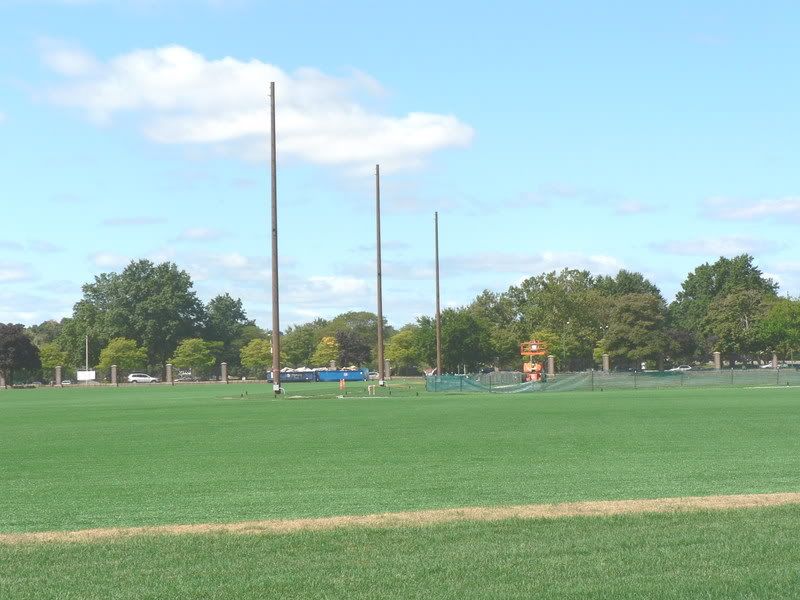
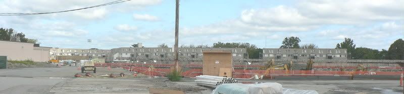
Trying to outguess Harvard; Part B: Harvard is nearly done constructing at least two,and perhaps three, field turf fields NW of the stadium near Soldiers Field Road. None of these venues looks to be set out for track and field; the current track and field field is south of the stadium abutting N. Harvard St., and presumably would be a site foir an indoor athletic facility.
Looking NE from near Soldiers Field Rd.
Looking west:
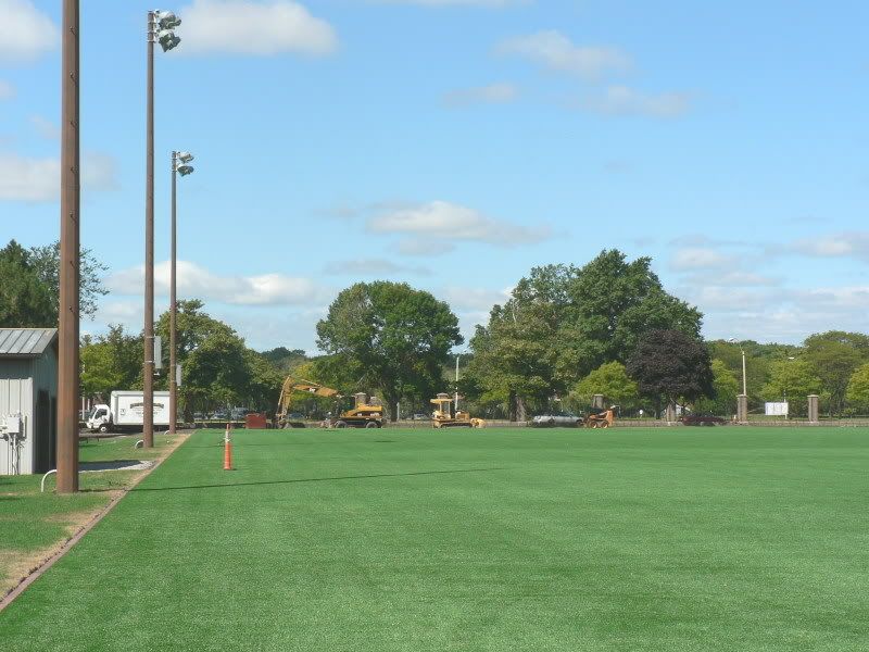
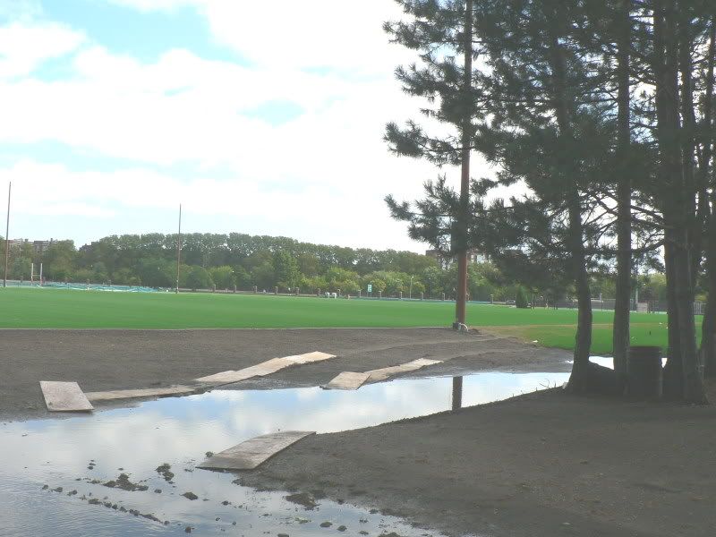
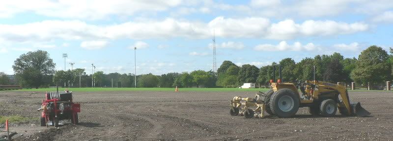
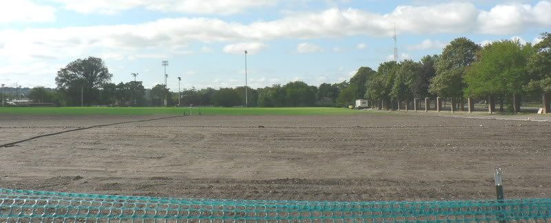
Harvard has nearly completed building two new natural grass soccer fields, west of the stadium, near Soldiers Field Road.
Looking NW
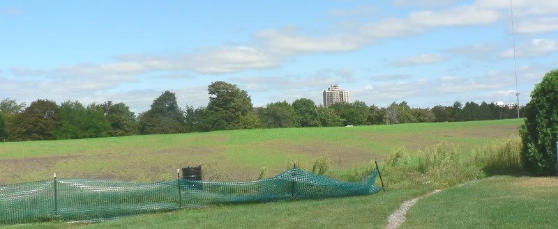
Looking south, completing final grading.
Harvard's current 2 and a half soccer fields, between Harvard Business School and Charlesview. In the draft IMP, Harvard's Graduate School of Education was to move here. Rashly speculating, perhaps Harvard is thinking of building some of the indoor athletic venues on this site, and shifting the Graduate School of Education buildings to near Barry's Corner, on the west side of N. Harvard St. where Harvard presently has buildings for certain administrative operations. Harvard's construction priorities in Allston are new undergraduate residence houses, and new athletic venues (so current indoor venues can be demolished to build the new residence houses.) Would seem to make little sense to move the soccer fields, unless you planned on soon building on them.
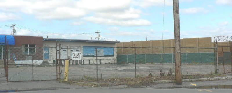
Finally, some construction pictures of the $1 billion Science I complex:
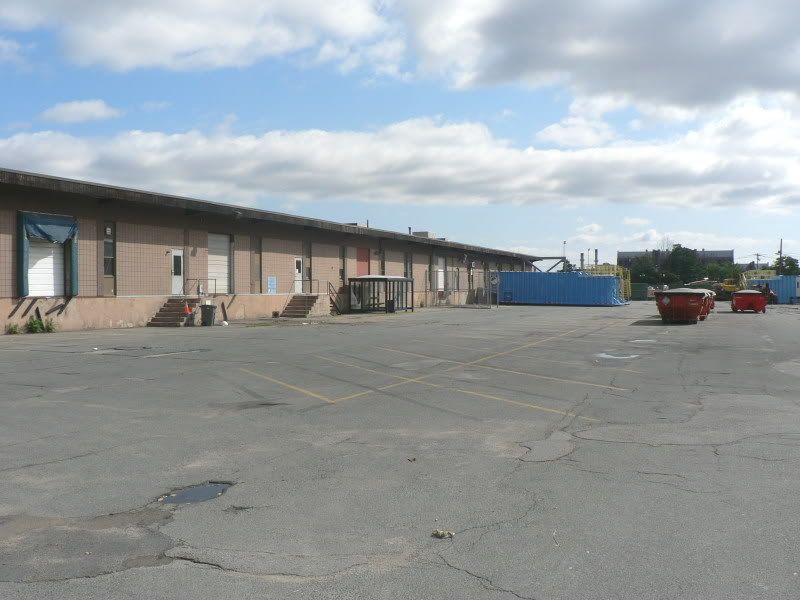
Looking west and northwest. The white paneled door buildings are part of the Boston Fire Dept. facility I believe. The buff-colored end wall is what remains of the old Comcast building:
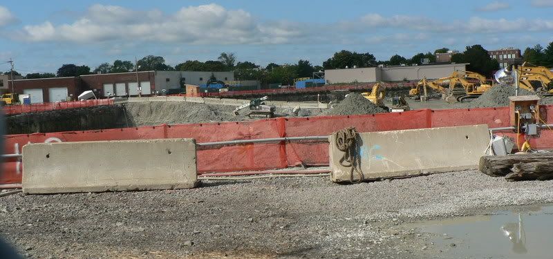
Looking SW from Western Ave.
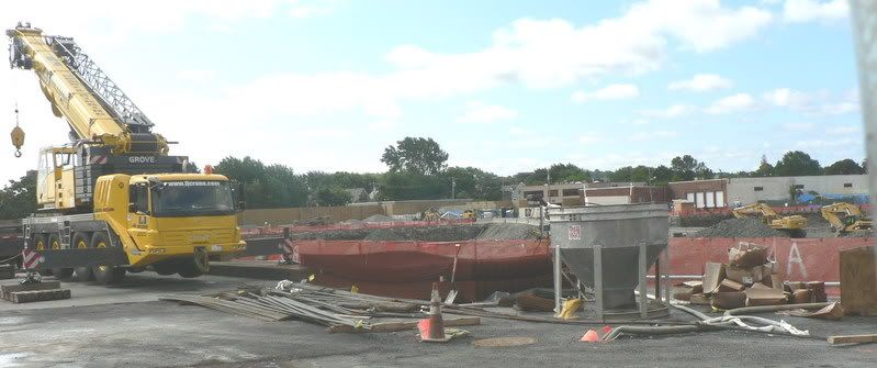
Looking north from Seattle St.
The sole remaining industrial property Harvard does not own near its Science I complex. Windom St. Note more of the Great Wall of Allston.
First, a future Harvard wind farm? Only a cad would suggest that Harvard would build a windfarm along the north side of Western Ave. between Soldiers Field Road and N. Harvard St. on all that commercial property it bought and is now doing geochemical and geophysical drilling on. But if not there, then where?
The base of the new anemometer in a stormwater runoff and filtration pond near Soldiers Field Road, west of the stadium.
The mast of the new anemometer. Must be at least 100-120 feet high. Measuring wind velocities at that height suggests they are not measuring the wind to ensure that track and field times are not wind-aided.
Trying to outguess Harvard; Part A. Harvard is clearing out businesses from Harvard-owned property that is slated to be the site of the Science II complex. Science II is to the west of Science I, which is under construction. Why is Harvard doing this now? Do they soon intend to construct the utlities and subgrade infrastructure for Science II? Is Harvard going to move certain Harvard administrative operations from the properties it owns at the NW corner of N. Harvard St and Western Ave, which are sited where future athletic venues are supposedly to be built? Is Harvard simply going to use this space to stage construction activities for Science I.
The VW dealership on Western Ave. Leaving as of the end of this month.
The Comcast service center. Harvard demolished the eastern half of the Comcast building for Science I construction, and did some rehab on the remaining western half. Coimcast stayed a while, but its now hone.
Note more of the Great Wall of Allston (south of the VW dealership).
A Boston Fire Dept. facility. This is to the south of Comcast, and part of the back of 84 Seattle St, which Harvard also owns. Harvard is moving the BFD facility to another location west of N. Harvard St. (A dead giveway to Harvard owned commercial buildings in this area was the use of large address numerals.)
Trying to outguess Harvard; Part B: Harvard is nearly done constructing at least two,and perhaps three, field turf fields NW of the stadium near Soldiers Field Road. None of these venues looks to be set out for track and field; the current track and field field is south of the stadium abutting N. Harvard St., and presumably would be a site foir an indoor athletic facility.
Looking NE from near Soldiers Field Rd.
Looking west:
Harvard has nearly completed building two new natural grass soccer fields, west of the stadium, near Soldiers Field Road.
Looking NW
Looking south, completing final grading.
Harvard's current 2 and a half soccer fields, between Harvard Business School and Charlesview. In the draft IMP, Harvard's Graduate School of Education was to move here. Rashly speculating, perhaps Harvard is thinking of building some of the indoor athletic venues on this site, and shifting the Graduate School of Education buildings to near Barry's Corner, on the west side of N. Harvard St. where Harvard presently has buildings for certain administrative operations. Harvard's construction priorities in Allston are new undergraduate residence houses, and new athletic venues (so current indoor venues can be demolished to build the new residence houses.) Would seem to make little sense to move the soccer fields, unless you planned on soon building on them.
Finally, some construction pictures of the $1 billion Science I complex:
Looking west and northwest. The white paneled door buildings are part of the Boston Fire Dept. facility I believe. The buff-colored end wall is what remains of the old Comcast building:
Looking SW from Western Ave.
Looking north from Seattle St.
The sole remaining industrial property Harvard does not own near its Science I complex. Windom St. Note more of the Great Wall of Allston.
stellarfun
Senior Member
- Joined
- Dec 28, 2006
- Messages
- 5,726
- Reaction score
- 1,586
I'll be 71 when harvard considers building on this land. That is an extremely scary thought to me, yet at the same time exciting to see harvard (and technology for that matter. Maybe the internet will be completely neural or something by then--matrix???)in 50 years.
Rather than sidetrack the Genzyme thread, I'll post this reply in the Harvard Allston thread.
I think by the time you're 71, Harvard will have decided what to do about this Allston Landing property, and probably it (or others) will have built something there. Its just that Harvard has pretty much exhausted its ideas for what it hopes to build in Allston over the next several decades.
(The draft IMP did not cover all the land Harvard owns, and continues to acquire on the north side of Western ave. between the city park/playground (Smith field) and Soldiers Field Road. The BRA is asking Harvard to describe potential future uses for this land in the final IMP.)
To some extent, Harvard is playing musical chairs with the moves into Allston. For instance,
> when the Graduate School of Education moves, that frees up four or five large buildings in Cambridge, west of Brattle Sq., for some other Harvard entity.
> when the School of Public Health moves, that will free up space in Longwood for Harvard Medical School.
> when new undergraduate residence houses are built in Allston, that will eventually free up current housing (the Quad) NW of Harvard Sq for graduate students.
The one Harvard school that looks to be expanding substantially in Allston is the Business School, which is projected to add 500,000 sq ft of new space.
In total, Harvard has identified building between 8 and 10 million square feet of new buildings in Allston over the next 3-4 decades, not counting anything that would be built in Allston Landing, nor anything built along the northern side of Western Ave. (supra).
---And there is the hundreds of thousands of sq ft it owns and occupies in the old Watertown Arsenal. Might it some day acquire more of the Arsenal?
kz1000ps
Senior Member
- Joined
- May 28, 2006
- Messages
- 9,187
- Reaction score
- 13,718
Designing new Harvard neighborhoods
By Andreae Downs
Globe Correspondent / September 21, 2008
After years of planning and negotiation, a vision for North Allston's future is taking shape. In meetings with the Boston Redevelopment agency over the past several months, the neighborhood is starting to agree to an outline for how residents would like the see the streets and shopping areas of Allston evolve.
At a Community Wide Planning meeting for North Allston and Brighton earlier this month, city-hired consultants asked residents whether they could agree that they had reached consensus on improvements to the area's roads, open space, and shopping districts so that those plans could be moved forward.
Among these items were the planting of trees along neighborhood streets, creating public pedestrian- and bike-ways through Harvard's existing and proposed Allston Campus, and any other new developments, easing access to the parks along the Charles River, creating or improving neighborhood open space and access to any Harvard-created park areas, protecting neighborhoods from being replaced with dorms and college buildings, making Barry's Corner (the intersection of North Harvard Street and Western Avenue) more vibrant, and improving mass transit.
The Cecil Group, consultants hired by the Boston Redevelopment Agency, provided a checklist of areas of agreement about "what makes a great neighborhood" to roughly 45 residents who attended the meeting.
The goal of the planning process is to present Harvard with a clear idea of what the neighborhood wants and expects as the university develops its new campus. The university now owns much of the land north of the turnpike, but detailed plans for the new campus have not yet emerged.
Steven Cecil, founder of the urban planning and design firm, acknowledged there was still controversy about certain areas of the neighborhood and how they should be developed.
Chief among these is Brighton Mills, the now mostly-closed strip mall, once a rope factory, that is slated to be developed into affordable housing to replace the crumbling Charlesview Apartments now located at Barry's Corner.
"This area is central to the neighborhood," Cecil said at the meeting. "It lies between two residential areas, the Mass. Turnpike and the Charles."
A neighborhood group has already proposed a plan for the area, which includes 13 acres beyond what is currently slated for the Charlesview Apartments. Meanwhile, neighbors await revised plans for the apartment complex, which were promised for September. The private, nonprofit board of the Charlesview said earlier this summer that it would address neighborhood and BRA concerns about the density and height proposed in the initial plans, among other things.
Cecil said that the challenge planners faced at the Brighton Mills and the nearby Holton Street corridor was to find a development that would make enough money to warrant tearing down what is now there.
But residents quickly pointed out that Harvard's objectives in developing in Allston were not just about turning a profit on any particular block, but also about advancing the university's goals, which could include putting staff and faculty housing in nearby neighborhoods, keeping areas abutting its campus particularly livable and vibrant, and providing recreation and open space for students and faculty.
"You can't visualize the Allston neighborhood in a traditional market way," said Bruce Houghton of the Harvard Task Force. "You have to assume that this area is owned by a rich institution that would like a healthy and vibrant neighborhood for the benefit of its mission."
The BRA's Community Wide Planning process includes a Sept. 24 meeting on transportation with the Boston Transportation Department, the MBTA, and the Executive Office of Transportation and meetings in October and November. For a complete outline, visit www.cityofboston.gov/bra/ and follow the links to planning initiatives or call Carlos Montanez at 617-918-4442.
Link
kz1000ps
Senior Member
- Joined
- May 28, 2006
- Messages
- 9,187
- Reaction score
- 13,718
Stopping traffic before it starts near expanded Harvard
By Andreae Downs
Globe Correspondent / October 5, 2008
Transportation and gridlock at the Allston offramps and throughout the neighborhood are already an issue in North Allston/Brighton.
But with Harvard planning massive investment and development, with thousands of additional employees and students to descend on the roughly 600 acres between the Mass. Turnpike and the river, residents worry that both air quality and quality of life may suffer.
So a Boston Redevelopment Authority meeting last month at the Honan-Allston library branch drew more than 50 concerned residents and elected officials or their staffs to hear from top transportation officials and experts.
But many left griping that their questions and remarks could not be aired - the meeting was taken up primarily with PowerPoint presentations. Speakers included the city-hired Cecil Group, consultants whose job is to collect residents' comments and present a workable plan for the neighborhood; Harvard's Development Group for its Allston campus; and a representative from the Executive Office for Transportation, who gave an overview of plans for an urban ring - bus transit that that would connect the Longwood Medical Area, Boston University, and Harvard's Allston and Cambridge campuses.
Harry Mattison, a member of the Harvard Allston Task Force, said, "There's just not enough time, either tonight or in the schedule" of fall meetings. "We are miles apart on the issues: on bridges over the river, on how we get over the Pike."
In a later interview, Jessica Shumaker, spokeswoman for the BRA, said that while the fall was packed with other community planning meetings, after the winter holidays there would "absolutely" be additional time for resident questions and feedback on streets and transit.
In the limited time allowed, neighbors panned a Cecil Group suggestion to mitigate traffic on Western Avenue and North Harvard Street by expanding capacity on Lincoln and Everett streets. They were also skeptical of a proposal to put a parking garage near the Turnpike offramps. This was put forward as a way to keep cars out of the neighborhood, but also as part of a "multimodal transit hub" that would include, eventually, rail on what are now CSX freight lines, a bike rental/bike rack area, bus connections, and the planned urban ring.
The presentations did not explore redesigning the Turnpike ramps, which several planners conceded would have to happen - in a meeting earlier this year, speakers had noted that the ramps are dropping concrete on the rail lines below. Similarly, the neighborhood's often-requested stop on the commuter rail lines running along the Turnpike were mentioned only as a long-term (15 to 25 years) benefit.
"I am just shocked to hear that this now can't happen in my lifetime," said Len Kelliher, 75 , a lifelong resident.
"I hear from constituents all the time about getting a rail stop in the neighborhood," said Representative Kevin Honan, a Democrat from Brighton. "People have come back saying it's not economically feasible. But with recent development" - he cited the New Balance headquarters and St. Elizabeth's Hospital - "it's time to revisit that."
Putting parts of Storrow Drive underground was also touted, but not by all, as a way to open up the neighborhood to the river parks. Proposals to add pedestrian-activated signals, as suggested by Harvard's representatives, would "push traffic into the neighborhoods," according to Paul Berkeley, a member of the Harvard Allston Task Force .
"We want" a depressed Storrow Drive "in the mix," said Tim McHale of Litchfield Street. Additionally, "Harvard has to come up with a new traffic plan that generates zero new trips."
Harvard's Joe Beggan took a half-hour to show the group what the university's planners envision so far; creating more connections across the river to Harvard Square and south across the Turnpike (to link to the Longwood Medical Area) are essential, Beggan said.
Harvard's plans would make pedestrians and bikes more welcome, and provide better access to transit. Their sketches included bike lanes along Western Avenue and North Harvard Street, bike and pedestrian paths through the campus and to the river, and bus lanes that would also be for bicyclists.
But Galen Mook, a BU student representing Allston Brighton Bikes, questioned whether speeding buses and bikes could safely mix. He also pointed out the weaknesses of painted, rather than substantially separated, bike lanes.
On Commonwealth Avenue, near BU, where new bike lanes have recently been painted, "three bikes were hit by cars last week," he said. "Bikes should be separated from cars with a curb."
The university is also talking about creating a new street, Stadium Way, that would parallel North Harvard Street and could be where the urban ring buses could have a dedicated right-of-way.
Finally, all planners touted so-called "mobility hubs," consisting of a kiosk with rental bikes, wireless Internet, and real-time information on when buses or shuttles would arrive, maps, and information on how to connect with other transportation options. These hubs are low-cost, and increase commuters' non-automobile options, they said.
Link
czsz
Senior Member
- Joined
- Jan 12, 2007
- Messages
- 6,043
- Reaction score
- 8
Theory:
Practice:
a representative from the Executive Office for Transportation, who gave an overview of plans for an urban ring
Practice:
Similarly, the neighborhood's often-requested stop on the commuter rail lines running along the Turnpike were mentioned only as a long-term (15 to 25 years) benefit.
"I am just shocked to hear that this now can't happen in my lifetime," said Len Kelliher, 75 , a lifelong resident.
stellarfun
Senior Member
- Joined
- Dec 28, 2006
- Messages
- 5,726
- Reaction score
- 1,586
Interesting views on mixing market-price and affordable in the same building, in this instance, a high-rise with views of the Charles.
(The subhead is not grammatical.)
http://www.thecrimson.com/article.aspx?ref=524762
(The subhead is not grammatical.)
Harvard Profs Weigh in on Charlesview Design
Urban planning professors say that density is not a problem but that concerns about segregation
Published On 10/21/2008 1:01:32 AM
By NAN NI
Crimson Staff Writer
In the 1960s, the Charlesview Apartments were born amid fervent community protests, built upon the rubble of homes razed in the name of urban renewal.
Now, nearly four decades later, the aging and dilapidated buildings are about to be given a second life: the affordable housing complex will relocate to land further down Western Avenue in the coming years, giving residents more modern facilities on the Harvard?s dime and handing control of the site?s prime real estate to the University.
But while both Harvard officials and the owners of Charlesview say they are pleased with the deal, the community protests are back. The soon-to-be neighbors of the relocated buildings have expressed strong concerns about the design of the new complex, saying that the plan will lead to too much density and could segregate residents based on income.
The Crimson contacted five urban planning experts at the Harvard?s Graduate School of Design for an independent assessment of the Charlesview plan, which was drafted by Community Builders Inc., a non-profit urban housing developer.
Four of the five academics said they agreed that the proposal was mostly in line with principles of good design, and that while the density issue may be overblown, there is some merit to the residents? criticisms of whether the plan sufficiently integrates affordable and market-rate units.
The professors also said that Allston residents should withhold their judgment until more concrete plans are presented because numbers and two-dimensional grids cannot give a true sense of how effective a design will be.
?Neighborhood residents without exception will speak against buildings that are denser and new developments in general,? said Brent Ryan, a professor of urban planning at the Design School. ?From what I can see so far, people anywhere else would say that they are getting a pretty good deal from an urban design perspective.?
BEYOND THE NUMBERS
According to Allston/Brighton North Neighbors Forum President Tim McHale, the neighborhood?s opposition to the Charlesview plan is anything but your typical Not-In-My-Backyard obstructionism. The objections, McHale says, are over what the residents see as specific flaws in the design.
?We really want Charlesview in the neighborhood, but it has got to be done right,? he said.
McHale says that residents are most concerned about the height and density of the proposed project because it would change the feel of the residential neighborhood, which has an average density of 25 units per acre and few buildings over four stories high.
The proposed Charlesview plan has an average density of 55 units per acre, and includes one 10-story tower on the north side of Western Avenue and a series of four- and six-story buildings on the Brighton Mills site on a total of 6.9 acres of land. The 10-story building consists of 118 condominiums, and lower-elevation buildings contain 282 affordable housing units. The current Charlesview apartments consists of 213 units on 4.5 acres of land.
But several urban planning experts said they disagreed with Hale?s view that the new Charlesview would be too dense, noting that adding density and height are not necessarily detrimental to a neighborhood.
?Taller buildings can be better because they hold the scale of the street together,? Ryan said. ?Along a wide road like Western Avenue, adding some height is in line with good urban design principles.?
James Stockard, the curator of the Design School?s Loeb Fellowship, pointed out that some of Boston?s most desirable neighborhoods?Back Bay, Beacon Hill, and South Bay?are also the neighborhoods with the highest densities.
?Density does not have to do with desirability,? he said. ?That is a practical question determined by what it?s really like for people on the street.?
Martin Zogran, a professor of urban design, said that the debate over density could obscure discussion about the more important issues that could make or break Charlesview?s relocation.
?Rather than arguing over the number of units or the number of acres, they should really be looking at the design and what will provide the best environment going forward,? he said.
SEPARATE BUT EQUAL?
Even more contentious than the issue of density is the matter of socioeconomic segregation, which Allston residents say is a key factor in determining whether the new Charlesview will be an asset to Allston residents or a blight that hastens the deterioration of the neighborhood.
The urban planning experts voiced mixed opinions on whether the separation of the market rate condos and the affordable rentals would lead to the social inequities foreseen by concerned neighbors, who have compared the proposal to failed public housing projects that concentrated impoverished residents in enormous buildings.
Nicolas P. Retsinas, the director of Harvard?s Joint Center for Housing, a project of the Design School and the Harvard Kennedy School, called the comparisons of the Charlesview proposal and decades-old public housing ?historically inaccurate,? noting that the proposed apartments are much smaller in scale and more integrated with the neighborhood.
?It?s not a fair comparison because we have not built warehouses for poor people,? he said. ?While I think that we have learned over time the importance and the potential value of a mixed income community, that is not to say that every single street or building has to have mixed income.?
But some urban planning professors did express some sympathy to the residents? concerns.
Susan B. Fainstein ?60 said that while mixed-income housing is generally accepted as a tenet of good design, there could also be benefits to keeping the Charlesview residents together instead of splitting them into two buildings.
?People don?t necessarily want to be moved to a mixed income community because to do so would be to break up the existing community,? she said.
Fainstein also added that many housing studies have shown that within mixed-income developments, there is usually little relationship between people of different classes.
Zogran said that he supports a more even mix of affordable and market-rate units between the condo tower and the lower-rise in order to promote social equity.
?From appearances, it seems that the best units are really going to the market-rate units, which enjoy a view of the river and proximity to the park,? he said. ?A more even mix wouldn?t stigmatize the affordable units visually and separate them spatially.?
Guy D. Stuart, a public policy lecturer at the Kennedy School, was even more severe in his evaluation of the proposal, criticizing not only the segregation of rich from poor, but also of town from gown.
?I think segregation is bad planning, because it perpetuates social conflict and injustice,? he said in an e-mail. ?Furthermore, it is unnecessary for a university to segregate itself from the community in which it exists.?
Stuart suggested that Harvard?s developers should study Oxford and Cambridge for examples of universities that have successfully woven themselves into their cities.
?The debate about the Charlesview development is a debate about alternative visions for Allston,? he said. ?One vision is an integrated community where town and gown live, shop and work side-by-side. Another is one in which the community is segregated, town from gown, with the hope that ?connections? and intersections? will somehow mitigate the planned segregation.?
A PROPER ROLE
Stuart is not the only one calling on Harvard to reconsider its role in the Allston community.
This summer, McHale?s Allston/Brighton North Neighbors Forum?with the help of Sy Mintz, the now-retired architect who designed the original Charlesview?drew up a counter proposal framework that solves both the density and segregation problem.
The ABNNF framework calls for approximately 640 mixed-income units interspersed with new retail, spread out over the 28 additional acres of the Harvard-owned Holton Street Corridor, which is adjacent to the proposed Charlesview relocation site.
The additional land is not currently included in Harvard?s 50-year master plan for development in Allston.
?Our plan requires Harvard to transact some land that they have no plans for,? McHale said. ?The best use of this land is for housing, parks, retail, and open space that will knit the neighborhoods back together.?
Harvard?s Director of Community Relations Kevin A. McCluskey ?76 said that the University will continue to refine the plan for Charlesview on its current plot, allowing Boston?s review process to address resident concerns.
?We?re working within the framework we?ve been operating in for a few years now, a framework that was established after many constructive conversations,? McCluskey said. ?We think that this proposal is the appropriate place for our attention to be in.?
In April, the Boston Redevelopment Authority issued its scoping determination for the Charlesview relocation, a 200-page document that gives comments and suggestions on how Community Builders?which is responsible for the redesign?can improve the proposal key issues such as neighborhood connectivity, density, and public realms.
?The truth is, I think that whatever is to be built, we expect to be built to very high standards,? said the BRA?s deputy director for institutional development, Michael F. Glavin.
A spokeswoman for Community Builders said that the firm expects to submit its altered plan for consideration in early 2009.
While the urban planning experts said they agreed that Harvard should be vigilant of relocation negotiations, several said that the University?s decision to take a hands-off approach is understandable.
?Harvard is not a developer for building affordable housing,? Stockard said. ?By choosing a firm that has a reputation for addressing community concerns, they have taken the first step in being responsible.?
Ryan cautioned against focusing on any one element of the ongoing discussions to shape Charlesview, adding that the planners involved had many angles to consider simultaneously.
?Factors such as urban design, land usage, and social equity all occur in tandem and it is difficult to disentangle them,? he said. ?Could I predict, right now, whether Harvard?s current plan will be social failure or an absolute success? Absolutely not.?
http://www.thecrimson.com/article.aspx?ref=524762
AdamBC
Active Member
- Joined
- Feb 28, 2007
- Messages
- 596
- Reaction score
- 19
I've mostly sat to the side on this issue, but some of the points made in this article make me wonder what kind of a city Boston is or wants to be. Simply put, widely mixed income housing rarely works. I have a buddy who lived in East Boston in one of the new condo developments near Maverick Square. Due to the lack of demand for Eastie condos, the developer filled out the rest of the building with section 8 housing to ensure they hit the occupancy level desired.
This was news to my buddy and he quickly learned the issues when the families would put 10 family members in one 3- bedroom apartment. Or when the neighbor was beating his wife and when the police showed up at my buddy's door he had to let the police inspect his g/f for bruises. That said, mixed income works if you're mixing incomes by mixing 700sq ft 1-BR apts with 3000 sq ft 1-BR apts (and so on up the chain to 4-BR apts) and charging the 'market rate' for each square footage. This ensures that people of different incomes live together and they all feel each other is paying a 'fiar share'. Vouchers would only ensure the entire building becomes voucher housing before long.
That said, the real issue I have with some of the comments in the article shows how ignorant people are with regards to their place in history. People will block the construction of a new residential/commercial building out of selfish reasons - be it they can see the water from their roof deck or the amount of blue sky they can see from their front door. These people don't consider the stifling effect their NIMBY-ism has on the city. The true importance of these buildings won't be felt for another generation. Preventing new buildings from going up only decrease the jobs available for your children/makes it too expensive for them to live in the city you grew up in.
I get it... we swung too far during the 60's and lost the West End and Scolley Square to bland concrete jungle gyms - but now we've swung too far the other direction where selfish people can prevent a city from growing upward for over a decade. A correlated problem is the type of concern aired - instead of demanding timeless architecture that lives up to the standard set by the Hancock Tower or the Trinity Church or even Rowes Wharf, the objectors will rant about height and shadows of a tower - damn the consequences on what the building looks like in the end. If people were more concerned with how the building looked rather than how many blades of grass will no longer receive direct sunlight for e^i hours a day, Boston could be a beacon of architectural promise, rather than a beacon of stymied projects.
Finally, I despise the concept of 'mandatory open space' - a major part of the urbanity of the area is that there are few buffers between buildings - buildings often push up to the lot lines. The idea of building the 'tower in the park' is deeply flawed in that it encourages the idea of suburban development at the cost of land use and urban feel. The parks that are built are rarely frequented by the denizen of the tower above as they are not 'smart space.' These expanses of concrete, brick and planters push retail uses or cafes to other lots, making the 'park' an undesirable place to tarry. Don't get me wrong - parks are an important part of a city - the Common, the Public Garden, Post Office Square - but open space for it's own sake often plays out as dead space that people rush through to get to the more 'urban' areas (City Hall Plaza, the Greenway, any brick/grassy area within the 'Pru campus').
I have more rants about the above article, but I feel some sleep is in order.
stellarfun
Senior Member
- Joined
- Dec 28, 2006
- Messages
- 5,726
- Reaction score
- 1,586
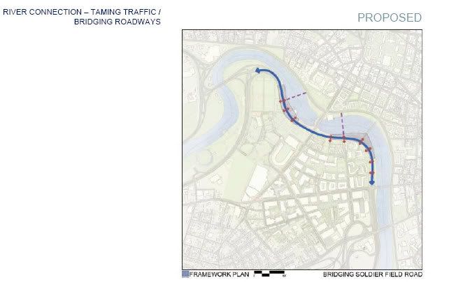
Harvard has posted graphics sketching proposed changes to the draft IMP for Allston to the web.. One of the transportation maps shows the alignment for a possible Urban Ring transit tunnel running from between south of Harvard Sq. and the Mass Pike. They also seem to have abandoned the idea of decking Soldiers Field Rd near N. Harvard St. I'll try and post pics of several of the graphics when I get a chance later.
http://www.allston.harvard.edu/imp/Harvard in Allston Master Plan Concepts_10.22.08.pdf
http://www.allston.harvard.edu/imp/Harvard in Allston Master Plan Concepts_10.22.08.pdf
stellarfun
Senior Member
- Joined
- Dec 28, 2006
- Messages
- 5,726
- Reaction score
- 1,586
The road and transportation map:
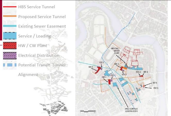
The earlier version of decking Soldiers Field Rd.
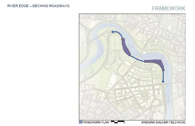
The current version, deck gone.
Barry's Corner (lower left) with general building type schematic
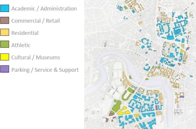
Barry's Corner with buildings. (Harvard does not yet own the buildings with dark gray roofs in the highlight area)
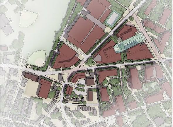
Barry's Corner rendering
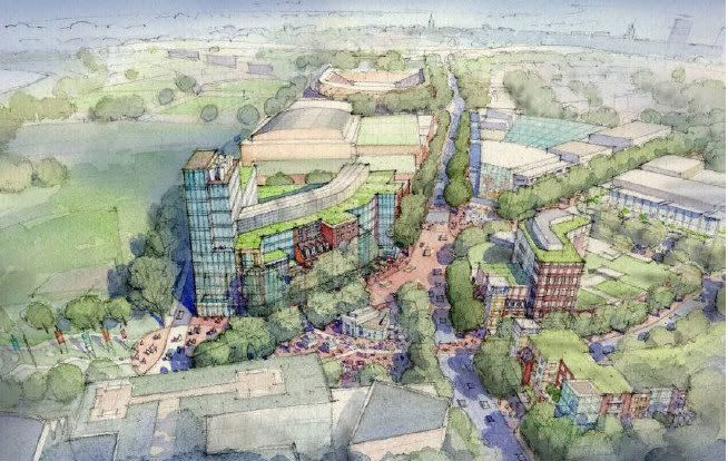
IMO, the mass and height of the buildings as shown in the rendering are reflective of what Harvard would like to build, and gain approval for via the final IMP. I doubt the rendering represents even a preliminary design for the buildings.
The earlier version of decking Soldiers Field Rd.
The current version, deck gone.
Barry's Corner (lower left) with general building type schematic
Barry's Corner with buildings. (Harvard does not yet own the buildings with dark gray roofs in the highlight area)
Barry's Corner rendering
IMO, the mass and height of the buildings as shown in the rendering are reflective of what Harvard would like to build, and gain approval for via the final IMP. I doubt the rendering represents even a preliminary design for the buildings.
Last edited:
kz1000ps
Senior Member
- Joined
- May 28, 2006
- Messages
- 9,187
- Reaction score
- 13,718
Residents find faults with Harvard architects' plans
Traffic and shadows voiced as concerns

By Andreae Downs
Globe Correspondent / November 2, 2008
As Harvard's architects last month unveiled the university's revised master plans for what are now acres of concrete, cars, and industrial buildings in North Allston, neighbors grumbled about traffic, shadows, and being totally outgunned.
"Isn't there a process so we aren't coming here every Wednesday night to argue about plans with a bunch of people who are paid a lot more than we are?" asked Tom Lally of Alcott Street. "We need someone to help us understand this."
The plans include contingencies for an underground train or bus tunnel, in case the Urban Ring should need such a spur to Harvard Station, and multiple hubs for alternative energy plants connected to dozens of not-yet-conceived buildings. Slides presented showed tree-lined boulevards with bike lanes, pedestrian paths, apartments, classrooms, offices, stores and restaurants, parks, a farm, and more.
In response to neighborhood requests, the plans include more points for neighbors to access the campus, more public open space, and more connections to the river. For instance, planners added a park that runs from the back of the branch library at North Harvard Street all the way to Soldiers Field Road at the eastern end of Western Avenue.
On the other hand, planners rejected residents' suggestion to depress Soldiers Field, arguing that drivers would be deprived of spectacular river views of the Cambridge side of Harvard's campus.
For their part, neighbors rejected Harvard planners' proposal to add at-grade pedestrian crossings of Soldiers Field Road as unsafe and likely to divert traffic back onto residential streets.
"This highway works really well now," said Tim McHale. "Why would you ruin that?"
The Boston Redevelopment Authority's all-volunteer Harvard Allston Task Force was skeptical about the plan's details, many of which remain sketchy - no sequence of buildings has been proposed, no actual projects laid out besides the Allston Science Complex, which is under construction. The details will come after Harvard weighs opinions from the neighborhood, said Kathy Spiegelman, chief planner for the Allston Development Group.
The university put its master plan on ice for more than a year while it worked on plans for the Allston Science Complex, which is being constructed on an 8-acre parcel on Western Avenue. It hopes to have a plan ready in early 2009 for the authority's review, Spiegelman said.
But task force members worry about the enormity of their job.
"This is incomplete right now, and there's pressure on our discussions that Harvard will want to wrap this up in the next few weeks," member Harry Mattison said in a later interview.
A particular issue for task force members was how the university's plans lined up with an ongoing Community Wide Planning process. Residents have been meeting with city planners for months to outline what they want or need in the surrounding neighborhood - from better train connections downtown to a more vibrant retail area at Barry's Corner, at North Harvard Street and Western Avenue.
Another concern is Harvard's proposal to add streets. Two proposed streets, named Stadium Way and Cattle Drive, would run roughly north-south in Harvard's maps of the new campus from four-lane Cambridge Street, where the Turnpike disgorges traffic, to Western Avenue and North Harvard Street near the stadium.
"We had conversations a year or so ago, where everyone rejected Stadium Way as too intrusive. Has Harvard rejected our rejection?" asked Ed Studdert of Hopedale Street.
Spiegelman said that Stadium Way was envisioned as a conduit for Harvard-bound traffic and deliveries.
Without it and connecting Cattle Drive, she said, cars and trucks would have to use residential streets to access the campus.
Paul Alford of Windom and Joyce Radnor of Hopedale Street worried that tall housing proposed in back of their homes would overshadow them. They also were concerned about who might be housed there - tenants or owners, transient graduate students or more long-term staff and faculty. None of that is fixed, but Spiegelman took note of residents' preference for longer-term neighbors.
How Harvard might enhance Barry's Corner was also a hot topic, including whether the massive buildings shown in the plan might overwhelm the neighborhood feel, and what kind of retail or museum might best serve neighbors as well as students.
Harvard's plan architect, Adam Gross, admitted to neighbors that a caf? and daycare in every building would mean that Harvard employees and students would rarely frequent Barry's Corner businesses or walk outside. He said that planners would revisit that idea.
Mattison suggested that Harvard's presentation was difficult for neighbors to digest.
"I'd like to see the information organized as 'how we are going to make your life better,' " he said. "Right now we can't say 'Wow, I can't wait to go there.' "
The presentation, including maps and sketches, can be viewed online at http.allston.harvard.edu. The authority is taking community comments; e-mail them to Gerald.Autler.bra@cityofboston.gov.
Link
Traffic and shadows voiced as concerns
By Andreae Downs
Globe Correspondent / November 2, 2008
As Harvard's architects last month unveiled the university's revised master plans for what are now acres of concrete, cars, and industrial buildings in North Allston, neighbors grumbled about traffic, shadows, and being totally outgunned.
"Isn't there a process so we aren't coming here every Wednesday night to argue about plans with a bunch of people who are paid a lot more than we are?" asked Tom Lally of Alcott Street. "We need someone to help us understand this."
The plans include contingencies for an underground train or bus tunnel, in case the Urban Ring should need such a spur to Harvard Station, and multiple hubs for alternative energy plants connected to dozens of not-yet-conceived buildings. Slides presented showed tree-lined boulevards with bike lanes, pedestrian paths, apartments, classrooms, offices, stores and restaurants, parks, a farm, and more.
In response to neighborhood requests, the plans include more points for neighbors to access the campus, more public open space, and more connections to the river. For instance, planners added a park that runs from the back of the branch library at North Harvard Street all the way to Soldiers Field Road at the eastern end of Western Avenue.
On the other hand, planners rejected residents' suggestion to depress Soldiers Field, arguing that drivers would be deprived of spectacular river views of the Cambridge side of Harvard's campus.
For their part, neighbors rejected Harvard planners' proposal to add at-grade pedestrian crossings of Soldiers Field Road as unsafe and likely to divert traffic back onto residential streets.
"This highway works really well now," said Tim McHale. "Why would you ruin that?"
The Boston Redevelopment Authority's all-volunteer Harvard Allston Task Force was skeptical about the plan's details, many of which remain sketchy - no sequence of buildings has been proposed, no actual projects laid out besides the Allston Science Complex, which is under construction. The details will come after Harvard weighs opinions from the neighborhood, said Kathy Spiegelman, chief planner for the Allston Development Group.
The university put its master plan on ice for more than a year while it worked on plans for the Allston Science Complex, which is being constructed on an 8-acre parcel on Western Avenue. It hopes to have a plan ready in early 2009 for the authority's review, Spiegelman said.
But task force members worry about the enormity of their job.
"This is incomplete right now, and there's pressure on our discussions that Harvard will want to wrap this up in the next few weeks," member Harry Mattison said in a later interview.
A particular issue for task force members was how the university's plans lined up with an ongoing Community Wide Planning process. Residents have been meeting with city planners for months to outline what they want or need in the surrounding neighborhood - from better train connections downtown to a more vibrant retail area at Barry's Corner, at North Harvard Street and Western Avenue.
Another concern is Harvard's proposal to add streets. Two proposed streets, named Stadium Way and Cattle Drive, would run roughly north-south in Harvard's maps of the new campus from four-lane Cambridge Street, where the Turnpike disgorges traffic, to Western Avenue and North Harvard Street near the stadium.
"We had conversations a year or so ago, where everyone rejected Stadium Way as too intrusive. Has Harvard rejected our rejection?" asked Ed Studdert of Hopedale Street.
Spiegelman said that Stadium Way was envisioned as a conduit for Harvard-bound traffic and deliveries.
Without it and connecting Cattle Drive, she said, cars and trucks would have to use residential streets to access the campus.
Paul Alford of Windom and Joyce Radnor of Hopedale Street worried that tall housing proposed in back of their homes would overshadow them. They also were concerned about who might be housed there - tenants or owners, transient graduate students or more long-term staff and faculty. None of that is fixed, but Spiegelman took note of residents' preference for longer-term neighbors.
How Harvard might enhance Barry's Corner was also a hot topic, including whether the massive buildings shown in the plan might overwhelm the neighborhood feel, and what kind of retail or museum might best serve neighbors as well as students.
Harvard's plan architect, Adam Gross, admitted to neighbors that a caf? and daycare in every building would mean that Harvard employees and students would rarely frequent Barry's Corner businesses or walk outside. He said that planners would revisit that idea.
Mattison suggested that Harvard's presentation was difficult for neighbors to digest.
"I'd like to see the information organized as 'how we are going to make your life better,' " he said. "Right now we can't say 'Wow, I can't wait to go there.' "
The presentation, including maps and sketches, can be viewed online at http.allston.harvard.edu. The authority is taking community comments; e-mail them to Gerald.Autler.bra@cityofboston.gov.
Link
statler
Senior Member
- Joined
- May 25, 2006
- Messages
- 7,944
- Reaction score
- 562
On the other hand, planners rejected residents' suggestion to depress Soldiers Field, arguing that drivers would be deprived of spectacular river views of the Cambridge side of Harvard's campus.
God forbid.
- Joined
- May 25, 2006
- Messages
- 7,064
- Reaction score
- 1,990
Thoughts:
You know what will happen when Harvard finally builds out is that all these people complaining will move out and rent their houses/apartments to students.
The MBTA really needs to rethink the Urban Ring. Start by building a branch of the Green Line out here to connect to Harvard.
That is a very nice rendering but it is still just a rendering. Anyone have the rest of the stuff?
stellarfun
Senior Member
- Joined
- Dec 28, 2006
- Messages
- 5,726
- Reaction score
- 1,586
I will try and post some additional renderings / graphics later today.
With regard to the Globe writeup, Harvard originally proposed burying parts of Soldiers Field Rd. beneath a grassy-decked tunnel. I think Harvard examined the cost, read in this forum about all those ultrafine particles that would need to be collected and scrubbed, heard Secy of State Galvin (who is also a protagonist in the BC expansion) opine his objection, and decided to call it a day.
Two other newspaper articles.
From the Allston Brighton Tab
http://www.wickedlocal.com/allston/...-attack-proposed-revisions-to-Harvard-s-plansResidents are attacking Harvard?s proposed revisions to its Institutional Master Plan, criticizing this week the university?s plans for its border with Allston and the increased traffic Harvard would bring into the neighborhood.
The Oct. 27 meeting of the Harvard Allston Task Force, at which residents spoke up, was a continuation of the Oct. 22 task force meeting, where Harvard?s consultants presented a preliminary revised version of their Institutional Master Plan.
One of the tensest issues of the night was Harvard?s proposed ?affiliate housing? along the new Stadium Way running parallel to Windom Street. The current version of the IMP shows eight buildings, each of which could be three to four stories tall and house faculty, staff and graduate students, according to Kathy Spiegelman, chief planner for Harvard?s Allston Development Group.
Residents attacked the plans, saying that the buildings shown in the firm?s graphic are too large and would overshadow the houses on Windom Street. Others felt that the apartments would encroach too far onto the existing neighborhood.
One resident, who asked not to be named, implored the university to respect the area?s history. ?You?re right next to a hundred-year-old community,? he said.
Harvard officials and consultants sought to allay neighborhood concerns by emphasizing that plans shown were preliminary, the scale of the buildings can still be changed and that they are aware of the sensitivities at the Harvard-Allston border.
?Anything that?s at the edge of a residential neighborhood will get a lot of attention,? said Spiegelman.
Many in the Campus Task Force remained skeptical. ?If I understand what we?re hearing tonight, you?re going to have a hard time convincing anybody that that kind of housing is acceptable,? said CTF Chairman Ray Mellone.
Residents and CTF members also criticized the planned intersection of Cambridge Street and Stadium Way as dangerous, especially for those making a left turn onto Cambridge Street. Others called for the removal of Stadium Way altogether, citing longstanding community opposition to the road.
Harvard responded that the road is a necessary addition because the new campus will bring more traffic to the area. ?If you drop Stadium Way, the concern is that the traffic will find its way through your streets,? said Spiegelman.
Residents also complained that they were being asked to comment on plans that had little to no indication of whether areas contained placeholder graphics or concrete proposals. ?I don?t know how we?re supposed to give feedback to an IMP that you?re not proposing,? said Joyce Radnor, an Allston resident.
Additional confusion resulted because the schematics were computer-drawn, rather than by hand. Though easier to view, the precise nature of the drawings created the false impression for many that the plans were nearly finalized. ?In that clarity, it?s offended some folks,? said Kairos Shen, Boston Redevelopment Authority director of planning.
Shen also addressed the question of whether Harvard could submit an IMP that ignored residents? concerns, saying the university had already incorporated many of the suggestions it has received, such as extending Rena Park all the way to the Charles River.
?We will continue to assert our regulatory role. We?re not going to make progress by actually not listening to the feedback,? Shen said.
http://www.thecrimson.com/article.aspx?ref=524933Allston Meeting Becomes Heated
Residents criticized Harvard's plans for new roads in the neighborhood
Published On 10/27/2008 10:57:58 PM
By NAN NI
Crimson Staff Writer
Uncertainties abounded and voices were raised as residents grilled city and Harvard planners about the specifics of the University?s plans for development at a tense meeting of the Harvard Allston Task Force last night.
Residents questioned everything from the merits of adding density to the neighborhood, to effectiveness of the discussion and feedback process itself.
?We?ve lived through these last eight years and looked at these master plans changing like a motion picture,? said Allston resident Tom Lally. ?But when I have objections, I don?t even know where to address them.?
The University presented revisions to its 50-year Allston development master plan at the previous task force meeting last Wednesday, showing off a plan that will increase green space, create an academic common, and add two major roads through the neighborhood.
This third change incited a heated discussion as residents reminded Harvard?s representatives of their objections to constructing new roads in the neighborhood, which University planners said were necessary to handle the increased traffic flow brought by the development.
?I cannot believe that [even though] we were opposed to additional roads, [that] now there are two,? said Allston resident Paul Alford. ?It doesn?t appear that the community?s input is being listened to at all.?
Kathy A. Spiegelman, Harvard?s chief planner for Allston, said that although the new roads were needed to keep traffic off residential streets, the University would continue to solicit resident feedback and amend the plan.
?I have found that you all know a lot more about the traffic here than anyone on our team,? she said. ?I hope that you will continue to challenge whether there are problems with our design or better solutions out there, but our common objective is the same.?
Spiegelman?s comment sparked criticism from several residents who questioned the University?s familiarity with the traffic problems that Allston denizens face daily.
The meeting took a more optimistic turn when Kairos Shen, Boston?s popular chief planner, asked residents to not just criticize Harvard?s plan, but to also specify an alternative vision.
?Rather than just saying what you don?t like, tell us what you would like to see in its place,? he said. ?We are much better when we know what you think rather than have to guess what you think.?
Although several attendees said that they agreed with Shen?s suggestion, others said the onus to design acceptable plans on Harvard, which they said has still not provided details about the specific components of its Allston plan.
In particular, residents complained about what task force chair Ray Mellone called ?nebulous? plans for the Holton Street Corridor and a proposed housing complex for Harvard affiliates in the South District. Some residents also questioned how Harvard?s master planning would fit in with the community-wide planning efforts lead by the city.
?This seemed to me like it was a quick study of how to prepare for changes in that area without really knowing whats best,? Mellone said. ?These are not the characteristics of the neighborhood we imagined.?