MBTA Buses & Infrastructure

Maybe we're slowly starting to get back to 1915 with projects like Columbus Ave?

screenshot-2024-02-16-at-2-34-36%E2%80%AFpm-png.47682
Mass Ave should look like that (plus bike lanes) all the way from the South End of Boston through Central Square in Cambridge.
 
Really barely related, but the globe recently had a pictures of this section of Route 9, from 1915. This intersection at Harvard St used to have a streetcar stop and quite a lot going on. Almost every building in the pictures was demolished to make way for a widened, 7-or-8 lanes of asphalt. And it's still considered a bottleneck.

View attachment 47672
If I'm not mistaken this is both a stop for the BERy Ipswich Line (60) that proceeded to Chestnut Hill around where the mall is today and on the Boston & Worcester Air Line that ran a limited stop trolley all the way to Worcester until the construction of the present Rt 9 'highway' in 1932. This is in addition to the West End Street Railway's Brighton Center trolley (65) and BERy Harvard-Dudley trolley (66). With all that service it makes sense that it'd be a bustling place.

There's still a green BERy pole on Rt 9
1708188636242.png

and the former carhouse was on Cypress Street I believe where Kurkman's Market is today.

Also the irony of Jamaicaway being formerly Pleasure Drive.
 
So I read the BNRD and executive summary, and I skimmed the BNRD final report, and for the life of me I can't figure out: what exactly does the "T" prefix on some the new bus routes mean? I get the sense that it means they're imprtant and frequent, but it doesn't seem to exactly map to that criteria...?

(Insert Andy meme: I don't know what's going on and I'm too afraid to ask at this point)

Following up on my semi-obvious question here, the new "T" prefix does indeed indicate high-frequency routes. Specifically, from this map:
"Every 15 min or better 5:00 am to 1:00 am, 7 days a week. In some cases this service is provided by two overlapping routes. The letter T before a number denotes this frequency and span of service"

What was confusing me was that there are other corridors that are part of the new navy-blue-denoted "high frequency" network, but without the "T" prefix. I figure now that's because those corridors are on the overlap of two 30-minute-or-better routes, which together turn the corridor into a 15-minute-or-better route.
Screenshot 2024-02-17 at 6.10.43 PM.png


While we're on nomenclature, I find it silly that SL4 and SL5 will still have special BRT branding even though they seem no better than any other high-frequency bus route at this point. I'm sure they'll never do it, but wouldn't it make logical sense to down-brand them to numbered "T" routes?
 
I figure now that's because those corridors are on the overlap of two 30-minute-or-better routes, which together turn the corridor into a 15-minute-or-better route.
You are correct.
While we're on nomenclature, I find it silly that SL4 and SL5 will still have special BRT branding even though they seem no better than any other high-frequency bus route at this point. I'm sure they'll never do it, but wouldn't it make logical sense to down-brand them to numbered "T" routes?
They do have reduced stop spacing, much higher frequency, and, at least from what I'm aware of, the most extensive use of TSP, so they are clearly special in some ways. The other problem is the political aspect: The MBTA has been very eager to brand the SL routes as "Rapid transit" which means that changing them into bus routes would mean, by MBTA logic, that the MBTA would be removing rapid transit access to the South End.
 
They do have reduced stop spacing, much higher frequency, and, at least from what I'm aware of, the most extensive use of TSP, so they are clearly special in some ways. The other problem is the political aspect: The MBTA has been very eager to brand the SL routes as "Rapid transit" which means that changing them into bus routes would mean, by MBTA logic, that the MBTA would be removing rapid transit access to the South End.
What gets me, though, is that they don't declare a distinct higher service level for SL routes. It's still "Every 15 minutes or better", just like "T" bus routes. That's good bus service, but it's not rapid transit.

The political part of it... yeah, I know. 🙃
 
What gets me, though, is that they don't declare a distinct higher service level for SL routes. It's still "Every 15 minutes or better", just like "T" bus routes. That's good bus service, but it's not rapid transit.

The political part of it... yeah, I know. 🙃
Interestingly, the BNRD has each of SL1, SL2 and SL3 with the exact same service standards as most other Key Bus Routes, but the combined SL4-5 (a single route) now gets exactly twice as many buses as each individual Key Bus Route:
Time (Weekday)Most Key Bus RoutesCombined SL4/5
5-6am15 min8 min
6-9am8 min4 min
9am-4pm11 min6 min
4-7pm8 min4 min
7-10pm11 min6 min
10pm-1am15 min8 min

Deviations from the "Key Bus Route service standard" are also made for:
  • T1, T32, T111: All day
  • T23, T28, T57, T66, T77, T116: Selected time periods (peak, off-peak, or early/late)
 
Just got an announcement on a bus “Beginning March 1st, bus fareboxes will no longer administer change.” I thought the bus ones haven’t administered any change in years? Potential sign of very near future AFC 2.0 as well?
 
It’s not so much a sign of AFC 2.0 as the last component of AFC 1.5. I believe the “Change Tickets” issued by fare boxes are the last remaining use of the old magstripe CharlieTickets that were otherwise replaced by tappable RFID tickets in AFC 1.5. When fully implemented, AFC 2.0 will phase out cash fares on board entirely.
 
If I'm not mistaken this is both a stop for the BERy Ipswich Line (60) that proceeded to Chestnut Hill around where the mall is today and on the Boston & Worcester Air Line that ran a limited stop trolley all the way to Worcester until the construction of the present Rt 9 'highway' in 1932. This is in addition to the West End Street Railway's Brighton Center trolley (65) and BERy Harvard-Dudley trolley (66). With all that service it makes sense that it'd be a bustling place.

There's still a green BERy pole on Rt 9
View attachment 47703
and the former carhouse was on Cypress Street I believe where Kurkman's Market is today.

Also the irony of Jamaicaway being formerly Pleasure Drive.
Pleasure Drive is the former counterflow lane parallel to Pond Ave. It was eliminated as an auto road in the 1990s thanks to local advocacy. Both are west of the Muddy River, and of the Riverway.

Cool about the pole on Boylston. Looks close to the fire station up toward Chestnut Hill?
 

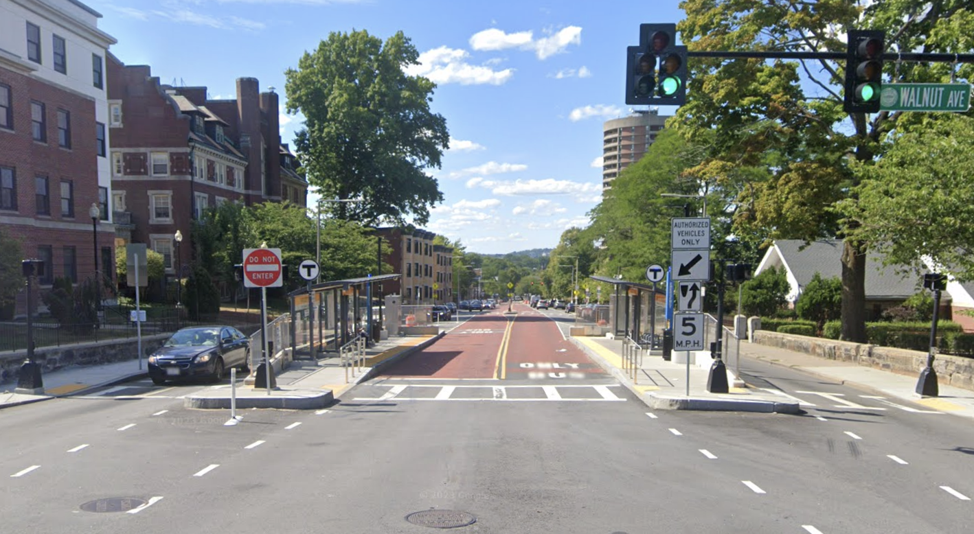
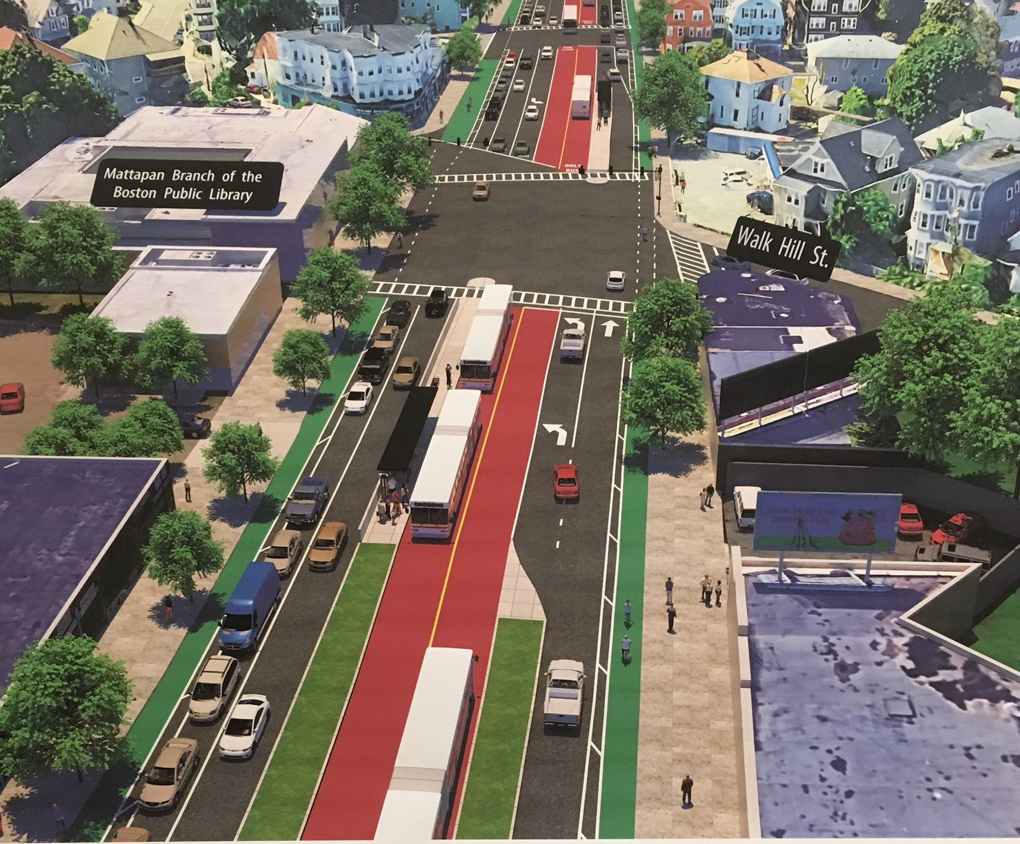
After at least 15 years of hand wringing, debates, and proposals from different administrations in City Hall, Boston Mayor Michelle Wu announced the $44 million project to reconfigure the main thoroughfare that runs through the heart of Boston’s Black community, connecting Mattapan Square to Grove Hall. The goals are ambitious: to speed up bus trips, prevent car crashes on a street known for frequent disruptions, provide more shade, and make the street safer for pedestrians, the city said.

Right now, the trip can take as long as an hour, the city said, but predicts that the redesign should make the trip from Grove Hall to Mattapan Square a consistent 25 minutes.

Construction will begin in 2026 and take "several years" per the article.
 
From the article said:
Right now, the trip can take as long as an hour, the city said, but predicts that the redesign should make the trip from Grove Hall to Mattapan Square a consistent 25 minutes.
It is simply astonishing and completely unreasonable that it's possible to shave almost 60% off the trip time and we've been arguing about this for 15 years. Do it, start right now, and do it everywhere else where it can be so transformative.
 
It is simply astonishing and completely unreasonable that it's possible to shave almost 60% off the trip time and we've been arguing about this for 15 years. Do it, start right now, and do it everywhere else where it can be so transformative.

Local politics is so deeply, frustratingly, small “c” conservative. We dreamed big and fucked up big with post-war planning and development. Now each individual change to the built environment has a hefty burden of proof that it won’t make things worse, even when the benefits seem obvious.


Construction will begin in 2026 and take "several years" per the article.

Ok I get that building the new curbs and bus islands will take a while, but there has to be a quick-build method for this right? Put down paint in the center bus lanes and put down planters and flexposts to designate the bus-stop islands. And paint new zebra-crossings and traffic-calming markings for all the new mid-block ped crossings.
 
Ok I get that building the new curbs and bus islands will take a while, but there has to be a quick-build method for this right? Put down paint in the center bus lanes and put down planters and flexposts to designate the bus-stop islands. And paint new zebra-crossings and traffic-calming markings for all the new mid-block ped crossings.
For the completed Phase 1 of Columbus Ave center-running bus lanes, planning started in August 2019, construction started in October 2020, and the corridor opened in October 2021. Phase 2 (north to Ruggles) is currently at 30% design with a time frame of 2022-2025.
 

Back
Top