Acela & Amtrak NEC (HSR BOS-NYP-WAS and branches only)

I didn't have much of a problem with the ticketed waiting area when I was last down there - seating was more than sufficient for my 6pm-ish NER. my bigger issue, and I realize this is more of a legacy of the century old Penn Station, is the inevitable bottleneck getting down to the platforms and your coach, and their escalator layout doesn't help. It's not meaningfully fixable without moving MSG, but I'd love to see what Penn Redesign means by "improve subterranean structure" and if it can open up some of the platforms.

The irony with this is that because I usually am taking Amtrak to Albany, I know it's only ever going to be on track 5 or 6. So while everyone is lined up upstairs, I wait in the cramped lower mezzanine and get to the train first.
 
I didn't have much of a problem with the ticketed waiting area when I was last down there - seating was more than sufficient for my 6pm-ish NER. my bigger issue, and I realize this is more of a legacy of the century old Penn Station, is the inevitable bottleneck getting down to the platforms and your coach, and their escalator layout doesn't help. It's not meaningfully fixable without moving MSG, but I'd love to see what Penn Redesign means by "improve subterranean structure" and if it can open up some of the platforms.
One or two delayed trains and the waiting area fills to capacity.
 
One or two delayed trains and the waiting area fills to capacity.
Super busy as well at about 2 p.m. with several long-distance departures and a regional. Sometimes that 6 p.m. push can get a bit too chaotic - thankfully that's more "commuter" types so folks just know to avoid the ticketed area and opt for something (anything) else.
 
Not a single bench to be found. :(
As someone who lived through a 3 hour Acela delay there (after they had lined us up to queue), less than ideal. There are some sitting areas off to the side (under the ticketed waiting room sign on the right) but agree with a few others that its hard to provide seating without interrupting the flow of foot traffic to the platforms
 

Paywalled article, but Amtrak is allegedly finally about to begin its New Haven to Providence Capacity Planning Study. (I say “allegedly” because they previously said they were about to begin at the beginning of 2024, and the last page of this FAQ sheet claims they began in early 2025, so only time will tell if this will be yet another false start.)

While the study’s scope is a little broader than just looking into opportunities for a high-speed rail bypass, I’m pretty sure that whole investigation a decade ago through the NEC Future process is what prompted the need for this study.
 

Paywalled article, but Amtrak is allegedly finally about to begin its New Haven to Providence Capacity Planning Study. (I say “allegedly” because they previously said they were about to begin at the beginning of 2024, and the last page of this FAQ sheet claims they began in early 2025, so only time will tell if this will be yet another false start.)

While the study’s scope is a little broader than just looking into opportunities for a high-speed rail bypass, I’m pretty sure that whole investigation a decade ago through the NEC Future process is what prompted the need for this study.
The delays in starting the study were directly due to the controversies over NEC FUTURE's HSR bypasses, as the states threatened to spike funding if the Capacity Planning Study had any aims on reviving them. $4M of the $5M total project budget came from joint federal-state funding sources, with CT and RI demanding answers about study scope before they would commit their shares. It was pretty controversial with the two states' Congressional delegations, because in the early going Amtrak wouldn't say exactly what the study was going to be about leading to lots of suspicions that it was going to reintroduce the Old Saybrook-Kenyon bypass that the states hated so very much. It took some amount of haggling before things were clarified enough to get the go-ahead to proceed, which chewed up two years.

$5M is not much of a total funding pot for sprawling initiatives, so they're most likely going to stay conservative in scope with on-NEC capacity improvements around Commuter Rail interference and climate resiliency stuff. It's interesting that the FAQ includes the Springfield Line in the study area; it may be a sign that they're deadly serious about hourly Amtrak service via northward continuation of the Keystones to Springfield or beyond. But since the study's not going to contain any EIS'ing activities whatsoever, which the much broader NEC FUTURE study did, given the huge impacts of any of the projected bypasses you basically can't produce a new study product worth the paper it's printed on without any work quantifying impacts. So they might pay lip service to the fact that NEC FUTURE studied that stuff, but since the Old Saybrook-Kenyon bypass was officially withdrawn after the end of that study (plus the fact that they've already been shaken down by 2 states' Congresscritters before starting) they're definitely not going to re-breach the subject.
 
Aveila non-revenue moves from the Alstom factory are still banned on the Hudson and New Haven Lines due to the childish two-month old Metro-North dispute, so new set deliveries from the Hornell, NY plant have taken to going the long route via the serpentine Southern Tier corridor through Binghamton and Port Jervis. This is probably the most scenic ride an Acela is ever going to take.
55296349988_e71ed18121_k.jpg
 
Not a single bench to be found. :(
The ticketed passenger waiting area could be more spacious, but adding benches to the main hall would be a total disaster at peak times due to the sheer amount of foot traffic moving through the station. At 5pm when NJ Transit / LIRR commuters are sneaking down the escalators rather than use the other concourses and multiple Amtrak trains arriving & departing in a small window, it's amazingly busy. Toss in the way they do the track line up, and it would be total chaos.

BTW, an "official" reason i was given for why people are lined up outside the ropes at the track was that the track could be changed at the last second and moving people out of the ropes would be too chaotic, so everyone waits outside the ropes until the train is in the station, and then the line can move into the roped area.
 
The chances of this working out are very very small. The passenger cars don't have traditional couplers, so they can't intermix with coach-class Amfleets to provide typical Northeast Regional capacity. Acelas are first-class and business-class only, with only 304 seats per 6-car set vs. up to 84 seats per Amfleet car. They don't have door traps for boarding at low-level platforms, meaning they can't be on any schedules that serve Aberdeen, MD; Newark, DE; Mystic, CT; or Westerly, RI and can't serve on Keystone Service all-locals...and they don't work for any long sets that have to board at New London, CT because of unfavorable dwell times at the very short high platform. And the extremely problematic and aged tilt mechanisms, even if they're running disabled, will have to be maintained at $$$ because there is some wear on the mechanisms that occurs even in normal running without tilt.

Alstom is doing this trial because of the complicated ownership of the A1's that includes leaseback to the manufacturer (originally Bombardier, who Alstom now owns). It behooves them financially to find any life extension possibility that maintains the lease, and it doesn't cost them much to poke under the hood of just one set to see if any possibilities shake out. But they aren't sticking their necks out very far for this, and the chances aren't very good that there'll be a fit.
 
The chances of this working out are very very small. The passenger cars don't have traditional couplers, so they can't intermix with coach-class Amfleets to provide typical Northeast Regional capacity. Acelas are first-class and business-class only, with only 304 seats per 6-car set vs. up to 84 seats per Amfleet car. They don't have door traps for boarding at low-level platforms, meaning they can't be on any schedules that serve Aberdeen, MD; Newark, DE; Mystic, CT; or Westerly, RI and can't serve on Keystone Service all-locals...and they don't work for any long sets that have to board at New London, CT because of unfavorable dwell times at the very short high platform. And the extremely problematic and aged tilt mechanisms, even if they're running disabled, will have to be maintained at $$$ because there is some wear on the mechanisms that occurs even in normal running without tilt.

Alstom is doing this trial because of the complicated ownership of the A1's that includes leaseback to the manufacturer (originally Bombardier, who Alstom now owns). It behooves them financially to find any life extension possibility that maintains the lease, and it doesn't cost them much to poke under the hood of just one set to see if any possibilities shake out. But they aren't sticking their necks out very far for this, and the chances aren't very good that there'll be a fit.
Also the interiors of the legacy Acela are beat to shit. Lavatory doors don't lock properly, toilets falling off the wall, automatic end doors cycling at random, tray tables that don't work, seats that won't recline, or only recline, power outlets that don't work, next station signage stuck on Stamford, etc. They need a total interior rebuild to stay in service under any condition.
 
Also the interiors of the legacy Acela are beat to shit. Lavatory doors don't lock properly, toilets falling off the wall, automatic end doors cycling at random, tray tables that don't work, seats that won't recline, or only recline, power outlets that don't work, next station signage stuck on Stamford, etc. They need a total interior rebuild to stay in service under any condition.
Yeah. They did a decent interior refresh on them not long ago, but, I feel it hasn't aged very well at all. Probably went as cheap as possibly thinking it only needed to last a few years for the Acela II to take over.
 

New Haven-Providence Capacity Planning Study now has an official website with opportunities to sign up for their mailing list and submit comments. There’s also a version of the FAQ sheet I posted a month ago (a few posts up on this page) and their Outreach & Engagement Plan.
 

NJ Transit, Amtrak announce start of Sawtooth Bridges construction

NJ Transit and Amtrak are beginning initial construction on the Sawtooth Bridges replacement project in Kearny, N.J., the passenger operators announced today (Friday, June 26).
The bridges, dating to 1907, carry Northeast Corridor tracks 2 and 3 over NJ Transit’s Morris and Essex lines, Conrail’s Center Street Branch, and the Port Authority Trans-Hudson line between Newark and the World Trade Center. The staggered design of the viaduct structure that crosses those lines gives the bridges their name.
[...]
An Amtrak overview of the project says it involves the construction of three bridges. Bridge 1 will realign Morris & Essex track 5 further to the north; Bridge 2, made possible by Bridge 1, will be built next to the existing Sawtooth bridges to carry two additional NEC tracks; and Bridge 3 will replace the existing structure. The project will eliminate a current 60 mph speed restriction and allow operations at 90 mph.
[...]
Construction is projected to be completed in 2035.
 
After more than a year of evaluations, Amtrak and the Federal Railroad Administration identified changes intended to improve construction sequencing and respond to cost pressures.
The revised plan would eliminate the intermediate ventilation facility and its smaller connecting tunnel. Engineers also plan to raise the future track alignment by approximately 10 to 22 feet at its deepest section, reducing excavation while retaining a maximum depth of about 150 feet below street level at that location.
[...]
Manufacturing is under way for two tunnel boring machines, one for each new tube. The first machine is more than 50% complete, and the tunneling contractor is preparing the site for its planned launch in 2028.
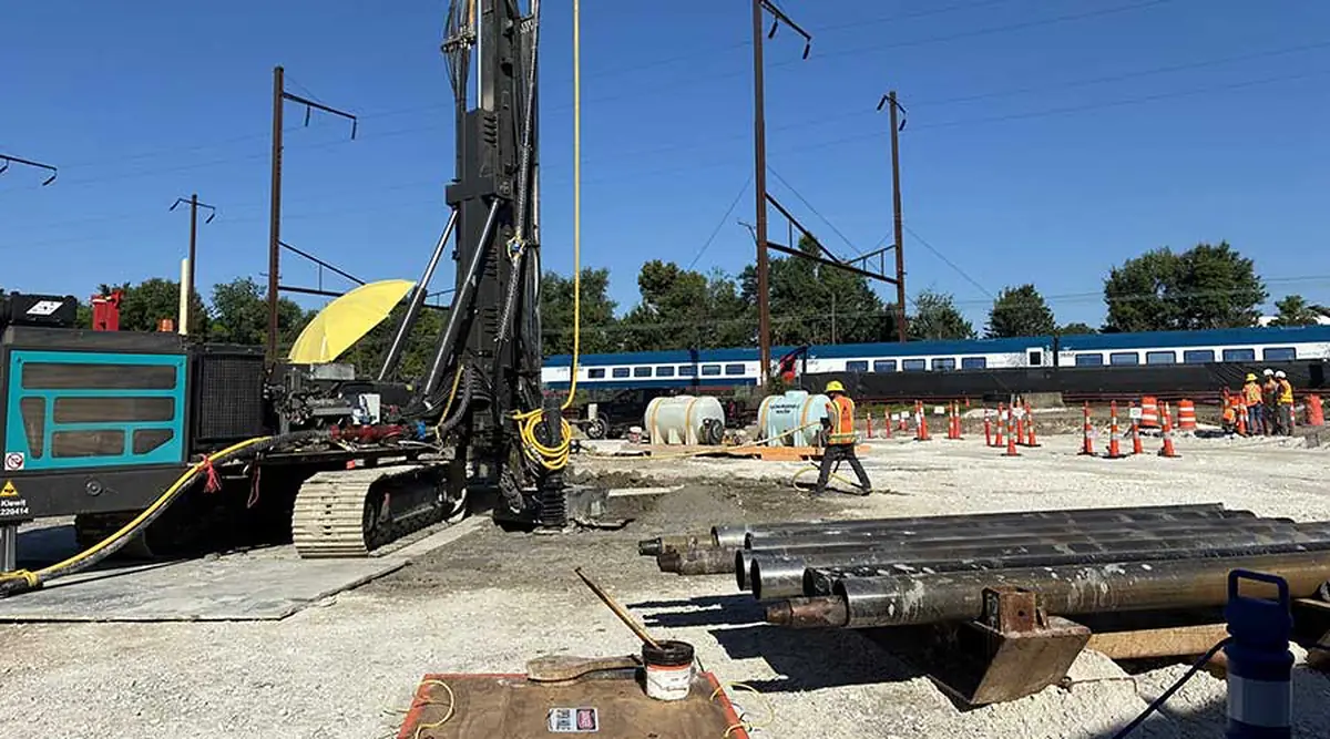
Work is also advancing above and below the active Northeast Corridor. Crews have excavated and built initial footings for the new Mulberry Street railroad bridge, the first of five bridges to be reconstructed under the program.
A separate 345-foot utility tunnel is due for completion in 2027. It will carry water, sewer, communications and electrical infrastructure beneath the existing and future NEC tracks, clearing the way for the corridor realignment south of the new tunnels.
 

Amtrak awards contracts for renovation of New Jersey’s Dock Bridge

Amtrak has awarded construction and management contracts for rehabilitation of the six-track, triple-span Dock Bridge in New Jersey, a $242 million project to begin later this year.
More than 700 Amtrak, NJ Transit, and Port Authority Trans-Hudson trains use the bridge across the Passaic River connecting Newark and Harrison, N.J. Four tracks are used by Amtrak and NJ Transit and two by PATH.
The project will see the bridge, opened in 1935, converted from a moveable lift bridge to a fixed bridge under a permit granted by the U.S. Coast Guard in 2024. Skanska was awarded a design-bid-build contract, while LiRo-Hill received the project management contract to provide oversight and support. The Federal Railroad Administration awarded a $188 million grant for the project; the remainder will be funded by NJ Transit, PATH, and Amtrak.
 
Out of curiosity, how much of the Passaic River was navigable above the Dock Bridge?
 
Out of curiosity, how much of the Passaic River was navigable above the Dock Bridge?
Ever or recently?

Bits of history:
  • The federal navigation channel is to mile 15.4 in Wallington NJ. The northern most movable bridge was I believe the West Eighth Street Bridge at mile 15.3. The Passaic River Falls are another two miles upriver and are an obvious hard blocker to all navigability.
  • Dock is at mile 5.0, so 10.4 miles upriver was at one point considered navigable (although the upper reaches were only ever maintained to 10ft mean low water depth)
  • However, much of the channel has long since been effectively abandoned.
  • 20 years ago they'd already legally stated that the bridges at 14.0, 14.7, and 15.3 no longer needed to function: https://www.govinfo.gov/content/pkg/CFR-2005-title33-vol1/xml/CFR-2005-title33-vol1-sec117-739.xml
    • And at that time, in reality WR Draw at 8.0 was already abandoned and welded shut (per RR.net reports from around that time) and Lyndhurst draw at 11.7 was also bolted shut.
      • It is worth noting these have decent clearance in the closed position, I think 40ft?
  • Route 3 at mile 11.8 was rebuilt in 2010 as a fixed-span, although a pretty high clearance one.
  • This USACE study from 2010 makes it clear that the channel had been left to rot long before all of this. The last recorded dredging operations to actually maintain the channel at the authorized depths was in 1983.
    • As of 2010 there were no commercial berths in existence above mile 8.1, and the only berth above mile 2.5 that had seen much usage in the 1997-06 period has I believe been redeveloped out of existence.
-------

Recently:

  • 12/11/24 - Dock (this bridge) at mile 5.0 was authorized to be converted to a fixed bridge, 24ft clearance when closed.
  • 12/1/25 - The feds authorized fixing the I-280 Stickel Bridge (35ft clearance when closed) at mile 5.8 in position, and stated it hadn't been opened for marine traffic in over 20 years.

tl;dr - This bridge is at mile 5.0, at one point historically it was navigable to mile 15.4 without a fixed span in the way. For at least 20 years there has been a fixed span at mile 8.0, and the channel is not maintained to it's historical navigation depths in general.
 
Ever or recently?

Bits of history:
  • The federal navigation channel is to mile 15.4 in Wallington NJ. The northern most movable bridge was I believe the West Eighth Street Bridge at mile 15.3. The Passaic River Falls are another two miles upriver and are an obvious hard blocker to all navigability.
  • Dock is at mile 5.0, so 10.4 miles upriver was at one point considered navigable (although the upper reaches were only ever maintained to 10ft mean low water depth)
  • However, much of the channel has long since been effectively abandoned.
  • 20 years ago they'd already legally stated that the bridges at 14.0, 14.7, and 15.3 no longer needed to function: https://www.govinfo.gov/content/pkg/CFR-2005-title33-vol1/xml/CFR-2005-title33-vol1-sec117-739.xml
    • And at that time, in reality WR Draw at 8.0 was already abandoned and welded shut (per RR.net reports from around that time) and Lyndhurst draw at 11.7 was also bolted shut.
      • It is worth noting these have decent clearance in the closed position, I think 40ft?
  • Route 3 at mile 11.8 was rebuilt in 2010 as a fixed-span, although a pretty high clearance one.
  • This USACE study from 2010 makes it clear that the channel had been left to rot long before all of this. The last recorded dredging operations to actually maintain the channel at the authorized depths was in 1983.
    • As of 2010 there were no commercial berths in existence above mile 8.1, and the only berth above mile 2.5 that had seen much usage in the 1997-06 period has I believe been redeveloped out of existence.
-------

Recently:

  • 12/11/24 - Dock (this bridge) at mile 5.0 was authorized to be converted to a fixed bridge, 24ft clearance when closed.
  • 12/1/25 - The feds authorized fixing the I-280 Stickel Bridge (35ft clearance when closed) at mile 5.8 in position, and stated it hadn't been opened for marine traffic in over 20 years.

tl;dr - This bridge is at mile 5.0, at one point historically it was navigable to mile 15.4 without a fixed span in the way. For at least 20 years there has been a fixed span at mile 8.0, and the channel is not maintained to it's historical navigation depths in general.
Dock went a full decade between requested maritime openings from 2004-2014. They would do test openings on select Sunday mornings just to make sure the lifts still worked, but the PATH span kept getting stuck during those tests so 6 years ago a temporary close order was put on that side until funds could be arranged for repairs. Nobody complained. That led to the granted 2024 request to take the Amtrak-only lift out of service, and the amendment to that request to make the whole works permanently fixed.

The whole Passaic River is basically an ecological disaster area, completely choked off by runoff silt that has high degree of chemical contamination in it. After the 2010 Army Corps study there was an ambitious state proposal to re-dredge and remediate, with Amtrak getting notified that there'd be a temporary large spike in Dock openings from the dredging barges if it came to pass. But the state could find no tangible avenues for new boat traffic, and ecologically there was not a lot left to salvage by trying to make the river more 'natural'...so they basically decided to leave the silt undisturbed. Much like happened with the Charles River's steadily improving water quality, as long as the contaminated layers of runoff were left undisturbed and gradually topped off by newer/cleaner layers of silt runoff (obviously with fresh sources of contamination cut off at the source), it would cease being a threat to water quality and the river would start to self-remediate. You just can't have any activity in the river that disturbs the soil cap and re-perturbs the contaminated layers for that to work. New Jersey has basically decided writ-large that leaving the Passaic be is the best course forward vs. an expensive/invasive dredging and remediation operation that wouldn't return any benefit from increased maritime traffic.
 
Dock went a full decade between requested maritime openings from 2004-2014. They would do test openings on select Sunday mornings just to make sure the lifts still worked, but the PATH span kept getting stuck during those tests so 6 years ago a temporary close order was put on that side until funds could be arranged for repairs. Nobody complained. That led to the granted 2024 request to take the Amtrak-only lift out of service, and the amendment to that request to make the whole works permanently fixed.

The whole Passaic River is basically an ecological disaster area, completely choked off by runoff silt that has high degree of chemical contamination in it. After the 2010 Army Corps study there was an ambitious state proposal to re-dredge and remediate, with Amtrak getting notified that there'd be a temporary large spike in Dock openings from the dredging barges if it came to pass. But the state could find no tangible avenues for new boat traffic, and ecologically there was not a lot left to salvage by trying to make the river more 'natural'...so they basically decided to leave the silt undisturbed. Much like happened with the Charles River's steadily improving water quality, as long as the contaminated layers of runoff were left undisturbed and gradually topped off by newer/cleaner layers of silt runoff (obviously with fresh sources of contamination cut off at the source), it would cease being a threat to water quality and the river would start to self-remediate. You just can't have any activity in the river that disturbs the soil cap and re-perturbs the contaminated layers for that to work. New Jersey has basically decided writ-large that leaving the Passaic be is the best course forward vs. an expensive/invasive dredging and remediation operation that wouldn't return any benefit from increased maritime traffic.
Hate to disagree, but I'm fairly sure the plan is still to dredge, then cap the thing - as recently as this April the EPA was still talking about it. Albeit not to make it navigable, They just had a meeting on Monday - that presentation hasn't surfaced yet, but afaik they're still moving forward with the dredging plan, despite want of funding. Also, the issues with the Charles was mostly sewage ... which does decompose. Dioxin / Agent Orange is another beast entirely.
5105.jpg


That said, with 10ft of available draft you're not going to be sailing anything large up the river to accomplish the dredging - if the rehab leaves the bridge in the down position, they can always get one of those funny tugs that can fit under the dock bridge while closed. Or, there's an entire variety of tugs/ barges/ dredges that are road-transportable - you'd just have to source the equipment.
 

Attachments

  • Screenshot_20260731_230456_Chrome.jpg
    Screenshot_20260731_230456_Chrome.jpg
    349.7 KB · Views: 16

Back
Top