cybah
Active Member
- Joined
- Feb 24, 2012
- Messages
- 278
- Reaction score
- 1

Dude, this is an awesome map.. shows both orange lines. Pre-1987 and current.
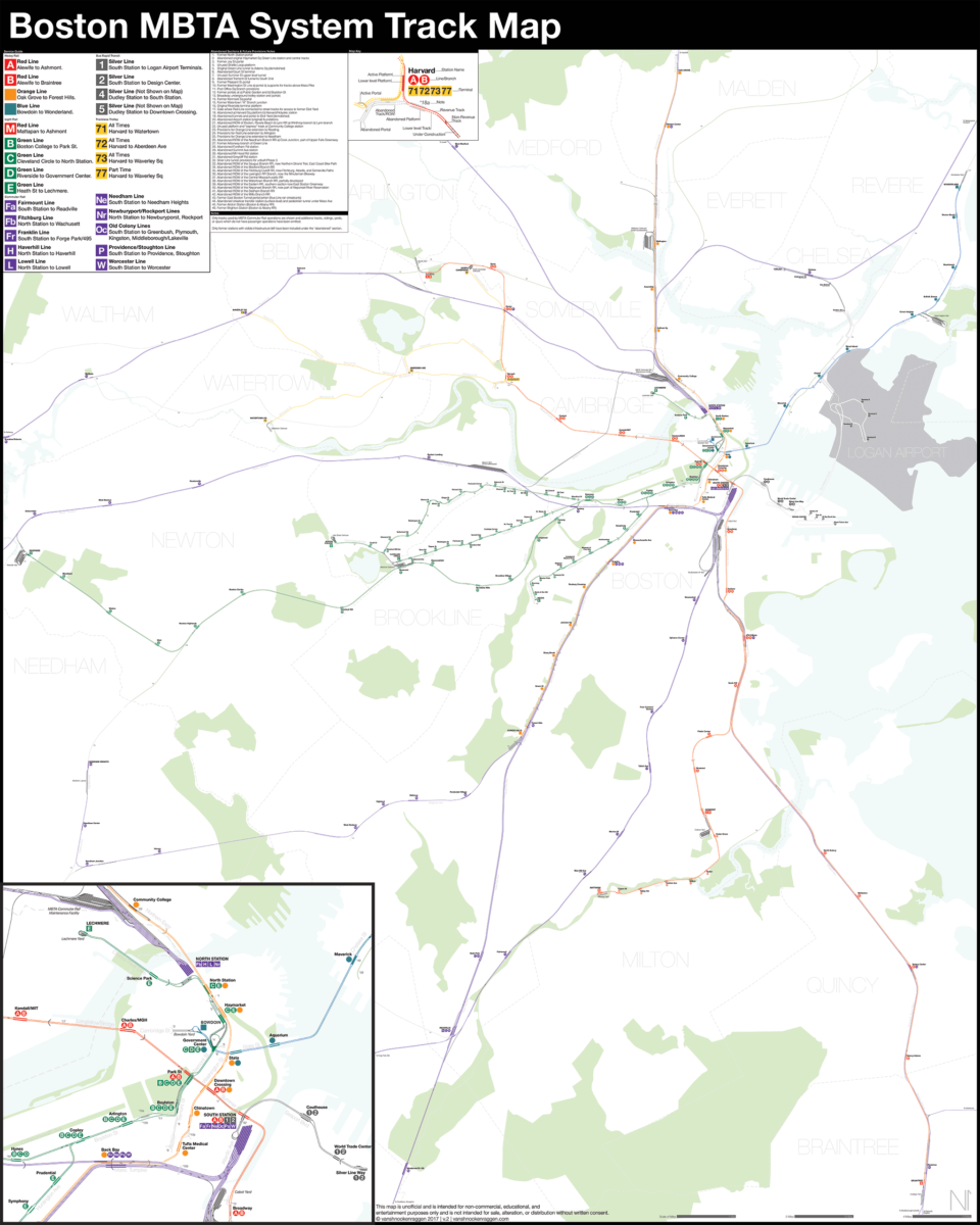
Ok y'all, I listened to the critizism of the map and I went back and added the commuter rail, trackless trolleys, and a myriad of other fixes (all things I should have done in the first place really). Let me know what you think: