A Complete and Geographically Accurate Boston MBTA Subway Track Map

vanshnookenraggen

Moderator
Staff member
Joined
May 25, 2006
Messages
6,964
Reaction score
1,586


Link

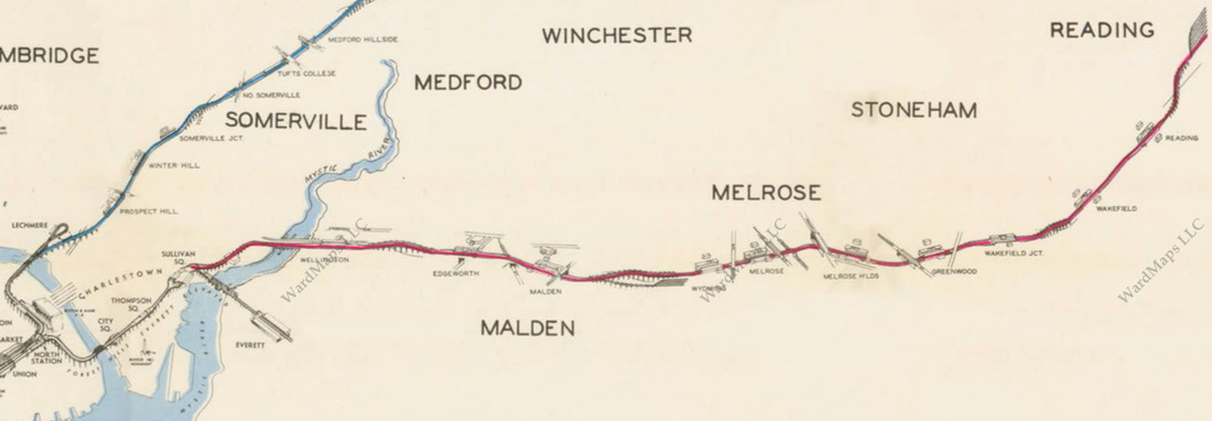
I'm hoping this will get some more love here than Reddit which seems to be full of trolls on the Boston page. I've been working on full scale track maps and this is the one from Boston I just published. I'm making changes and tweaks as people find errors so the link to the PDF of the map on my site will be updated as I make them.

I am also selling prints at my online store, vanmaps.com, but the PDF will always be free.

Lastly I will most likely be adding commuter rail lines to the map, though, I don't plan on making a full commuter rail track map.

Let me know what you think!
 
Saw this on Reddit, Awesome work!

I then spent way too much of my work day with your MTA Map w/2nd Ave, google maps, and historic aerials looking at remnants of bygone rights of way & elevated rail.
 
That is an awesome map showing the train yards so well. The Red Line Cabot yards and the south end of the busway tunnel at South Station are soooo close. It would be great to connect them and make the Silver Line tunnel into a branch of the Red Line by running revenue trains up the line to Cabot yards, then into the Silver Line.


36225734620_382f506c8a.jpg
 
I can certainly help give it some love! :)

One tiny comment - The "Zakim Bunker Hill Bridge" label implies that the Orange Line runs across the bridge in the context of the Charles River Dam and Longfellow Bridge labels... :)
 
Last edited:
That is an awesome map showing the train yards so well. The Red Line Cabot yards and the south end of the busway tunnel at South Station are soooo close. It would be great to connect them and make the Silver Line tunnel into a branch of the Red Line by running revenue trains up the line to Cabot yards, then into the Silver Line.


36225734620_382f506c8a.jpg

If you're gonna add a northern branch to Red, this is way too far south to do it. Adding rail to the transitway is Green Line or bust.
 
I like it. Though my hope (before reading below the picture) was that a full commuter rail one would be coming too.

Looking for a new home currently, and want to be near the train still. But, in general I don't know where the stations all are. The MBTA maps are helpful, but not geographically correct on the big picture ones. Google maps has them all, but they don't jump out at you.

Something like this would be super helpful.
 
Van, great work - thanks.

Also - have been looking for a long time for a detailed map of underground subway stations - she what are the actual detailed layouts of dtx, haymarket, etc. (for pedestrians, not trains). Have seen recent work on this for Nyc featured in various places around the web. Any idea if something like this exists for Boston?

I've never seen them for Boston but I'm sure deep inside the MBTA there are floor plans. I've seen them for New York.
 
Very cool! Small omission: On the Silver Line, it's missing the route where coming back from the airport it exits I-90 onto Congress St and then turns right onto Starboard Way and Silver Line Way.
 
Great Map! For what it's worth, I have a fold-out Boston Track Map from 1986 published by the BSRA (Boston Street Railway Association) https://thebsra.org/bsra/

It shows every Heavy Rail, Streetcar, and Trackless Trolley tracks and details. Since it was published in 1986, it shows both Orange Line configurations. If I can figure out how to post an image, I'll take a picture. LOL
 
Amazing. Can't wait for the addition of the CR.

Can someone explain the history of the non-revenue 3rd track that runs north on the OL? I remember hearing that it was meant to be an express track?
 
Amazing. Can't wait for the addition of the CR.

Can someone explain the history of the non-revenue 3rd track that runs north on the OL? I remember hearing that it was meant to be an express track?

Yes, planned express to/from the further Melrose-Wakefield-Reading segment that was part of the plan when changing the terminus from Everett to the 'burbs (which also assumed that OL would replace "Inner Haverhill" CR and so it was OK to leave CR single tracked.
7912828_orig.jpg
 
Last edited:
Amazing. Can't wait for the addition of the CR.

Can someone explain the history of the non-revenue 3rd track that runs north on the OL? I remember hearing that it was meant to be an express track?

Yes, that is correct. In the original plans, the Orange line would have been built out to Reading - a park and ride style station at the end. The express would have continued with it and replace the commuter rail. But Melrose blocked it and it is what it is since then. The express track never got to be used.

Edit: Damn I type slow
 
What I find interesting is if it was an express line then why are all the stations between Wellington and Community College (save for the new Assembly) "express" stations? It seems to me that the whole idea is to bypass closer in stations for a faster ride, not to serve everything. It seems to me that Sullivan Sq would have made the most sense with Wellington and CC both locals.

But I guess it will never really matter.
 
I like it. Though my hope (before reading below the picture) was that a full commuter rail one would be coming too.

Looking for a new home currently, and want to be near the train still. But, in general I don't know where the stations all are. The MBTA maps are helpful, but not geographically correct on the big picture ones. Google maps has them all, but they don't jump out at you.

Something like this would be super helpful.

Go to here then click the "Interactive Street Map" tab. It doesn't follow the exact path of the commuter rail but all of the station stops should be mapped pretty accurately.
 

Back
Top