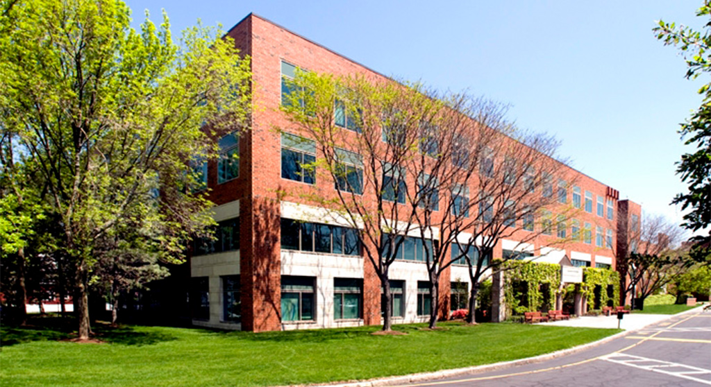
Alewife Park | 36-64 Whittemore Ave. | Cambridge

It's worth noting, though, that there are development and employees there now. I'm not sure that this isn't just going to be use conversion as opposed to major construction or densification.
The current building that's there is not worth 125 million. I think that they're planning on building something.

Anyway, I can understand why people who own property on Harvey St don't want that street to become a highway onramp. The issue is that dumping an 8 lane highway into onto city streets just doesn't work.
 
Last edited:
I can't imagine there won't be a big lab-centric TOD effort for this site. Look at all the lab proposals still happening at Assembly, Parcel 12, Union Sq etc, with "near Kendall and MIT!" to see there is serious money still available for lab development. This is directly on the coveted Red Line corridor, and its enormous for Cambridge.

TBH, an additional paid parking garage on the Alewife access road might even help the area...

Question for the locals - how big is the fight against making Ringe a bigger Mass-ave connector to Rt 2 traffic? If they straighten out the intersection, it's almost guaranteed to become a much busier road.
 
C0409-C98-D388-458-C-A69-B-F151811-CCE0-B.jpg
Ugh. This "vision" without rail expansion is so worthless - it's close to gridlock now before you try to make it 4x as dense. A GLX and a CR station would drastically change traffic demand patterns to better support the neighborhood.
 
Question for the locals - how big is the fight against making Ringe a bigger Mass-ave connector to Rt 2 traffic? If they straighten out the intersection, it's almost guaranteed to become a much busier road.

Big opposition. Rindge is wall-to-wall public housing, schools, parks, and triple-decker residential and major ped access to/from the various parks and housing between Rindge and Sherman. And the ped traffic is overrepresented by small children. The left-turn prohibition from the parkway and shorting of the 83 bus at Rusell Field parking lot / Alewife far headhouse instead of the busway are overt controls on that. Road's extremely narrow all points west of the Sherman intersection to the Parkway, and traffic-calmed with giant raised crossings on the wider Sherman-Mass Ave. section with on-street parking. Hazardous for a bike because of the minimal lane widths...though most of the locals know to shortcut on a cross street over to Dudley St. or cut through Danehy Park rather than bother with Rindge.

I used to live off the corner of Sherman & Walden for 9 years, so this was my stomping grounds. And I can say this is all a legit sticking point. Traffic volumes are already very heavy on the narrowest section just from loads originating from Sherman, so it simply can't handle much more. And the outsized representation of minors amongst pedestrians is a big concern around the crosswalks. I'm personally most leery of that one. The Sherman-induced traffic jams at least are purely local traffic represented by drivers who largely know through repetition what the neighborhood makeup is and what to look out for. Introduce a big random sample of suburban cut-thrus to/from the garages with people less familiar and they're not going to be as hip to the fact that there's so many children using those crosswalks with all the extra alertness that entails. Not that Rindge is in any way a jaywalker killzone...as with my drive-by yesterday the resident kids are by-and-large intrinisically well-educated about their surrounds and waiting for the WALK sign when it's busy (actually...all 8 of them I counted waiting at the Parkway crossing yesterday were also dutifully wearing masks despite no adult supervision, so the kids are alright!). But kids are kids...you have to be top-level alert as a driver when the surroundings are swarming with them. And I just don't think that level of alertness is going to be there if it's an all-access thru street.

If the intersection were squared up to a unified light I don't see how there wouldn't continue to be a turn prohibition. Maybe the 83 would be exempted to go thru to/from the busway at long last, but that's it. It'll bring out the voters in-force at all the public housing triggered by the self-interest, and the rest of the owner-occupied and triple-decker neighborhood would follow suit. Rindge corridor is one of the most densely-populated wards in all of Cambridge. Not the highest voter participation because it tilts heavy to public housing, but give the public housing residents a galvanizing issue to vote on and the numbers become overwhelming. I just can't see cut-across being allowed because of what issue intensity it would bring out of the woodwork. And if I were still living there and attending those same meetings...I'd be inclined to side with the neighborhood concerns. Rindge is very much a neighborhood street for neighborhood traffic (which is intense enough); I just don't see enough safety offsets available to make it a cut-through navigable by skew-percentage out-of-towners without a severe degradation to pedestrian safety. It's legit complicated.


This of course wouldn't be a problem if Alewife were actually transit-oriented. But it's not. Open up Rindge to cut-across traffic from Cambridgepark and you know exactly what's going to happen. Where I'm skeptical of this new Jerry's Pit redev is that I have no faith whatsoever that siting on the residential side of the parkway is going to in any way remove the brainslugs from the planners' heads and get them thinking differently that there can't be 1:1 parking space-to-employee ratios on that side or else it's instantaneously D.O.A. with the City. The way Concord Ave. is falling into the same car-centric hole just shows me that they're that incapable of adjusting. So we're probably looking at a process of 37 roundly rejected renders before it gets pounded into somebody's thick skulls that "Oh, that side of the parkway is 'North Cambridge where people live'...maybe we should stop trying to 'Alewife it'". And probably Sen. Brownsberger eating both of his feet some more trying to mediate a stalemate well above his meager brainpower.

It's not that it can't be done. I mean, WR Grace has been a walk-up friendly local employer for the entirety of the time they've been there, so the right attention to parking-free/few density would work. You've got the little Brickyard complex on Sherman that's representative of mixed-use dev that works well within the density surroundings of the neighborhood. And honestly if they expanded the parkland around Jerry's Pit (whether the pond itself has to be chain-linked off as forever-unsuitable for swimming or not) they'd be speaking directly to the hearts of the kid-friendly residential.

But it's Alewife. And Alewife is planning brainslugs. Alewife is satanically cursed. After living right there for a decade's worth of builds and primally screaming through a couple in-person City meetings and way too many hours of CCTV broadcasts of meetings my brain is simply broken through repetition that the dev pitches will ever be rehabilitated. And that's with Concord Ave.'s predictable fall into parking-oriented redev largely coming since I moved out. Prepare for this slate to be ENORMOUSLY frustrating to watch go through the motions, even though I'd trust almost any aB crayon drawing to do better than what the actual dev money is going to push.
 
Last edited:
If they do standard "bio lab height" buildings, it'd almost be that they make the low "industrial" buildings ialong whittemore nto something about as tall as the current "white collar building" facing the MVP.

I'd also look at the Acorn Park redo as a model: smaller footprint, going from 3-story/4-story buildings to 6-ish, and structured parking, and putting amenities where the parking lots were* (several of ADLittle's parking lots were on parkland leased from DCR, so going up meant being able to green those former lots closest to the Alewife T/Wetlands.
 
Ugh. This "vision" without rail expansion is so worthless - it's close to gridlock now before you try to make it 4x as dense. A GLX and a CR station would drastically change traffic demand patterns to better support the neighborhood.

But the issue there is you have to go really big to make a difference. Most of the traffic is coming through Alewife which means you need to do something to the west and northwest to really make a dent. And extending the Red Line is a generation off if it's ever going to be serious. There are far more projects which can be done sooner and cheaper. Green Line doesn't really help you all that much for the same reason. It would only really be necessary if most of that traffic was going to Kendall and even then Alewife Red Line is a better alternative. A CR stop isn't going to bring many riders either. More CR service on the Fitchburg Line would help somewhat but it still misses the northwestern quadrant of 128 where most of your car traffic is coming from. I'd argue BRT would be a better route. Take a couple lanes off the over built Rt 2 and there ya go.
 
Most of the entire Alewife area was originally a wetland. Instead of having balls-to-the-wall office park development proposed everywhere, it would be great to re-establish some wetland space and corridors, especially along the trail routes. It would bring back the open feeling I knew there as a kid in the 1950's, would help with flood control and wildlife, and just make the area a much higher quality environment and experience.
 
Most of the entire Alewife area was originally a wetland. Instead of having balls-to-the-wall office park development proposed everywhere, it would be great to re-establish some wetland space and corridors, especially along the trail routes. It would bring back the open feeling I knew there as a kid in the 1950's, would help with flood control and wildlife, and just make the area a much higher quality environment and experience.
I'm going to have to disagree with this. The alewife area still has a bunch of wetlands on the other side of Alewife Brook Parkway. The location of this development is right on top of a red line station. While I think it would a better spot for residential rather than office/lab space (less auto traffic), it's still somewhere that should be densified.
 
I'm going to have to disagree with this. The alewife area still has a bunch of wetlands on the other side of Alewife Brook Parkway. The location of this development is right on top of a red line station. While I think it would a better spot for residential rather than office/lab space (less auto traffic), it's still somewhere that should be densified.

I mean, in a perfect world you can do both. Taller buildings, less parking, paths and trees and boardwalks in between. The area around Acorn Park that has trails and marshes on the way to the train is very nice.
 
I mean, in a perfect world you can do both. Taller buildings, less parking, paths and trees and boardwalks in between. The area around Acorn Park that has trails and marshes on the way to the train is very nice.
Actually that's what I had in mind. I fear the entire Alewife area will be filled with uniform-height, box-like buildings. We need some open corridors with trails, wetlands preferably, abbuted by high density development having a mix of low, medium, and high rise.
 
Last edited:
This might deserve its own thread, but life sciences developer IQHQ is buying the 26-acre GCP Applied Technologies (formerly W.R. Grace) property for $125 million. This appears to include all the private land east of Alewife Brook Parkway between Whittemore and Rindge Aves, including the buildings on Whittemore, surface lots, and Jerry's Pond.


If life sciences money is enough to clean up and activate (or redevelop) Jerry's Pond, that'd be a win.
$125M wasn't enough - they just bought another building next door.

IQHQ buys more Alewife property for $54M
 
I grew up in North Cambridge, so all this brings back memories. Before the site was owned by WR Grace, it was Dewey and Almy, a huge polluter of the area. I believe they were the same company, just different names. So much toxic waste in the area. Dewey and Almy had a fairly large settling pond on the east side of Alewife Brook Parkway about where the bus ramp exiting Alewife station is now, and it was literally full of brightly colored chemicals that would thickly cake as they dried. Then, of course, Jerry's pit, a public beach in the 1950's that I used to swim in, was full of chemicals. And oh yeah, where Danehy Park is now was a huge city dump (not a landfill but with the trash fully exposed) that stretched from the Fitchburg line all the way over to Garden Street, and as wide as it was long, which was also a regular dumping ground for toxic waste from Dewey and Almy. It would catch on fire at times (from the neighborhood kids) and I lived immediately across the Fitchburg Division tracks from it. My dad had chronic emphysema and my mother had cancer, and they died at ages 59 and 63, respectively. My uncle, who was in the Cambridge fire department, told us that the chemicals were very bad, and he was certain that the toxic fumes from when they would catch on fire caused my parents ill health. I have COPD today although I never smoked, which I attribute to that toxic mess as well, but actually other than that I'm in excellent health at 71. All in all, I liked North Cambridge and still do.
 
As most people remember, it's the same awful company that polluted a large area of Woburn and was responsible for the deaths of numerous residents, young and old. This lead to the very large lawsuit and was made into a rather crappy and inaccurate movie starring John Travolta, A Civil Action. This is why Woburn residents now have free and extremely clean water, at least for about 20 more years I believe (I think under the settlement, they had to provide clean water to the city for 50 years). I live in this area of Woburn and, not to make light of a very tragic time, most of us have very nicely watered and manicured lawns now. The neighborhood home values have skyrocketed over the past 10 years and there are many beautiful new and improved homes.
 
BBJ has a first look at IQHQ's plans:

1610723339952.png


Current plans appear to call for keeping and renovating two existing buildings and redeveloping the existing parking lots and footprints of a few other existing buildings. Height of new buildings will fit current zoning. Plans also call for opening up Jerry's Pond to surrounding streets and building a public "overlook" next to it; presumably this would require some remediation.

 
Last edited:
I get that it's currently a parking lot, but they couldn't put that parking under their 3 story lab buildings?
 
I didn't see this mentioned earlier. Is that Red Line headhouse on the East side of Alewife Brook Parkway open and in use? I've never been over there. Maybe it's open for the Linear Path?
 
I didn't see this mentioned earlier. Is that Red Line headhouse on the East side of Alewife Brook Parkway open and in use? I've never been over there. Maybe it's open for the Linear Path?

Yep, it's open. The original Fishbook master plan for Alewife had it as the centerpiece of a plaza surrounded by buildings, but it serves the path, the field, and the neighborhood on that side.

Inside the station, you just walk to the "far" end of the platform to get there.
 
BBJ has a first look at IQHQ's plans:

View attachment 9591

Current plans appear to call for keeping and renovating two existing buildings and redeveloping the existing parking lots and footprints of a few other existing buildings. Height of new buildings will fit current zoning. Plans also call for opening up Jerry's Pond to surrounding streets and building a public "overlook" next to it; presumably this would require some remediation.

I'm back -- in case anyone cares

By the way there will be a public meeting on this and there is a webpage with more than was in the BBJ


westie
 

Back
Top