B Line Improvements

I think a lot of our short stop spacing on Green Line and buses come from the perception that people in Boston really don't want to ride transit and so they need to be offered very convenient access. .

I have a 1905 listing of stops for all streets served by Boston Elevated streetcar lines. It was a document given to streetcar conductors and operators. Just for a historical comparison, here is the 1905 list of stops on the segments that would survive to become the surface part of today's B, C, and E lines

C line from Cleveland Circle to St. Mary:
Reservoir Carhouse
Strathmore
Englewood and Clinton
Killsyth
Dean and Corey
The Beaconsfield
Tappen and Williston
Winthrop
Washington & University
Jordan’s Steps and Westborn
Hotel Majestic
Fairbanks and Lancaster
Hotels Bonair and Kenmoir
Marion
Summit
Park & Winchester
Centre and Webster
Whitney Hall
Coolidge Corner
Pleasant
Charles
St. Paul
Richmond Court
Kent and Powell
Hawes
Carlton
St. Mary

B Line from Boston College to Blandford:
Lake St. (Boston College)
St. John’s Seminary
Evergreen Cemetery
Foster
South
Chestnut Hill Ave.
Strathmore
Chiswick
Wallingford and Kinross
Sutherland
Cummings
Washington
Summit
Warren
Allston
Pole Station (opposite # 1287)
Harvard Ave.
Linden
Thorndike
Chester
Commonwealth and Brighton Ave.
Naples
Babcock
Pleasant
St Paul
Pole Station (197-47)
Essex (Cottage Farm Station)
Chillmark
St. Mary and Ashby
Lawton
Granby
Sherborn

E Line from Heath St. to Northeastern:
Heath
Pole Station 129-59-Page Estate
Parker Hill Ave.
Kempton
Wait
Calumet
Tremont and Francis
Hotel Helvetia
Smith and Wigglesworth
Conant and Worthington
Longwood Ave.
Ward
Vancouver
Ruggles
Skating Rink
Greenleaf and Parker
Bryant
American League Grounds

(anything marked "pole station" meant it was mid-block and was identified by the nearest line pole number vs. a street or landmark name)

So the C Line had 27 stops vs 13 today, the B line 32 stops vs. 18 today, and the E line 18 stops vs. 9 today. From a 108 year historical prospective, they have made great progress in stop consolidation!
 
So the C Line had 27 stops vs 13 today, the B line 32 stops vs. 18 today, and the E line 18 stops vs. 9 today. From a 108 year historical prospective, they have made great progress in stop consolidation!

Thanks for history lesson!

Even with all that progress, I wonder why Boston remains so far off from transit planning orthodoxy? Sure we have a long transit history, but we aren't the only place with a legacy streetcar system. Maybe others more knowledge than I can comment on how Boston stacks up against other legacy systems in terms of stop consolidation over the last century. Maybe there is nothing "wrong" with us other than our long history.
 
SF still uses yellow stripes to mark street-running trolley stops. I think they're supposed to be fixing up some more of those sometime in the next ten years (MUNI's glacial pace).

Winston, any idea what the schedule was like for those trolley runs back then, end to end?

Also: 1905? I've found conflicting reports about the "B" branch. Some say it opened in 1909, because there was not any real development on the new segment of Comm Ave, and they wanted a trolley line to spur construction (TOD!). Others say as early as 1900, only 5 years after the road originally opened.
 
Thanks for history lesson!

Even with all that progress, I wonder why Boston remains so far off from transit planning orthodoxy? Sure we have a long transit history, but we aren't the only place with a legacy streetcar system. Maybe others more knowledge than I can comment on how Boston stacks up against other legacy systems in terms of stop consolidation over the last century. Maybe there is nothing "wrong" with us other than our long history.

I think it just is long history. And the fact that that long history was so incremental, unlike other cities that grew with more centralized planning. We don't have a geometric street grid, so a lot of the bus route and bus stop locations grew up on demand spacing and path of least resistance from long ago. Sometimes so long ago you have to pull out historical records from 100 years ago to even figure out why a route is laid out like it is. Sometimes so long ago you can never pinpoint exactly why a stop came to be. And with a lot more unintentional consequences for removing a stop on Boston's unkempt street grid than on a planned grid in increments.

This is a hard city to traffic-model, and that keeps things staying the same. They pretty much never even try to think outside the box on local routes except for the same handful of wide-boulevard uber-corridors that are always talked about. That's not necessarily a lack of planning imagination. It's just a lot harder to game out all the dependencies on a generic city street here than it is in NYC or most other American cities.


Re: what stop consolidation did take place. . .

Prior to the 1920's streetcars had to shoulder an unusually outsized load as the only viable means of urban transit. Prior to the 20's you didn't have cars affordable for anything but rich-man's leisure, you still had lots of horses and horsecarts making business deliveries, you didn't have technologically viable buses or delivery trucks (there was even a brief few years' peak of streetcar freight in Boston), bicycles were pricey, and Boston still had many unpaved throroughfares in the outer neighborhoods that turned to ankle-thick thick mud when it rained. So having a streetcar line every other street on the grid, making stops on every block, and waving them into the Central Subway single-file one after the other after the other was the only band-aid that could keep up with the city's rapid urbanization while the diversity of transportation infrastructure was so very limited.

First wave of cutbacks was in the 20's when things got more properly multi-modal. Buses could take up the non-key routes, the last streets got paved, cars and bicycles got affordable to the whole middle class, horsecarts were no longer clogging up the streets with delivery trucks now being able to transport goods cheaper/faster/cleaner. Central Subway had refocused from the collector/distributor setup it operated under for its first 20 years into a faster Key Corridors feeder. I would venture most of those excess stops on the 1905 BERy timetable were dropped and consolidated no later than 1915-20 because of the changing nature of thru Central Subway traffic on the A, B, C, E and greater overall mobility block-to-block throughout the city. By the end of the 20's stops and streetcar routes started more or less resembling today's Green and Yellow Line system map with few variations. It wasn't a slow and steady churn through the years...you had a massive recalibration in the '10s and '20s, then a lot of sameness on the routes that passed intact (or at least unchanged after being bustituted) through the postwar system cutbacks.

That period during the 20's was more or less the 'idealized' streetcar era we've been aiming to re-create more of ever since we realized what damage the auto-only era did to us. It was the 30's when the Depression forced BERy to start cutting routes it didn't want to, and the 30's-40's when highway-ization started fucking up several key thoroughfares with gratuitous over-widening, high-speed traffic, disappearing sidewalks, and withering of any/all transit options.
 
SF still uses yellow stripes to mark street-running trolley stops. I think they're supposed to be fixing up some more of those sometime in the next ten years (MUNI's glacial pace).

Winston, any idea what the schedule was like for those trolley runs back then, end to end?

Also: 1905? I've found conflicting reports about the "B" branch. Some say it opened in 1909, because there was not any real development on the new segment of Comm Ave, and they wanted a trolley line to spur construction (TOD!). Others say as early as 1900, only 5 years after the road originally opened.

The section from Chestnut Hill Ave to Brighton Ave. opened on May 26, 1900.
Line ran 75 round-trips per day when it opened.
 
I would venture most of those excess stops on the 1905 BERy timetable were dropped and consolidated no later than 1915-20 because of the changing nature of thru Central Subway traffic on the A, B, C, E and greater overall mobility block-to-block throughout the city. .

Some of those old stops from the 1905 list were around for a lot longer than you might think.

There was some consolidation of stops on Beacon St. around 1972 as part of a track reconstruction project and again in 1982, following a second and more extensive track construction project. As an example, the stop at Strathmore Rd, just after Cleveland Circle, and the stop at Carlton, just before St. Mary, both lasted until the 1982 reconstruction work.

There was some stop consolidation on Commonwealth Ave. again as part of track reconstruction (including moving the reservation from Warren to B.C) from the 1950s through 1970 and some work along the rest of the line in the early 1970s. There was a major track reconstruction project in 1980 that also resulted in additional stop consolidation when it was complete.

On Huntington Ave., the same pattern. Some stop consolidations took place in the 1970s and some grade crossings were closed between Brigham Circle and Northeastern. There was a major reconstruction of the reservation (including a full shut-down) in 1980, the present stop pattern between Brigham Circle and Northeastern was established following this work in 1980.
 
Also: 1905? I've found conflicting reports about the "B" branch. Some say it opened in 1909, because there was not any real development on the new segment of Comm Ave, and they wanted a trolley line to spur construction (TOD!). Others say as early as 1900, only 5 years after the road originally opened.

1896 was the start of Kenmore-Oak Sq. streetcars and tracks through Packards Corner. Can't find it, but there's a pic from that era showing just tracks running straight through Packards Corner onto Brighton Ave. with nothing diverging up the hill.

Brighton Historical Society says 1909 for tracks up the hill: http://www.bahistory.org/HistoryCommAve.html

Then has this photo on another part of its site purporting to be near Wallingford Rd. in 1900:
CommAveWall1900%20.jpg


This source also says 1900: http://www.bostonstreetcars.com/b-branch.html


Or it could be a little of both. The Harvard Ave. tracks for the 66 pre-dated them all, so the hill could've opened in stages Harvard Ave.-Chestnut Hill and forked around the block before the last Harvard Ave.-Packards link opened.
 
Last edited:
Brighton Historical Society says 1909 for tracks up the hill:
Then has this photo on another part of its site purporting to be near Wallingford Rd. in 1900:

This is the confusion that I'm citing. I don't have any other references really. As far as I know, there wasn't really any development along that stretch of Comm Ave until around 1910 anyway, so the picture could have been taken any time until then.
 
This is the confusion that I'm citing. I don't have any other references really. As far as I know, there wasn't really any development along that stretch of Comm Ave until around 1910 anyway, so the picture could have been taken any time until then.

The 1904 edition of "By Trolley Through Eastern New England", on page 18,
https://archive.org/stream/bytrolleytrough00derrgoog#page/n32/mode/2up
suggests "a delightful ride" through Brookline to Chestnut Hill Reservoir. they suggest riding a circuit, going out to the Reservoir via Beacon St. and returning via the Commonwealth Ave line.

The description of the return via Commonwealth Ave.:

"From the Newton line, by taking a Commonwealth Avenue car, another attractive ride is afforded for the return
journey. The car turns off to the left and runs through a
delightful combination of city and country until it reaches
the Brighton junction, off to the left being the links of the
Kenil worth Golf Club. At Pleasant Street, on the left,
may be seen the links of the Allston Golf Club, and one of
the most picturesque county clubhouses in the country is
visible across a little pond. The car comes back into
Beacon Street again after passing Cottage Farm station, "
 
P.S. regarding the remainder of Comm Ave, the section from Packard's to Warren might go under design later this year, but current word is they do not want to move the reservation. And on a historical note, the reason why the reservation is "offset" is because it was originally completely off the street on the north side of Olmsted's Comm Ave. All the car travel was south of the tracks (except perhaps some access lanes). But sometime in the dirty 1950s, some assholes downtown decided to take land from Olmsted's park, starting at Warren Street, on the north side of the tracks and turned it into a second motorway. It's not well documented but I've seen the pictures and heard from a historian.

.

Here is a link to a photo from 1970 when the reservation from Chestnut Hill Ave. to Boston College was moved to the center. They built a new eastbound track, reconfigured the original eastbound track to become the new westbound track, and then removed the original westbound track to widen the roadway.

https://www.flickr.com/photos/ck4049/5638286792/in/set-72157627204598272

the section from Warren to Chestnut Hill was done in about 1960,
 
Nice find, except that I must mention that the photograph is from near South Street, not between Warren and Chestnut Hill Ave. The photo I saw claimed to be from the 1950s and showed them clearing the land adjacent to the hill going up from Warren Street.

More fun stuff buried in the collection:

6269436343_f1bf95bc37_b.jpg


https://flic.kr/p/9AbJhZ
 
Last edited:
Nice find. The photo I saw claimed to be from the 1950s and showed them clearing the land adjacent to the hill going up from Warren Street.

More fun stuff buried in the collection:

[/url]

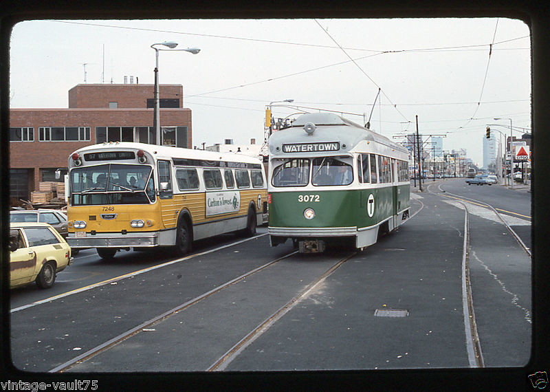
The photo with PCC 3072 was taken on a BSRA fantrip in 1976, 7 years after the line closed to revenue service. As many who follow the history of the A line probably already know, the tracks/wires were kept in operating condition for decades after the line closed so equipment could reach Watertown carhouse.
 
Nice find, except that I must mention that the photograph is from near South Street, not between Warren and Chestnut Hill Ave. /url]

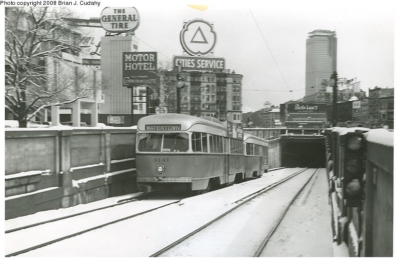
Yes, Chestnut Hill Ave to Boston College was done in 1970. You can tell the photo is after 1964 because the PCC cars have "T" logos on them. the Warren-Chestnut Hill Ave part was done about 10 years earlier.
 
Here's what Strathmore Road on the C Line looked like in 1967, with 15 years of deterioration to go:
640px-MBTA_3168_Beacon_St._%40_Strathmore.jpg


Photograph is by one David Wilson who has made dozens of his 1967 photos available to view/reuse under a free-use (attribution required!) license.
 
Has anyone heard any developments on the relocation of BC Station? That died out... pretty quick... it was supposed to be a fairly easy project, no?
 
Stalled since 2012 pending additional funding. From the project page:

Design Status:
The design was brought to a 15 percent level in August 2012. The 30 percent design was delivered in late-November 2012. The NEPA review package was finalized and will be sent to FTA in late-October 2012.

Future:
Upon completion of the 30 percent design and NEPA process, the MBTA will work to procure the additional funding. If and when secured, the Authority will commence the Request for Proposal process to procure professional services to complete the design and provide Construction Phase Services, and to bid and build the station. Again, the Authority does not currently have the funding to proceed beyond a 30 percent design level. Further design and construction is dependent upon procuring a new funding source.
 

Back
Top