Biking in Boston

They only care about emergency vehicles when it is convenient for themselves.
..like people who drive cars and pull out behind the ambulance or fire truck right after it passes and rides in its wake.
 
..like people who drive cars and pull out behind the ambulance or fire truck right after it passes and rides in its wake.

Yep. I happened to see a fine example of that today while walking to work. Ambulance going up Comm Ave and right behind it a couple of SUVs jockeying for position.

And pretty much every day now I see drivers gunning it along Comm Ave. It's been kept down to bare pavement and dry, so vroom vroom. It's almost like we spent all this money on plowing just so some rich kid in a Porsche can drive 20 MPH over the speed limit just like a summer day...

At least BU keeps the sidewalks mostly clear. Until you get to the portions maintained by MassDOT :/
 
If you mean the section between Murray Circle and Forest Hills: see page 14 of the Part 3 pdf linked above which shows that the Arboretum side has a two-way off-street bike path proposed, grade-separated from the mainline vehicles by a 4' concrete buffer. The one-way bike path on the "Arborway Hillside" side (the residential side up the hill) is also grade-separated and buffered by 1.5'. Unclear to me how they would hook that up with the Casey Arborway portion towards South Street (which isn't grade separated or physically buffered), or how these grade separations connect to Casey generally.

yeah - that'll be completely covered in snow unless DCR has a plan to clear it. A lot of people rely on these routes for biking - especially heading south into Roslindale.

Another thing that bugs me is that Washington street is a pretty busy bike corridor, but it's considered a secondary route on the bike network plan. It's pretty bad right now just for cars and buses, but you still see a considerable number of people on bikes in spite of the current conditions.
 
Key Electrical Transmission Project Could Spark Finish of Bike to the Sea Pathway

The solution to a gaping hole in the electricity needs of some three million Greater Boston residents could pay dividends for residents of Everett, Revere and Lynn in the form of a long-stalled bicycle/walking path.

The SeaLink – would have tremendous benefits for three local communities in the form of a new or expanded biking and walking path from Everett’s lower Broadway neighborhood to the beaches in Lynn.

“This is a major transmission project to solve a problem all over New England,” said Matt Valle, president of New Hampshire Transmission. “However, communities have to want this infrastructure. We understood that and worked with the MBTA to have an opportunity for a win-win. The electrical cables in our project are buried so there is no visual element. It does generate property taxes and there will be jobs for construction too. Most importantly, we wanted to mitigate the project and in working with the communities we have suggested expanding the bike path and walking path to make the final connection between the beaches in Lynn and through Revere and Everett and to the area where the new casino is proposed.”

The path – which for years has languished and is unfinished – has been known as Bike to the Sea and is placed on an old railroad bed right-of-way owned by the MBTA. In Everett and Malden, a lot of the path has been paved in anticipation of the eventual expansion. However, other parts in Lynn and Revere are still basically dirt and mud – in some parts impassable.

“In some of the parts where it has already been paved, we would propose to install lighting or to expand the pathway that’s already there,” Valle said. “Part of the bike path isn’t really developed, though…We would propose to complete the path all the way to Lynn and finish what has already been started while we’re in there doing the construction. Obviously, we’re developing a reliable transmission project to help keep 3 million people’s lights on…You look for win-win opportunities though so the communities hosting the project will have some value out of it.”
http://www.lynnjournal.com/2014/12/...ould-spark-finish-of-bike-to-the-sea-pathway/
 
This announcement that Boston was selected for the national Green Lane Project initiative looks like good news, but what, in practical terms does it really mean? I really like seeing pictures like this cycletrack on Arlington St alongside the Public Garden
10-path-Arlington-St-06-9.26.12-300x225.jpg
 
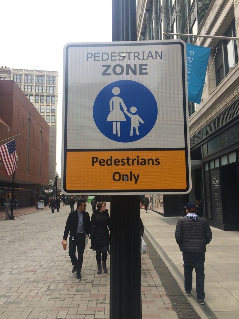
I was in Downtown Crossing today an noticed a number of these signs... Are bikes no longer allowed on Summer/Winter/Washington? If you're standing at Park St Station and looking toward Winter St, there's one of these on the left and on the right there are a bunch of the bike directional signs pointing down Winter St.
 
I've always felt a little bad biking through there, although I don't know if there are any formal rules preventing it. I tried to look it up once, got nowhere.

But the obnoxious one-way streets (like Tremont) make it very difficult to reach certain destinations without biking through DTX.
 
i feel no compunction biking through there. Cabs and trucks go through here all day, why shouldn't bikes? the city needs to get its act together and return the giant rotary around the public garden to two way streets.
 
CT11.jpg


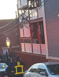
The strong winds on Tuesday actually picked this bicycle up from a porch on Salem St. and then it became entangled in the power line. Boston Firefighters were needed at the scene.

From Charlestown... Link
 
For those of you who don't know yet, Nicole Freedman, Boston's "bike czar" is leaving the City for the west coast. Having known her personally and professionally for a couple of years now, she will truly be missed. She had such a passion for biking and was able to accomplish so much, even with the City's lukewarm/negative feelings about the importance of biking. Here's to hoping we can get someone just as effective to take her place. I wish her the best of luck in Seattle.

http://listserv.cityofboston.gov/read/archive?id=32145
 
i feel no compunction biking through there. Cabs and trucks go through here all day, why shouldn't bikes? the city needs to get its act together and return the giant rotary around the public garden to two way streets.

True, true.

I guess it's also because DTX is actually quite busy with people walking about, so I must go slowly and carefully through there. It's a good thing though. Don't know why so many storefronts are closed. People keep talking about DTX like it's 1980 or something, when in fact, the streets are crowded with people most of the day.
 
I think those pedestrians only signs were mainly meant to keep the cars out. It's still a bit ambiguous about whether bikes are allowed or not, but I see a lot of people biking through there, including myself. Going slow and being courteous is key. There are also some bike navigation signs at Milk St, which you can only get to by riding through the per zone, so yeah...
 
I think those pedestrians only signs were mainly meant to keep the cars out. It's still a bit ambiguous about whether bikes are allowed or not, but I see a lot of people biking through there, including myself. Going slow and being courteous is key. There are also some bike navigation signs at Milk St, which you can only get to by riding through the per zone, so yeah...

There are bicycle directions signs routing bikes through Downtown Crossing, so it's safe to assume that bikes are not only allowed to ride through, but are encouraged to.
 
From Nicole's goodbye letter:

"Under Mayor Walsh, the city has continued to move Boston forward for cycling. There will be an exciting announcement about Commonwealth Avenue on Tuesday, cycletracks on Connect Historic Boston should break ground in the spring, and New Balance Hubway is expanding in Boston in late summer 2015."

The suspense has been killing me! Does anybody know what's being announced about Commonwealth Ave?
 
From Nicole's goodbye letter:

The suspense has been killing me! Does anybody know what's being announced about Commonwealth Ave?

I haven't been involved in the process, but I saw the plan and it looked good at first glance. They definitely made an effort to try out some new ideas. I don't know what people are expecting or what has changed since the last presentation though.
 
Nicole is probably referring to the fact that BTD is expected to present a design for protected bike lanes on Comm Ave from Packard's Corner to BU Bridge, at the meeting on Tuesday.
 
It's pretty remarkable how many bike lanes have been striped in the last 8 or so years. I remember when Perkins and Ruggles were the only streets around my neck of the woods with lanes. She [Nicole] deserves a lot of credit - and so does Menino. It's been one of the most important things for Boston and so much has happened so quickly.

So Connect Historic Boston is happening, definitely? That's excellent.
 

Back
Top