Biking in Boston


Does anyone have the history around why this roadway was built so wide in the first place?
 
DCR road, so that would be MSP whereas the others would be the local police.
Im pretty sure it was newton police. Haven’t ever seen a DCR (or MDC before that) cop car speed trapping, ever
 
Im pretty sure it was newton police. Haven’t ever seen a DCR (or MDC before that) cop car speed trapping, ever
That's probably because the DCR doesn't have its own police force. MDC did, but it was folded into the MSP during the Weld administration.
 
  • Like
Reactions: FK4
That's probably because the DCR doesn't have its own police force. MDC did, but it was folded into the MSP during the Weld administration.
I was pretty young during Weld, so that makes sense.
 
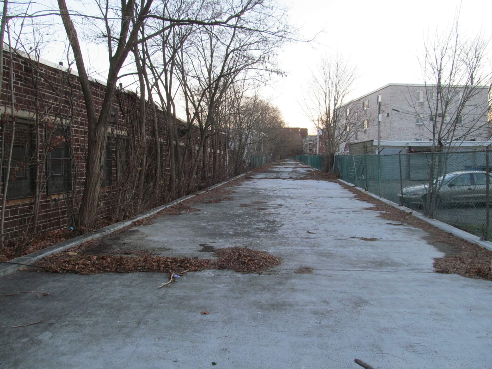
Biked the length of the Melnea Cass Shared Use Path for the first time in a while (at least since it was repaved). TBH, the repaving seems like a pretty cheap job, and is especially poor around the Boston Water & Sewer Commission building. And it looks like most of the branches / trash / debris from the bad windstorm we got about a week ago still haven't been cleaned up.

However, the path is still miles better than what it was before the repaving, and a useful off-street link through an area otherwise devoid of separated bike infrastructure. Frustrating though, that the intersections are completely unprotected and there's no separation for pedestrians and cyclists. (And the curb cuts at each intersection are generally in horrible shape!)

It's also a really stark difference between this path and the fantastic bidirectional cycle tracks on Northeastern's campus to which this path connects (photo at the end).

1704042332457.png


1704042468812.png


1704042493950.png


1704042672426.png
 
Last edited:
I used to bike on the Melenea Cass path as part of my everyday commute. But eventually it became so terrible that I switched to continuing down Columbus Ave (which had by then become much better than it had previously been), then turning right on Mass Ave. Since repaving, I've switched back to Melnea Cass. I agree that it's not perfect, but it is really quite good, just the same. The alternative to both that and to Mass Ave, is the contra-flow track on Ruggles St. It's really fantastic, but the connection to the SW Corridor is a little bit awkward. So nothing is perfect, but at least there are a few different options to consider.
 
Biked the length of the Melnea Cass Shared Use Path for the first time in a while (at least since it was repaved). TBH, the repaving seems like a pretty cheap job, and is especially poor around the Boston Water & Sewer Commission building. And it looks like most of the branches / trash / debris from the bad windstorm we got about a week ago still haven't been cleaned up.

However, the path is still miles better than what it was before the repaving, and a useful off-street link through an area otherwise devoid of separated bike infrastructure. Frustrating though, that the intersections are completely unprotected and there's no separation for pedestrians and cyclists. (And the curb cuts at each intersection are generally in horrible shape!)

It's also a really stark difference between this path and the fantastic bidirectional cycle tracks on Northeastern's campus to which this path connects (photo at the end).

View attachment 46243

View attachment 46244

View attachment 46245

View attachment 46247
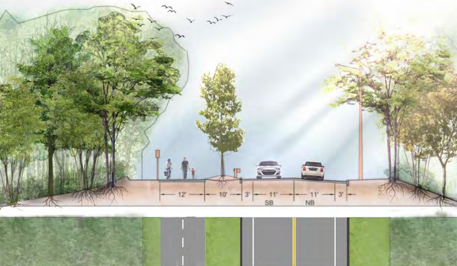
I will say that I would consider the MC path, subpar in many ways as it is, to roughly meet the standards of what I would expect from a similar path here in NL, maybe a tiny bit worse.
 
Biked the length of the Melnea Cass Shared Use Path for the first time in a while (at least since it was repaved). TBH, the repaving seems like a pretty cheap job, and is especially poor around the Boston Water & Sewer Commission building. And it looks like most of the branches / trash / debris from the bad windstorm we got about a week ago still haven't been cleaned up.

However, the path is still miles better than what it was before the repaving, and a useful off-street link through an area otherwise devoid of separated bike infrastructure. Frustrating though, that the intersections are completely unprotected and there's no separation for pedestrians and cyclists. (And the curb cuts at each intersection are generally in horrible shape!)

It's also a really stark difference between this path and the fantastic bidirectional cycle tracks on Northeastern's campus to which this path connects (photo at the end).

View attachment 46243

View attachment 46244

View attachment 46245

View attachment 46247
It's because it was done as a stopgap measure since the Melnea Cass redesign got put on the backburner. They couldn't leave it as it was (unrideable), but it also didn't make sense to throw too much money at something that had only a few years left. Maybe that few years will end up being a decade, but it IS better now at least.
 
Biked the length of the Melnea Cass Shared Use Path for the first time in a while (at least since it was repaved). TBH, the repaving seems like a pretty cheap job, and is especially poor around the Boston Water & Sewer Commission building. And it looks like most of the branches / trash / debris from the bad windstorm we got about a week ago still haven't been cleaned up.

However, the path is still miles better than what it was before the repaving, and a useful off-street link through an area otherwise devoid of separated bike infrastructure. Frustrating though, that the intersections are completely unprotected and there's no separation for pedestrians and cyclists. (And the curb cuts at each intersection are generally in horrible shape!)

It's also a really stark difference between this path and the fantastic bidirectional cycle tracks on Northeastern's campus to which this path connects (photo at the end).

View attachment 46243

View attachment 46244

View attachment 46245

View attachment 46247
Welcome to the glaring difference in how the state and city treat Roxbury, Dorchester and Mattapan as opposed to everything else

Roads suck there. Potholes are way worse. Street trees sparser. Street signs missing far more often. It’s night and day and always has been. It’s pretty mind blowing how blatant it is.

While I agree with the sentiment, and it’s blatantly visible in many examples of the city and state treating poor black neighborhoods worse than wealthy white ones, it isn’t applicable in the case of the Melnea Cass path. Many of the local residents shot themselves in the foot on this one. I was heavily involved in the proposed Melnea Cass Shared Use Path improvements and the local NIMBYs came out in force claiming it was racist. I was one of the very, very few voices in support as it appeared many didn’t want to come out opposed to black peoples claiming racism around the height of the Black Lives Matter movement. Nonetheless, NIMBYs preventing progress come in all colors and the NIMBYs here used race relations to prevent improvements. That should be called out just as much as white NIMBYs preventing progress in wealthy areas.
 
Welcome to the glaring difference in how the state and city treat Roxbury, Dorchester and Mattapan as opposed to everything else

Roads suck there. Potholes are way worse. Street trees sparser. Street signs missing far more often. It’s night and day and always has been. It’s pretty mind blowing how blatant it is.
While I agree with @bigeman312's sentiment on this specific corridor, I do want to add to this comment: The decision to rule out bus lanes from the Columbia Rd redesign is certainly... Something. Especially when there's the high-frequency T16 bus that's proposed to run on the entire corridor. Even if not intentional racism, it feels like such a massive missed opportunity.
 
While I agree with the sentiment, and it’s blatantly visible in many examples of the city and state treating poor black neighborhoods worse than wealthy white ones, it isn’t applicable in the case of the Melnea Cass path. Many of the local residents shot themselves in the foot on this one. I was heavily involved in the proposed Melnea Cass Shared Use Path improvements and the local NIMBYs came out in force claiming it was racist. I was one of the very, very few voices in support as it appeared many didn’t want to come out opposed to black peoples claiming racism around the height of the Black Lives Matter movement. Nonetheless, NIMBYs preventing progress come in all colors and the NIMBYs here used race relations to prevent improvements. That should be called out just as much as white NIMBYs preventing progress in wealthy areas.
That may be so and part of some important broader points, but the bike path as long as I've been around has been poorly paved, and more importantly, poorly maintained. Lots of trash, grass never cut in the summer... yet on the Southwest Corridor, grass is always mowed and teams pick up trash regularly. The difference is striking. There certainly are interesting wealth and racial tensions around various urban improvement and transit-related policies, but when it comes down to whether a government official is making sure someone mows the lawn on one trail, but doesn't on another trail just down the street from the first one, you can't just blame the neighborhood.
 
That may be so and part of some important broader points, but the bike path as long as I've been around has been poorly paved, and more importantly, poorly maintained. Lots of trash, grass never cut in the summer... yet on the Southwest Corridor, grass is always mowed and teams pick up trash regularly. The difference is striking. There certainly are interesting wealth and racial tensions around various urban improvement and transit-related policies, but when it comes down to whether a government official is making sure someone mows the lawn on one trail, but doesn't on another trail just down the street from the first one, you can't just blame the neighborhood.
But also the southwest corridor is state-owned and the Melnea Cass bike path/sidewalk/park is city-owned.
 
But also the southwest corridor is state-owned and the Melnea Cass bike path/sidewalk/park is city-owned.

This, and while the SW Corridor Park is generally well-maintained, the state of the path is fairly bad imo (and was even worse before the recent repavings done in the last few years).
 
But also the southwest corridor is state-owned and the Melnea Cass bike path/sidewalk/park is city-owned.
Ah OK, well that does mean something then... the city's DPW sucks ass all around. Funny, I could have sworn there was a DCR sign for Melnea Cass right on that little triangle of land when you take the right onto it, off Columbus/Tremont, but just checked street view and it's not. https://www.google.com/maps/@42.335...ro7Kdj7EGwSfg-3w!2e0!7i16384!8i8192?entry=ttu

This, and while the SW Corridor Park is generally well-maintained, the state of the path is fairly bad imo (and was even worse before the recent repavings done in the last few years).
Yeah, the roots of the trees really mess up the pavement. I've often wondered if there are types of concrete or pavement that dont deteriorate due to roots as fast as what we get around here.
 
Yeah, the roots of the trees really mess up the pavement. I've often wondered if there are types of concrete or pavement that dont deteriorate due to roots as fast as what we get around here.
Typically, that would be rubberized paving that you might see around street trees. However, snow plows would chew it up during the first winter.
 
  • Like
Reactions: FK4
This, and while the SW Corridor Park is generally well-maintained, the state of the path is fairly bad imo (and was even worse before the recent repavings done in the last few years).
Yes, it was unacceptably poor, but still possible to ride on. Melnea Cass, on the other hand, had been impossible to use for several years by the time they repaved. But as noted above, the likely distinction is jurisdictional, not anything more sinister.
 
Yes, it was unacceptably poor, but still possible to ride on. Melnea Cass, on the other hand, had been impossible to use for several years by the time they repaved. But as noted above, the likely distinction is jurisdictional, not anything more sinister.
I will concede that for the bike paths, but as someone who grew up around here and has always spent a lot of time tooling around in my car in random neighborhoods, the overall care for the road and sidewalk and sign infrastructure in the neighborhood I mentioned in my initial post is very obvious.
 
Got to try out the new Bluebikes e-bikes today and wow - they are excellent! The pedal assist feels natural and it feels like you’re riding a luxury product which was shocking to me. Not sure how often I’ll feel like paying for the premium, even with a membership it’s not exactly a cheap ride, but for long crosstown rides where biking is much faster than transit I’ll probably reach for an e-bike at least half the time from now on.
 

In Dorchester, a 0.75-mile long segment of the Red Line may soon have a new linear park built on top of it. With $300,000 in funding from the MassTrails program, a state initiative, and an additional $368,000 from the city of Boston; officials, community leaders, and designers are gearing up to build a new pathway for walkers and bikers, dubbed The Dorchester Greenway.
 

Back
Top