Biking in Boston


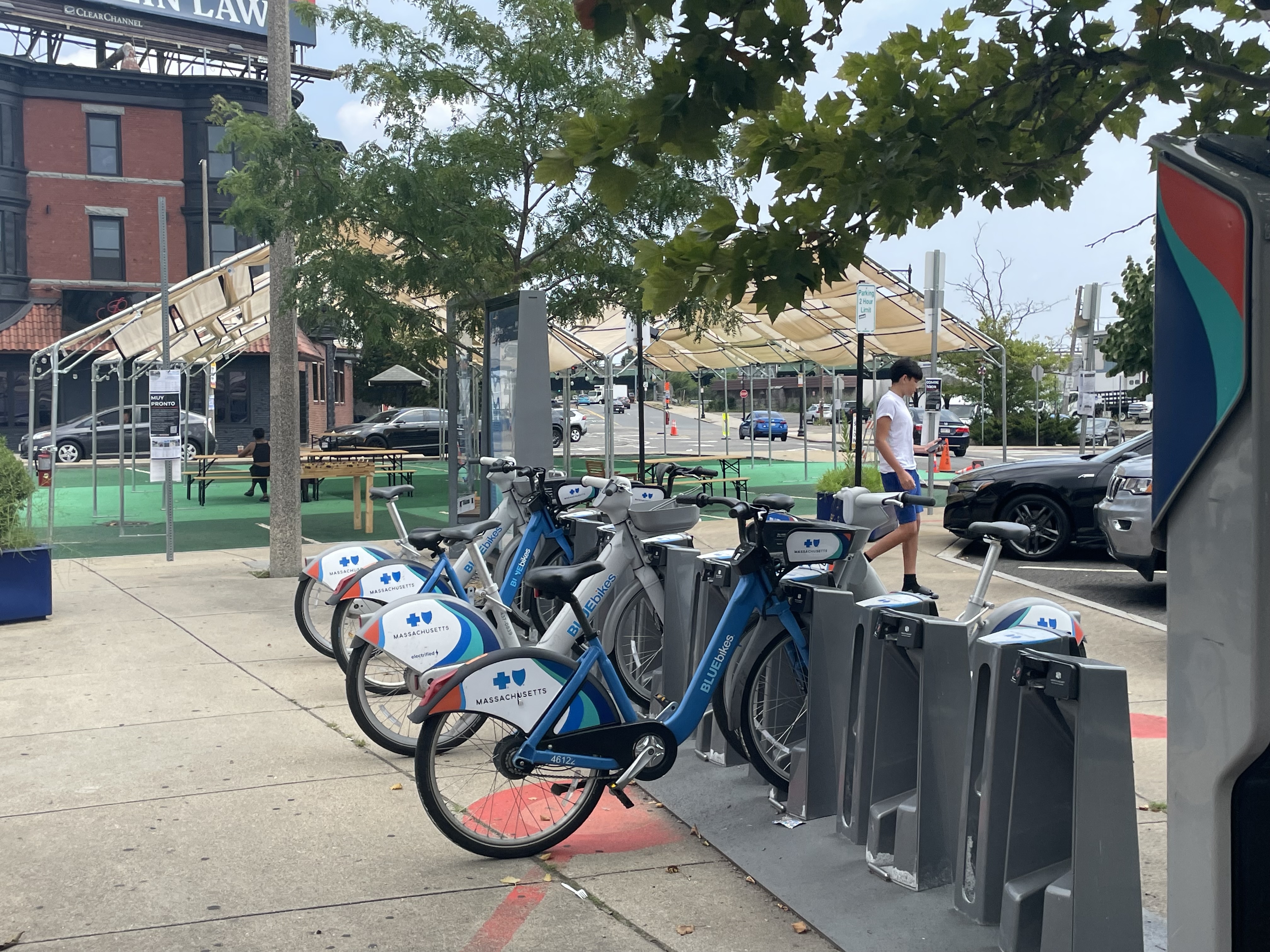
a bunch of new stations coming, starting this fall. Looks like major focus areas were the downtown-crossing pedestrianized area, north station, and north end. This should help with trips in the city although the infrastructure still ranges from good to non-existent in those areas. This should be a big boon even for existing stations as the increased capacity will reduce occurrence of arriving at a station with no open docks or trying to start your trip at a station with no bikes.
 
This should be a big boon even for existing stations as the increased capacity will reduce occurrence of arriving at a station with no open docks or trying to start your trip at a station with no bikes.
Yeah, definitely a lot of usage around North Station.

Right now at noon on a very temperate Monday (~70ºF at 9am, ~78ºF at noon, 50% humidity) -- 5 bikes available out of 113 docks (95.5% usage) over these 4 docks:

Screen Shot 2024-08-12 at 12.02.44 PM.png

(via https://account.bluebikes.com/map)
 
Question, do any of the cycling advocacy organization try to orchestrate "cyclizing" particular downtown streets.

By Cyclizing, I don't mean legal, City of Boston action. I mean guiding cyclists to make use of these street, for the purpose of creating a critical mass of cyclists. Flood a street with enough cyclists, and the street is no longer attractive to drivers. They seek alternate routes.

Are there key connection streets in Boston where this could be an effort? Particularly streets that connect to (are gaps in) critical cycling infrastructure.
There's a group that organizes a "critical mass" bike ride. But I'm not sure on the details of it. I don't think it's quite what you're looking for though.
 
There's a group that organizes a "critical mass" bike ride. But I'm not sure on the details of it. I don't think it's quite what you're looking for though.
Yeah, that's definitely different. They go for a monthly Friday night ride in which they take lanes as a form of visible protest to say that bike riders are here, this road belongs to us. I'm supportive of the concept, but it's definitely not about establishing specific routes for visibility of daily rider usage.
 

a bunch of new stations coming, starting this fall. Looks like major focus areas were the downtown-crossing pedestrianized area, north station, and north end. This should help with trips in the city although the infrastructure still ranges from good to non-existent in those areas. This should be a big boon even for existing stations as the increased capacity will reduce occurrence of arriving at a station with no open docks or trying to start your trip at a station with no bikes.

This is amazing and sorely needed.

On the topic of BlueBikes, does anyone know if/when BlueBikes is going to expand to Lynn or Swampscott? It's kinda funny but also odd that Salem has BlueBikes while Swampscott and Lynn don't. It's time to fill the gap!
 
This is amazing and sorely needed.

On the topic of BlueBikes, does anyone know if/when BlueBikes is going to expand to Lynn or Swampscott? It's kinda funny but also odd that Salem has BlueBikes while Swampscott and Lynn don't. It's time to fill the gap!
That's largely up to Swampscott and / or Lynn really! BlueBikes is a publicly-owned bike-share with each of the service area municipalities paying into it. The ten cities and towns BlueBikes serves have bought into the system. Sometimes MassDOT and the MPO provide capital funding for buying new docks but otherwise, operating supports come from the local level (definitely something MassDOT should be more actively supporting in terms of helping to bring down costs on cities and towns to lower the barrier to entry for communities that can't budget for it).
 
That's largely up to Swampscott and / or Lynn really! BlueBikes is a publicly-owned bike-share with each of the service area municipalities paying into it. The ten cities and towns BlueBikes serves have bought into the system. Sometimes MassDOT and the MPO provide capital funding for buying new docks but otherwise, operating supports come from the local level (definitely something MassDOT should be more actively supporting in terms of helping to bring down costs on cities and towns to lower the barrier to entry for communities that can't budget for it).
So if I was to put in a request for a new dock installation, I would direct it at the town/city and not towards BlueBikes?
 
So if I was to put in a request for a new dock installation, I would direct it at the town/city and not towards BlueBikes?
Correct, and keep in mind the going rate for a new dock is ~$50,000 and to have a successful expansion you need a reasonable density of stations. Most of the towns that have joined have started with grant funding, the MPO and MassDOT have done several $200k-$500k size grants that towns outside of the big three have used to join/add stations. If you reach out to a politician type person it might be helpful to reference some of the successful grant programs that other towns have used (MPO Community Connections, MassDOT Shared Streets & Spaces, Massachusetts Gaming Commission Transportation Construction).
 
Correct, and keep in mind the going rate for a new dock is ~$50,000 and to have a successful expansion you need a reasonable density of stations. Most of the towns that have joined have started with grant funding, the MPO and MassDOT have done several $200k-$500k size grants that towns outside of the big three have used to join/add stations. If you reach out to a politician type person it might be helpful to reference some of the successful grant programs that other towns have used (MPO Community Connections, MassDOT Shared Streets & Spaces, Massachusetts Gaming Commission Transportation Construction).

We, both the advocate and professional side, really do not do enough highlighting of the cost discrepancy between bike investments and auto-oriented investments. "Here's what a routine mill-and-pave project on West Bumbleton Street would buy you in bike investments". People make the fallacious "we could just buy everyone who's projected to ride this train a car for cheaper" point all the time. Where's the "we could just buy the whole town e-bikes for the cost of this intersection reconstruction that's only required because of how unsafe people drive."
 
Last edited:
We, both the advocate and professional side, really do not do a enough highlighting of the cost discrepancy between bike investments and auto-oriented investments. "Here's what a routine mill-and-pave project on West Bumbleton Street would buy you in bike investments". People make the fallacious "we could just buy everyone who's projected to ride this train a car for cheaper" point all the time. Where's the "we could just buy the whole town e-bikes for the cost of this intersection reconstruction that's only required because of how unsafe people drive."
We also do a poor job of highlighting how many more travelers fit in the same space on bikes versus SOV (both moving and parking).
 
Cambridge’s presentation for the pedestrian crossing of the Fitchburg Line mentioned they are looking at building out the stretch of the Watertown branch trail behind Danehy Park. Has there been any proposal for the path crossing Alewife Brook Parkway? I really hope they aren’t going to settle for the existing signalized grade crossing.
 
Cambridge’s presentation for the pedestrian crossing of the Fitchburg Line mentioned they are looking at building out the stretch of the Watertown branch trail behind Danehy Park. Has there been any proposal for the path crossing Alewife Brook Parkway? I really hope they aren’t going to settle for the existing signalized grade crossing.
I don’t find that crossing to be too bad. It is a pretty instant red light when the beg button is hit and not a HAWK. Traffic calming and a road diet would probably be better use of funding than a bridge there, but the issue would be with getting DCR to cooperate.
 
Cambridge’s presentation for the pedestrian crossing of the Fitchburg Line mentioned they are looking at building out the stretch of the Watertown branch trail behind Danehy Park. Has there been any proposal for the path crossing Alewife Brook Parkway? I really hope they aren’t going to settle for the existing signalized grade crossing.
Here is more info on that project: https://www.cambridgema.gov/Departments/communitydevelopment/danehyparkconnector. Assuming you're referring to the Concord Ave crossing, the most recent presentation (in March) shows it remaining largely the same, just some small accessibility upgrades.

Not a fan of the routing between the path entrance and the crosswalk, which makes path users do a zigzag that crosses the driveway apron for the gas station entrance. I wish they'd at least harden that turn a bit to slow down drivers entering the gas station, who may not be expecting a runner or cyclist to pop out from behind the fireplace shop.
 
Not a fan of the routing between the path entrance and the crosswalk, which makes path users do a zigzag that crosses the driveway apron for the gas station entrance. I wish they'd at least harden that turn a bit to slow down drivers entering the gas station, who may not be expecting a runner or cyclist to pop out from behind the fireplace shop.
There's not a lot they can do about that. The crossing signal needs to have adequate sightlines coming off the rotary so drivers who are flooring it around have enough time to react when the signal changes. At low traffic hours drivers really gun it around the rotary, and there are frequent close calls at the New St. intersection from unexpected movements. The ex- grade crossing in particular is way too soon for safe traffic sorting before the signal cycle, so the best option is to leave the signal where it is.

I used to live a few blocks away from there, and would use the signal on a daily basis for my walk around Fresh Pond Reservoir. Drivers are pretty well-behaved around the existing signal and the gas station driveway, since there's an expectation of frequent pedestrian traffic all hours of the day. The gas station is also pretty busy during the day so drivers have to slow into the driveway to navigate the logjam at the pumps and garage waiting areas. But I wouldn't want to see the signal moved at/near the old grade crossing. There's just way too much going on there for drivers to be fully alert of peds or signal changes.
 
Is a bike path bridge with enough clearance even possible to shoehorn into the area? Would it end up being a smaller copy of the GLX path bridge?
 
Is a bike path bridge with enough clearance even possible to shoehorn into the area? Would it end up being a smaller copy of the GLX path bridge?
Would that really be a good use of time and funds? I ride this path twice a week, and while I wish the crosswalk were a bit wider to accomodate 2-way ped+bike traffic, I never wait for more than 10 seconds and have never had a close call. I would rather that effort and money be spent on one of many other bike infra projects in the Alewife area.
 

City's project page

 
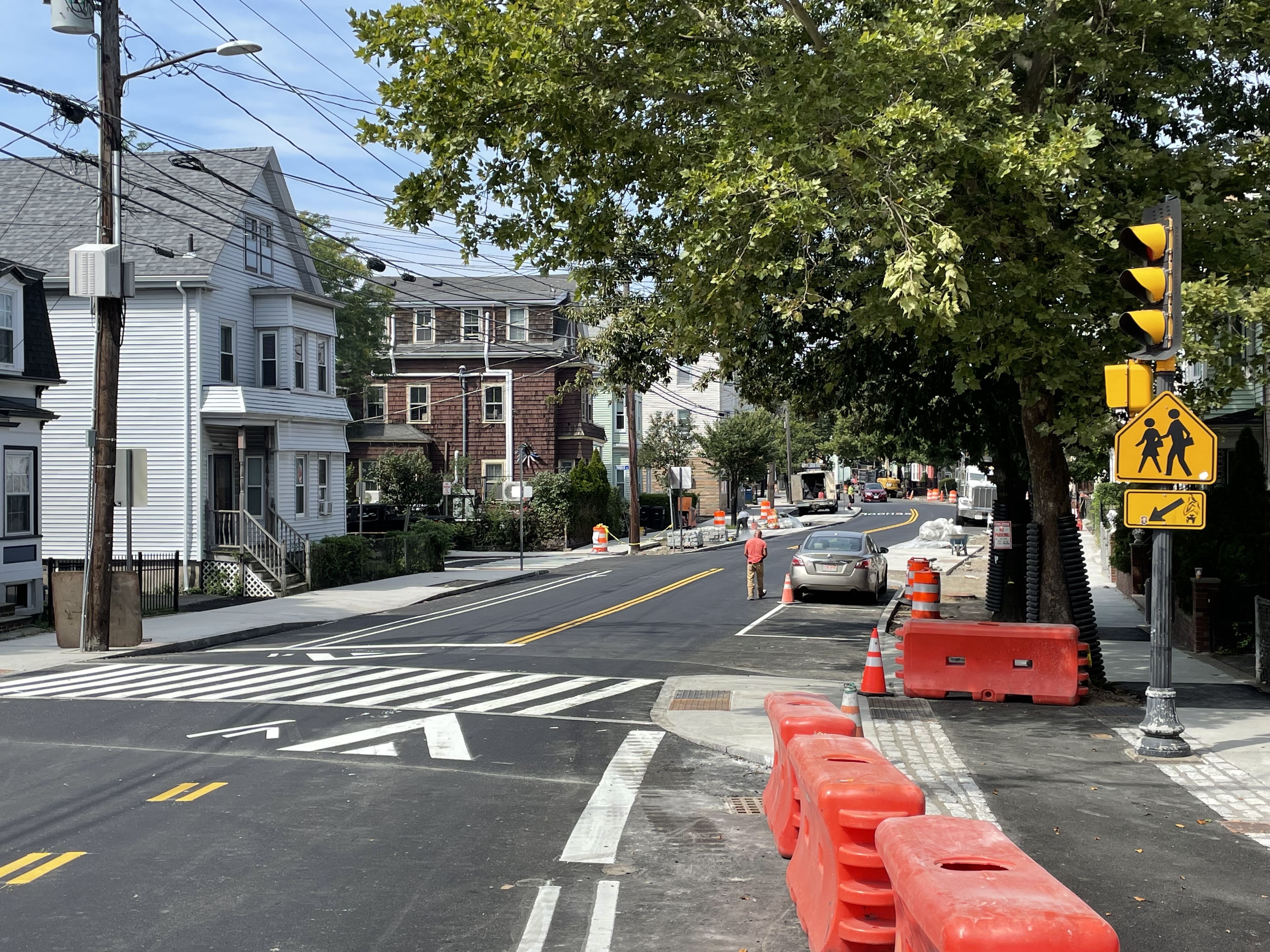
Construction update on Washington Street in Somerville. This street went from having nothing but sharrows in 2019 to getting curb-protected bike lanes in 2024.

A great case study on how to add bus and bike infrastructure in a typical, not-particularly-wide neighborhood street (about 40' from curb to curb):


Back
Top