Biking in Boston

Somerville is kicking off community engagement for its first cycling infrastructure project since the Safe Streets Ordinance was adopted. They’re calling it the Elm-Beacon Connector and it stretches from the edge of Davis Square towards Somerville Ave and Beacon st: https://voice.somervillema.gov/elm-...community-meeting-on-september-25-at-6-00-p-m

Elm is the last section between Union and Davis square that doesn’t have any sort of cycling infrastructure on it, so I’m psyched to see that hole patched.
 
If it’s quick-build, they’re probably not repaving the various patch jobs.
 
Somerville is kicking off community engagement for its first cycling infrastructure project since the Safe Streets Ordinance was adopted. They’re calling it the Elm-Beacon Connector and it stretches from the edge of Davis Square towards Somerville Ave and Beacon st: https://voice.somervillema.gov/elm-...community-meeting-on-september-25-at-6-00-p-m

Elm is the last section between Union and Davis square that doesn’t have any sort of cycling infrastructure on it, so I’m psyched to see that hole patched.

I’m hugely in favor of adding bike infrastructure here (on Elm between Russell and Somerville Ave), but this project does not cover the stretch of Elm between Dover and Russell. So, to be clear, this will not fully “patch” the last section without bike infrastructure between Union and Davis, but rather 0.7 miles of that 0.9 mile gap.

Even if this project is done perfectly, I’d still love to see some bike infrastructure on Elm between Dover and Russell.
Given Dover-Russell is the core of Davis Square, I'd personally rather they "go all the way" and do it properly the first time around - either the version they were kicking around before the pandemic, which involved two-waying the currently one-way Elm & Highlands and removing the connection to Dover, or as the post-pandemic restarted process seems to favor, a pedestrianized "shared street" Elm. I'll happily take either.

Sept 2019 Version:
1000036996.jpg


From the Jan 2024 Draft:
1000036993.jpg
1000036989.jpg

1000036998.jpg
 
So, to be clear, this will not fully “patch” the last section without bike infrastructure between Union and Davis, but rather 0.7 miles of that 0.9 mile gap.

Depends on which direction you’re traveling. There are painted lanes on Cutter and Highland, so westbound has lanes the entire way.

I find the one way section of Elm to be “fine”. The narrowness caused by on street dining and double parking and the foot traffic has kept drivers in line every time I’ve ridden through.
 
That’s a non-sequitor.

🙄 I was merely sharing my own experience with the section. God forbid we have personal experiences with the areas we’re talking about.

If we want to be extremely pedantic, you could have already taken Somerville Ave -> Mass Ave -> Community Path instead of taking Elm and you’d have infrastructure the entire way.
 

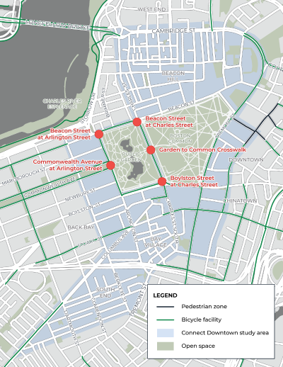
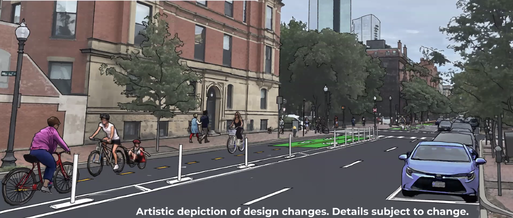
This is really great progress: 2-way protected cycle track on Dartmouth st from the esplanade to boylston. This helps to connect Back Bay with a southbound route although there still is no safe southbound route from Boylston into the South End. But it will make for a fully-protected route from the esplanade to the office buildings near copley.
 

This is really great progress: 2-way protected cycle track on Dartmouth st from the esplanade to boylston. This helps to connect Back Bay with a southbound route although there still is no safe southbound route from Boylston into the South End. But it will make for a fully-protected route from the esplanade to the office buildings near copley.
Looks good overall. However I would prefer this approach instead:
1726157414661.png
 
Looks good overall. However I would prefer this approach instead:
View attachment 55457
I agree, but this is a big step in the right direction.

The section you highlighted does not appear to be part of the project, and rather shows the existing layout. I think it would be highly preferable if the full two-way bikeway continued along Dartmouth to Stuart, but it is currently only proposed to go to Boylston.

As proposed, this leaves a big gap southbound from Boylston to Stuart. If I were traversing that on bike, I’d end up going right on Newbury, left on Exeter, and left on Stuart. That stretch of Stuart is built in a way that would discourage the average person from cycling on it, so that’s a problem.
Yea.. with all the construction going on in copley square, they missed an opportunity to build sidewalk-level bike lanes (makes sense both on Dartmouth St and St James ave).
 
For fucks sakes they need to repave Columbus. It’s one thing to have a dangerous bike lane ripe for getting doored, but another to have the same lane so rough that you take your life in your hands riding on it even without all the other risks. Disgusting that Boston hasn’t redone this stretch after years and years of bad road.
 
For fucks sakes they need to repave Columbus. It’s one thing to have a dangerous bike lane ripe for getting doored, but another to have the same lane so rough that you take your life in your hands riding on it even without all the other risks. Disgusting that Boston hasn’t redone this stretch after years and years of bad road.
I stopped using it once the Tremont protected lanes opened. And now Boylston St. is a similarly useful alternative. But you are absolutely right -- Columbus is atrocious between Mass Ave. and Berkeley St. The parking protected sections on either side of that are good, but the entire corridor needs to be re-surfaced and then get the same parking protected treatment. It's a direct shot to downtown off of the SW Corridor and should be a safe option for all the people connecting between those two areas.
 
I stopped using it once the Tremont protected lanes opened. And now Boylston St. is a similarly useful alternative. But you are absolutely right -- Columbus is atrocious between Mass Ave. and Berkeley St. The parking protected sections on either side of that are good, but the entire corridor needs to be re-surfaced and then get the same parking protected treatment. It's a direct shot to downtown off of the SW Corridor and should be a safe option for all the people connecting between those two areas.
Ive tried Tremont, which is nice, but of course lacks the full connection to the Southwest Corridor and moreover it has many more cross streets (or it seems to). Columbus is. more direct anyway... Also, I really dont get why the Charles St leg between the Common and Public Garden is not two-way... and what in God's name is the holdup on Charles St thru Beacon Hill still being three car lanes + 2 parking lanes, with zero bike lanes. I have ridden this against traffic for years because it's the only way to directly get to my destination. It's so unbelievable that these obvious segments still haven't been addressed.
 
Also, I really dont get why the Charles St leg between the Common and Public Garden is not two-way...

This project has already gone out to bid and will enter construction in spring of next year. Its easy to forget but the original project was quick build, no curb relocation, and minimal signal work. The space was allocated for a future two way conversion, the original idea being to do it when Charles Street through Beacon Hill was done but the local opposition to that project is pretty strong.
 

This project has already gone out to bid and will enter construction in spring of next year. Its easy to forget but the original project was quick build, no curb relocation, and minimal signal work. The space was allocated for a future two way conversion, the original idea being to do it when Charles Street through Beacon Hill was done but the local opposition to that project is pretty strong.
As much as I've wanted the bike lanes in both directions there - I think the biggest issue on Charles St in Beacon Hill is actually how bad the sidewalks are and the lack of loading zones. It's wild if you do StreetView on Charles St - so many metered spots and very few actually usable spots for all the active delivery. I think if the city could shift how they manage the curbs there - it would help so much more to get some buy-in on bike lanes too.
 
Really happy to share a project I just wrapped up, Parking in Bike Lanes: Strategies for Safety and Prevention

This is is essentially a literature review and survey of best practices to prevent people from obstructing bike lanes with motor vehicles. We'll be producing a more friendly and flashy ~2 page summary for sharing and such soon but the technical memo was published yesterday and will be presented to the MPO board this Thursday. I would be happy to answer any questions or take any feedback people have!

A copy/paste of the Recommendations section is below. All recommendations are directed towards individual municipalities unless otherwise specified.

Short Term
  • Develop a tool to collect citizen reports of bike lane obstructions and create a database to document these occurrences. This would be most effective if it were a universal tool that could be utilized by people biking in any municipality in the region. As such it is recommended to be developed as part of the Boston Region MPO Bicycle and Pedestrian Program or in a public-private partnership with an entity such as Bike Lane Uprising, which already solicits obstruction reports in the Boston metropolitan region.
  • Conduct an inventory of loading zones within the municipality and identify where the zones can be shifted to block ends to better facilitate vehicle entry and exit.
  • Review parking enforcement policies to ensure alignment with the nature of the blocked bike lane problem.
  • Develop a bicycle unit within the agency or department responsible for parking enforcement.
  • Identify areas in which on-street parking occupancy consistently exceeds 85 percent and implement (or, if already existing, raise) parking meter rates as needed to achieve 85 percent occupancy.
  • Encourage state-level legislation to legalize bus and bike lane enforcement via camera.
  • Develop educational outreach on the impacts of business-hour deliveries and the benefits of overnight deliveries for local businesses, as well as incentives for business delivery receivers to switch to overnight deliveries. The Boston Region MPO should develop template materials under the Freight Program that municipalities may customize.
  • Encourage new development to use common carrier parcel lockers for delivery.
Longer Term
  • Develop a training program, guidebook, and submission and appeals process for a volunteer citizen enforcement program.
  • Develop a comprehensive bicycle plan that identifies hotspots for people obstructing the bike lane (or likely hotspots where lanes are planned but do not presently exist) and strategies to mitigate lane blockage. This can be done by individual municipalities or as a regional plan with representative case studies conducted by the Boston Region MPO.
  • Implement physical separation via either a buffer-or grade-separated bike lane where space allows.
  • When authorized by the state, implement bus-mounted cameras for bus and bike lane automated enforcement in cooperation with the MBTA and regional transit authorities.
  • Implement neighborhood-level pick-up and drop-off zones for taxi and ride-share operators that give in-app instructions, locations, and wayfinding assistance to facilitate navigation to the zones.
  • Implement smart loading zones in high-demand commercial areas using automated enforcement.
  • Coordinate with carriers on their needs to facilitate delivery via incrementally smaller vehicles. Assist in the procurement and development of staging hubs to facilitate e-cargo bike delivery.
 
A driver jumped the curb on Mem Drive near the BU bridge and killed a cyclist on the sidewalk. The traditional blood price has been paid. Perhaps we’ll get infrastructure improvements out of it… and maybe some DCR reforms
It's unfortunate that delays in the Memorial Drive reconstruction has resulted in blood - but the Reid overpass and that segment of Mem Drive has $51M in funding from MassDOT for full reconstruction in 2027 and is apparently in design but as far as I know nothing has been made public, much to the recent consternation of Cambridge city council. I know DCR gets a ton of flack around here, but I will say they seem to have stood their ground against Decker - their proposed road diet of Memorial Drive from Eliot Bridge through to Anderson Bridge is still moving forward - the below design is fully approved and as far as I'm aware it's scheduled to go out to bid in the next couple of months for construction in the spring.

Looking at their plans, it's going down to one lane for the vast majority of that segment, and they're removing the slip lanes from Gerry's Landing/Eliot Bridge and Hawthorn. Hopefully the Reid overpass segment gets a similar treatment, though I'm less certain that an outright reduction in lanes there makes sense - probably just rebuilding it as a surface intersection.
1000037384.jpg
1000037382.jpg
1000037390.jpg
1000037392.jpg
1000037388.jpg
1000037386.jpg

1000037380.jpg
 
It's unfortunate that delays in the Memorial Drive reconstruction has resulted in blood - but the Reid overpass and that segment of Mem Drive has $51M in funding from MassDOT for full reconstruction in 2027 and is apparently in design but as far as I know nothing has been made public, much to the recent consternation of Cambridge city council. I know DCR gets a ton of flack around here, but I will say they seem to have stood their ground against Decker - their proposed road diet of Memorial Drive from Eliot Bridge through to Anderson Bridge is still moving forward - the below design is fully approved and as far as I'm aware it's scheduled to go out to bid in the next couple of months for construction in the spring.

Looking at their plans, it's going down to one lane for the vast majority of that segment, and they're removing the slip lanes from Gerry's Landing/Eliot Bridge and Hawthorn. Hopefully the Reid overpass segment gets a similar treatment, though I'm less certain that an outright reduction in lanes there makes sense - probably just rebuilding it as a surface intersection.
View attachment 55956View attachment 55957View attachment 55958View attachment 55959View attachment 55954View attachment 55960
View attachment 55973
A good start, and can’t happen soon enough, but the entire stretch from DeWolfe Boathouse to Eliot Bridge is woefully inadequate. The worst part of the Cambridge side is the stretch from DeWolfe Boathouse to BU Bridge in particular, where this fatality happened. The entire path needs to be an 11’ shared-use path, at least between the Museum of Science and Arsenal Street.
 

Back
Top