Biking in Boston

Braintree MBTA station has the worst biking experience (ok, perhaps not the worst, I haven't been to every station).

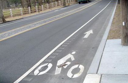
I used Braintree yesterday for a reverse bike trip yesterday. The pedestrian access was poor, but the biking access was ridiculously poor. Like all of Braintree, Quincy and part of Weymouth these places feel intrinsically bike inhospitable including the drivers, the people, the lanes, the signage, the roads, the lights, the retail, even the parks. The station feels like it was designed by someone who was born grew up and went to school without ever leaving a car. It has that Miami feel to it where bikes and people walking just aren't even considered to exist.

Just leaving the station required a very complicated calculus about where one was supposed to travel. Union St looked like a no go because of the 'interstate sized' rotary under route 3. But Ivory St was no better with a typical south shore 4-lane divided no shoulder 50m/hr throughway with no way to cross the street. Luckily one side had a sidewalk. Immediately you run into strip mall fast entry/exits. And as far as I can tell there is no way to exit the station to the east.

This city has a long long long way to go before it can said to be embracing TOD or similar philosophies.

Everytime I go through there I remind myself never to come back. Which is a shame, because I love to bike along the south shore and it is a lovely trip from Boston through the harborwalk JFK (even the missing Dorchester piece isn't terrible), but getting from the Neponset River to Hingham is horrible.

I would much rather take the commuter rail to the South Shore, of course it does not run on the weekends. I have read the discussion here, if there is insufficient demand, then I understand it may not be worth it. Such a service might need some creative marketing and development support, and likely would not be worth it in the winter. But it would be a terrific summer destination. 2 miles to beaches in Hingham, Hull, Cohasset, Scituate. Access to the ocean. Rivermoor Park, Wompatuck, Great Esker etc.

It's a long walk to these places, but possible, it would be an easy bike ride, a shuttle could also work, or shared biking. Through running with a North South link would help as well. Of course places like Cohasset probably don't want anyone to show up. But, I don't see why such a service should be any less successful than weekend Rockport/Newburyport.
 
FWIW, in opposition to what I just posted, and referencing my earlier post about rotaries in Roxbury, this one in Braintree near route 3 which seems pretty new is much better.

I don't know all the details which make it work, but basically, it's a lot smaller, no opportunity for cars to go straight through, so they need to come to slow way down to under 5 or 10mph to enter. Only one travel lane. Good potential for pedestrian crossings.

Overall a B+/A- compared to a straight D for VFW.
 
I got picked up in Braintree one time, it was pretty awful. The worst part is that bike and ped access could be made a million times better if they built an entrance on the west side of the station in that residential neighborhood (Union Place or French Ave). It's the exact same stupidity as Sullivan Square. You can live in a house abutting the T station, but have to walk a half mile on horrible roads to get into it.
 
Creating a sympathetic dialog between modes (both in public forums and "live" on the street) takes a critical mass of people who are multi-modal.

For biking, I think Hubway is the single most important way of getting people accustomed to other modes to try cycling (and understand its problems) or to at least think "that could be me" or "that person looks like me" (for better and worse we sympathize most easily with people who "look like" ourselves. Hubway users *dress* like motorists ;-)
 
Took a trip up Northern Strand Community Trail today. What a pleasure. Between that, improved Sullivan Square (paving, lanes, bike lane!, tidying up), Alford Bridge (almost done) improvements if you connect through Charlestown Paul Revere Park and Memorial Drive to Mass Ave back to South End, it's a great way to start a trip.

Now only if those bozos in Lynn would finish thing. And if only there was an extension up to Salem there would be a real development, alt transit, recreation potential etc.

A few improvements could be made. However, this will never be the Minuteman. But once there is good usage on it, a little landscaping budget would go a long way. Keep the corners clear at the excessive street crossings in Revere. Improve accessibility to adjacent spaces particularly public ones. Kudos to CVS for allowing a direct connection to its store.

Some signage would be good. Particularly to connect with the Saugus path.

Also, I'm not convinced about lining the edge with gravel. Grass sidings require maintenance but also allow for easy escape routes.

I will be interested to see in 20 years if this spurs increased development and investment in the area.

It will also be interesting if this helps spur the demonstration effect. A well known and successful implementation of a project then gets cited time and again in arguing for similar projects elsewhere (Needham).

Finally, I was somewhat surprised to see it not completely deserted. There were a reasonable number of locals out on the path.

Salem's semi-doable, but it requires a bicycle-safe on-street connecting route to tie it all together. The Marblehead Branch ROW forks off of Swampscott station, only 2.5 miles down Summer St./Tremont St./Liberty St./Essex St. from the end of the Northern Strand. Right now the M'head trail ends at Beach Bluff Ave. and has 1.5 miles of westward infill left to go before it reaches Route 1A/Abbott Park a block away from Swampscott platforms. That trail already forms a nearly 6-mile loop through Marblehead, as the also-trailed Salem Branch ROW merges with it downtown. You can currently ping back out on that other trail to Canal St. Salem, passing straight through the Salem State U. campus. So, very good linkage between downtown Swampscott, downtown Marblehead, and sowntown Salem...the University...commuter rail...ample bus routes...and the ocean when they finish that last segment of the M'head trail.


You just have to find the best bike route through downtown Lynn to tie them together. Maybe some redevelopment of that moonscape of a shoreline by West Lynn with appropriate bike paths. Then ability to cross from the West Lynn end of the Northern Strand to other side of the Lynnway and wind your way down to Lynn Shore Dr. Then up Monument Ave. to the nearest M'head trail access point, with ample signage between the two trails. That's probably bike-safer than plowing across downtown Lynn.
 
But, as I also do a lot of biking a lot in that area, I first usually avoid the parkways in general because I dont like biking next to fast traffic, and really hate biking in rotaries, but when I have to negotiate them, I hug the shoulder as much as possible,...

Please don't do this. You're asking to be right-hooked.
Especially on the DCR rotaries it's hold the lane or walk across.
 
Any lessons to be learned from the garbage truck vs Hubway accident yesterday (7/29)? How did the truck end up on top of the bike and the guys leg?

In the pictures the truck appeared to have turned right across the bikes path (I always keep in mind the Murphy's Law corollary that I call Patel's Law, proposed by an experienced cyclist friend: "Any vehicle that can turn right across your path, will."
 
Hey all, I recently started a co-op at the Charles River Conservancy, and we're initiating a campaign to focus on improving the biking and pedestrian paths along the Charles from the locks all the way up to the Watertown Dam.

To build a stronger base of knowledge to advocate from, I've created and launched a short survey about the paths. Please consider taking a look if you have a few minutes in your day, especially if you use the paths for commuting/exercise/etc.

Sorry for the pitch! It's a one-time thing, and I figured a lot of you would have good insights and something to say. Thank you!
Great news and great work, and, hey, this is the kind of non-commercial project that the internet was invented for. No need to apologize.

You might also consider letting folks annotate an open source map, the way that, for example, Medford's Bike Advisory group has (see http://www.medfordbikes.org/interactive-map.html frankly the whole metro area needs such a thing)
 
Excellent. There's so much that needs to be done. And DCR needs a kick in the pants.
 
From a new Transportation Research Board study (partly conducted on Mass Ave, Cambridge) via StreetsBlog Chicago:
If there’s enough space to make a wider bike lane, the authors conclude, that extra space should be used to install a “narrower bicycle lane with a parking-side buffer,” which “provides distinct advantages over a wider bike lane with no buffer.”
...with the aim being to keep cyclists from being "doored" when travelling in the cars' "door zone"
Screen-Shot-2014-07-29-at-17.16.14-.png

I wonder how even a 4+3 (lane + buffer) would do. Probably even better
 
Hey all, I recently started a co-op at the Charles River Conservancy, and we're initiating a campaign to focus on improving the biking and pedestrian paths along the Charles from the locks all the way up to the Watertown Dam.

To build a stronger base of knowledge to advocate from, I've created and launched a short survey about the paths. Please consider taking a look if you have a few minutes in your day, especially if you use the paths for commuting/exercise/etc.

Sorry for the pitch! It's a one-time thing, and I figured a lot of you would have good insights and something to say. Thank you!

Excellent! Good luck with the co-op!
 
From a new Transportation Research Board study (partly conducted on Mass Ave, Cambridge) via StreetsBlog Chicago:
...with the aim being to keep cyclists from being "doored" when travelling in the cars' "door zone"
I wonder how even a 4+3 (lane + buffer) would do. Probably even better

I had been thinking the same thing about Comm Ave lately. If we can't get a cycle track then the buffer should go on the parking side.
 
Just be careful what you ask for. As we've seen, once a bike lane and buffer becomes as wide as a car, people start using it as another travel lane. I'm thinking anything wider than 7' is asking for trouble. (7' is the minimum width of a parking lane.)
 
Just be careful what you ask for. As we've seen, once a bike lane and buffer becomes as wide as a car, people start using it as another travel lane. I'm thinking anything wider than 7' is asking for trouble. (7' is the minimum width of a parking lane.)

The buffer usually has cross-hatching, which seems to do a decent job keeping cars out.

Regarding this phenomenon though, they need to put up plastic bollards to keep cars out of the super wide bike lane on Beacon St near Mass Ave and the Charlesgate. Cars CONSTANTLY use that as a travel lane, which is not just really dangerous for cyclists, but for cars trying to make a right onto Storrow from the actual right turn lane. My girlfriend has almost been hit twice driving there by people flying up in the bike lane.


Db, I took the survey, good luck with your advocacy! I use the Charles paths almost daily, and they can defiantly use improvement.
 
They really just need to repave most of the paths. And on the Cambridge side between the BU Bridge and Longfellow Bridge add an asphalt one away from the seawall for bicyclists.

The sad thing is DCR actually knows what they need to do. Many surveys have been done over the years. They simply (a) don't have the money and (b) seem to spend what money they do get on guardrails and repaving Storrow Drive for the 50th time.

Here is a study with plentiful recommendations done a few years ago when all the Charles River Bridge work began:

http://www.mass.gov/eea/agencies/dcr/massparks/region-boston/charles-river-basin.html
 
Just be careful what you ask for. As we've seen, once a bike lane and buffer becomes as wide as a car, people start using it as another travel lane. I'm thinking anything wider than 7' is asking for trouble. (7' is the minimum width of a parking lane.)

I am 50% driver, 50% cyclist. I noticed that on many curvy roads the drivers simply don't respect the lane markings, resulting in bike lane paint wearing out. One awesome and surprising solution to this I saw recently in Northampton, MA, where they separated the bike lane from the travel lane by a narrow rumble strip as usually seen on highways.

Something like this:

les14fig8.jpg


I'm not sure how well that works in practice, but seemed better than nothing.

In Canada, namely in Quebec (city) suburbs (in the suburbs!), they use removable bollards like these:

dscn1857_2005-06-08-quebec-village-two-way_bike_lanes-separated-pavemnt-marking.jpg


Presumably, they detach them for winter-time snow removal. We could definitely use some of these around here, especially in areas prone to right-hook accidents (Mass Ave/Columbus near Dorchester). With that said, we could use something to slow the cyclists down as the approach intersections, to discourage the bad apples from running through red lights (or how about some enforcement?)
 
Oh but don't you know, we can't have flexposts here because we HAVE SNOW!!!

Where's Quebec? That's some wicked sinful foreign land that cannot possibly have any relevance to our special and unique BOSTON conditions!!

...

Running through red lights at a bad time has its own self-enforcement mechanism (splat).

Doing that is pretty obviously stupid. But, most of the complaints I see don't have to do with that scenario. Instead, they center around driver resentment: "oh it's not fair, the cyclist got the head-start in an empty intersection when there's no cross traffic, but drivers aren't allowed to do that". Nevermind that a biker has a much better field of vision than a driver, this is purely about envy.

Big fucking whoop, honestly. There's enough safety issues to go around to worry about, beyond red light pedantry, to care about satisfying some sadistic impulses. Same goes for worries about so-called "jaywalking" (a slur invented by resentful drivers, again). It's not something that's appropriate to persecute.
 
...and in warm weather, flexposts are designed to be jagged-edged launchable projectiles within 4 hours after they're installed. You'd almost have better luck in this state dropping a bunch of traffic cones there...with one of those big sand-filled drums every 10 cones for extra emphasis.


Note all those cheap plastic buoy-looking things marking the middle of crosswalks and school zones in this state. They're pretty much designed to be deposited in somebody's front yard twice a day, carried back into place by the nearest crossing guard or meter maid, then thrown out with the plastic recycling when they get too dented and flattened to stand upright any longer.

ansi-safe-crosswalk.jpg
 

Back
Top