Biking the Boston 'Burbs (Trails, MDC, & Towns beyond Hubway area)

^Nice.
BigEMan gave us this update on Belmont:
Here is a map (source obscure, but I think it must be the Belmont Committee's somehow)
AR-140619253.jpg&MaxW=650
 
^Nice.
BigEMan gave us this update on Belmont:

Here is a map (source obscure, but I think it must be the Belmont Committee's somehow)
AR-140619253.jpg&MaxW=650

Yep. They had meetings throughout the summer and fall and have committed to begin the planning & design process.
 
anyone know of what the deal is with the neponset greenway extension, specifically the southernmost segment that ends at neponset valley pkwy? there's a big break where the "path" on the truman ends around fairmount, and i though there was talk of a real trail along the river?
 
Yesterday (Sun June 12 '15) I biked from Medford to Melrose. Unsurprisingly (for those who follow the Bike threads here) the DCR's parkways were of highly variable quality.

Truly a mystery is why sections of the Fellsway East are striped for WIDE travel and tiny shoulders. As you see from this streetview, there's plenty of space for a bike lane or bike-friendly wide paved shoulder even on the narrow stretches. Instead, it is currently striped for what looks like a 16' travel lane and a 2' shoulder.

Meanwhile, there are other places on Fellsway West in Medford with super-wide lanes and parking buffers where it is a mystery why they don't go ahead and green-stripe the leftmost 4 or 6' as a bike lane (or build a real protected bike lane)

Wow, that's pretty bad, and definitely a good candidate for striping.

Woodland Road needs to be rethought as well. The speed limit is 35, but they encourage much higher speeds with four wide lanes on an over-capacity road. In some locations there is neither a shoulder or a sidewalk for bikes, you just have to hope the car speeding up behind you will switch lanes. In others you are expected to use an unmaintained parallel path. You'd think what is supposed to be a park drive, not a commuter route, would make some accommodation for bikes.
 
According to June 18th Traffic Commission agenda the City of Waltham is discussing striping bike lanes on Lincoln Street from Wyman/Smith St to Lake Street.
 
MAPC updated their regional bike path plans, including a fresh progress map that shows existing routes, routes likely to happen, and routes without any serious momentum.
 
^ A great find and a must-read--thanks for sharing it! I am heartened by all the stuff in yellow, and think that some of the Reds are further along (like the Mystic trails in Medford being in the MPO's 2016-2020 plan, even if getting no current funds, {edit: Here is a link to the MAPC "LandLine" project page (for a bit more explanation of what we're looking at. And while the pdf is clearer, everyone loves a little PNG action:}
LLJuly15.PNG
 
Last edited:
^ Looks to me like the Northside has done a better job of getting its projects "yellowed" (funded for design), with the Southside having a lot in "dreamer's red"

But as noted, I think this map--as a map of what is currently funded-- is a little deceiving because the red masks a lot of projects that are on the MPO's next 6-year plan.
 
I love it and am very glad they released the map, but it's certainly misleading in points. For example, the Harborwalk through Charlestown is much less complete and connected than the map makes it seem.
 
Likewise, the "completed" paths along the MDC aqueducts are barely even footpaths in places while much of the Reformatory Branch shows up as yellow/red despite being bike-able (at least on a mountain) between Bedford & Concord. A lot of things are also shown to connect where small gaps exist in reality. Nevertheless, it's still a very useful tool for envisioning the regional path system.
 
kjdonovan said:
Make all this green...
Kudos to the MAPC for calling it a "line" (LandLine) where "line" in Boston has a usage synonymous with "transit line" it underscore its rule in our mobility network
...and who needs an urban ring? ;)
except that it is cheap 10' paths it sure feels like a crazy transit pitch, doesn't it? the paths and the Ring will work great together as long as Hubway and Pedal and Park continue to expand
 
Likewise, the "completed" paths along the MDC aqueducts are barely even footpaths in places while much of the Reformatory Branch shows up as yellow/red despite being bike-able (at least on a mountain) between Bedford & Concord.

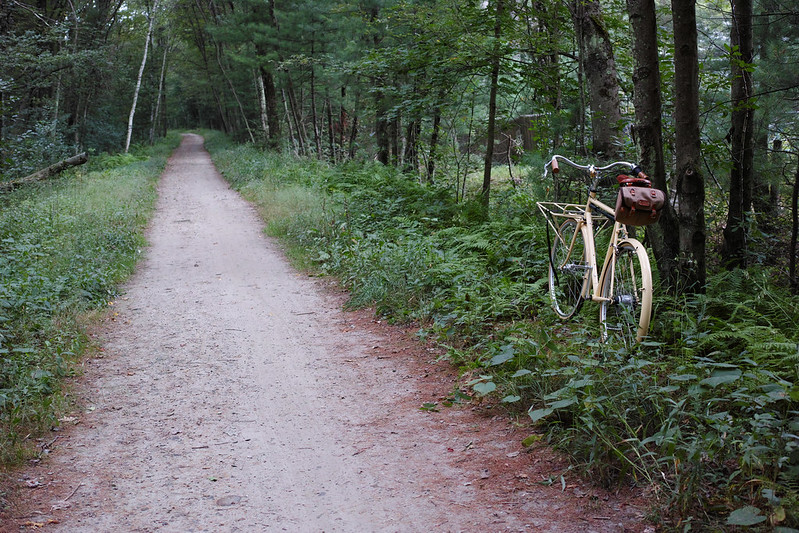
Pretty much rideable by any bike, depends only on the confidence of the rider. I took this last fall:


DP2Q0087, P/R and the path to come

There are some bumpier stretches north of 62, but mostly it's this kind of path.

A lot of things are also shown to connect where small gaps exist in reality. Nevertheless, it's still a very useful tool for envisioning the regional path system.

Agreed!
 
Reformatory will probably get more love when the Yankee Doodle trail gets its Billerica gap filled. Right now both the unpaved trails forking off the end of the Minuteman are hamstrung by not being totally complete: Bedford & Billerica stopping well short of Route 3 and not getting nearly close enough to downtown, Reformatory stopping well short of West Concord/Freeman Trail because of all the missing river crossings.

Billerica's at least got a plan for stitching together the parts west of the highway that have lapsed into private property with the stretch east of the highway that's more conveniently claimed by power line ROW. That'll pump up the utilization past Bedford Depot enough to get some resurfacing and better landscaping on both paths. Not sure there's much hope of getting the Reformatory all the way to W. Concord, but the west end of it has a lot of potential for better wayfinding to center of Concord.
 
I rate the chances of Reformatory being built through to West Concord, at least on the original route, as nil to nonexistent; that part of the line was abandoned early in the 20th century and I think even the old bridge abutments are long gone. I didn't see them when I canoed that stretch of the Assabet a few years ago.
 
I rate the chances of Reformatory being built through to West Concord, at least on the original route, as nil to nonexistent; that part of the line was abandoned early in the 20th century and I think even the old bridge abutments are long gone. I didn't see them when I canoed that stretch of the Assabet a few years ago.

Surprisingly enough, the MAPC map seems to indicate a possible extension as far as the Barretts Mill Farmland just west of the 2nd river crossing. Looking at Google Maps, the ROW property line actually looks fairly contiguous from Concord center out to this point, with practically no encroachment at all. Things get really broken up between Barretts Mills and the junction with the Framingham & Lowell, but for a line abandoned in the 20s the section immediately west of Concord does look relatively undisturbed. The bridges over the river would be a project; based on this blog post, there isn't much left of the original western crossing, and I doubt that the eastern crossing is much better. If the trail were to be extended, it would have the advantage of putting the Reformatory within striking distance of the Bruce Freeman Trail via a combination of backroads and some sidepath around the Concord Rotary area. Nevertheless, I'd agree that for the next decade or so this is firmly in "Crazy Bike Pitches" territory.
 
That'll pump up the utilization past Bedford Depot enough to get some resurfacing and better landscaping on both paths.

MassDOT is currently designing a paved path for the Reformatory Branch from the Depot to the Concord line.
 
MAPC is great for pulling this together. Would be good to fill in these red sections that run along roads next time those state or local roads get repaved.
 
MassDOT is currently designing a paved path for the Reformatory Branch from the Depot to the Concord line.

This actually makes me a little sad. As Brazile's photo shows, the Reformatory Branch from Bedford Depot to the Concord line is really nice as is. Widening and paving it will certainly take away some of its beauty and charm.

I lived much of my childhood in Bedford and ran track and cross-country for Bedford High, so between workouts, mountain biking, and "playing in the woods" I easily spent hundreds of hours on that trail every year. I understand that paving it will increase access and surely benefit more people, but the NIMBY in me is a little sad about the possible destruction of what's there now.
 

Back
Top